
Where Flight Simulation Enthusiasts Gather from Around the World!
AVSIM Library - Search Results

| Category: Flight Simulator 2004 - Scenery | |
| WRRB Bima/Mohammad Salahuddin, Indonesia |

|
Images related to this file:
File Description:
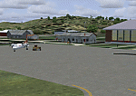
Googly scenery for WRRB Bima/Mohammad Salahuddin, Indonesia. In Flight Simulator
2004 little is provided other than a runway at this small domestic airport,
although in the real world it sees regular local flights from airlines
such as Merpati Nusentara and Pelita Air Service. These scenery files add aprons,
taxiways, buildings and other airport features to Flight Simulator's limited
representation and allow "AI" traffic to land, taxi, park and take off in a
realistic manner.
The scenery does not purport to be ultra-accurate. Based on high-detail satellite
imagery from Google Earth, the layout is proportionally correct but the added
airport features, such as buildings, are built from default Microsoft objects
and add-on libraries so will not look exactly like the real thing.
You are not obliged to download and install any additional scenery libraries,
but to enjoy this scenery in its entirety, you may wish to. It will work fine,
with or without.
[File re-uploaded at request of AVSIM]
| Filename: | WRRB_BimaMohammad_Salahuddin_Indonesia.zip |
| License: | Freeware |
| Added: | 15th June 2010, 01:03:28 |
| Downloads: | 1,931 |
| Author: | John Hinson |
| Size: | 65.89 KB |
| Category: Flight Simulator 2004 - AFCAD Files | |
| YALG Adels Grove, Queensland, Australia |
|
Images related to this file:
File Description:
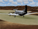
Googlyafcad A&F Data file for Adels Grove, based on Google Earth satellite data.
Unfortunately, Microsoft have omitted this location from Flight Simulator 2004 and this file will allow you and your "AI" traffic to land, taxi, park and take off in a realistic manner.
Adels Grove is a small airstrip serving Lawn Hill National Park, a port of call on the Heron Airlines Northern Affordable Air Tour. The very last commercially operated de Havilland Heron flight called here in 2003 but the service still operates and is now worked by Metroliner aircraft.
These files have been tested with Flight Simulator 2004 default scenery, Visual Australia (VOZ) enhanced scenery and add-on mesh by Andy Weir and is compatible with all. [File re-uploaded at request of AVSIM]
| Filename: | YALG_Adels_Grove_Queensland_Australia.zip |
| License: | Freeware |
| Added: | 20th June 2010, 10:48:26 |
| Downloads: | 412 |
| Author: | John Hinson |
| Size: | 60.12 KB |
| Category: Flight Simulator 2004 - AFCAD Files | |
| LLMG Meggido, Israel |
|
Images related to this file:
File Description:
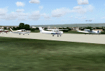
Googlyafcad A&F Data for Meggido, based on Google Earth satellite data.
Unfortunately, Microsoft have provided no facilities at this airport in Flight Simulator 2004 other than a runway and this file will allow you and your "AI" traffic to land, taxi, park and take off in a realistic manner.
Meggidio airfield was built in 1942 by the British Forces and was used by the Israeli Air Force (under the name Shachar 7) until turned over to general aviation, gliding and crop spraying use in the 1970s. There are proposals to transform it into a commercial airport with international flights to develop tourism. [File re-uploaded at request of AVSIM]
| Filename: | LLMG_Meggido_Israel.zip |
| License: | Freeware |
| Added: | 20th June 2010, 10:49:59 |
| Downloads: | 497 |
| Author: | John Hinson |
| Size: | 47.28 KB |
| Category: Flight Simulator 2004 - AFCAD Files | |
| A&F Data For South Australia airfields v2 |
|
Images related to this file:
File Description:
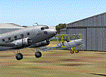
This set of 76 AFCAD2 files are for use with the free add-on scenery from Roger Leupold (fs9sav1.zip) are not suitable for the default FS2004 airfields. They will allow the scenery (designed for FS2002) to become more useable in FS2004. They will allow you to plan routes, and take off and land at some 76 airfields featuring in the scenery, with ATC routing you appropriately.
AI aircraft can now land, taxi, park and take off in the correct locations, and you can introduce your own AI traffic, too, if you wish. Every aifield has at least one parking space (even the tiniest airstips) but airfields featuring hangers and other scenery have more.
[File re-uploaded at request of AVSIM]
| Filename: | AF_Data_For_South_Australia_airfields_v2.zip |
| License: | Freeware |
| Added: | 13th May 2010, 09:58:39 |
| Downloads: | 914 |
| Author: | John Hinson |
| Size: | 84.15 KB |
| Category: Flight Simulator 2004 - Scenery | |
| SSJA Joaçaba, Brazil |
|
Images related to this file:
File Description:
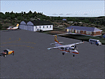
Googly scenery for SSJA Joaçaba - a small domestic airport
in the state of Santa Caterina, Brazil, that is poorly provided for in Flight
Simulator 2004. These scenery files add taxiways, aprons, buildings and other
airport features, so that you and your "AI" traffic can land, taxi, park and
take off in a realistic manner.
The small but prosperous city of Joaçaba was originally established in 1917 as
Cruzeiro and later known as Limeira and Cruzeiro do Sol, but in 1943 adopted
the current name following the introduction of legislation prohibiting cities
in Brazil using the same name - not a bad idea really. Joaçaba has a high
quality medical centre serving the state of Santa Caterina and a renowned
university which both bring traffic to the airport which is served by mainly
by LET410 aircraft of local airline NHT Linhas Aéreas.
The scenery does not purport to be ultra-accurate. Based on high-detail satellite
imagery from Google Earth, the layout is proportionally correct but the added
airport features, such as buildings, are built from default Microsoft objects
and add-on libraries so will not look exactly like the real thing.
[File re-uploaded at request of AVSIM]
| Filename: | SSJA_Joaccedilaba_Brazil.zip |
| License: | Freeware |
| Added: | 14th May 2010, 04:47:22 |
| Downloads: | 1,263 |
| Author: | John Hinson |
| Size: | 65.83 KB |
| Category: Flight Simulator 2004 - Scenery | |
| VEAT Argatala, India |
|
Images related to this file:
File Description:
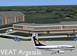
Googly scenery for VEAT Argatala, India - one of the airports that Microsoft seem to have, um, "forgotten" in FS2004. In the real world it is regularly served by Boeings and Airbii of Alliance Air, Indian Airlines, Jet Airways and Kingfisher Airlines (and smaller aircraft), using the 6000 foot runway with little room for manoevre. These scenery files add aprons, taxiways, buildings and other airport features to Flight Simulator's bland representation and allow you, and "AI" traffic, to land, taxi, park and take off realistically. The scenery does not purport to be ultra-accurate. Based on high-detail satellite imagery from Google Earth, the layout is proportianally correct but the added airport features, such as buildings, are built from default Microsoft objects and add-on libraries so will not look like the real thing. You are not obliged to download and install any additional scenery libraries, but to enjoy this scenery in its entirety, you may wish to. It will work fine, with or without. Details of optional additional scenery library downloads are provided within.
[File re-uploaded at request of AVSIM]
| Filename: | VEAT_Argatala_India.zip |
| License: | Freeware |
| Added: | 14th May 2010, 04:49:05 |
| Downloads: | 1,658 |
| Author: | John Hinson |
| Size: | 65.16 KB |
| Category: Flight Simulator 2004 - Scenery | |
| VAKE Kandla/Gandhidham, India |
|
Images related to this file:
File Description:
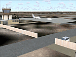
Googly scenery for VAKE Kandla/Gandhidham - a small domestic airport
in the state of Gujurat, India, for which little other than a runway is
provided in Flight Simulator 2004. These scenery files add taxiways, aprons,
buildings and other airport features, so that you and your "AI" traffic can
land, taxi, park and take off in a realistic manner.
Gandhidham is a small city about 5 miles from the seaport of Kandla, in the
Gulf of Kutch, and was developed in 1950 after the separation of Pakistan and
India left the key port of Karachi in Pakistan. The airport is served by daily
flights using turboprop aircraft of Air Deccan.
The scenery does not purport to be ultra-accurate. Based on high-detail satellite
imagery from Google Earth, the layout is proportionally correct but the added
airport features, such as buildings, are built from default Microsoft objects
and add-on libraries so will not look exactly like the real thing.
You are not obliged to download and install any additional scenery libraries,
but to enjoy this scenery in its entirety, you may wish to. It will work fine,
with or without.
[File re-uploaded at request of AVSIM]
| Filename: | VAKE_KandlaGandhidham_India.zip |
| License: | Freeware |
| Added: | 14th May 2010, 05:11:31 |
| Downloads: | 848 |
| Author: | John Hinson |
| Size: | 67.36 KB |
| Category: Flight Simulator 2004 - Miscellaneous Files | |
| Scotflight Scenery FS2004 AI Fix |
|
Images related to this file:
File Description:
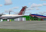
Additional information to address the issues of "hovering" or "sunken" AI traffic with the add-on airport scenery by Scotflight when used with FS2004. This documentation should be used in conjunction with the file scflAFD1.zip. However, the instructions apply equally well to other add-on scenery with the same problems.
[File re-uploaded at request of AVSIM]
| Filename: | Scotflight_Scenery_FS2004_AI_Fix.zip |
| License: | Freeware |
| Added: | 15th May 2010, 01:19:59 |
| Downloads: | 805 |
| Author: | John Hinson |
| Size: | 269.58 KB |
| Category: Flight Simulator 2004 - Scenery | |
| OPGD Gwadar International, Pakistan |
|
Images related to this file:
File Description:
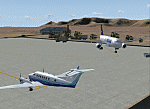
Googly scenery for OPGD Gwadar International, Pakistan. In Flight Simulator
2004 only general aviation parking is provided at this so-called international airport but in the real world it is served two or three times a day by Airbii of Airblue and ATRs of Pakistan International Airways. These scenery files improve or add
aprons, taxiways, buildings and other airport features to Flight Simulator's limited
representation and allow "AI" traffic to land, taxi, park and take off in a realistic
manner.
The scenery does not purport to be ultra-accurate. Based on high-detail satellite
imagery from Google Earth, the layout is proportionally correct but the added
airport features, such as buildings, are built from default Microsoft objects
and add-on libraries so will not look like the real thing.
You are not obliged to download and install any additional scenery libraries,
but to enjoy this scenery in its entirety, you may wish to. It will work fine,
with or without.
[File re-uploaded at request of AVSIM]
| Filename: | OPGD_Gwadar_International_Pakistan.zip |
| License: | Freeware |
| Added: | 15th May 2010, 23:51:51 |
| Downloads: | 170 |
| Author: | John Hinson |
| Size: | 58.09 KB |
| Category: Flight Simulator 2004 - Aircraft Repaints, Textures and Modifications | |
| Aegean Airlines Boeing 737-400 |
|
File Description:
Re-upload. This is a repaint of the very good 737-400 PIC published by Wilco (www.wilcopub.com) in the Aegean Airlines current (01/2006) livery with the registration SX-BGJ. ###YOU MUST OWN THE PIC 737-400 by WILCO FOR THIS LIVERY TO WORK!!!### It supports all models, VC/WV, 2D... This repaint was done using the official paintkit. It Features: 32-bit external textures, both engines and fuselage, for superb clarity and no-mip maps to remove blur! Light alpha layer to all external textures to give the true feeling of light reflective fuselage! Repainted interior of both business class and coach class in aegean's current leather configuration. You can even see the blue magazine that the airline offers to the passengers on each seat and across the fuselage. Registration SX-BGJ under the Left Wing and more.....
| Filename: | Aegean_Airlines_Boeing_737400.zip |
| License: | Freeware, limited distribution |
| Added: | 20th May 2010, 09:35:39 |
| Downloads: | 1,608 |
| Author: | John Orfanos |
| Size: | 5.5 MB |


© 2001-2026 AVSIM Online
All Rights Reserved
Privacy Policy |