
Where Flight Simulation Enthusiasts Gather from Around the World!
AVSIM Library - Search Results

| Category: Flight Simulator 2004 - Scenery | |
| The Queen Mary II at New York Harbor |

|
Images related to this file:
File Description:
The Queen Mary II at New York Harbor. Using the exceptionally fine AI model of the QM2 by the Japanese artist Mitsuya Hamaguchi (Hama), this package presents the Brooklyn Cruise Terminal (home of the Cunard Cruise Lines) with the QM2 making regular departures and arrivals. Also included is a representation of the Cape Liberty Cruise Port, Bayonne, New Jersey - just across the river. An animated wake has also been added to the default Cruise ship seen in the harbor. This package is designed to work in the default FS2004 setting ONLY. This scenery uses several custom objects created by John B.Loney Jr. as well as objects from the EZ Scenery and RWY12 libraries. Complete details will be found in the instructions.If you have the Lago FSE program you will also hear the horn of the QM2 occasionally. Please unzip to a temporary folder and follow the simple installation instructions. Compiled for your flying enjoyment by David "Opa" Marshall in collaboration with John B. Loney Jr.
| Filename: | The_Queen_Mary_II_at_New_York_Harbor.zip |
| License: | Freeware |
| Added: | 10th December 2009, 12:41:38 |
| Downloads: | 3,560 |
| Author: | David "Opa" Marshall |
| Size: | 1023.05 KB |
| Category: Flight Simulator X - Aircraft Repaints, Textures and Modifications | |
| Grumman F-14A VF-11 Red Rippers 201 |
|
Images related to this file:
File Description:
IRIS F-14B in VF-11 Red Rippers 75th Paint Scheme Hi Vis
Aircraft #: AA201
Callsign: Ripper 201
Highly detailed repaint including decals and patches as used on jackets and helmets during the 2002 Season aboard the USS John F Kennedy.
High resolution repaint in Grey/Blue with clean paint and no weathering/wear and tear effects added.
Armaments and stores repainted to live ammunition loads. Callsign VCPMOD included for EditVoicepack users.
| Filename: | Grumman_F14A_VF11_Red_Rippers_201.zip |
| License: | Freeware |
| Added: | 25th June 2010, 01:35:43 |
| Downloads: | 200 |
| Author: | Scott Minty |
| Size: | 2.24 MB |
| Category: Flight Simulator X - Aircraft Repaints, Textures and Modifications | |
| Aircalin Airbus A330-200 |
|
Images related to this file:
File Description:

This is a repaint of Thomas Ruth's A330-200 in the livery of Aircalin. Original model created by Thomas Ruth. Repaint by John Hancock. This is a TEXTURES ONLY download, as you are required to install Thomas Ruth's original A330-200 Package before installation. This addon is only compatible with Flight Simulator X Service Pack 1 (SP1) and Service Pack 2 (SP2). Includes added Alpha Channels, fuselage dirt effects, Photoreal windows, and accurate livery details.
| Filename: | Aircalin_Airbus_A330200.zip |
| License: | Freeware |
| Added: | 8th October 2011, 03:02:58 |
| Downloads: | 903 |
| Author: | Thomas Ruth / John Hancock |
| Size: | 3.92 MB |
| Category: Flight Simulator X - Aircraft Repaints, Textures and Modifications | |
| Mooney M20J C-GWFT FS9 Compatible |
|
Images related to this file:
File Description:
Repaint is for the Carenado Mooney M20J and texture sets for FS 9 and FS X are included .
Repaint by Leen de Jager , originally made for X Plane and converted for use in FS 9 & FS X by John Glanville with Leen's permission .Leen had already converted my FS 9 / FS X Mooney paints for use in X Plane ,so I am returning the favour .
Full instructions are included to install into either sim .
| Filename: | Mooney_M20J_CGWFT_FS9_Compatible.zip |
| License: | Freeware |
| Added: | 5th July 2011, 04:54:44 |
| Downloads: | 331 |
| Author: | John Glanville / Leen de Jager / Carenado |
| Size: | 13.76 MB |
| Category: Flight Simulator 2004 - Scenery | |
| Moore-Murrell Airport KMOR |
|
Images related to this file:
File Description:
FS2004 Scenery - Moore-Murrell Airport (KMOR) serves Morristown and Hamblen County and is owned by the City Of Morristown, TN. The paved runway extends for 5701 feet. The facility is at an elevation of 1313 feet at a distance of about 4 miles from Morristown. This scenery employs the usual scenery objects libraries. Check the readme file for more information. Original concept and design by Maurice Butz in collaboration with John B. LOney, Jr.
| Filename: | MooreMurrell_Airport_KMOR.zip |
| License: | Freeware, limited distribution |
| Added: | 10th June 2011, 09:07:28 |
| Downloads: | 301 |
| Author: | Maurice Butz and John B Loney Jr |
| Size: | 1.2 MB |
| Category: Flight Simulator X - Aircraft Repaints, Textures and Modifications | |
| North American Aviation "Damn Yankee" P-51D-30-NA ( PH-PSI) |
|
Images related to this file:
File Description:
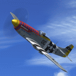
A repaint only for the payware Warbirdsim product 'Mustang Tales'. This repaint depicts the North American Aviation P-51D-30-NA, 122-40968, serial no. 44-74425, registered PH-PSI, owned and operated by Tom van de Meulen, based in Lelystad & Oostwold, The Netherlands, also known as "Damn Yankee".
To be used with the payware "Mustang Tales" by John Terrell
Available at: http://warbirdsim.com
This repaint features new bump maps, wheel well and cockpit textures.
| Filename: | North_American_Aviation_Damn_Yankee_P51D30NA___PHP.zip |
| License: | Freeware, limited distribution |
| Added: | 30th June 2013, 19:32:17 |
| Downloads: | 114 |
| Author: | Marcel Ritzema |
| Size: | 7.76 MB |
| Category: Flight Simulator X - Scenery | |
| Cape Girardeau Regional Airport |
|
Images related to this file:
File Description:
FSX Scenery - Cape Girardeau Regional Airport (IATA: CGI, ICAO: KCGI) is a public airport located five miles (8 km) southwest of the central business district (CBD) of Cape Girardeau, a city in Cape Girardeau County, Missouri, USA. The airport covers 557 acres (225 ha) and has two runways. It is used for general aviation. Created using Instant Scenery. Libraries listed. Created With assistance from David "Opa" Marshall, by John B. Loney, Jr.
| Filename: | Cape_Girardeau_Regional_Airport.zip |
| License: | Freeware, limited distribution |
| Added: | 27th February 2011, 04:41:31 |
| Downloads: | 694 |
| Author: | John B. Loney, Jr. |
| Size: | 5.85 MB |
| Category: Flight Simulator 2004 - Scenery | |
| Beluga Lake, Homer, AK |
|
Images related to this file:
File Description:
FS2004 Scenery - This scenery corrects the issue of the lake's location for the Ultimate Terrain users. Homer-Beluga Lake Seaplane Base is located in Homer, AK. Type: Seaplane Base, Status: Operational, Acivation Date: 11/01/1950, Runways: 1, Ownership: Publicly owned. This scenery is not exactly true to life, but does make a nice companion to my recently released Homer Airport scenery (paho_homer_scenery_fs9.zip). For Ultimate Terrain users only. By John B. Loney, Jr.
| Filename: | Beluga_Lake_Homer_AK.zip |
| License: | Freeware, limited distribution |
| Added: | 29th January 2011, 03:08:56 |
| Downloads: | 396 |
| Author: | John B. Loney, Jr. |
| Size: | 619.67 KB |
| Category: Flight Simulator 2004 - Scenery | |
| Multinational Force and Observers |
|
Images related to this file:
File Description:
This project brings to life the Multinational Force and Observers North Camp at El Gorah AB (HEGR) and South Camp near Sharm El-Sheikh. Included are scenery for both camps, FS9 tested flight plans as well as FS9 and FSX repaints for the UH-60s of the US Army Task Force Sinai 1st Support Battalion using John Youngs AI UH-60. Please see the readme file for a list of required scenery libraries.
| Filename: | Multinational_Force_and_Observers.zip |
| License: | Freeware |
| Added: | 1st October 2015, 08:36:28 |
| Downloads: | 315 |
| Author: | Brent Newman |
| Size: | 4.79 MB |
| Category: Flight Simulator 2002 - Scenery | |
| Myrtle Beach, SC |
|
File Description:
Microsoft made Myrtle Beach a mass of farmland. This corrects that and it's easy to install. I have used Topozone.com to see where the business district is and the residential areas are . It is as accurate as I can make it, and covers an area of about 12 miles of coast line, from South of Myrtle Beach to North of North Myrtle Beach
This scenery was created with John Cillis's LandClass Assistant.
| Filename: | Myrtle_Beach_SC.zip |
| License: | Freeware |
| Added: | 12th July 2002, 20:45:40 |
| Downloads: | 1,666 |
| Author: | Joe Watson |
| Size: | 173.27 KB |


© 2001-2026 AVSIM Online
All Rights Reserved
Privacy Policy |