
Where Flight Simulation Enthusiasts Gather from Around the World!
AVSIM Library - Search Results

| Category: Flight Simulator 2002 - Aircraft Repaints, Textures and Modifications | |
| Hellenic Air Force Republic Aviation F-84F Thunderstreak |

|
File Description:
This is one of the first jet age aircrafts served in Hellenic Air Force, almost 50 years ago (!!!). There are three (3) repaint versions of Royal Hellenic Air Force in the zip package: The first one, represents an F-84F, as placed in front of 113rd Wing's main entrance as a "gate guard monument". The aircraft was placed there during early '90ies and the idea was captured by Brigadier General Vlachandonis who used to be the 113rd Wing's commander at that time. The second, shows an F-84F, as it was painted from 1957 to 1967. The specific aircraft used to belong to 339th Sqdr.with a white-blue-white stripe painted close to the nose as a squadron's ID mark. Additionaly, the "Mighty Mouse" official Sqdr's badge was placed on the left part of fuselage, just behind the cockpit. The thrird repaint is representing an F-84F, as it was painted from 1971, until the "retirement" on 1984. The aircraft which is presented into this "VietNam typed" repaint version used to belong to 338th Sqdr. operating from Larisa AB. This "F84F_HAF.zip" package is full compatible with FS2K2 and FS9 too and contains realistic sound made by Angelos Hatzikatakos, new panel made by Nick Karatzides, helpfull checklist and a VERY completed (as always...) flight manual (46 pages) which can be read with Adobe Acrobat. This repaint was based on the original model made by Kazunori Ito. A total NEW flight model ("air" file and aircraft.cfg file) have been created by Nick Karatzides and have been tested hard, to ensure that the aircraft flies as close as possible like a real fighter! This "F84F_HAF.zip" package is for EXPERIENCED FlightSimers and virtual pilots who have a "good feeling" on the stick and do not "kick" the contol stick while flying. The package contains new visual effects, night lighting, fine looking mechanical parts movement, contrails, realistic gears extracting / retracting etc.
| Filename: | Hellenic_Air_Force_Republic_Aviation_F84F_Thunders.zip |
| License: | Freeware |
| Added: | 10th March 2004, 03:59:45 |
| Downloads: | 723 |
| Author: | Nick Karatzides, Angelos Hatzikatakos |
| Size: | 12.35 MB |
| Category: Flight Simulator 2002 - Aircraft Repaints, Textures and Modifications | |
| Canadair CL-13 Mk 2 Sabre (F-86E) Royal Hellenic Air Force |
|
File Description:
This is one of the first jet age aircrafts served in Royal Hellenic Air Force, almost 50 years ago (!!!). There are two repaint versions of Royal Hellenic Air Force in the zip package: The first one, represents a Royal Hellenic Air Force Canadair CL-13 Mark 2 Sabre used to fly with 342nd Sqdr. of Royal Hellenic Air Force (RHAF) in Elefsina, Greece with an interception role. The second, represents the aniversary "Alexander the Great" texture, painted in "patriotic" colours, by a gas station owner (!!!) in Thessaloniki - Greece after buying the aircraft (sn. 19294) as scrap and finaly display it as a memorial by his store. This specific aircraft used to fly with 343rd Sqdr. In Nea Anchialos, Greece. The Canadair CL-13 Mark 2 Sabre aircraft (Canadian build F-86E under North American licence) used to be one of the most succesfull aircrafts during the 50'ies and the Korean war. This "CL-13_RHAF_v1.zip" package is full compatible with FS2K2 and FS9 too and contains realistic sound made by Angelos Hatzikatakos, NEW (made by the author) panel, the official checklist and a VERY completed (as always...) flight manual (31 pages) which can be read with Adobe Acrobat. This repaint was based on the original model made by Rey Lopez . The primary panel was made by Ken Mitchell and modified by Nick Karatzides to look more realistic and closer to the Hellenic CL-13 Mk 2 cockpit. A total NEW flight model ("air" file and aircraft.cfg file) have been created by Nick Karatzides and and I test it hard, to ensure that it flies as close as possible like a real fighter! This "CL-13_RHAF_v1.zip" package is for EXPERIENCED FlightSimers and virtual pilots who have a "good feeling" on the stick and do not "kick" the contol stick while flying. The package contains new visual effects, night lighting, fine looking mechanical parts movement, contrails, realistic gears extracting / retracting etc. Repaint and stuff by Nick Karatzides.
| Filename: | Canadair_CL13_Mk_2_Sabre_F86E_Royal_Hellenic_Air_F.zip |
| License: | Freeware |
| Added: | 4th October 2003, 00:15:30 |
| Downloads: | 1,408 |
| Author: | Nick Karatzides |
| Size: | 11.28 MB |
| Category: Flight Simulator X - Original Aircraft | |
| Antonov AN225-210 "Colossus" |
|
Images related to this file:
File Description:
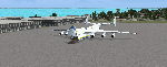
The AN225-210 is the result of a proposed 1 to 2-year projected modernization program which will
convert the current AN225 into a much more useful and capable aircraft than the already infamous
ÐœÑ€Ñ–Ñ (Mriya) . The latter First flew on December 21, 1988, and is currently 33 years old. There have
been a few maintenance periods and 1 major avionics modification, but otherwise is too old for reliable
future use. The 2 year process involves reconstructing the landing gear system to support much more weight. The
new engines are much more powerful, but lighter in weight, and much more fuel efficient. The wings
are replaced with similar wings with more wing-area built of modern light-weight material which gives
her higher lift capacity. The cargo hold area is reinforced for heavier weight limits. The crew areas
(upper deck, fore/aft main wing) are modernized for long duration flight, and two galleys are included.
The fuel tanks (9) now also involve 3 tanks in the upper center portion of the fuselage in order to put
less stress on the wings. The pressure system is modernized to achieve 6,000 feet cabin pressure up to
FL470. The internal and external lighting is fully modernized, the former for a pleasing effect and the
latter for distinct recognition during flight. Overall, the aircraft does not appear different to the
common observer.
Originally Created by:
Thomas Ruth & Alexander Kvitta (2009)
RB-211 Sounds by Sanjay Blair
Panel by: Philippe Wallaert
Auto Smoke Effects by: Richard Wisman
Camera Definitions by: Marc Renaud
Real World Aero/Engine Dynamics, EVP Mods, Effects and Data by:
Douglas E. Trapp
[email protected]
April 2021
All modifications herein are authorized by Thomas Ruth as contained within the AN225-210 Document pdf file.
This aircraft is designed for educational use protected by the Fair Use Doctrine:
http://www.expertlaw.com/library/intellectual_property/fair_use.html
| Filename: | Antonov_AN225210_Colossus.zip |
| License: | Freeware |
| Added: | 12th April 2021, 23:47:59 |
| Downloads: | 669 |
| Author: | Douglas Edward Trapp |
| Size: | 49.92 MB |
| Category: Microsoft Flight Simulator (2020) - Utilities | |
| Flightplan Visualizer 1.22 |
|
Images related to this file:
File Description:
Flightplan Visualizer (FV) version 1.22. Copyright 2018-2022 by Pelle F. S. Liljendal ([email protected]), all rights reserved.
FV comes with 1599 pre-imported AI flightplans (of which +726 are BizJet flightplans, the rest are commercial, government and military). However you are able to import additional (AI) flightplans yourself. Once imported these (AI) flightplans can be visualized on a map-view, and the user will be able to search accross all these. Hence you can use the program as inspiration as to which routes to fly. E.g. you can search across all imported flightplans to find all flights in an A321 flying into/out from LDDU, or simply to look for all flights in a Boeing 747-8F.
Simply run the included installer to install the software. The program will be installed into "C:\Program Files (x86)\Flightplan Visualizer" and all datafiles will be installed into: "C:\Users\[UserName]\AppData\Roaming\FlightplanVisualizer". The program comes with a full manual explaining everything, and a 3 page quick manual to get you started. The first 3 times you run the program the quick manual will automatically open. The forum is hosted here: https://forum.aerosoft.com/index.php?/forum/919-flightplan-visualizer/
Version 1.22 Contains the following changes:
- I had initially added a feature to download AIG airline-logos, however a later change in AIG's server setup rendered this feature useless. In stead you can now specify the local folder holding AIG's airline logo's (if/when you are using AIG AIM on your computer for AI-traffic). If specified, airline-logo's will be obtained from this folder.
- On the same note, I had to remove the menu-item to download AIG flightplans, as this program no longer have directly access to the AIG servers. For the same reason the menu-item to access the index with flightplans (up to summer 2021) was re-enabled.
- In the past when opening the Airport-Info form it defaulted to show in-/out-going traffic for the selected flightplan or active leg-search only. Now there is a new setting where you can set it up to in stead default to showing all traffic in/out of the airport (the Airport-info form still contains a combobox where you maually can choose what to see).
- "Owned aircraft" was renamed into "Simulator-aircraft", as these are the (flyable) aircraft you have available within your simulator of choise.
- When choosing to use calculated flight-times in a leg-search, you can now specify a percentage-difference (between leg-time and calculated-time). Only when the difference between leg-time and calculated-time exceeds this specified value will the calculated time be used during leg-search (e.g. "only use calc-times if diff. exceeds 50%, otherwise use leg-times").
- Began using (aircraft) short-names many places where the program in the past used IATA/ICAO-code (e.g. when hovering the mouse over a route, or list of aircraft servicing specific airports when editing flightplans). Also added short-name columns to aircraft browser and when choosing favorites (these stil contains columns for IATA/ICAO-codes).
- Pressing the "Usage" button when editing/viewing an aircraft-type or right-clicking an aircraft-type in the browser and choosing "View usage-report..." from the context menu, you will be shown a report that inform you how that aircraft-type is used: which simulator-aircraft are based on that type, which owned aircraft that have been marked as substitute for that type, which airlines are using that type (as carrier/operator), and finally in which (active) flightplans that type is used.
- Items in airline-browser are now by default sorted by (airline) name, and the usage-column shows the size of the airline if its in use. If available a logo for the selected airline is displayed in the upper/right corner.
- Improved performance when searching for ICAO-codes in the airport-browser. Also improved priority of the default selected item, in cases when an airport had a 3 letter ICAO-code, and another was using the same 3 leters for its IATA code.
- When searching for ICAO/IATA-codes in the airline-browser, it will now prioritize non-defunct airlines, if multiple airlines share the same ICAO/IATA-code.
- When enabling/disabling flightplans, you can now select all BizJet flightplans (those prefixed with "Bz_"), all Military (prefixed with "Ml_") or all Goverment (prefixed with "Gv_").
- Individual FP sub-folders can now be setup to leave (not move) defunct- and/or obsolete FP, even if the settings to automatic move these to the disabled folder is set.
- Performing "Search legs" you can now filter on aircrafts you are allowed to fly via type-ratings ("Must be type-rated").
- Performing a substitute of a user-airline, that airline will remain selected (previously the list scrolled to the top, and selected the 1st item).
- Added new check-box to "Search legs" that can exclude round-trips (legs taking-off and landing at same airport).
- Airline/Aircraft-repaint -filter can now filter on size of airline (e.g. "size=major"). Size is determined from usage as carrier/operator in active flightplans. Airlines not in use by active flightplans are listed with a size of "unknown").
- Added GPS-conversion (deg deg,min,sec) to the conversion-form, as requested by a colleague. You can either manually enter lat/lon or look-up an airport to get it. There is both a primary lat/lon and a secondary, and the form will show the (GC)distance between these and the initial/final course.
- Added new "Max airport-distance" for airport-redirections. At the same time added new feature when importing/editing airports to permanent change an airport. If used, it is not saved/handled as a redirection (can't be restored) but rather as a perpament change.
- Reordered- and renamed some of the tab-pages in the Airport-info form.
- Reordered the length/distance-fields in the unit-conversion form.
- The Wind-calculator have been removed from the main-menu, in stead wind-calcuations can now be performed using the unit-conversion form. Also now the speed of the wind is always displayed as a positive value, and in stead the label will either say "Head-wind" or "Tail-wind".
- Added new "Country list" menu-item in the misc-menu. Will list all countries twice (sorted by names, and sorted by ISO3-codes).
- Showing airport-marker tool-tips on the main-map is now prioritized over showing route tool-tips.
- Added "Min take-off fuel ("MTFL") field to user-aircraft weight-fields. As of now its not set for any aircraft in the database, however it can be estimated as 60 minutes of flight at cruise.
- Moved several group-boxes of the settings-form to the 2nd tab-page, and added new fields for defalt simulator/logging-environment based on the File-prefix used when starting the program.
- Also now the header-names that was previous fixed to "Rank" and "Traffic-density" can be changed, so the selectable 6 values can be used for something entirely different, if anyone have the need for this. If/when changed, these new names are shown when editing an airport, or when performing a leg-search (as the leg-search can filter on these fields).
- MakeRunways (MkRwy) by Pete Dowson is challenged handling unicode in the scenery it scans/writes to XML. E.g. the Icelandic airport (BIFL) "Flúðir Airport" is exported by MkRwy as "Flúðir Airport". In this version FV will try to identify when this happens, and then it will fall back using the airport/city-names from the databases bundled with FV. This is not a perfect solution, but at least it improves the result.
- Various minor changes and tweaks to multiple forms (e.g. Unit conversion form can now be closed with ESC, renamed log-archives and so on).
- Fixed: If the main-form had an active flightplan filter when using the search-legs feature the flightplan combo-box still only contained the filtered context. Pressing the Clear button did not resolve the issue.
- Fixed: Since adding support for the AIGFP file-format, there could be flights departing from- and arriving at the same airport (e.g. helicopter flights). In previous versions the calculated flights-time would only consist of taxi-out/in times. In this version the flightplan leg-time will now also be uses for the calculated time, when the same airport is used both for departure and destination.
- Fixed: In some cases re-processing flightplans (resetting and performing redirection) could corrupt the flightplans and remove airport-data from the flightplans. This version will also try to add any missing airport-data to flightplans when re-processing them.
- Fixed: Selecting "only show favorites" in the Search aircraft-type form would filter out all aircraft (including those marked as favories).
- Fixed: In the leg-info form the fields to show times (Out, Off, On, In) were too narrow for multi-week flights, when showing the week-number (e.g. "TH7/14:37").
- Fixed: Issues when estimating cruise/taxi fuel-burn for user-aircraft, where in some cases some fields were not saved, and wrong calcuation if setup to show weight in Kg.
- Fixed: In some cases wrong TimeZone was used when calculating local time for OUT, OFF, ON, IN-times.
- Data: The airport redirection file ("UserAirportRedirect.xml") in the UserData folder have been updated to match the latest MSFS world update. However this new file is only installed by the installer if it does not already exists (in case you made your own changes), hence you need to delete this file manually prior to running the version 1.22 installer.
- Data: Quite a few airports in the airport-database were updated (had wrong names due to issues with unicode-letters). Also some additional airports were added.
- Data: The installer comes bundled with +300 airline-logos (optional install), and a separat package of +1400 airline-logos are avilable for download from AVSIM (in both cases these are encoded into a propriotary format using the ".CAL" extension).
- Data: Added the P2F (Passenger-to-Freighter) versions of the Airbus A320, A321 and A330. Also added the package freighter versions of CRJ100 and CRJ200.
- Data: Improved detection of Boeing 737-700/800 BCF/BDSF when importing flightplans utilizing these (passenger aircraft converted into freighters). Also improved a few other freighter detections.
- Data: Changed a few (aircraft) short-names to either shorten them a bit, or make them "more readable".
- Flightplans: All new/updated flightplans have been added to the installer, and all obsolete/defunct have been marked/removed. A total of 1599 active flightplans are bundled with the installer.
| Filename: | Flightplan_Visualizer_122.zip |
| License: | Freeware, limited distribution |
| Added: | 18th October 2022, 23:31:28 |
| Downloads: | 392 |
| Author: | Pelle Liljendal |
| Size: | 45.57 MB |
| Category: Flight Simulator 2004 - Scenery | |
| Cyprus: Airfields plus landmarks and land class for all of Cyprus and AI |
|
Images related to this file:
File Description:
Cyprus, an island in the eastern Mediterranean. Without the benefit of Ultimate Terrain, which does not exist for Cyprus, the land class provided by FS9 stands out as hopelessly inadequate. I have added the extensive farmland and the larger towns and villages, plus the major roads. Four completely new airfields are included here, three in the north and one in the south. Ercan LCEN is in the north and functions as the airport for all of the north. It was recently closed for two years while a new terminal was built and the runway updated and an apron extended etc, and during that time Gecitkale LCGK functioned (barely) as the airport for the north. Gecitkale is now hardly used at all. The third northern airfield is Ilker Karter LCIK and this functions as the HQ base of the Turkish Army Corp in northern Cyprus. The last of the new airfields is Kingsfield LCRE, which is in the Sovereign Base area to the east of Larnaca and is now used for recreational purposes. Ercan is now undergoing further expansion with a new runway and a new terminal building and apron, so this scenery is for the period between 2010 to 2015. My set up of Cyprus already included a payware Larnaca by Aerosoft (now only 12 euros) plus a freeware Paphos, Nicosia, and Akrotiri; that was my starting point. Larnaca has been the major airport for Cyprus since the mid 1970's, with a huge tourist trade that peaks in the summer but which is year long (almost a million Brits visit every year, let alone the other nationalities). I have adapted this (gate sizes etc) to allow parking by a multitude of B737's and others. Nicosia is freeware (posted in 2010) and I have included modifications to reflect its now total disuse. Paphos is at the far western end of the island and freeware, and I have modified this to allow larger and military ai aircraft to function properly; the poster improved his first version to better cater for ai but I was unaware of this and I have stayed with my modifications. Akrotiri is freeware and includes a lot of library object input from MAIW. I have modified the parking somewhat and added further residential areas and munitions storage. The AI is based upon recorded take offs and landings in April, with some further additions in later months. At Ercan the visible gate numbers on the apron are as per real life, but the numbers within FS9 reflect the fact that planes are directed to gates at the centre of the terminal building and not at the far ends. Follow the pink line and obey ATC when it says taxi to gate number 2 even if it is visibly numbered 4.
| Filename: | Cyprus_Airfields_plus_landmarks_and_land_class_for.zip |
| License: | Freeware, limited distribution |
| Added: | 13th August 2017, 21:21:46 |
| Downloads: | 942 |
| Author: | Roger Wensley |
| Size: | 29.61 MB |
| Category: Flight Simulator 2004 - Scenery | |
| Medicine Hat CYXH in Alberta Canada |
|
Images related to this file:
File Description:
Medicine Hat is a town in south Alberta, beside the South Saskatchewan River, and around 180 miles southeast of Calgary. Originally a railroad town, and in fact still served by the railway and now also by the Trans-Canada Highway, it is currently mainly known for the large natural gas fields in the area. As Rudyard Kipling said, Medicine Hat has "all hell for a basement". The name of the city is a translation of the Blackfoot tribal name for the eagle tail feather headdress worn by tribal medicine men, and it was curiosity about the name that first got my attention.
The date of this scenery is not 2010, as is usual for my scenery; it is more like 2015. The terminal building has been extended and improved, the apron around the two large southern hangars and the large rental hangars behind them is still visibly new, and the tie-down parking places on the grass accessed off one side of the old taxiway are in place and in use. The airport is now (2015) not in the busy usage that it experienced in the second half of the 1900's and old taxiways and a runway have been left to decay and large old hangars have been demolished. Hence the visible remains. The current runways were rebuilt (on top of the existing as foundations) and are 03-21 with 4,990 feet of lit asphalt 150 feet wide with PAPI at both ends, and 09-27 with 2,885 feet of lit asphalt 100 feet wide.
The two newish hangars to the south are a helicopter operating and maintenance company with a flight training school based in the adjoining offices (light grey buildings) and an FBO in hangar and offices (dark grey). Further buildings have been erected since then, and some existing ones have been reclad (eg. light grey now, in 2021, has a light blue roof).
I have cheated in one respect. In reality, the edges of the airport have been gradually utilised for various purposes, such as workshops, storage sheds, factories, etc, with access from the surrounding urban roads. As I have almost no information regarding their appearance I decided to leave the airport area as it was originally built, rather than incorporating buildings that I know are false. I admit that this was also the laziest solution.
The scenery includes a grass strip 3 miles to the south of Medicine Hat, namely Schlenker CFZ3. It is the only airfield I have come across where the fences are not around the edge of the airfield, they are instead around the runways and apron. I presume this is so animals can be left to feed off the grass in summer.
The AI includes flights by Air Canada Jazz.
| Filename: | Medicine_Hat_CYXH_in_Alberta_Canada.zip |
| License: | Freeware, limited distribution |
| Added: | 23rd January 2022, 20:11:10 |
| Downloads: | 142 |
| Author: | Roger Wensley |
| Size: | 19.15 MB |
| Category: Flight Simulator 2004 - Scenery | |
| Prince George CYXS in British Columbia, Canada |
|
File Description:
Prince George is centrally located in British Columbia, mid way between the border with the USA in the south and the northern border with the Northern Territories, and around 100 miles west of the eastern border with Alberta. The town now has a population of around 74,000 and is regarded as the province's northern capital. It is at the meeting point of the Fraser and Nechako rivers and the crossroads of highways 16 and 97. It started out as Fort George in the early 1800's when a trading post was established by the Northwest Company,serviced by paddle boats on the rivers. The railway arrived in the area in 1914 and growth continued, albeit slowly due to wars and the financial collapse of the 1930's. Timber and timber products were and still are the mainstay of the area, along with a military and governmental presence.
The date for this scenery is around 2010. I have made some new buildings from memory and the available information online. They are not totally accurate reproductions; for instance I know that the terminal building is brick faced and also has parts that are stone (or metal?) faced, but where? So I used brick everywhere. The control tower is also brick faced, but is not exactly the right shape. The airport management team have continued to grow the activity and services provided with the result that flights and passenger numbers continue to increase. The 15-33 runway was lengthened to the south, (in the period 2003 to 2005) from the original FS9 scenery 7,400 feet to my updated 11,450 feet with central lighting and ILS at the northern end. This made it the third longest runway in Canada. At the same time a loading/unloading cargo area was created with professionally run storage and also a large scale refueling storage. If DHL want to refuel their 737 then they can do so without making prior arrangements.
The AI included here is for Air Canada Jazz and an Air Canada 737, Westjet 737 and Dash8, a helicopter company that is based there, Pacific Coastal, Central Mountain Air, and GA. The range of airlines and planes reflects the "northern capital" status of the town.
| Filename: | Prince_George_CYXS_in_British_Columbia_Canada.zip |
| License: | Freeware, limited distribution |
| Added: | 11th November 2022, 23:10:19 |
| Downloads: | 160 |
| Author: | Roger Wensley |
| Size: | 28.04 MB |
| Category: Flight Simulator 2004 - Scenery | |
| Bella Coola CYBD in British Columbia, Canada |
|
Images related to this file:
File Description:
Bella Coola is in one of the deep east-west fjords amid the Coastal Range on the coast of BC, approximately mid way between Vancouver and the Alaskan border and some 70 miles inland from the open ocean. The town of Bella Coola has a small population of around 150, while the population of the whole Bella Coola Valley is around 2,000. The valley is warmer in both summer and winter than the surrounding area, and tourism flourishes along with forestry, fishing, and local government administration. Although there is road access, the ferry service is the main connection to larger coastal towns or cities such as Vancouver. The airport, 7 miles east of the town, is connected by daily Pacific Coastal flights to Vancouver and Anahim Lake (to the east). The asphalt runway is 4,200 feet long and aligned 04-22 in FS9 (by 2010 this had changed to 05-23 in reality) and is without lighting of any sort, so it is restricted to daylight hours only. At the eastern end is the terminal building and in the middle the West Coast Helicopter hangar, which has a large fenced paddock-like enclosure in front of it. The helicopters hop over the three feet high fence as they "taxi" to the apron in front of the hanger (but not in FS9!). Between the two there are four other company hangars spread out along the roadway beside the fence. I have never seen the airfield in Summer, and I have not attempted to replicate the apron as it now shows in Google Earth. The screenshots show the main and overwhelming feature of Bella Coola, the large valley amid the steep mountains. This terrain has an inevitable effect on the ai, in that you will never see a plane land as it hits solid rock before it makes it to the runway. You will, however, see them take off. Pacific Coastal currently flies Beechcraft 1900's to Bella Coola; I have used the Saab 340 which I have seen there some years ago and which I prefer.
| Filename: | Bella_Coola_CYBD_in_British_Columbia_Canada.zip |
| License: | Freeware, limited distribution |
| Added: | 25th October 2018, 17:57:06 |
| Downloads: | 286 |
| Author: | Roger Wensley |
| Size: | 14.57 MB |
| Category: Flight Simulator X - Scenery | |
| Merrill Field PAMR |
|
Images related to this file:
File Description:
This is a version for FSX of the Merrill Field made by Roger Wensley (me) for FS9, converted by John B Loney jnr. "PAMR read this first" explains this but I have modified John's original procedure, and instead of first installing the Merrill Field original plus two updates I have included here the current FS9 version as installed on my computer. Note that to see the apron lighting working in FS9 it was necessary to have Sidney Schwartz's light library installed, along with his updated textures (to avoid severe blurries caused by a faulty texture). The original installation instructions are included giving file library priorities etc. Just ignore the bits that do not apply, such as installing AI that is not included. I have of course omitted the original AI as this is replaced by John's version. I have no comment to make on installing in FSX as I have not done so, and I have not tested it in FSX. If you have comments or questions I will respond as much as I am able. Merrill Field is in Anchorage Alaska, between Anchorage International to the southwest and and Elmendorf Air Force Base to the north. It caters for general aviation and is the land equivalent of the Lake Hood float plane base, with fuel and numerous maintenance facilities, and several hundred parking spots for small planes. There are three runways, and the longest is 4,000 feet of 100 feet wide asphalt, the second 2,635 feet of asphalt 75 feet wide, and the third 2,000 feet of 60 feet wide gravel. The first two have runway lights. It is a controlled airfield with a relatively new control tower to cater for the numerous flights and to coordinate with Elmensdorf and Anchorage International, the latter also controlling flights from Lake Hood and the adjacent gravel strip Z41. (See my Lake Hood scenery). The gravel runway at Merrill Field is not connected with active taxiways to the rest of the airfield; this avoids you being ordered to land on it when flying a plane too large to do so.
| Filename: | Merrill_Field_PAMR.zip |
| License: | Freeware, limited distribution |
| Added: | 3rd July 2017, 18:00:19 |
| Downloads: | 452 |
| Author: | Roger Wensley and John B loney jnr |
| Size: | 21.73 MB |
| Category: Flight Simulator X - Scenery | |
| Freeware Project Kobe X (RJBE) Japan |
|
Images related to this file:
File Description:
Freeware project KOBE X (RJBE) Japan. Contains fully detailed airport with custom ground polygons. Accurate 3d model and texture of all the building of the airport including the terminal, control tower, hangars, bridge and many more. Please note that this project was my initial experience in many fields of scenery design so take it as it is and enjoy flying in Japan. The design is never done but I think it was ready to be released. Still have some work to do with the animated jetways and night lighting for my next "payware" project (KSAN, San Diego Intl). It's going to be far better than this freeware.
You can download the world of ai installer and install the All Nippon Airways package and maybe the JAL too. The jetways are not animated but you can park a 747 in gate 1, a 767 in gate 5 and a 737 in gate 6 and be perfectly aligned with the jetway door.
Also I've not try this scenery in a less powerful computer than mine. I run a Windows 7, I7-950 @ 3.8 GHz and a GTX 570. So don't get mad if you're having bad performances :). With all sliders in the "display settings" set to max I've around 20 fps in the virtual cockpit of the level-d 767. You'll get a nicer airport with also the global texture resolution set to max, water effects set to High 2.x and traffic to ultra-high. Do not turn on Ground scenery shadows as it will make a shadow for the entire airport (ground poly).
I've some tutorial on my YouTube channel (n170toga) on how to make fsx sceneries if you are interested. Don't forget to subscribe there and have updates for the upcoming scenery. Please review this airport if you like as I will learn a lot for my next
project and it's only going to be better.
This scenery is a freeware and should be considered as a freeware. Arigato, Sagga Toure (Devinci), Devinci Design and Development (3De)
| Filename: | Freeware_Project_Kobe_X_RJBE_Japan.zip |
| License: | Freeware |
| Added: | 12th June 2011, 08:28:51 |
| Downloads: | 6,653 |
| Author: | Sagga Toure |
| Size: | 66.48 MB |


© 2001-2026 AVSIM Online
All Rights Reserved
Privacy Policy |