
Where Flight Simulation Enthusiasts Gather from Around the World!
AVSIM Library - Search Results

| Category: Flight Simulator X - Aircraft Repaints, Textures and Modifications | |
| Canopy Transparence Fix for Viperden-Type F-16s |

|
Images related to this file:
File Description:

That is a fix for the FSX Viperden-type F16s, which is the F-16 Figthting Falcon (VIPER) by Kirk Olsson adapted to FSX by Danny Garnier. That fix is about the canopy transparency which happens to cause troubles with the latest FSX versions. A fix already released gives a completely clear canopy, which does not respect the F-16 canopy's tinted hue.
| Filename: | Canopy_Transparence_Fix_for_ViperdenType_F16s.zip |
| License: | Freeware |
| Added: | 16th December 2014, 14:36:24 |
| Downloads: | 188 |
| Author: | G. Guichard |
| Size: | 238.85 KB |
| Category: Navigation and ATC - Navigation | |
| San Francisco Sectional Chart Chunks for Aerosoft's FSMap |
|
File Description:
Sectional chart chunks made from the August 2009 Sectional charts at the original scale, formatted in the WGS84 lat/long geographic coordinate system for the FSMap, moving map application for flight simulation use. The chart chunks are the full sectional divided by 2 tiles (east/west) and converted to baseline 8bit tiffs with packbits compression applied. The images average 6,000x6,000 pixels at about 25mb each, also included is the FSMap fsm Calibration file for importing. No further calibration is needed, just import, save, and enjoy.
| Filename: | San_Francisco_Sectional_Chart_Chunks_for_Aerosofts.zip |
| License: | Freeware |
| Added: | 27th March 2010, 20:58:01 |
| Downloads: | 510 |
| Author: | David Myers |
| Size: | 29.38 MB |
| Category: Navigation and ATC - Navigation | |
| Los Angeles Sectional Chart Chunks for Aerosoft's FSMap |
|
File Description:
Sectional chart chunks made from the August 2009 Sectional charts at the original scale, formatted in the WGS84 lat/long geographic coordinate system for the FSMap, moving map application for flight simulation use. The chart chunks are the full sectional divided by 2 tiles (east/west) and converted to baseline 8bit tiffs with packbits compression applied. The images average 6,000x6,000 pixels at about 25mb each, also included is the FSMap fsm Calibration file for importing. No further calibration is needed, just import, save, and enjoy.
| Filename: | Los_Angeles_Sectional_Chart_Chunks_for_Aerosofts_F.zip |
| License: | Freeware |
| Added: | 27th March 2010, 20:58:18 |
| Downloads: | 474 |
| Author: | David Myers |
| Size: | 26.25 MB |
| Category: Navigation and ATC - Navigation | |
| Las Vegas Sectional Chart Chunks for Aerosoft's FSMap |
|
File Description:
Sectional chart chunks made from the August 2009 Sectional charts at the original scale, formatted in the WGS84 lat/long geographic coordinate system for the FSMap, moving map application for flight simulation use. The chart chunks are the full sectional divided by 2 tiles (east/west) and converted to baseline 8bit tiffs with packbits compression applied. The images average 6,000x6,000 pixels at about 25mb each, also included is the FSMap fsm Calibration file for importing. No further calibration is needed, just import, save, and enjoy.
| Filename: | Las_Vegas_Sectional_Chart_Chunks_for_Aerosofts_FSM.zip |
| License: | Freeware |
| Added: | 27th March 2010, 20:58:26 |
| Downloads: | 464 |
| Author: | David Myers |
| Size: | 31.75 MB |
| Category: Flight Simulator X - Aircraft Repaints, Textures and Modifications | |
| JAT McDonnell Douglas DC-10 livery for MD11 |
|
Images related to this file:
File Description:

JAT - Yugoslav Airlines DC-10-30 livery in 1990's for FS9 and FSX
| Filename: | JAT_McDonnell_Douglas_DC10_livery_for_MD11.zip |
| License: | Freeware |
| Added: | 2nd April 2010, 01:21:25 |
| Downloads: | 461 |
| Author: | Nikola Jovanovic |
| Size: | 962.47 KB |
| Category: Flight Simulator 2004 - AI Aircraft | |
| National Science Foundation's National Center for Atmospheric Research |
|
Images related to this file:
File Description:
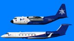
National Science Foundation's National Center for Atmospheric Research EC-130Q Hercules and Gulfstream G-V N677F for AI traffic. Representative flightplans based on actual flightplans for the aircraft in March/April 2010. Painted on the HTAI C-130H and HTAI Gulfstream G-V models by Henry Tomkiewicz.
| Filename: | National_Science_Foundations_National_Center_for_A.zip |
| License: | Freeware |
| Added: | 5th April 2010, 11:50:41 |
| Downloads: | 843 |
| Author: | Chris Dworjan |
| Size: | 376.13 KB |
| Category: Flight Simulator 2004 - Scenery | |
| Static Aircraft for California Central Coast Scenery CCCoastF |
|
Images related to this file:
File Description:
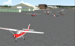
Static Aircraft for California Central Coast Scenery CCCoastF released
12/18/04. The static A/C are now separate from the CCC scenery per several requests. Requires CCCOASTF.ZIP.
This is a replacement file for the 12/18/04 file corrupted by the library hack.
| Filename: | Static_Aircraft_for_California_Central_Coast_Scene.zip |
| License: | Freeware |
| Added: | 9th May 2010, 11:38:40 |
| Downloads: | 1,601 |
| Author: | Al Wheeler |
| Size: | 1.43 MB |
| Category: Flight Simulator 2004 - AI Aircraft | |
| Sikorsky S76 "Northwest Rotors" - fictitious paint for AI |
|
Images related to this file:
File Description:
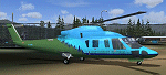
Sikorsky S76 "Northwest Rotors" - fictitious paint for AI. This paint is intended to replace the plain white S-76 AI aircraft in Robert Lacy's nicely crafted S23 Ione airfield scenery (ione_s23.zip) available at AVSIM. This paint requires the AI Sikorsky S-76C (elvis_sikorsky_s-76.zip - also available at Avsim). If you have the Ione scenery you may well already have Chris Jones' base model.The scheme is fictitious, made using a paintkit by fellow Aussie Mal Lloyd. Repaint by John Burford. Please unzip to a temporary folder and follow the simple installation instructions.
This is a replacement file for the file lost in the library hack.
| Filename: | Sikorsky_S76_Northwest_Rotors__fictitious_paint_fo.zip |
| License: | Freeware, limited distribution |
| Added: | 11th May 2010, 01:13:46 |
| Downloads: | 385 |
| Author: | John Burford |
| Size: | 249.26 KB |
| Category: Navigation and ATC - Navigation | |
| IFR EnRoute High Alt Charts for Aerosoft's FSMap |
|
Images related to this file:
File Description:
IFR enroute high altitude chart chunks from the late 2009 charts, formatted in the lat/long geographic coordinate system for FSMap moving map application for flight simulation use.
The images are customized for moving map display (see link), and included is a Legend in PDF format.
Coverage is the lower 48 H-series divided into 45 tiff tiles from a full mosaic and converted to baseline 8bit tiffs with packbits compression applied. Included is the FSMap fsm Calibration file for importing. No further calibration is needed, just import, save, and enjoy.
| Filename: | IFR_EnRoute_High_Alt_Charts_for_Aerosofts_FSMap.zip |
| License: | Freeware |
| Added: | 18th April 2010, 09:55:51 |
| Downloads: | 608 |
| Author: | David Myers |
| Size: | 31.5 MB |
| Category: Navigation and ATC - Navigation | |
| Puerto Rico VI TAC Chunks for Aerosoft's FSMap |
|
File Description:
The chart chunks are from the latest Puerto Rico Virgin Islands TAC at the original scale, formatted in the WGS84 lat/long geographic coordinate system for the FSMap, moving map application for flight simulation use.
The chart chunks are baseline 8bit tiffs with packbit compression applied, not for size but for efficiency. The images are 3800x3806 pixels at about 13.5mb each. Also, included is the FSMap fsm Calibration file for importing.
| Filename: | Puerto_Rico_VI_TAC_Chunks_for_Aerosofts_FSMap.zip |
| License: | Freeware |
| Added: | 19th March 2010, 01:17:08 |
| Downloads: | 324 |
| Author: | David Myers |
| Size: | 21.19 MB |


© 2001-2026 AVSIM Online
All Rights Reserved
Privacy Policy |