
Where Flight Simulation Enthusiasts Gather from Around the World!
AVSIM Library - Search Results

| Category: Flight Simulator X - Scenery | |
| Fantasy of Flight Scenery |

|
Images related to this file:
File Description:
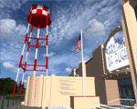
Fantasy of Flight Airport Scenery for FSX SP2 (version 1.0) by Vassilios Dimoulas
Airport details: The scenery represents FA08 Polk City, the private airport housing the "Fantasy of Flight - World's Greatest Aircraft Collection". The collection is owned by the legendary Kermit Weeks and includes over 40 rare and vintage arcraft, many of them restored to flying condition. For more information you may visit http://www.fantasyofflight.com/.
The scenery includes 32 custom built objects in an effort to represent the actual buildings and objects around the field as best as possible. Nearly everything is included except the "Wing Walk Air" attraction. The surrounding grounds are made by landclass polygons. trying to represent the vegetation. A photoreal version might be made in the future.
| Filename: | Fantasy_of_Flight_Scenery.zip |
| License: | Freeware |
| Added: | 22nd June 2012, 03:32:26 |
| Downloads: | 2,146 |
| Author: | Vassilios Dimoulas |
| Size: | 7.95 MB |
| Category: Flight Simulator X - Scenery | |
| City of Taichung, Taiwan |
|
Images related to this file:
File Description:
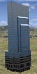
This is an improvement of the default scenery for the City of Taichung, Taiwan. Google Earth 3D models of several prominent buildings were converted to FSX with explicit permission from the respective authors. Made using ModelConverterX and SBuilderX. Building models by Bor-Kai Hsiung and Sophia Wu. FSX conversion and placement by Mike Huang.
| Filename: | City_of_Taichung_Taiwan.zip |
| License: | Freeware |
| Added: | 19th June 2010, 04:10:40 |
| Downloads: | 2,143 |
| Author: | Bor-Kai Hsiung, Sophia Wu, Mike Huang |
| Size: | 4.28 MB |
| Category: Flight Simulator X - Scenery | |
| City of Paris - France |
|
Images related to this file:
File Description:
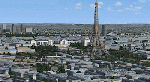
City of Paris - France v1.2 It's a photoreal seasonned scenery of the capital with new typical autogen, a bunch of buildings and monuments, trafic, etc. It covers about 140 km2 and also includes suburbs towns in the west, and the business area of "La Defense". It's apparently compatible with Prepar3D.
| Filename: | City_of_Paris__France.zip |
| License: | Freeware |
| Added: | 15th September 2016, 12:32:19 |
| Downloads: | 2,195 |
| Author: | marc-henri Guitteny |
| Size: | 417.86 MB |
| Category: Flight Simulator 2004 - Scenery | |
| Airstrips of Southern Germany |
|
Images related to this file:
File Description:
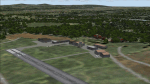
The next my Western Europe airstrips project, herewith about 170 small airfields, mostly in Baden-Wurttemberg and Bavaria, each enhanced with buildings, taxiways, parking spaces and aprons as appropriate, to further facilitate the generation of lightweight AI traffic in the area, without overloading the more major airfields.
Again, there's no photo-realism here, just a selection of basic 'generic' buildings, more or less accurately sized and placed to reflect the airfield layout as seen on on-line satellite imagery and aerial photography. These buildings have minimal effect on frame-rates, so are ideal for this kind of job. The airfields are aligned as well as possible with the roads etc. in UT Europe and the Genesis Europe mesh, but should mostly be fine in a default installation or other configuration.
Please read the rest of this "blurb" in the included text file. There may be some details of note or interest.
| Filename: | Airstrips_of_Southern_Germany.zip |
| License: | Freeware |
| Added: | 25th December 2024, 20:54:30 |
| Downloads: | 134 |
| Author: | Chris Eve |
| Size: | 2.84 MB |
| Category: Flight Simulator X - Scenery | |
| Grass Fields of Norway |
|
Images related to this file:
File Description:
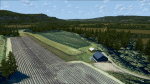
Grassfields of Norway (GFoN), by Marius Risan, adds quite a few missing Norwegian grassfields. The first edition, v1.0, adds 8 grassfields.
ENKE Kjellstad, ENHY Huseby, ENEB Eidsberg, ENRT Ruteig, ENVM Veum, ENLE Lier, ENEE Egge & ENTN Torsnes.
| Filename: | Grass_Fields_of_Norway.zip |
| License: | Freeware |
| Added: | 5th March 2014, 06:35:38 |
| Downloads: | 1,045 |
| Author: | Marius Risan |
| Size: | 322.53 MB |
| Category: Flight Simulator 2004 - Scenery | |
| Airports of Iran V1.1 |
|
Images related to this file:
File Description:

This package creates a simple basic scenery of airports of Iran and it is purposed to have the maximum technical match with the reality, not necessarily the exact scenery textures. The most of Iranian airports in FS2004 have a very poor, out of date and incomplete design, some are only a runway and some do not even exist! No model design has been performed using for this package and all the scenery objects are the available free-ware objects on the online libraries. The main purpose of PERSIAN-SIM | Airports of Iran is to create a maximum match of the airports technical elements with the reality, e.g. the size and location of the buildings, dimensions and distances of runways, taxiways, aprons, stands, gates etc. and also airports lighting systems and NAVAIDs. The technical information including Comm. Frequencies, navigation systems, NAVAIDs, TWYs and RWYs characteristics and dimensions are designed and updated using Iran AIP and other valid up-to-date aviation resources. Special thanks to John Stinstrom and Sidney Schwartz for their permission and helps.
| Filename: | Airports_of_Iran_V11.zip |
| License: | Freeware, limited distribution |
| Added: | 15th January 2013, 17:27:17 |
| Downloads: | 2,620 |
| Author: | Behnam Zamani / PERSIAN-SIM |
| Size: | 25.88 MB |
| Category: Flight Simulator 2004 - Scenery Design | |
| Jordan, North of Beirut |
|
File Description:
This package DOES NOT contain finished FS scenery products! Instead, the three bitmaps (N33.7-35.0 E35.4-36.5) are meant to be used for FS landscape scenery design with Ground2K4 (by Christian Fumey) or similar utilities. Source data are public domain Landsat 7 ETM+ satellite images, at 15-m and 30-m ground resolution. I used professional GIS software for the geographic transformation to lat/long-WGS84 projection, and photo processing software for channel merging and image enhancements. Each image has been tested in Ground2K4 for accurate placement. Note: these images have been ECW-compressed and need special (free) software for decompression (instructions included).
| Filename: | Jordan_North_of_Beirut.zip |
| License: | Freeware, limited distribution |
| Added: | 4th March 2004, 23:58:58 |
| Downloads: | 464 |
| Author: | Holger Sandmann |
| Size: | 12.7 MB |
| Category: Flight Simulator X - Scenery | |
| City of Birmingham 1.0 |
|
Images related to this file:
File Description:
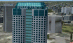
TalonSim is very excited to bring to you City of Birmingham 1.0. Finally Birmingham, Alabama has character as many features about this historic city have been detailed into Microsoft Flight simulator. This scenery package depicts key architectural structures of The Magic City skyline.
| Filename: | City_of_Birmingham_10.zip |
| License: | Freeware, limited distribution |
| Added: | 6th July 2011, 01:16:50 |
| Downloads: | 727 |
| Author: | Dexter Pierre Gray and Talonsim |
| Size: | 3.51 MB |
| Category: Flight Simulator 2004 - Scenery | |
| "City of Manila" Philippines |
|
File Description:
Fly over the city of Manila as you have never done it before!
Lots of landmarks of Manila city are represented in these files.
These files are optimized for a good frame rate performance.
| Filename: | City_of_Manila__Philippines.zip |
| License: | Freeware |
| Added: | 8th May 2008, 19:49:15 |
| Downloads: | 7,785 |
| Author: | Nestor D'Angelo |
| Size: | 6.74 MB |
| Category: Flight Simulator 2004 - AFCAD Files | |
| Republic Of Congo AFCADs |
|
Images related to this file:
File Description:

The Freightshifters 2013 brings you 32 AFCAD's for the Republic Of Congo for FS2004 (Not to be confused with the Neighbouring Democratic Republic of the Congo) - Included in this pack are AFCAD's based on Google Earth images where possible and best guess interpretation of most of the obscure Airfields and Dirt Strips listed in FS2004. They include basic Parking, Traffic Comm's frequencies and a tower view point for all AFCAD's, also included are minor Airports and Military Bases, more Info in the Readme.
| Filename: | Republic_Of_Congo_AFCADs.zip |
| License: | Freeware, limited distribution |
| Added: | 4th October 2013, 02:47:01 |
| Downloads: | 573 |
| Author: | Kevin McCarthy - Freightshifters 2013 |
| Size: | 28.5 KB |


© 2001-2026 AVSIM Online
All Rights Reserved
Privacy Policy |