
Where Flight Simulation Enthusiasts Gather from Around the World!
AVSIM Library - Search Results

| Category: Flight Simulator 2004 - AI Flight Plans | |
| Helicopter |

|
File Description:
This project was started to get the AI helos I enjoyed seeing in FS2002 working in FS2004. The work within is largely just a rehash of Holger Sandmann and Doug Callihan's work on AI helos. While their helos mostly worked in FS2004 (the TLUK Blackhawk was one of only a few which wouldn't), the same couldn't be said of the AI plans. What I've done is made new AFCADs and amended the txt flightplan files to enable the files to work.
| Filename: | Helicopter.zip |
| License: | Freeware, limited distribution |
| Added: | 8th April 2005, 00:08:44 |
| Downloads: | 1,793 |
| Author: | Rob Nieuwenhoven |
| Size: | 177.89 KB |
| Category: Flight Simulator 2004 - Scenery | |
| Glacier Bay National Park, Alaska |
|
File Description:
Add-on meshes can greatly improve the detail of the FS terrain but often conflict with the inaccurate placement of the other default FS landscape elements, particularly in coastal and mountainous areas. This project showcases new methods and software that allow for semi-automated development of FS landscapes from accurate source data. The files completely replace the default FS landscape of Southeast Alaska's Glacier Bay National Park and the adjacent Lynn Canal area between Juneau and Skagway (N58-60 W134-138), including shorelines, islands, and lakes, as well as glaciers, landclass, man-made features, and a LOD9 (76-m) terrain mesh. Optional AI floatplane traffic at four seaplane bases is included. A LOD10 (38-m) mesh of the same area is available as a separate optional download. FS2002 users please use fs8glbay.zip instead.
| Filename: | Glacier_Bay_National_Park_Alaska.zip |
| License: | Freeware, limited distribution |
| Added: | 16th February 2004, 03:40:31 |
| Downloads: | 17,192 |
| Author: | Holger Sandmann, Jim Keir |
| Size: | 10.43 MB |
| Category: Flight Simulator 2004 - Scenery | |
| Official Water Aerodromes located in Province of Quebec. SUPPLEMENT. |
|
File Description:
These are AFCAD2 Scenery files for most popular and visited waterbases located in the
province of Quebec, Canada. Your Ai floatplanes will come alive with these "invisible"
waterbases airports installed (AI traffic flightplans required.) and your flyable
floatplanes will be allowed to take-off directly into water, at official water
aerodromes, using FS9 airports menu. Thanks to Holger Sandmann who has developped this
technique. Must be used with Gilles Gauthier's "Terrain Mesh Province of Quebec" for FS2004
and his excellent "Quebec Sceneries Enchancements". READ the TXT files.
| Filename: | Official_Water_Aerodromes_located_in_Province_of_Q.zip |
| License: | Freeware |
| Added: | 10th May 2010, 23:33:54 |
| Downloads: | 1,738 |
| Author: | Jean Morissette |
| Size: | 1.12 MB |
| Category: Flight Simulator 2004 - AI Flight Plans | |
| Pacific Wings Airlines Package -- Canada (BC) |
|
File Description:
AI flightplans for Pacific Wings Airlines(Winter 2005-06 schedule)--a seaplane charter operator in British Columbia, Canada with scheduled services. AI plans are in MRAI format. Included in the package are repaints for the Cessna 172 (wheeled plane) and DHC2 Beaver floatplane. Original models for the repaints by Fred Choate (Cessna) and John L. Woodward (Beaver) are available on AVSIM. AFCADS and RWY12 scenery objects are provided for seabases. They are designed to fit addon scenery for Vancouver by P Nigel Grant and Victoria/British Columbia by Jon Patch and Holger Sandmann.
| Filename: | Pacific_Wings_Airlines_Package__Canada_BC.zip |
| License: | Freeware |
| Added: | 15th January 2006, 07:01:22 |
| Downloads: | 929 |
| Author: | John Hambly |
| Size: | 709.04 KB |
| Category: Flight Simulator 2004 - Scenery | |
| Alps LOD10 Topo Mesh - Update 1 |
|
File Description:
Patch files to remove tall spike in terrain near Salzburg at N47 44´ E13 00´ and to add the missing/distorted peaks of La Grande Moucherolle at N45 00´ E5 34´ and Mont Aiguille at N44 50' E5 33'.
Requires the full version of our Alps LOD10 mesh files, alpse_fe.zip and alpsw_fe.zip. Source data by Jonathan de Ferranti, compiled for FS by Holger Sandmann. Fully compatible with FS2002. A big thank-you to those who reported the "Salzbug" and the missing peaks in the French Alps.
| Filename: | Alps_LOD10_Topo_Mesh__Update_1.zip |
| License: | Freeware, limited distribution |
| Added: | 9th February 2006, 15:02:59 |
| Downloads: | 32,355 |
| Author: | Holger Sandmann, Jonathan de Ferranti |
| Size: | 2.57 MB |
| Category: Flight Simulator 2004 - AI Aircraft | |
| Sikorsky HH-60J JayHawk Helicopter |
|
Images related to this file:
File Description:
Sikorsky HH-60J JayHawk Helicopter in U.S. Coast Guard livery for AI use only. The Sikorsky HH-60 Jayhawk needs almost no introduction. In its many variants, it is one of the most widely recognized helicopters in the world. Thanks to Mr. Jordan Moore of Hovercontrol.com for granting permission to release this AI version of his excellent model. AI Helicopter configuration files by Holger Sandmann and Doug Callihan. Model by Jordan Moore. Aircraft.cfg based on Stemme motor glider aircraft.cfg by Al Kaiser. Project compiled for your flying enjoyment by David "Opa" Marshall.
| Filename: | Sikorsky_HH60J_JayHawk_Helicopter.zip |
| License: | Freeware |
| Added: | 10th December 2009, 15:02:33 |
| Downloads: | 2,824 |
| Author: | David "Opa" Marshall |
| Size: | 1.7 MB |
| Category: Flight Simulator X - Scenery | |
| BIRDS 7 The GOLD Valley.... |
|
File Description:
Thanks to the great work made by Holger Sandmann I have discovered Bella Coola Valley and how can I say....I felt in love with this place. So this is probably the best BIRDS volume I had the pleasure to upload and the one where I put the most of myself and of ...my imagination because of course the scenery is pure ficton. If you have appreciated the previous volumes this one will give you, I think, a lot of fun and pleasure.
A warm thanks again to Adam Mills for his textures and to Aime Leclercq (Oscar) for his nice trees.
Enjoy :-)
| Filename: | BIRDS_7_The_GOLD_Valley.zip |
| License: | Freeware, limited distribution |
| Added: | 1st March 2007, 04:06:21 |
| Downloads: | 3,421 |
| Author: | David Roch |
| Size: | 1018.04 KB |
| Category: Flight Simulator 2004 - AFCAD Files | |
| Alaska Version 032505 |
|
File Description:
The files contained in this version of Alaska AFCAD files for FS2004 are intended for users that understand how to use AFCAD files and traffic in FS2004. THIS RELEASE IS A WORK IN PROGRESS. This file contains AFCAD files for most of the nearly 850 airports in the state of Alaska. No previous editions required.
The revisions in this version are intended to work with the Misty Fjords project by Holger Sandmann. Also included are files for those who do not have Misty Fjords, although there has been no change to those files since version 020905.
| Filename: | Alaska_Version_032505.zip |
| License: | Freeware, limited distribution |
| Added: | 25th March 2005, 16:34:07 |
| Downloads: | 2,097 |
| Author: | Chris Coarse |
| Size: | 5.62 MB |
| Category: Flight Simulator 2004 - Scenery | |
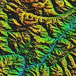
| "Himalayan Peaks" LOD10 Mesh, Volume 4 - Annapurna |
|
Images related to this file:
File Description:

Highly detailed terrain mesh of the Annapurna area, N28-30 E83-85. The files in this package are based on Shuttle Radar (SRTM) Version 2 data but with many of the void areas, especially the most significant sections, filled with elevation data generated from topographic maps by Jonathan de Ferranti. While Jonathan's work is unrelated to flight simulation he kindly gave me permission to compile his data for use in FS. The result is a wonderful improvement in detail and accuracy over any existing mesh file, freeware or commercial, based on SRTM or DTED data alone.
Due to the large area of the Himalayas I've compiled the source data as two separate series: the "Himalayan Peaks" series covers prominent mountains and ranges in higher detail and locally overrides any existing LOD9 terrain mesh. In addition, a LOD9 "base mesh" series covering the entire Himalayas will be available for those who do not yet have an add-on terrain mesh of these beautiful mountains.
| Filename: | Himalayan_Peaks_LOD10_Mesh_Volume_4__Annapurna.zip |
| License: | Freeware, limited distribution |
| Added: | 29th May 2010, 08:59:29 |
| Downloads: | 10,459 |
| Author: | Holger Sandmann, Jonathan de Ferranti |
| Size: | 15.07 MB |
| Category: Flight Simulator 2004 - Scenery | |
| "Himalayan Peaks" LOD10 Mesh, Volume 8 - Tirich Mir and Pamir |
|
Images related to this file:
File Description:
Highly detailed terrain mesh of the Tirich Mir and Pamir areas, N36-39 E71-74. The files in this package are based on Shuttle Radar (SRTM) Version 2 data but with many of the void areas, especially the most significant sections, filled with elevation data generated from topographic maps by Jonathan de Ferranti. While Jonathan's work is unrelated to flight simulation he kindly gave me permission to compile his data for use in FS. The result is a wonderful improvement in detail and accuracy over any existing mesh file, freeware or commercial, based on SRTM or DTED data alone.
Due to the large area of the Himalayas I've compiled the source data as two separate series: the "Himalayan Peaks" series covers prominent mountains and ranges in higher detail and locally overrides any existing LOD9 terrain mesh. In addition, a LOD9 "base mesh" series covering the entire Himalayas will be available for those who do not yet have an add-on terrain mesh of these beautiful mountains.
| Filename: | Himalayan_Peaks_LOD10_Mesh_Volume_8__Tirich_Mir_an.zip |
| License: | Freeware, limited distribution |
| Added: | 29th May 2010, 08:52:47 |
| Downloads: | 9,103 |
| Author: | Holger Sandmann, Jonathan de Ferranti |
| Size: | 47.94 MB |
© 2001-2026 AVSIM Online
All Rights Reserved
Privacy Policy |