
Where Flight Simulation Enthusiasts Gather from Around the World!
AVSIM Library - Search Results

| Category: Flight Simulator 2004 - Scenery Design | |
| Saint Barthelemy and Saint Martin Caribbean Islands (partial) |

|
File Description:
This package DOES NOT contain finished FS scenery products! Instead, the two bitmaps (N17.8-18.2 W62.7-63.1) are meant to be used for FS landscape scenery design with Ground2K4 (by Christian Fumey) or similar utilities. Source data are public domain Landsat 7 ETM+ satellite images, at 15-m and 30-m ground resolution. I used professional GIS software for the geographic transformation to lat/long-WGS84 projection, and photo processing software for channel merging and image enhancements. Each image has been tested in Ground2K4 for accurate placement. Note: these images have been ECW-compressed and need special (free) software for decompressing (instructions included).
| Filename: | Saint_Barthelemy_and_Saint_Martin_Caribbean_Island.zip |
| License: | Freeware, limited distribution |
| Added: | 8th March 2004, 13:54:05 |
| Downloads: | 705 |
| Author: | Holger Sandmann |
| Size: | 404.02 KB |
| Category: Flight Simulator 2004 - Scenery Design | |
| Caribbean Islands of Saint Kitts, Nevis, and Saint Eustatius |
|
File Description:
This package DOES NOT contain finished FS scenery products!!! Instead, the two bitmaps (N17.0-17.6 W62.5-63.1) are meant to be used for FS landscape scenery design with Ground2K4 (by Christian Fumey) or similar utilities. Source data are public domain Landsat 7 ETM+ satellite images, at 15-m and 30-m ground resolution. I used professional GIS software for the geographic transformation to lat/long-WGS84 projection, and photo processing software for channel merging and image enhancements. Each image has been tested in Ground2K4 for accurate placement. Note: these images have been ECW-compressed and need special (free) software for decompressing (instructions included).
| Filename: | Caribbean_Islands_of_Saint_Kitts_Nevis_and_Saint_E.zip |
| License: | Freeware, limited distribution |
| Added: | 28th February 2004, 00:15:17 |
| Downloads: | 607 |
| Author: | Holger Sandmann |
| Size: | 525.63 KB |
| Category: Flight Simulator 2004 - Scenery Design | |
| Ketchikan and Revillagigedo Island, Alaska |
|
File Description:
This package DOES NOT contain finished FS scenery products! Instead, the three bitmaps (N55.2-56.1 W130.6-131.9) are meant to be used for FS landscape scenery design with Ground2K4 (by Christian Fumey) or similar utilities. Source data are public domain Landsat 7 TM satellite images, at 15-m and 30-m ground resolution. I used professional GIS software for the geographic transformation to lat/long-WGS84 projection, and photo processing software for channel merging and image enhancements. Each image has been tested in Ground2K4 for accurate placement. Note: these images have been ECW-compressed and need special (free) software for decompressing (instructions included).
| Filename: | Ketchikan_and_Revillagigedo_Island_Alaska.zip |
| License: | Freeware, limited distribution |
| Added: | 8th March 2004, 13:55:52 |
| Downloads: | 259 |
| Author: | Holger Sandmann |
| Size: | 16.13 MB |
| Category: Flight Simulator 2004 - Scenery Design | |
| Yellowstone National Park, Wyoming |
|
File Description:
This package DOES NOT contain finished FS scenery products! Instead, the three bitmaps (N44.2-45.4 W110.2-111.2) are meant to be used for FS landscape scenery design with Ground2K4 (by Christian Fumey) or similar utilities. Source data are public domain Landsat 7 ETM+ satellite images, at 15-m and 30-m ground resolution. I used professional GIS software for the geographic transformation to lat/long-WGS84 projection, and photo processing software for channel merging and image enhancements. Each image has been tested in Ground2K4 for accurate placement. Note: These images have been ECW-compressed and need special (free) software for decompressing (instructions included).
| Filename: | Yellowstone_National_Park_Wyoming.zip |
| License: | Freeware, limited distribution |
| Added: | 27th April 2004, 15:36:03 |
| Downloads: | 435 |
| Author: | Holger Sandmann |
| Size: | 17.09 MB |
| Category: Flight Simulator 2004 - Scenery Design | |
| Jordan, North of Beirut |
|
File Description:
This package DOES NOT contain finished FS scenery products! Instead, the three bitmaps (N33.7-35.0 E35.4-36.5) are meant to be used for FS landscape scenery design with Ground2K4 (by Christian Fumey) or similar utilities. Source data are public domain Landsat 7 ETM+ satellite images, at 15-m and 30-m ground resolution. I used professional GIS software for the geographic transformation to lat/long-WGS84 projection, and photo processing software for channel merging and image enhancements. Each image has been tested in Ground2K4 for accurate placement. Note: these images have been ECW-compressed and need special (free) software for decompression (instructions included).
| Filename: | Jordan_North_of_Beirut.zip |
| License: | Freeware, limited distribution |
| Added: | 4th March 2004, 23:58:58 |
| Downloads: | 464 |
| Author: | Holger Sandmann |
| Size: | 12.7 MB |
| Category: Flight Simulator 2004 - Scenery Design | |
| Austria & Germany - Innsbruck to Bad Toelz, Background Bitmaps |
|
File Description:
This package DOES NOT contain finished FS scenery products! Instead, the three bitmaps (N46.7-47.8 E10.7-12.0) are meant to be used for FS landscape scenery design with Ground2K4 (by Christian Fumey) or similar utilities (see my Innsbruck_G2K4.zip). Source data are public domain Landsat 5 TM satellite images, at 30-m ground resolution and a NIMA SPOT satellite mosaic, at 10-m ground resolution (Innsbruck area only). I used professional GIS software for the geographic transformation to lat/long-WGS84 projection, and photo processing software for channel merging and image enhancements. Each image has been tested in Ground2K4 for accurate placement. Note: these images have been ECW-compressed and need special (free) software for decompressing (instructions included).
| Filename: | Austria__Germany__Innsbruck_to_Bad_Toelz_Backgroun.zip |
| License: | Freeware, limited distribution |
| Added: | 1st March 2004, 14:14:31 |
| Downloads: | 2,008 |
| Author: | Holger Sandmann |
| Size: | 5.35 MB |
| Category: Flight Simulator 2004 - AI Flight Plans | |
| Floatplanes Starter Kit |
|
File Description:
This Starter Kit provides AI traffic of three floatplanes in the San Francisco Bay (Pier 39) and instructions for setting up other floatplanes and additional AFCAD2 water strips anywhere in the FS world. Simple installation! The AI floatplanes - Piper J-3C-65 Cub, Waco Classic Biplane, and Aviat A-1B Husky - have their contact points adjusted so that their floats are actually in the water. Realistic wake and spray effects. Also includes three additional floatplane templates for the default C208 Amphibian and a DHC-2 Beaver and Noorduyn Norseman (separate downloads).
| Filename: | Floatplanes_Starter_Kit.zip |
| License: | Freeware, limited distribution |
| Added: | 24th January 2004, 04:48:45 |
| Downloads: | 7,892 |
| Author: | Holger Sandmann |
| Size: | 2.31 MB |
| Category: Flight Simulator 2002 - Scenery | |
| Monashee-Selkirk Region of Southern B.C., Canada Mesh |
|
File Description:
New high-resolution (76-m) terrain mesh of two mountain ranges in south-central British Columbia, covering a 1.5-degree longitude by 2.5-degree latitude transect (N48.5-51, W117-118.5) from south of the U.S. border to Revelstoke and Glacier National Park. Visit the steep valleys and high alpine areas enclosed by Slocan Lake and the Arrow Lakes. Made from 50-m digital elevation data, resampled to LOD9 (76-m) horizontal spacing. Designed as an add-on to my LOD7 mesh of the entire province but can be used independently.
| Filename: | MonasheeSelkirk_Region_of_Southern_BC_Canada_Mesh.zip |
| License: | Freeware, limited distribution |
| Added: | 19th January 2003, 23:59:34 |
| Downloads: | 3,684 |
| Author: | Holger Sandmann |
| Size: | 4.98 MB |
| Category: Flight Simulator X - Aircraft Repaints, Textures and Modifications | |
| Majestic Q400 - De Havilland Bombardier MSN4001 Color Scheme 1998 |
|
Images related to this file:
File Description:
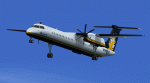
Repaint for Majestic Software Q400 into Bombardier/De Havilland house colors from 1998. Major artwork by Jonathan Alba and details by Alexandre Alves.
| Filename: | Majestic_Q400__De_Havilland_Bombardier_MSN4001_Col.zip |
| License: | Freeware |
| Added: | 12th July 2021, 05:05:59 |
| Downloads: | 74 |
| Author: | Alexandre Alves and Jonathan Alba |
| Size: | 1.96 MB |
| Category: Flight Simulator 2004 - Scenery | |
| Ship and Plane AI Traffic, Montréal Harbor |
|
File Description:
These files add Mike Hill's beautiful HMS Bark Endeavour sailing ship underway in front of Montréal's old port. There are also seaplanes taking off and landing. The ai traffic files were very well done by Holger Sandmann. The pictures indicate add on scenery as well. Details in the download. Thanks a lot guys.
| Filename: | Ship_and_Plane_AI_Traffic_Montral_Harbor.zip |
| License: | Freeware |
| Added: | 4th February 2004, 04:23:35 |
| Downloads: | 3,081 |
| Author: | Leon Louis |
| Size: | 353.01 KB |


© 2001-2026 AVSIM Online
All Rights Reserved
Privacy Policy |