
Where Flight Simulation Enthusiasts Gather from Around the World!
AVSIM Library - Search Results

| Category: Flight Simulator 2004 - Scenery | |
| Grand Junction Regional |

|
File Description:
FS2004 - Scenery Grand Junction Regional Airport (Walker Field) (IATA: GJT, ICAO: KGJT, FAA LID: GJT) is a public airport located three miles (5 km) northeast of the central business district of Grand Junction, a city in Mesa County, Colorado, United States. The airport covers 2,357 acres (9.5 km²) and has two runways. It is the largest airport in western Colorado. This Scenery is compatible with both FS9 default and Ultimate Terrain. Created using Instant Scenery by John B. Loney, Jr.
| Filename: | Grand_Junction_Regional.zip |
| License: | Freeware, limited distribution |
| Added: | 11th September 2008, 00:10:25 |
| Downloads: | 1,685 |
| Author: | John B. Loney, Jr. |
| Size: | 1.14 MB |
| Category: Flight Simulator 2004 - Scenery | |
| Glenorchy Airfield, New Zealand. NZGY. |
|
File Description:
Welcome to Glenorchy, a small rural airfield, 2 nautical miles south of the small village of Glenorchy,
on the shores of the beautiful Lake Wakatipu, in the South Island of New Zealand.
Glenorchy is only a very short flight from Queenstown Airport (NZQN), at the opposite end of Lake Wakatipu.
This scenery was built to fit into Robin Corn's freeware "Queenstown area Photoreal Scenery", freely
available on avsim.com ( filename.. nzqnv1.5.zip ).
Requires some EZ Scenery object sets (see INSTALL instructions for details).
| Filename: | Glenorchy_Airfield_New_Zealand__NZGY.zip |
| License: | Freeware, limited distribution |
| Added: | 12th September 2008, 09:06:11 |
| Downloads: | 1,011 |
| Author: | Lawrie Roache |
| Size: | 2.12 MB |
| Category: Flight Simulator X - Scenery Design | |
| Make photo-real ground textures |
|
Images related to this file:
File Description:
It is very easy to create your very own high-resolution, custom (photo-real) ground textures.
This document explains the concepts and techniques and illustrates the use of SBuilderX with which you can quickly and easily download aerial images and make this type of scenery.
So, why hesitate? Make Flight Simulator scenery as real as it gets!
Very sorry - no support of any kind is offered. Please do not write. For any questions, please post in the Avsim Scenery Design Forum.
| Filename: | Make_photoreal_ground_textures.zip |
| License: | Freeware |
| Added: | 21st November 2009, 23:20:06 |
| Downloads: | 19,284 |
| Author: | Luis Feliz-Tirado |
| Size: | 2.09 MB |
| Category: Flight Simulator X - Scenery | |
| LEMG-X-v2 |
|
Images related to this file:
File Description:
Hello Flightsim friends.
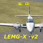
This is an new reworked ADE scenery of LEMG, Malaga Airport VERSION-2
Updated taxiway designators and the Taxiways: T2,T1, HN1- HN-2 HN-3
The Runways are now: 13 and 31. Many improvments to LEMG-X [1]
e.g.: No Entry signs at high speed turn-offs
If you've got my previous LEMG-X, replace the scenery folder with the one inside this LEMG-X folder
Scenery best viewed in extremely dense settings.
AVSIM upload only.
Have Fun!
| Filename: | LEMGXv2.zip |
| License: | Freeware, limited distribution |
| Added: | 2nd April 2010, 19:47:55 |
| Downloads: | 1,214 |
| Author: | Joost Visser |
| Size: | 394.88 KB |
| Category: Flight Simulator 2004 - Scenery | |
| X04 Orlando Apopka Airport |
|
Images related to this file:
File Description:
FS2004/FS9 Scenery--Orlando Apopka Airport X04 formally known as Orlando Country. A re-do of the default scenery and airport located in Apopka, Florida (FL). Buildings, parking, taxiways, etc. placed in the correct positions per Google Earth and all comm frequencies are correct. I added over 30 buildings and extended the runway from 964 meters to it's true length of 1215 meters as per AirNav. Scenery was created using ADE 9x. For installation instructions view the readme file. Enjoy
| Filename: | X04_Orlando_Apopka_Airport.zip |
| License: | Freeware |
| Added: | 11th March 2012, 19:56:13 |
| Downloads: | 256 |
| Author: | Bruce Bouley |
| Size: | 83.16 KB |
| Category: Flight Simulator 2004 - AFCAD Files | |
| KCLT Charlotte/Douglas International Airport |
|
File Description:
This is an up to date AFCAD file for ImagineSim's KCLT scenery as of 21.11.12. All gate assignments are 100% correct with all commuter airlines ICAO's included (AWEX,EGF, ASH, SKW etc); councourse E (US Airways Express flights) is now booming with aircraft as the original afcad had previous icao's (USAX). Runways are crosswind activated. ImagineSim's KCLT Payware scenery is required.
THIS DOES NOT INCLUDE THE NEW RUNWAY 18L/36R as the scenery by ImagineSim is quite old now.
| Filename: | KCLT_CharlotteDouglas_International_Airport.zip |
| License: | Freeware |
| Added: | 21st November 2012, 19:44:40 |
| Downloads: | 459 |
| Author: | Olly Pollard |
| Size: | 16.17 KB |
| Category: Flight Simulator X - Scenery | |
| Detailed Terrain Features for Southern Africa, Update 3 |
|
Images related to this file:
File Description:

Scenery consist of Updated Terrain Vector data concerning Coastlines, rivers, dams, streams, roads, traffic, railroads, power lines and extrusion bridges for Southern Africa countries South of the Equator. The Bree River, Robertson, Arnot, Witbank, Middelburg (South Africa) and Areas around Beira (Mozambique) was updated by utilizing Satellite image backgrounds.
This scenery is important and will be needed with release of future scenery by Aeroworx. Please install the previous release fsxWorx01.zip and updates before this file.
| Filename: | Detailed_Terrain_Features_for_Southern_Africa_Upda.zip |
| License: | Freeware |
| Added: | 2nd December 2012, 18:47:40 |
| Downloads: | 4,193 |
| Author: | Hannes Steyn, Aeroworx |
| Size: | 7.92 MB |
| Category: Flight Simulator X - AFCAD Files | |
| KPSO - Stevens Field, Pagosa Springs, Colorado, USA - V2.0 |
|
Images related to this file:
File Description:
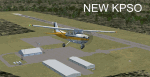
Updated scenery of Stevens Field, Pagosa Springs Airport nested in the high-altitude Rocky Mountains of Colorado. This scenery includes the airport and land class for surrounding areas to include the many small lakes, the city of Pagosa, and nearby inhabited areas. Airport features runway distance markers, new taxiways, taxiway signs, realistic parking, scenery objects, hangars, and FBO. How is your high-altitude flying? Enjoy! Version 2 includes updated taxiway structure circa 2013, signage, major roads added, and land class tweaks.
| Filename: | KPSO__Stevens_Field_Pagosa_Springs_Colorado_USA__V.zip |
| License: | Freeware |
| Added: | 30th May 2013, 06:10:06 |
| Downloads: | 536 |
| Author: | AJ Cook |
| Size: | 17.21 KB |
| Category: Flight Simulator X - Scenery | |
| Anthorn VLF Transmitter - Cumbria, UK |
|
File Description:
Formerly RNAS Anthorn until 1958, work began on the VLF Transmitter in 1962.
Work was completed in 1964 and the station was accepted by the MoD the same year.
This Scenery depicts only the masts and thier lights, I have not modelled any of the site buildings.
It works well enough in FSX Accelleration with Horizon VFR Scenery.
I have not tested it in any other FSX versions though I suspect it will work fine.
For image of the scenery please use "ZipDive".
| Filename: | Anthorn_VLF_Transmitter__Cumbria_UK.zip |
| License: | Freeware |
| Added: | 23rd December 2015, 12:34:09 |
| Downloads: | 397 |
| Author: | Mark Byers |
| Size: | 1.61 MB |
| Category: Flight Simulator 2004 - Scenery | |
| Townsville NQ Australia |
|
File Description:
QUEENSLAND COASTAL REVAMP FROM TOWNSVILLE TO CAIRNS FOR FS2004
This package contains 3 zip files covering:
1. Revamped coast, towns, islands, rivers & roads for the coastal strip of Queensland from the Burdekin River just south of Townsville to meet up with my Cairns scenery near Babinda in North Queensland.
2. Also includes a minor fix for a water flatten for the Mulgrave River.
3. Landclass files which upgrade my previously posted SE Qld Coast & Landclass scenery to accomodate the above new scenery.
| Filename: | Townsville__NQ_Australia.zip |
| License: | Freeware |
| Added: | 1st April 2004, 16:29:23 |
| Downloads: | 2,691 |
| Author: | Ross Casey |
| Size: | 202.91 KB |


© 2001-2026 AVSIM Online
All Rights Reserved
Privacy Policy |