
Where Flight Simulation Enthusiasts Gather from Around the World!
AVSIM Library - Search Results

| Category: Flight Simulator 2004 - AFCAD Files | |
| TBPB - Grantley Adams International, Barbados (Max Kraus - Freeware scenery) |

|
Images related to this file:
File Description:

This is part of the fifth round of Afcads issued by Alpha India Group. AIG Ground aims to create high quality Afcads for both FS2004 and for FSX default and Add On Scenery airports. Our Afcads are created drawing on a number of resources and aim to simulate the real world airport as closely as possible but also to take account of FS constraints and to ensure good levels of traffic and realistic traffic parking and flow around the airport.
Please read and follow installation instructions in the Readme file carefully, as these do vary.
Visit us at www.alpha-india.net for more information.
| Filename: | TBPB__Grantley_Adams_International_Barbados_Max_Kr.zip |
| License: | Freeware |
| Added: | 2nd November 2009, 04:11:58 |
| Downloads: | 1,065 |
| Author: | Mariano Bonaccorso & Alpha India Group |
| Size: | 393.48 KB |
| Category: Flight Simulator 2004 - Scenery | |
| Boulder (KBDU) / Longmont / Loveland, Colorado, Photo-Scenery (FS9 & FSX) |
|
Images related to this file:
File Description:
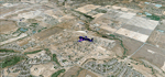
Boulder is situated where the Rocky Mountains meet the Great Plains. Just west of the city are imposing slabs of sedimentary stone tilted up on the foothills, known as Flatirons. Located at the base of the foothills is Boulder's main campus of the University of Colarado which is clearly visible from the sky. Longmont is home of the Denver ARTCC (Air Route Traffic Control Center) which controls all flights in the upper airspace of most of Colorado and parts of adjoining states. To explore the scenery depart from Boulder (KBDU) and head northeast. Extends my Rocky Mountain Park scenery to the east and my Denver scenery to the north. Provides another 3.500 sq km in 4.7m/pix quality. High resolution versions for FS9 and FSX (much sharper, but larger and multiple downloads) are available at www.blueskyscenery.com/GNB_East.html . The screenies are taken from the high-res versions, so expect this version to be slightly more blurry. YourDonation@Work: Dedicated to Senges and Eric.
| Filename: | Boulder_KBDU__Longmont__Loveland_Colorado_PhotoSce.zip |
| License: | Freeware, limited distribution |
| Added: | 28th December 2009, 20:14:09 |
| Downloads: | 2,389 |
| Author: | Gottfried Razek - blueskyscenery.com |
| Size: | 94.26 MB |
| Category: Flight Simulator 2004 - Scenery | |
| Leadville (KLXV), Mt. Elbert, Colorado, Photo-Scenery (FS9 & FSX) |
|
Images related to this file:
File Description:
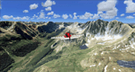
Extends my Aspen scenery to the east and contains more gorgeous Continental Divide area of the Rocky Mountains. Covers Leadville Lake County Airport (KLXV), which is the highest airport in North America (9.927 ft) and Mt. Elbert, which is the highest peak in the Rocky Mountains (14.443 ft). Aircraft performance deteriorates
with altitude, so many companies use the Leadville Airport as a base for high altitude performance testing. This scenery brings you another 3.500 sq km of beautiful Colorado in 4.7m/pix quality.
High resolution versions of this scenery for FS9 and FSX (much sharper, but larger and multiple downloads) are available at www.blueskyscenery.com/GNB_South2West.html . The screenies are taken from the high-res versions, so expect this version to be slightly more blurry. YourDonation@Work: Dedicated to Daniel, Art and Rotui.
| Filename: | Leadville_KLXV_Mt_Elbert_Colorado_PhotoScenery_FS9.zip |
| License: | Freeware |
| Added: | 1st February 2010, 19:06:58 |
| Downloads: | 1,713 |
| Author: | Gottfried Razek - blueskyscenery.com |
| Size: | 94.68 MB |
| Category: Flight Simulator 2004 - Scenery | |
| Martin Garcia and Timoteo Dominguez Islands Photo-Real Scenery |
|
Images related to this file:
File Description:
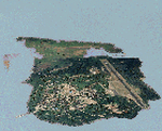
Photo-real scenery of the Martin Garcia and Timoteo Dominguez Islands on the River Plate, between Uruguay and Argentina. This package includes photo-real textures for the islands. Also included are Autogen vegetation and houses, together with a corrected airport location.
Scenery also works in FSX.
| Filename: | Martin_Garcia_and_Timoteo_Dominguez_Islands_PhotoR.zip |
| License: | Freeware, limited distribution |
| Added: | 20th February 2010, 02:08:20 |
| Downloads: | 862 |
| Author: | "As the Bird Flies / A Vuelo de Pajaro" group member Alan Pereira-Pierce |
| Size: | 396.4 KB |
| Category: Flight Simulator 2004 - Scenery | |
| Comb Ridge, Rock Point (49AZ), Utah/Arizona, Photo-Scenery |
|
Images related to this file:
File Description:
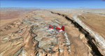
Comb Ridge, Rock Point (49AZ), Utah/Arizona, Photo-Scenery (FS9 & FSX)
This scenery extends my Monument Valley scenery to the east. It covers the area between the San Juan River in the north down to Rock Point, AZ (49AZ). Most of the scenery lies on the Navajo Nation Reservation. It completes the southeastern corner of Utah and paves our way into Colorado.
High resolution versions of this scenery for FS9 and FSX (much sharper, but larger and multiple downloads) are available at www.blueskyscenery.com/CNY_South3West6.html . The screenies are taken from the high-res versions, so expect this version to be slightly more blurry. Thanks to Joop Mak for providing custom AFCADs that correct airport layouts so that they align with the photo-textures! They are available at www.blueskyscenery.com/AFCADs.html . YourDonation@Work: Dedicated to Olivier, Kevin and Ruben.
| Filename: | Comb_Ridge_Rock_Point_49AZ_UtahArizona_PhotoScener.zip |
| License: | Freeware, limited distribution |
| Added: | 9th April 2010, 21:57:41 |
| Downloads: | 1,360 |
| Author: | Gottfried Razek, blueskyscenery.com |
| Size: | 90.99 MB |
| Category: Flight Simulator X - Scenery | |
| Branson Airport KBBG--New Airport, Scenery, and Flight Plans |
|
Images related to this file:
File Description:
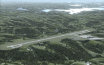
This project adds a new, detailed Branson Airport KBBG (Missouri) to FSX, which opened in May 2009, and is a privately developed commercial airport. The construction of the airport, which involved the flattening of several Ozark Mountains, is claimed to be the largest earthmoving project in Missouri history. As a result, the airport actually sits on a manmade plateau, surrounded by rolling hills. The airport uses the ICAO identifier BBG, however, the airlines use the IATA code BKG. The airport is served by AirTran, Frontier, and ExpressJet (Branson AirExpress), and is located in hilly terrain. Aircraft equipped with a terrain avoidance warning system may experience system activation on final approach. Birds are in the vicinity of the airport. AFCAD with sloping terrain created using Airport Design Editor X v1.47.07, and the hilltops were cleared and flattened and roads were added using SBuilderX 3.13. The terminal, hangar, FBO, and cars were added and modified from stock FSX scenery, using the FSX Object Tool, to resemble as closely as possible the actual airport.
| Filename: | Branson_Airport_KBBGNew_Airport_Scenery_and_Flight.zip |
| License: | Freeware |
| Added: | 5th August 2010, 01:08:33 |
| Downloads: | 2,005 |
| Author: | Carlyle Sharpe |
| Size: | 6.02 MB |
| Category: Flight Simulator 2004 - Scenery | |
| Branson Airport KBBG--New Airport, Scenery, and Flight Plans |
|
Images related to this file:
File Description:
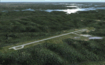
This project adds a new Branson Airport KBBG (Missouri) to FS 2004, which opened in May 2009, and is a privately developed commercial airport. The construction of the airport, which involved the flattening of several Ozark Mountains, is claimed to be the largest earthmoving project in Missouri history. As a result, the airport actually sits on a manmade plateau, surrounded by rolling hills. The airport uses the ICAO identifier BBG, however, the airlines use the IATA code BKG. The airport is served by AirTran, Frontier, and ExpressJet (Branson AirExpress), and is located in hilly terrain. Aircraft equipped with a terrain avoidance warning system may experience system activation on final approach. AFCAD created using Airport Design Editor 9 v1.47.07, and the hilltops were cleared and flattened and roads were added using SBuilder 2.05 revision 06. The terminal and hangar were added and modified from within Airport Design Editor 9. This airport is based on my more detailed FSX version, Branson_Airport_Project.zip.
| Filename: | Branson_Airport_KBBGNew_Airport_Scenery_and_Flight.zip |
| License: | Freeware |
| Added: | 16th August 2010, 20:50:16 |
| Downloads: | 1,734 |
| Author: | Carlyle Sharpe |
| Size: | 3.23 MB |
| Category: Flight Simulator X - Scenery | |
| Hangar Scenery for DVA (Delta Virtual Airlines) Version 1.0 |
|
Images related to this file:
File Description:
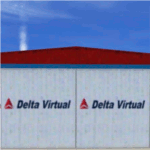
This scenery has been developed for FSX Flight Simulator SP1 or SP2. It has also been tested with Microsoft Acceleration but compatibility is not guaranteed by the author. The scenery includes the DVA hangar in Atlanta. The scenery is primarily developed for the DVA community, however, any flightsim enthusiast is more than welcome to install and use this hangar as a Service Center for maintenance.
For Installation of the scenery please look at the documentation inside the .zip file.
| Filename: | Hangar_Scenery_for_DVA_Delta_Virtual_Airlines__Ver.zip |
| License: | Freeware |
| Added: | 13th December 2011, 13:24:08 |
| Downloads: | 361 |
| Author: | Dietmar Loleit, Kaj O. Hallstrom |
| Size: | 14.29 MB |
| Category: Flight Simulator X - Scenery | |
| Polish Airports Photo Scenery Vol.1 - EPBK - Bialystok Krywlany |
|
Images related to this file:
File Description:
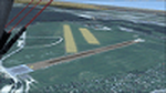
The first Vol. of my VFR Photo Sceneries. In this volume we've got EPBK- Bialystok Krywlany.
| Filename: | Polish_Airports_Photo_Scenery_Vol1__EPBK__Bialysto.zip |
| License: | Freeware, limited distribution |
| Added: | 28th September 2013, 12:16:37 |
| Downloads: | 381 |
| Author: | Mikolaj Dudko |
| Size: | 24.62 MB |
| Category: Flight Simulator 2004 - Scenery | |
| Little Port Walter for Holger Sandmann's Tongass Fjords scenery |
|
Images related to this file:
File Description:
This is a second fish farm at the southern end of Baranof Island and Chatham Strait in southern Alaska. Big Port Walter is named on the chart of the area, and there is a section of the chart included here. Little Port Walter is a much smaller offshoot bay, sheltered from the weather and ideal for a fish farm. This scenery is designed specifically for use in the Tongass Fjord scenery. I may have incorrectly identified Tongass Fjords as being required for Hawk Logging when Glacier Bay is needed. Ah well, it is one or the other of them. The fish farm (or hatchery, the description varies) has an identifying code so it will show up on a gps as PWL. There is no interaction with atc as there are no designated water runways, so PWL on the gps just acts as a waypoint. There will be further posts for use with Tongass Fjords, Misty Fjords, and Glacier Bay, and I still find these scenery areas by Holger and his crew the most satisfying in FS9.
| Filename: | Little_Port_Walter_for_Holger_Sandmanns_Tongass_Fj.zip |
| License: | Freeware, limited distribution |
| Added: | 23rd November 2014, 01:33:12 |
| Downloads: | 235 |
| Author: | Roger Wensley |
| Size: | 3.38 MB |


© 2001-2026 AVSIM Online
All Rights Reserved
Privacy Policy |