
Where Flight Simulation Enthusiasts Gather from Around the World!
AVSIM Library - Search Results

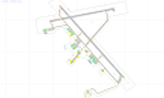
| Category: Flight Simulator X - AFCAD Files | |
| TTPP - Piarco International Airport / Trinidad and Tobago |

|
Images related to this file:
File Description:
TTPP - Piarco International Airport / Trinidad and Tobago
This airport update was made with the latest version of ADE (Airport Design Editor) and made for FSX as a replacement for the stock (default) airport. I've made several changes to the airport which are listed below. All these enchancements are as close to the real airport as I can get with stock library objects. I've used satellite images, terminal photos and maps throughout the whole process so building locations are as accurate as possible. Happy landings in festive Trinidad and Tobago!
Features:
*Expanded parking apron
*Taxiway improvements
*Minor runway corrections
*Completely redesigned main terminal building with accurate gate numbering and jetways
*Old south terminal redesigned and now handles cargo and executive flying
*GA ramp
*Misc airport buildings added
*Airport vehicles and objects throughout the airport
*Fuel vehicles
*Fire station and vehicles
*Static aircraft
*CAUTION: Birds in vicinity of runway
| Filename: | TTPP__Piarco_International_Airport__Trinidad_and_T.zip |
| License: | Freeware |
| Added: | 29th January 2013, 00:37:14 |
| Downloads: | 1,220 |
| Author: | Jaison Diaz / Endeavour ai |
| Size: | 127.93 KB |
| Category: Flight Simulator X - Scenery | |
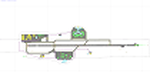
| FA44 - Willis / Boynton Beach - Miami, Florida - USA |
|
Images related to this file:
File Description:
Neighbor to my 'Antiquers Aerodrome' here at avsim, Willis is another small grass strip just North of Antiquers Aerodrome in the Miami/Ft. Lauderdale area.
I gave it a light touch-up, changed concrete taxiways to oil-treated, added an avgas station, lit the runway, fenced it, an added a small parking lot.
This is a bee-utiful area to fly around in with many many airports. Some are nothing more than a a unmarked no bldg. grass strip all the way up to Miami International. Bahamas a short hop to the East, and Key West to the south. Best observed low & slow in an 'ol tail-dragger.
Three freeware beauties are included to get you started: A.F. Scrub's Fairey Fantome, Yak air7, and P. Clawson's Stinson Voyager.
They are written into the Traffic file along with the retro-paints MS Piper Cub and Mooney Bravo.
| Filename: | FA44__Willis__Boynton_Beach__Miami_Florida__USA.zip |
| License: | Freeware, limited distribution |
| Added: | 18th November 2014, 15:01:10 |
| Downloads: | 467 |
| Author: | Jeff Reed |
| Size: | 16.46 MB |
| Category: Flight Simulator X - AFCAD Files | |
| CYXU - London International Airport / London, Ontario, Canada |
|
Images related to this file:
File Description:
CYXU - London International Airport / London, Ontario, Canada
This airport update was made with the latest version of ADE (Airport Design Editor) and made for FSX as a replacement for the stock (default) airport. I've made several changes to the airport which are listed below. All these enchancements are as close to the real airport as I can get with stock library objects. I've used satellite images, terminal photos and maps throughout the whole process so building locations are as accurate as possible. Happy landings in the beautiful Canada!
Features:
*Expanded parking apron
*Main terminal building with its jetways and regional jet parking area
*Seperate parking aprons for GA traffic
*Hangars and other airport buildings added
*Airport vehicles and objects throughout the airport
*Parking lots with static vehicles
*Airport fire station with fire trucks
*De-icing vehicles/runway plows
*Cargo ramp
*Helipad
*Diamond Aircraft Industries building/apron
| Filename: | CYXU__London_International_Airport__London_Ontario.zip |
| License: | Freeware |
| Added: | 28th July 2012, 08:41:55 |
| Downloads: | 955 |
| Author: | Jaison Diaz / Endeavour ai |
| Size: | 128.88 KB |
| Category: Flight Simulator X - Scenery | |
| RNAS Henstridge (HMS Dipper) |
|
File Description:
Royal Naval Air Station Henstridge or RNAS Henstridge (HMS Dipper) is a former Fleet Air Arm base located 7 miles (11 km) west of Shaftesbury, Dorset (Now Somerset) and 12.4 miles (20.0 km) east of Yeovil, Somerset in South West England.
The main part of the land (355 acres) was purchased in August 1941, after which building of the airfield and the marsh lane accommodation site commenced, it was commissioned on April 1, 1943 as HMS Dipper, principally as number 2 naval fighter school, on the 11th September 1942, another 18 acres was acquired at the adjoining gibbs marsh area for an aircraft repair and maintenance site. The design and lay-out of the airfield was quite unique, having 5 runways, 2 of these being east west lay-out (07-25) both 1000 yards long, the northern runway incorporated a dummy deck landing strip, complete with under-ground arresting gear with four above ground arrestor wires, which was a duplicate of that installed on HMS Implacable for training of aircraft carrier landings, these mainly being carried out with the Seafire, a naval version of the spitfire with folding wings. The site also had its own cinema and stage hall
March 1952 the airfield became inactive and was placed under care and maintenance, during 1953 Air whaling (now Bristow group) used the facilities for repairs to the whaling fleet of helicopters until moving out in June 1958.June 1957 it was finally closed as a naval establishment, from 1958-1960 the entire site was sold off. 27 June 1980 the BBC purchased the whole site and applied for planning permission to erect at the airfield a shortwave radio station consisting of 21 self-supporting towers holding aerial arrays and ancillary buildings on a 300-acre site. The station would transmit overseas radio services to Eastern Europe, the Soviet Union and perhaps South America the application failed and the BBC sold the land during January 1987 The airfield is also the home of the wessex strut, a general aviation club formed in January 1977, which holds an annual fly in and other events their first fly-in was on 17 April 1977 and attracted 107 aircraft. As of today the only usable runway is the north 07-25 runway, extant with the concrete dummy deck, and the underground machinery chamber, it is also the home to a large number of light aviation enthusiasts aircraft as well as the Yakolevs aerobatic display team and the Dorset and Somerset air ambulance
The current airfield is operated by EGHS and is an unlicensed airfield. The only usable runway is 07/25 tarmac/concrete 750 mts long x 6 mtr wide. Henstridge radio can be contacted on 130.250 MHz, it can be found at the south eastern stub of the Yeovilton MATZ
Source:Wikipedia
| Filename: | RNAS_Henstridge_HMS_Dipper.zip |
| License: | Freeware |
| Added: | 9th February 2017, 22:14:54 |
| Downloads: | 165 |
| Author: | Terry Boissel |
| Size: | 4.53 MB |
| Category: Flight Simulator X - Scenery | |
| RAF Tholthorpe |
|
File Description:
RAF Tholthorpe opened in the late 1930s as a grass airfield, and operated as a sub-station of RAF Linton-on-Ouse.
From August 1940 to December 1940, Tholthorpe was a landing field for Whitley bombers of No. 58 Squadron RAF and No. 51 Squadron RAF based at Linton. From January 1941 to June 1943, Tholthorpe underwent maintenance to upgrade to Class A standards, with three intersecting concrete runways.
RAF Tholthorpe was assigned to No. 6 Group RCAF in June 1943. RCAF squadrons stationed here included No. 434 Squadron "Bluenose", 431 Squadron "Iroquois", 420 Squadron "Snowy Owl", and 425 Squadron "Alouette".
No. 434 Squadron, flying Halifax bombers, was formed and headquartered at Tholthorpe airfield from June 1943 until the squadron was moved to Croft. In July 1943, 431 Squadron moved to Tholthorpe airfield from Burn. It was later moved to Croft airfield as well. Not only were the operational squadrons quartered here, also their service echelons, - respectively Nos. 9431 and 9434 Service Echelon - which were formed from the ground crew of nos. 431 and 434 Squadron on 3 November 1943 and who moved with their squadrons on to Croft in December 1943.
In December 1943 No. 420 and No. 425 Squadrons (together with their service echelons, nos. 9420 and 9425 Service Echelon were moved to Tholthorpe airfield from Dalton and Dishforth respectively. These squadrons had returned from service with Wellingtons in North Africa, and it took them several weeks to work up on the newly acquired Halifax bombers. They were therefore unable to fly their first raids from Tholthorpe until mid-February 1944.
No. 420 Squadron flew 160 operations from Tholthorpe airfield and lost 25 Halifax’s. No. 425 squadron flew 162 operations from Tholthorpe airfield and lost 28 Halifax’s. In all, 119 Halifax bombers were lost from Tholthorpe. In April and May 1945 nos. 420 and 425 Squadron converted to Avro Lancaster’s, which they took with them when they left for RCAF Debert, Nova Scotia, Canada in June 1945.
The station closed in June 1945.
| Filename: | RAF_Tholthorpe.zip |
| License: | Freeware |
| Added: | 9th May 2017, 20:41:48 |
| Downloads: | 138 |
| Author: | Terry Boissel |
| Size: | 4.63 MB |
| Category: Flight Simulator 2004 - Scenery | |
| Airports Northern Coast Alaska (PALU, PPIZ, PAWI, AK03) |
|
Images related to this file:
File Description:
The town of Barrow is in the far north of Alaska, and these are coastal villages or radar installations to the west of Barrow, and there will be additions. Cape Lisburne is a gravel runway right next to the coast with radar gear and accomodation buildings close by, and what was called "Top Camp" at the end of a long and steep road to the top of a nearby hill, or mountain. The runway is lit, as are most of them in this area of long dark winter nights. Barrow is 270 miles to the northeast. Point Lay PPIZ used to have a radar installation as well as a village, but the old buildings have now been removed and the gravel runway 05-23 has been lengthened to 5,000 feet to serve the village throughout the year. The population is around 270, living mostly traditionally and with an annual beluga whale hunt. Barrow is 180 miles to the northeast.
Wainwright PAWI, some 80 miles southwest of Barrow and on the coast, has a population of around 570. The PAWI runway is just under 5,000 feet long and like PPIZ is aligned 05-23, lit, and with PAPI on each end. The original runway of some 2,000 feet is still visible next to the apron. Three miles to the southeast there is a third runway, at AK03, serving the Wainwright DEW station. It was decided in 2007 to close the station and to remove the buildings both there and at Point Lay because of subsidence, but everything at Wainwright was still in place in 2009 and beyond. The villages have been "sketched" as opposed to replicated exactly. The texture folder includes the missing car textures for Barrow PABR, and the AI is modified PABR to include passenger flights by Ravn and cargo flights by Northern Air Cargo, plus limited GA. There are no flattened grassed areas at these airfields; they are runways and taxiways and aprons on a bed of gravel on permafrost.
| Filename: | Airports_Northern_Coast_Alaska_PALU_PPIZ_PAWI_AK03.zip |
| License: | Freeware, limited distribution |
| Added: | 16th June 2016, 15:59:24 |
| Downloads: | 360 |
| Author: | Roger Wensley |
| Size: | 10.84 MB |
| Category: Flight Simulator X - Aircraft Repaints, Textures and Modifications | |
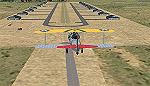
| George Bush N2S-1 Stearman (N50061) |
|
Images related to this file:
File Description:
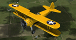
This is a repaint only, for the payware Vertigo Studios Stearman Vol.1 set. This repaint depicts the restored Stearman N2S-1, N50061, owned/operated by Paul Ehlen and based at the Wings of the North Museum at Flying Cloud Airport, Eden Prairie, Minnesota. The aircraft, originally manufactured as U.S. Navy BuNo. 3347, is one of five Stearmans known to still exist that were flown by President George H. W. Bush as a cadet in the Navy. He flew this aircraft while training in the cold Minnesota winter at Wold-Chamberlain Airfield, Naval Air Station Minneapolis (modern-day KMSP), in January and early February 1943. The aircraft was sent to AirCorps Aviation for ground-up restoration in 2014, and emerged in 2015 as one of, if not the most period-authentic restored Stearmans to-date, restored to just as it was in 1943 (no electric starter (only hand-crank start) and no radios of any sort). The aircraft won "Best Stearman" at Oshkosh 2015.
| Filename: | George_Bush_N2S1_Stearman_N50061.zip |
| License: | Freeware |
| Added: | 22nd January 2017, 04:10:24 |
| Downloads: | 213 |
| Author: | John Terrell |
| Size: | 25.25 MB |
| Category: Flight Simulator X - Scenery | |
| X2MB - RAF Membury - Berkshire, England |
|
File Description:
RAF Membury (ICAO X2MB) is a former Royal Air Force station built in the civil parish of Lambourn in Berkshire, England. The airfield is located approximately 4.6 miles (7.4 km) mi north-northwest of Hungerford, at the Membury services stop of the M4 motorway; about 60 miles (97 km) miles west-southwest of London. The airfield also lies immediately next to the Iron Age hill fort of Membury Camp.
Opened in 1942, it was used by both the Royal Air Force (RAF) and United States Army Air Forces (USAAF). During the war it was used by several combat units with varying missions. It was also a major supply and maintenance depot. After the war, it was a private airport until the construction of the M4 motorway in the 1960s when it was closed.
Today the remains of the airfield are located on private property with the former technical site now being an industrial estate (Membury Business Park).
Source: Wikipedia
| Filename: | X2MB__RAF_Membury__Berkshire_England.zip |
| License: | Freeware |
| Added: | 7th April 2016, 17:26:37 |
| Downloads: | 126 |
| Author: | Terry Boissel |
| Size: | 1.63 MB |
| Category: Flight Simulator X - Scenery | |
| RAF Snetterton Heath - Norfolk, England |
|
File Description:
RAF Snetterton Heath is a former Royal Air Force station located south east of the A11, 6 miles (9.7 km) south west of Attleborough, Norfolk, England.
RAF Snetterton Heath airfield was constructed in 1942 to Class-A specifications. Originally thirty-six hardstandings of the "frying pan" type were constructed as when work started, the base was intended for Royal Air Force (RAF) use. When re-scheduled for the United States Army Air Forces (USAAF), the number was increased to fifty, all of them being on the south and eastern side of the airfield as a railway line and the A11 road restricted dispersed locations.
With the end of military control Snetterton Heath was closed and privately purchased in 1952 with a view to utilizing the runways and perimeter tracks as a motor racing circuit. The first motor cycle meeting was held in 1953 and the first motor races the following year. Source: Wikipedia.
| Filename: | RAF_Snetterton_Heath__Norfolk_England.zip |
| License: | Freeware |
| Added: | 22nd January 2016, 16:10:44 |
| Downloads: | 172 |
| Author: | Terry Boissel |
| Size: | 1.43 MB |
| Category: Flight Simulator X - Scenery | |
| RAF Fiskerton |
|
File Description:
RAF Fiskerton was a Royal Air Force station located north of the Lincolnshire village of Fiskerton, 5.0 miles east of Lincoln, Lincolnshire, England
It was one of many new bomber airfields built in the early part of World War II. The airfield was situated north of the village from where it got its name. It was one of only 15 RAF airfield equipped with FIDO, a fog-clearing system utilizing petrol pumped through pipes alongside the main runway and burned via a sequence of nozzles.
No. 49 Squadron and No. 576 Squadron RAF were stationed at RAF Fiskerton. 49 squadron took part in the Peenemande raid on the research and development centre for the V2 missile. 576 Squadron took part in the raid on Hitler's hideout at Berchtesgaden and in Operation Manna.
Between 1962 and 1992 a Headquarters of the Royal Observer Corps was located within the airfield boundary.
| Filename: | RAF_Fiskerton.zip |
| License: | Freeware |
| Added: | 21st October 2015, 20:30:21 |
| Downloads: | 251 |
| Author: | Terry Boissel |
| Size: | 16.04 KB |
© 2001-2026 AVSIM Online
All Rights Reserved
Privacy Policy |