
Where Flight Simulation Enthusiasts Gather from Around the World!
AVSIM Library - Search Results

| Category: Flight Simulator 2004 - Scenery | |
| HLLM Wheelus Air Base 1955-1962 |

|
File Description:
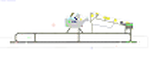
Wheelus AB was a USAF base located in Tripoli Libya until it was closed in 1970. Wheelus served many purposes: as a MATS station; as a Reflex base hosting various bombers for short rotations at different times; and as a gunnery and bombing training facility supporting many United States Air Forces in Europe squadrons which flew in for month long training sessions to practice live gunnery and bomb training exercises at the nearby El-Uotia Gunnery Range. This is also included in the scenery. Separate traffic is provided for 1955, 1957, 1959 and 1962, each schedule reflecting a mix of visiting squadrons and aircraft types. It can get to be a pretty colorful place if you install all those provided for.
| Filename: | HLLM_Wheelus_Air_Base_19551962.zip |
| License: | Freeware |
| Added: | 25th June 2023, 17:30:52 |
| Downloads: | 104 |
| Author: | Al Von Pingel, Ken Lawson, Dan French |
| Size: | 62.89 MB |
| Category: Flight Simulator X - AFCAD Files | |
| MNMG - Augusto C. Sandino International Airport - Managua, Nicaragua |
|
Images related to this file:
File Description:

MNMG - Augusto C. Sandino International Airport / Managua, Nicaragua. Augusto Cesar Sandino International Airport (Spanish: Aeropuerto Internacional Augusto Cesar Sandino) (IATA: MGA, ICAO: MNMG) is the main airport in Managua, Nicaragua and the busiest airport in the country.
Features:
*Runway properly renumbered
*Taxiways properly designed and signs updated
*Runway length expanded to current length
*Expanded parking apron
*Runway markings and lighting corrected
*Parking spots for commercial traffic
*Parking area for domestic flights
*Separate parking area for GA traffic
*Misc airport buildings added
*Airport vehicles and objects throughout the airport
*Fuel service vehicles
*Fire station and vehicles
*Static vehicles (requires objlib-large-car-parking-fsx.zip)
*Light poles (requires fsx_lts.zip)
| Filename: | MNMG__Augusto_C_Sandino_International_Airport__Man.zip |
| License: | Freeware |
| Added: | 14th April 2014, 23:33:21 |
| Downloads: | 1,035 |
| Author: | Jaison Diaz / Endeavour ai |
| Size: | 90.52 KB |
| Category: Flight Simulator 2004 - Scenery | |
| Airfield Delta Club Napoli |
|
File Description:
Scenery of airfield Delta Club Napoli situated 20 NM nord of Naples:
41° 3 55 Nord ; 13° 57 45 Est; ICAO Code: CECV
Features:
-Contain RW 06/24 two Hangars, one for parking and one for maintenance certified Tecnam;
-Gas station;
-Structure for the control of an unmanned airplane TECNAM forecast for collections by the Campania region
****************************
Aviosuperfice Delta Club Napoli situata a 20 nm da Napoli
41° 3 55 Nord; 13° 57 45 Est; Codice ICAO: CECV
Caratteristiche:
-Contiene RW 06/24, due hangar, uno per il parcheggio e una per la manutenzione certificata TECNAM; -Distributore di benzina; -Struttura per il controllo di un Tecnam senza pilota per le previsioni meteo da parte della Regione Campania
| Filename: | Airfield_Delta_Club_Napoli.zip |
| License: | Freeware |
| Added: | 15th January 2010, 20:19:57 |
| Downloads: | 609 |
| Author: | Stanislao Senese |
| Size: | 1.77 KB |
| Category: Flight Simulator X - Scenery | |
| PACD - Cold Bay Airport - Alaska, USA |
|
File Description:
Cold Bay Airport (IATA: CDB, ICAO: PACD, FAA LID: CDB) is a state owned, public use airport located in Cold Bay,a city in the Aleutians East Borough of the U.S. state of Alaska. First built as a United States Army Air Forces airfield during World War II, it is one of the main airports serving the Alaska Peninsula.
There is a National Weather Service (NWS) office (which sends up radiosonde balloons twice a day) colocated with the FAA Flight Service Station at the airport. The NWS ranks Cold Bay as the cloudiest city in the United States.
Changes were made based on 2011 construction plans and photos taken in 2013. Custom buildings were made for all services at the airport.
| Filename: | PACD__Cold_Bay_Airport__Alaska_USA.zip |
| License: | Freeware |
| Added: | 24th July 2013, 00:34:15 |
| Downloads: | 2,533 |
| Author: | Wayne Roberts |
| Size: | 5.53 MB |
| Category: Flight Simulator X - AFCAD Files | |
| KHSV - Updated |
|
File Description:
This is the update of my previous FSX AFCAD for the default airport KHSV (Huntsville-Intl-Jones-Airport) located at Huntsville, Alabama. The AFCAD was modified using ADE v1.37 and includes changes per FAA charts, and as seen from above using Google Earth. The original control tower has been removed, a helipad with night lights and some static aircraft have been added in its place. The real airport does not have a helipad. Also I added a Fire Station and roadways like the real airport. Additional information is included in the AFCAD readme!.txt zip file. This AFCAD has not been tested in Flight Simulator 2004 and you do not need my previous KHSV files for this AFCAD update to work.
| Filename: | KHSV__Updated.zip |
| License: | Freeware |
| Added: | 3rd July 2011, 03:16:57 |
| Downloads: | 376 |
| Author: | Leroy Mears |
| Size: | 32.68 KB |
| Category: Flight Simulator X - AFCAD Files | |
| SGAS - Silvio Pettirossi International Airport - Asuncion, Paraguay |
|
Images related to this file:
File Description:
Silvio Pettirossi International Airport (IATA: ASU, ICAO: SGAS) is Paraguay's main national and international gateway, located at Luque, suburb of the capital Asuncion. It is named after the Paraguayan aviator Silvio Pettirossi. The airport serves as a hub for TAM Airlines Paraguay and also receives international service from several carriers.
Features:
*Taxiways properly designed and signs updated
*Expanded parking apron
*Redesigned terminal building
*Runway markings and lighting corrected
*Parking spots for commercial traffic
*Parking area for GA traffic
*Parking for military aircraft
*Misc airport buildings added
*Airport vehicles and objects throughout the airport
*Fuel service vehicles
*Fire station
*Static vehicles (requires objlib-large-car-parking-fsx.zip)
*Light poles (requires fsx_lts.zip)
| Filename: | SGAS__Silvio_Pettirossi_International_Airport__Asu.zip |
| License: | Freeware |
| Added: | 8th July 2014, 23:14:09 |
| Downloads: | 1,069 |
| Author: | Jaison Diaz / Endeavour ai |
| Size: | 105.75 KB |
| Category: Flight Simulator 2004 - Scenery | |
| Chelsea Dams on the Gatineau River |
|
Images related to this file:
File Description:
The Chelsea Dams are on the Gatineau River, just north of Rockcliffe airfield. I have used the plural as while there is only one dam as such, there is a second generating station just south of the dam; so "it" is more generally called "the Chelsea Dams". The dams mark the point where, if you are flying south down the Gatineau River towards Rockcliffe, you should be either below 1,500 feet or talking to the Ottawa control tower. While not a reporting point as noted in the supplement notes about flying vfr in the Ottawa area the dams are still the natural reporting point when approaching Rockcliffe and announcing landing intentions. Plus they are a visible landmark from way off, so here they are.
| Filename: | Chelsea_Dams_on_the_Gatineau_River.zip |
| License: | Freeware, limited distribution |
| Added: | 14th February 2010, 23:11:15 |
| Downloads: | 256 |
| Author: | Roger Wensley |
| Size: | 879.08 KB |
| Category: Flight Simulator X - Scenery | |
| UTFN - Namangan, Uzbekistan |
|
Images related to this file:
File Description:
This is fictional scenery for Namangan (UTFN), Uzbekistan, designed for FSX.
I created this scenery to be more representative of the real life airport. I accomplished this by making modifications to the stock airport, using Google Satellite images and pictures for guidance. Also pictures of the terminal when they are available.
Here is what to look for in this scenery package:
- Added a custom made terminal as depicted in actual airport pictures.
- Added apron and taxiways as depicted in the actual airport pictures.
- Added a couple of hangers and SU-35 aircraft parked on the apron.
- Added a fire station and Control Tower.
- Flattened the terrain on the runway because part of the it was underground.
- Deleted a few trees on both approaches.
| Filename: | UTFN__Namangan_Uzbekistan.zip |
| License: | Freeware |
| Added: | 28th May 2014, 10:56:00 |
| Downloads: | 553 |
| Author: | Ed Bleck |
| Size: | 1.14 MB |
| Category: Flight Simulator 2004 - Scenery | |
| Retro Scenery for NAS Chase Field, Texas, U.S.A. |
|
Images related to this file:
File Description:

Originally opened as Beeville Municipal Airport, the land was leased from the Navy in 1943 for the construction of Chase Field, a training base for Naval Air Cadets and was one of three satellite airfields for Corpus Christi NAS. At the end of WWII the station was closed and re-purposed for various educational and local civic uses only to be reopened with the commencement of the Korean War in 1953. This resulted in a significant expansion of the original facilities and by the early 1980s Chase Field had a complement of 2,500, along with over 160 aircraft. Finally BRAC-ed in 1991 the field was finally closed in 1993. Scenery contains custom objects as well as photo-realistic ground cover with provisions for appropriate aircraft.
| Filename: | Retro_Scenery_for_NAS_Chase_Field_Texas_USA.zip |
| License: | Freeware, limited distribution |
| Added: | 27th April 2014, 21:31:40 |
| Downloads: | 670 |
| Author: | John Stinstrom |
| Size: | 2.58 MB |
| Category: Flight Simulator X - Scenery | |
| KSWF - Stewart Intl Airport, Newburgh, New York, USA |
|
Images related to this file:
File Description:
This airport update is for KSWF with two optional files made only for FSX, one version with the Crosswind runway activated and in full operation where both runways will be used for takeoff and landing and one version as the default airport runway operation: the passenger terminal and jetways now included, assigned parking as per their website, taxiways and taxi signs updated to the latest charts, cargo apron now in the correct place, ANG ramp area updated including its buildings, fuel trucks and support vehicle roads added, fire station, heli pad with start location, and many other scenery objects added, airport views are from the roof of the control tower (when in tower view) please view the readme before installation.
| Filename: | KSWF__Stewart_Intl_Airport_Newburgh_New_York_USA.zip |
| License: | Freeware, limited distribution |
| Added: | 26th April 2016, 02:07:18 |
| Downloads: | 7,728 |
| Author: | Craig Scott |
| Size: | 1.65 MB |
© 2001-2026 AVSIM Online
All Rights Reserved
Privacy Policy |