
Where Flight Simulation Enthusiasts Gather from Around the World!
AVSIM Library - Search Results

| Category: Orbiter - Spaceships | |
| STS Guidance MFD Beta 3c (for Version 2 Shuttles) |

|
File Description:
**NOTE** This beta version of STS Guidance MFD REQUIRES Ver 2 Shuttles and will only operate correctly if the line 'OMS' is in the Shuttle section of the scenario file you are flying. STS Guidance MFD provides a guidance & control system for the Space Shuttle, including an automated rendezvous program. The other programs in the MFD are automated apogee/perigee adjustments, automated orbital plane alignment and an on-orbit attitude controller which holds the shuttle in the "-ZLV -XVV" attitude (retrograde, heads-down). This release does not come with documentation, so if you wish to learn about how to operate it then you should consult the documentation given in Soyuz-GuidanceMFD (also available here). For updates & FAQ see www.massey.ac.nz/~rjcroy.
| Filename: | STS_Guidance_MFD_Beta_3c_for_Version_2_Shuttles.zip |
| License: | Freeware |
| Added: | 13th June 2003, 15:39:45 |
| Downloads: | 3,903 |
| Author: | Richard Croy, Chris Knestrick |
| Size: | 91.85 KB |
| Category: Flight Simulator X - Scenery | |
| RAF Shepherds Grove - Suffolk, England |
|
File Description:
RAF Shepherds Grove is a former Royal Air Force station located 9.9 miles (15.9 km) north-east of Bury St Edmunds, Suffolk, England.
The Station was originally built for the United States Army Air Forces (USAAF) Eighth Air Force during the Second World War. However the facility was not used by the USAAF and was opened by No. 3 Group RAF on 3 April 1944. The name came from a small copse nearby and the airfield is close to Walsham le Willows in Suffolk.
It was occupied by No. 196 Squadron RAF in January 1945 as a base for Operation Varsity, supporting the Rhine crossing.
Various American units occupied the station after WW2 but ended their use of the unit in December 1958.
On 22 July 1956, No. 82 Squadron RAF was activated at Shepherds Grove as a Thor missile unit. Thor launching sites were built on the main airfield and became operational in 1959.
The base was closed in 1966. Third party files are required - see the readme.txt for details.
| Filename: | RAF_Shepherds_Grove__Suffolk_England.zip |
| License: | Freeware |
| Added: | 4th December 2015, 09:34:13 |
| Downloads: | 159 |
| Author: | Terry Boissel |
| Size: | 13.26 KB |
| Category: Flight Simulator X - Scenery | |
| RAF Dalton |
|
File Description:
RAF Dalton was named after a local village although it was closer to RAF Topcliffe who it was intended to be the
satellite for.
RAF Dalton was home to No. 102 Squadron beginning in November 1941. No. 102 Squadron returned to Topcliffe in June
1942 and for a time Dalton hosted No. 1652 Heavy Conversion Unit (HCU) flying Halifaxes. The airfield was improved in
1942 and in early 1943 was allocated to No. 6 Group Royal Canadian Air Force (RCAF). Canadian squadrons stationed
here at one time or another included No. 428 Squadron, No. 424 Squadron, No. 420 Squadron, and No. 1666 Heavy
Conversion Unit (which moved to RAF Wombleton in October 1943). The station also housed no. 1691 Bomber Gunnery Flight
(BGF) RCAF and its successor, No. 1695 Bomber Defence Training Flight (BDTF) RCAF, the last RCAF unit to serve at this
station.
In November 1944, control passed from No. 6 Group to the new No. 7 (Training) Group. By August 1945 all units at
Dalton were disbanded or transferred and the Station closed in 1946.
Source:Wikipedia
| Filename: | RAF_Dalton.zip |
| License: | Freeware |
| Added: | 26th February 2017, 07:30:47 |
| Downloads: | 80 |
| Author: | Terry Boissel |
| Size: | 1.57 MB |
| Category: Flight Simulator X - Scenery | |
| RAF Skipton On Swale |
|
File Description:
RAF Skipton On Swale is a former Royal Air Force station operated by RAF Bomber Command during the Second World War.
The village of Sandhutton is located just to the east. RAF Skipton-on-Swale was a sub-station of RAF Leeming.
The airfield opened in autumn 1942, becoming operational in May 1943, originally a 4 Group facility and first hosted
420 Squadron, Royal Canadian Air Force (RCAF), which moved to RAF Middleton St. George in October 1942. Skipton was
assigned to No. 6 Group, Royal Canadian Air Force (RCAF) in January 1943. RCAF squadrons stationed here included 424
Squadron, No. 432 Squadron (which moved to RAF East Moor in September 1943), and 433 Squadron. Both squadrons flew the
Halifax bomber until replaced by the Lancaster in January 1945. 424 Squadron lost 52 aircraft and 433 Squadron lost 38
aircraft.
When Nos. 424 and 433 Squadrons were disbanded in October 1945 the airfield was closed. The station was not used again
and has since reverted largely to farmland. The site is home to turkey and pig farms.
Source:Wikipedia
| Filename: | RAF_Skipton_On_Swale.zip |
| License: | Freeware |
| Added: | 11th March 2017, 18:03:07 |
| Downloads: | 122 |
| Author: | Terry Boissel |
| Size: | 157.85 KB |
| Category: Flight Simulator 2002 - Scenery | |
| Hunter AAF & Tybee Island |
|
File Description:
Made from satilite photos, a fair representation of Hunter Army Air Field/CGAS Savannah, CGS Boat Station Tybee Island, Tybee Island lighthouse, ships, and Ft Pulaski, a Civil War Fort guarding the mouth of the Savannah River. Hunter AAF has most of the hangars on the main ramp represented with custom macros. Ramp is full of CH-47 Chinook, AH-64 Apache, HH-65 Dauphin helicopters and C-12 US Army Twin Props, as well as ground support vehicles. Tybee Island is under the approach to KSVN from the east and sits in the middle of the Savannah River. CGS Tybee Island is located there, a CG Boat Station with docks and a helipad (on the real tennis court location, sorry) and Ft Pulaski, a Civil War fort, the first duty station of a young Lt. Robert E. Lee, complete with cannons on the ramparts. Across the river in the town of Tybee Island is a working Tybee Island Lighthouse. Ramp statics can be easily removed if you prefer your own AI. Requires NOVA textures, a free download.
| Filename: | Hunter_AAF__Tybee_Island.zip |
| License: | Freeware, limited distribution |
| Added: | 22nd June 2003, 15:09:42 |
| Downloads: | 1,054 |
| Author: | Kyle Ramsey |
| Size: | 1.38 MB |
| Category: Flight Simulator 2004 - Original Aircraft | |
| Yankee Station F-8, F-4, R-5 and A-3 |
|
Images related to this file:
File Description:

ALPHASIM F8 A3 R5 F4 Rory Kelly’s CH46 and Paul Clawson's USS Stennis Modified by Peter Mercy with FSD, Dave Maltby and rcbco gauges By Rob Barendregt and Doug Dawson
| Filename: | Yankee_Station_F8_F4_R5_and_A3.zip |
| License: | Freeware |
| Added: | 20th January 2018, 00:08:27 |
| Downloads: | 589 |
| Author: | Peter Mercy |
| Size: | 213.47 MB |
| Category: Flight Simulator X - Scenery | |
| USCG Air Station Kodiak Alaska PADQ Scenery Package with AI Aircraft |
|
Images related to this file:
File Description:
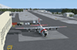
Thanks to Airport Design Editor(ADE), Military AI Works (MAIW) scenery and aircraft, along with AI Flight Planner3 (AIFP3), I did my best to re-create USCG Air Station Kodiak for FSX. Creating this airport scenery was my first BIG (for me) project in ADE, but thanks to MAIW and their Global Scenery Library Objects, I think I've succeed in re-creating the airbase. You'll need to go to MAIW's website and download the "Global Scenery" package for any of this to work for you, so I've copied that website link below (in STEP 1). I also painted Kodiak markings onto all the MAIW AI Aircraft for added realism.
And just for fun, I placed a USCG Cutter and a "fishing boat in distress" (complete with green smoke) out in the harbor as a "Practice Recue Scenario". The Cutter has a "hard deck" to land on and I've also illuminated both it and the Fishing boat for DUSK and NIGHT practice.
| Filename: | USCG_Air_Station_Kodiak_Alaska_PADQ_Scenery_Packag.zip |
| License: | Freeware |
| Added: | 31st January 2021, 06:43:03 |
| Downloads: | 1,003 |
| Author: | Daniel W Gregory |
| Size: | 25.65 MB |
| Category: Flight Simulator 2004 - Scenery | |
| Durban Island CWFB FOX-E DEW line station in Nunavut, Canada |
|
Images related to this file:
File Description:
Durban Island is 40 miles north of Cape Dyer on the southeast corner of Baffin Island, and around 60 miles southeast of Qikiqtarjuaq (known as Broughton until recently). Sitting on the top of the island is FOX-E, an intermediate station that was part of the DEW line. There is no runway (and once you have seen the island you will know why) and the station and its (usually) five man crew were supported by helicopter flights from Cape Dyer. The main feature is a 300' high mast, topped by comms gear to link both to Broughton to the north and Cape Dyer to the south. There was only one really habitable building, 80' x 30' in round figures, and this contained the generators, technical spaces, sleeping areas, kitchen, mess, and showers etc. There were also what were known as Anderson shelters, originally put up to house the construction crew and used in the summer for any maintenance people who visited for short periods. There was also a garage for a snow cat and tanks for fuel. And a view.
This post also includes new bgls for Cape Dyer to provide the 300' tower there too.
| Filename: | Durban_Island_CWFB_FOXE_DEW_line_station_in_Nunavu.zip |
| License: | Freeware, limited distribution |
| Added: | 1st July 2011, 22:11:33 |
| Downloads: | 315 |
| Author: | Roger Wensley |
| Size: | 1.87 MB |
| Category: Microsoft Flight Simulator (2020) - Scenery Design | |
| MSFS 2020 object library with 200+ models ranging from towers hangars to cones (v10 12 extra models) |
|
Images related to this file:
File Description:
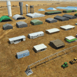
Object libraries for scenery developers (version 10 - improvements on curved surfaces + 10 lights(improved) + 3 windsocks + 3 animals + 5 animated people + 10 fuel_area +stable +fire_tower + 28 new fences + church + sheds). All objects in these libraries will be used in my own sceneries and the result of 100s hrs of effort. All objects from the real world. All objects use LOD (Level Of Detail) to keep frame rates high. Final long distance models have a large triangle added below ground to stop them disappearing in the distance. PBR materials used extensively. Included are 2 PDF files with photos of every object to make selection easy. Republish these files in any freeware scenery if required. READ "read me library instructions" before using.
---------------library1v10-cbj
Cones x4 Gables x3
Church x1
Fences (10 types farm chainlink x4 mesh x2 horse hand-rail paling cattle_grid) x94
Flag pole x1
Fuel_Signs_ x6
Fuel_area_pipes x2
Gas (petrol) station x3
Gliders x4
Glider trailers x4
Grain storage hoppers silos x 4
Power poles x2
Rail platforms station x5
Rail locomotive passenger_carriage grain_hoppers x5
Tower_forest_observation
Towers_radio x6
Weather station small x4
Windsock x3 Windsock-light x1
-------------library2v10-cbj
Animals - Cows x2 Sheep
Grain bunkers - large piles of grain covered with canvas x5
Hangars small airfield x15
Medical transfer station (building) x2
Obstacle-light x10
People x5 Men Women
Pivot irrigator x3
Sheds x10
Shelters x2
Terminals - small airfield x12
Water tanks x3
Towers water x4
Tractors farm x3
Water tanks x3
| Filename: | MSFS_2020_object_library_with_200_models_ranging_f.zip |
| License: | Freeware |
| Added: | 6th March 2022, 19:34:52 |
| Downloads: | 394 |
| Author: | COLIN JEFFERY |
| Size: | 198.25 MB |
| Category: Flight Simulator 2004 - Scenery | |
| CYUX - Hall Beach - Nunavut, Canada |
|
Images related to this file:
File Description:
This is the Fox-Main DEW line station that I somehow omitted to include when I posted Hall Beach. It is all those large radar things in the background in the screen shot.
Just install it like any scenery, just below HallBeachCYUX in the FS9 library priority.
| Filename: | CYUX__Hall_Beach__Nunavut_Canada.zip |
| License: | Freeware, limited distribution |
| Added: | 11th May 2014, 13:44:09 |
| Downloads: | 222 |
| Author: | Roger Wensley |
| Size: | 864.63 KB |


© 2001-2026 AVSIM Online
All Rights Reserved
Privacy Policy |