
Where Flight Simulation Enthusiasts Gather from Around the World!
AVSIM Library - Search Results

| Category: Flight Simulator 2004 - Scenery | |
| Kimmirut CYLC on Baffin Island in Nunavut, Canada |

|
Images related to this file:
File Description:
Kimmirut is a village of some 400 folks at the southern end of the southwest-facing coast of Baffin Island, 75 miles southwest of Iqaluit. It is on the northern side of the Hudson Strait between Baffin Island and Quebec, opposite Kangiqsujuaq on the Quebec shore. The airfield is served by two flights per week, one on Monday and another on Friday, only half fueled to be able to use the 1,899' of gravel 75' wide runway. The terminal building is small and there is a garage building for airport maintenance vehicles (snow clearing). There are some nearby buildings that I have included. The village is "represented" (not "modeled") with approximately the right shape and road layout. Take enough fuel so that you can leave again, as fuel is no longer for sale here. The Cape Dyer bgls are to make a small correction, it is explained in the text. I will not be posting new sceneries in the future and this is the last one for Avsim; it completes Baffin Island.
| Filename: | Kimmirut_CYLC_on_Baffin_Island_in_Nunavut_Canada.zip |
| License: | Freeware, limited distribution |
| Added: | 25th July 2011, 17:36:57 |
| Downloads: | 535 |
| Author: | Roger Wensley |
| Size: | 2.53 MB |
| Category: Flight Simulator 2004 - Scenery | |
| Cape Dorset CYTE, Baffin Island, Nunavut, Canada |
|
Images related to this file:
File Description:
Cape Dorset is a village of 1,300 or so inhabitants at N 64 13 W 76 31 on Dorset Island, off the southwest corner of Baffin Island. It's Inuit name is Kinngait, which means "High Mountains"; watch out if you fly there in low clouds. The village (again) does not feature in FS9 but is included in this scenery with approximately the right shape, or shapes as there are separate parts. The airfield runway is just under 4,000 feet of gravel 100 feet wide at 158 feet above sea level. There is a double gradient to it, but unfortunately this cannot be replicated in FS.
Cape Dorset had a Hudson Bay Company store as long ago as 1913, and is now known as a centre for Inuit art. I added the roads, a new airfield background, a pond between apron and runway, plus of course there is the scenery file and the AFCAD and AI, which has two planes visiting, a First Air HS748 and a Canadian North Dash 8-100, as per real life.
| Filename: | Cape_Dorset_CYTE_Baffin_Island_Nunavut_Canada.zip |
| License: | Freeware, limited distribution |
| Added: | 9th December 2010, 18:45:06 |
| Downloads: | 1,015 |
| Author: | Roger Wensley |
| Size: | 2.75 MB |
| Category: Flight Simulator 2004 - AFCAD Files | |
| Newark Liberty Int'l Airport (KEWR) with active Crosswind Runway |
|
Images related to this file:
File Description:
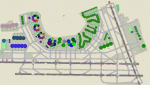
A high spec AFCAD2 for the FS2004 Newark Liberty Int'l Airport (KEWR) scenery by Steve Whalin. This afcad has been built using FAA Charts and information from the Airport Website. All taxiways are named and all aprons are reworked to be as real as possible according to photos. All gates are named as per real life and have airlines assigned to them. The Fedex and UPS aprons are represented and can accomodate many cargo aircraft. The final addition is random GA parking and the CO maintenance area to the north of the airport. Overflow parking is also available for rush hour periods (Ball Park). This airport features a tower view and also night and approach lighting. Finally, by using the crosswind runway technique, runways 04L/22R, 04R/22L and 11/29 can all be used simultaniously for take-off and landing. Runway 11/29 will be mainly used by CO Express flights. Enjoy!!
This afcad works with the Steve Whalin scenery only (Requires: kewr.zip).
| Filename: | Newark_Liberty_Intl_Airport_KEWR_with_active_Cross.zip |
| License: | Freeware |
| Added: | 2nd March 2010, 19:26:13 |
| Downloads: | 1,355 |
| Author: | Lee Brompton |
| Size: | 259.8 KB |
| Category: Flight Simulator 2004 - AI Aircraft | |
| Oberpfaffenhofen v2.2 - traffic package |
|
Images related to this file:
File Description:
This AI-Package has been prepared for the Oberpaffenhofen Airport (EDMO) located in
South-Germany 20 NM west of Munich and contains the following beautiful aircraft:
Dornier Do-27, Do-28, Do-228, Fairchild/Dornier, FD-328 Turboprop and Jet version,
FD-728 (did not go onto production line) and the amphibian Dornier Seastar,
Boeing-707 (AWACS/E3A), Breguet-Atlantic, Dassault/Dornier Alpha-Jet,
Lockheed-P3 Orion, British-Aerospace Canberra B.20, Hawker Sea-Fury, North-American
F-86A, and Bell UH-1D. The corresponding scenery "oberpfaffenhofen-v2.2_fs2004.zip"
is available here at the library.
Most of the planes perform testflights after a long term maintenance in the local
traffic pattern and some of the bigger ones leave IFR (in accordance with
"Instrument Flight Rules") to other airfields per attached flightplan. All the attached outstanding airplanes have been created by well known designers(see briefing). My part was just to put them together and to generate an almost reasonable AI-Flightplan. Gentlemen, let's take a rest, watching the airplanes and listening to ATC.
Re-upload.
| Filename: | Oberpfaffenhofen_v22__traffic_package.zip |
| License: | Freeware |
| Added: | 8th April 2011, 11:49:12 |
| Downloads: | 2,048 |
| Author: | Klaus Jone |
| Size: | 23.59 MB |
| Category: Flight Simulator X - AFCAD Files | |
| CYDF - Deer Lake Regional Airport / Deer Lake, Newfoundland and Labrador, Canada (v1.1) |
|
Images related to this file:
File Description:
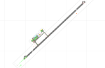
CYDF - Deer Lake Regional Airport / Deer Lake, Newfoundland and Labrador, Canada (v1.1)
This airport update was made with the latest version of ADE (Airport Design Editor) and made for FSX as a replacement for the stock (default) airport. I've made several changes to the airport which are listed below. All these enchancements are as close to the real airport as I can get with stock library objects. I've used satellite images, terminal photos and maps throughout the whole process so building locations are as accurate as possible. Happy landings in the beautiful Canada!
Features:
*Expanded parking apron
*Main terminal building with commercial aircraft parking
*Seperate parking aprons for GA traffic
*Hangars and other airport buildings
*Airport vehicles and objects throughout the airport
*Parking lot with static vehicles
*Airport fire station with fire truck
*De-icing vehicle/runway plow
*Helipads
*Fuel tanks
*Runway lengthened to 8,000ft as per recent upgrade (v1.1)
*Vehicle paths corrected (v1.1)
(For more information on Endeavourai please visit our site at endeavourai.com or our forums at http://endeavourai.boards.net/)
| Filename: | CYDF__Deer_Lake_Regional_Airport__Deer_Lake_Newfou.zip |
| License: | Freeware |
| Added: | 9th August 2012, 17:15:43 |
| Downloads: | 627 |
| Author: | Jaison Diaz / Endeavour ai |
| Size: | 66.97 KB |
| Category: Navigation and ATC - Navigation | |
| LSZS - Samedan visual approach chart v3 |
|
Images related to this file:
File Description:
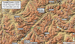
Custom made visual approach chart and pilot's briefing for Engadin (St. Moritz) Samedan LSZS airport in Switzerland, Europe's highest elevation airport (5,600 ft.) situated in the Swiss Alps. This airport is a day VFR operations only and has no instrument approach due to extreme terrain around it. A demanding visual descent into a canyon, in between steep rising terrain, is required to make the visual approaches for both runways with a steep 4.4* degrees final approach portion guided by the PAPI's. Still, executive jets up to Boeing 737(BBJ) size approach the airport often in the winter peak season VFR with these procedures. It is designed as per real operators' pilot briefing for Samedan. Real airport's full pilot briefing document also included. The real airport's excellent briefing (included) intentionally does not contain the maneuvers needed for the approach of jets through the mountains but only reporting points for all and maneuvers for light aircraft only. This gap is what this chart covers. Version 2 chart included better graphics and refined visual procedure for jets and version 3 now includes real pilot's briefing guide.
| Filename: | LSZS__Samedan_visual_approach_chart_v3.zip |
| License: | Freeware, limited distribution |
| Added: | 20th March 2015, 23:35:11 |
| Downloads: | 2,026 |
| Author: | Kyprianos Biris |
| Size: | 7.1 MB |
| Category: Flight Simulator 2004 - Miscellaneous Files | |
| Active ILS - KMCO (Orlando International Airport) |
|
File Description:
This is the 3rd Airport in a series of new ILS runways. As most know initiating the ILS at certain airports for AI Traffic is not a function at this time when using AFCAD2. If you add a new ILS runway to an airport such as KMCO (Orlando International Airport 17L/35R) only the user aircraft can use this runway when visibility falls below 3 miles. ATC will no longer use this runway for AI Traffic because FS9 sees it as a visual runway. This will cause ATC to vector your AI Traffic back to 17/35 (old numbers) 17R/35L (new numbers) which is also a Terminal departure runway. This file adds all NAVAIDS for making 17L/35R a Precision Instrument Runway. I have added all the radar fixes for both the ILS approach portion and the proper missed approach procedures, altitudes and intersections as per current published plates. All AI Aircraft will now continue to use 17L/35R when Airport visual conditions are less than 3 miles.
| Filename: | Active_ILS__KMCO_Orlando_International_Airport.zip |
| License: | Freeware, limited distribution |
| Added: | 25th June 2004, 01:50:15 |
| Downloads: | 3,846 |
| Author: | Jim Vile |
| Size: | 45.38 KB |
| Category: Orbiter - Miscellaneous Files | |
| Advanced Fuel System |
|
File Description:
Complete and integrated fuel system for Orbiter spacefract. For use in refueling/defueling operations as well as internal fuel transfers in orbit.
Indludes: Two fuel transfer pumps complete with spool times, governors, safety trips, pump temperature, and qusi-realistic fluid physics for static and dynamic pressure in the system. Ability to address up to 10 tanks per vessel with differening transfer rates and fuel temperature. Internal tank-to-tank transfers and refueling/defueling to and from remote tanks on docked ships. Transfer manifold for filling or refueling multiple tanks at the same time. Vessel and MFD independant operation, meaning the system continues to operate weather you're piloting the vessel or have switched to another one. An integraded MFD for controlling the fuel system. A 31-page users manual including detail on pump preformance, a system diagram, and step-by-step example procedures. PDF format with complete bookmarks and embedded cross-references.
This is half a beta at the present. While it gets the job done it's boud to be rough around the edges in some places.
| Filename: | Advanced_Fuel_System.zip |
| License: | Freeware |
| Added: | 13th March 2005, 02:53:16 |
| Downloads: | 3,412 |
| Author: | Imaginos |
| Size: | 1.29 MB |
| Category: Flight Simulator 2004 - Flight Plans | |
| PMDG SIDSTARS Update for KHOU Houston William P Hobby |
|
File Description:
Cycle 0603 PMDG SIDSTAR file by Terry Yingling revised 3/22/2006 by Dan Downs for KHOU Houston William P Hobby. The controllers at Houston are creative. There is a BLUBELL STAR that goes over the Bluebell Ice Cream creamry, with fixes at COWZZ and SNDAY. Houston Texan football fans are aware thay they have a new COACH, and are hoping for more TCHDN and fewer FMBLE from their QTRBK named CARRR. Basketball fans cheer for the ROKIT team, and love it when they SSLAM DUUNK. All SID, STAR and ILS procedures edited as required to comply with current charts. SIDS have initial tracks off of runway and vectors command to eliminate discontinuities. Constraints added to BLUBL2 DAS6 HOAGI1 LISSE6 MHF1(change MEAs to STAR constraints), DAS6 HOAGI1 RIICE1 ROKIT7 STAR routes for KHOU added, adjusted transition routes between BILEE and RIICE to conform with STAR instructions. Added TEXXN3.12R and TEXXN3.04 to provide direct RNAV to IAFs for rwys 12R/4 per note on chart. Minor adjustments to ILS 4/12R/30L, including set hard constraint at GS intercept.
| Filename: | PMDG_SIDSTARS_Update_for_KHOU_Houston_William_P_Ho.zip |
| License: | Freeware, limited distribution |
| Added: | 24th March 2006, 00:21:53 |
| Downloads: | 419 |
| Author: | Dan Downs |
| Size: | 6.62 KB |
| Category: Flight Simulator 2004 - AFCAD Files | |
| Metro Oakland Int'l (KOAK) with Active Crosswind Runways |
|
File Description:
A high spec AFCAD2 for the default FS2004 Metro Oakland Int'l Airport (KOAK). This afcad has been built from scratch using FAA Charts, various aerial photographs and information from the Airport Website. All runways feature real life lengths/widths and include overrun areas. All taxiways are named and all aprons are reworked to be as real as possible according to photos. All gates are named and have airlines assigned to them. As per real life, only Southwest Airlines will use Terminal 2, all other airlines being allocated to Terminal 1. The Fedex and UPS aprons are represented and can accomodate up to 20 cargo aircraft. The final parking area is random GA parking to the north of the airport. Overflow parking is also available for rush hour periods. This airport now features a tower view and also upgraded night and approach lighting. Finally, by using the crosswind runway technique, runways 9L/27R, 9R/27L and 11/29 can all be used simultaniously for take-off and landing. Runway 15/33 is closed as it is not used in real life. Enjoy!!
| Filename: | Metro_Oakland_Intl_KOAK_with_Active_Crosswind_Runw.zip |
| License: | Freeware, limited distribution |
| Added: | 30th July 2005, 06:15:21 |
| Downloads: | 2,529 |
| Author: | Lee Brompton |
| Size: | 80.4 KB |


© 2001-2026 AVSIM Online
All Rights Reserved
Privacy Policy |