
Where Flight Simulation Enthusiasts Gather from Around the World!
AVSIM Library - Search Results

| Category: Flight Simulator X - Scenery | |
| YPDN - Darwin Intl - Northern Territory, Australia |

|
Images related to this file:
File Description:
This airport update is made only for FSX with two optional files, one version with the Crosswind runway activated and in full operation where both runways will be used for takeoff and landing and one version as the default runway operation: airlines assigned to their gates as per their website with extra parking, taxiways and taxi signs updated to the latest charts, PAPI corrected to both sides of runway 11/29, extra fuel trucks, support vehicle roads rebuilt with many other scenery objects added, airport views are from the roof of the control tower (when in tower view) please view the readme before installation.
| Filename: | YPDN__Darwin_Intl__Northern_Territory_Australia.zip |
| License: | Freeware, limited distribution |
| Added: | 19th September 2014, 03:14:00 |
| Downloads: | 14,424 |
| Author: | Craig Scott |
| Size: | 411.23 KB |
| Category: Flight Simulator X - Scenery | |
| EKCH - Kastrup Airport - Copenhagen, Denmark |
|
Images related to this file:
File Description:
This is an accurate version of Kastrup Intl airport with two optional files and made only for FSX: one version with the Crosswind runway 12/30 operating where all 3 runways will be used for takeoff/landing and one version as the default airport runway operation, assigned parking as per their website with extra parking, Taxiways and Taxi signs updated to the latest charts, all ILS approaches updated and corrected where needed, support vehicle roads rebuilt and many other scenery improvements and objects added, airport views are from the roof of the east control tower (when in tower view) please view the readme before installation
| Filename: | EKCH__Kastrup_Airport__Copenhagen_Denmark.zip |
| License: | Freeware, limited distribution |
| Added: | 24th October 2017, 00:44:03 |
| Downloads: | 43,596 |
| Author: | Ray Smith |
| Size: | 2.92 MB |
| Category: Flight Simulator 2004 - Flight Plans | |
| Around the World by light aircraft - The flight of HG Schmid and HB-YCT, March 2000 |
|
File Description:
On a cold March 2nd, 2000, professional commercial pilot H.G. Schmid took off from Zurich at 11:00 AM local time and so began the first stage of his first of two consecutive circumnavigations of the globe by a light aircraft. This flight was eastwards and on his return to Zurich at the end of the month, Georg took off on the westward circumnavigation. The aircraft used on these adventures was the Rutan-designed "Long-EZ", a variation of the "Vari-EZ". Each day is a separate stage and therefore there is a separate flight for each day, named accordingly. (Some days have two stages). There is a total of nineteen (19) flights. Model of the Rutan is by Olivier Marechal and available from Avsim.com or FlightSim.com. Search for either Olivier's name or the file name, HBYCT_V1.zip. There is also an update, HBYCT_P1.zip.
| Filename: | Around_the_World_by_light_aircraft__The_flight_of_.zip |
| License: | Freeware |
| Added: | 18th April 2006, 21:47:42 |
| Downloads: | 1,004 |
| Author: | Bruce Kennewell |
| Size: | 586.72 KB |
| Category: Flight Simulator 2004 - Miscellaneous Files | |
| Active ILS - KATL v1.0 (Hartsfield Jackson Atlanta International Airport) |
|
File Description:
As most know initiating the ILS at certain airports for AI Traffic is not a function at this time when using AFCAD2. If you add a new ILS runway to an airport such as KATL (10/28) only the user aircraft can use this runway when visibility falls below 3 miles. ATC will no longer use this runway for AI Traffic because FS9 sees it as a visual runway. This will cause ATC to vector your AI Traffic back to 9R/27L which is also a South Cargo/Ramp Departure Runway. There are many additional Scenery Buildings, 274 Jetways and new Terminals (as per current Contractor plans) added to version 1.0. See the readme.txt file for additional details.
| Filename: | Active_ILS__KATL_v10_Hartsfield_Jackson_Atlanta_In.zip |
| License: | Freeware, limited distribution |
| Added: | 11th September 2005, 00:04:37 |
| Downloads: | 2,486 |
| Author: | Jim Vile |
| Size: | 553.64 KB |
| Category: Flight Simulator 2004 - Scenery | |
| Reanimated NATO-Airbase Pferdsfeld, ETSP (near Ramstein, Germany) including AI-Package and Tools. No FSE required. |
|
File Description:
This Nato-Combat-Airbase, located in Central Germany near Ramstein (Rhein / Mosel
region), was the homebase of JG73 and JaboG35. The airport has been closed in 1994,
was reanimated by Fritz Becker for FS2004 use and I did the rework to make it ready
for AI-Traffic.
The included AI-Package contains the Dornier Do-28, Fiat G91R, Douglas C-47/DC-6B,
McDonnell-Douglas F-4E, Nord-Aviation Noratlas ND2501, North-American T-6, and the
Republik F-84F.
All aircrafts perform "Touch and Go" in the local traffic pattern per attached
flightplan. Note: "Keep the final clear, the Flight Checker is here" (C-47).
Lago's FSE is not required this time.
| Filename: | Reanimated_NATOAirbase_Pferdsfeld_ETSP_near_Ramste.zip |
| License: | Freeware, limited distribution |
| Added: | 20th October 2005, 17:41:17 |
| Downloads: | 4,716 |
| Author: | Fritz Becker and Klaus Jone |
| Size: | 17.96 MB |
| Category: Flight Simulator 2004 - AI Flight Plans | |
| Adria Airways Summer 2006 v0.2 |
|
File Description:
Adria Airways, the airline of Slovenia, is operating from its hub Ljubljana to many European cities like Amsterdam, Brussels, Copenhagen, Frankfurt, Istanbul, London, Munich, Ohrid, Paris, Podgorica, Pristina, Sarajevo, Skopje, Vienna, Zurich, Warsaw and non European like Moscow and Tel Aviv. The new summer destinations will be Tel Aviv, Kiev, Rome – Fiumicino, Barcelona – El Prat, Manchester and Birmingham, a total of 24 destinations with 398 flights per week. Adria operates with 3 Airbus 320-321 and 7 Bombardier CRJ-200LR. Adria Airways is a REGIONAL STAR ALLIANCE member since December 2004. Adria entered this membership with Croatia Airlines (Croatia) and Blue 1 (Finland).
Due to recent changes in Adria`s timetable, there will be new FPs in March.
| Filename: | Adria_Airways_Summer_2006_v02.zip |
| License: | Freeware, limited distribution |
| Added: | 28th February 2006, 22:54:18 |
| Downloads: | 766 |
| Author: | Aleksander Grilj |
| Size: | 54.53 KB |
| Category: Flight Simulator 2004 - AI Flight Plans | |
| Halcyon Air Cape Verde Winter 2008 / Spring 2009 |
|
File Description:
Timetable flightplans for Halcyon Air Cape Verde for 26 October 2008 to 28 March 2009. A new airline which provides an air link between the main islands within the Cape Verde republic began business on March 1st. Halcyon Air runs daily flights between the three most populated islands of Santiago, Sal and Sao Vicente, as well as four weekly flights to Boavista Island and two flights per week between Sal, Santiago's capital Praia and the volcanic Fogo islands.
Fleet is : 1 ATR42-300 (D4-CBQ). Halcyon Air operates between Sal, Praia, Sao Vicente and Boavista. Repaint: (On Avsim.com) -> d4-cbq.zip by Uwe Hoffmann.
This schedule is 100% accurate based on a timetable received from the airline in PDF format.
| Filename: | Halcyon_Air_Cape_Verde_Winter_2008__Spring_2009.zip |
| License: | Freeware |
| Added: | 4th December 2008, 21:28:47 |
| Downloads: | 500 |
| Author: | Jerel Gregory Hayes |
| Size: | 1.96 KB |
| Category: Flight Simulator X - Scenery | |
| Frankfurt Main Airport with new 25R ILS approach (v2.0) |
|
Images related to this file:
File Description:
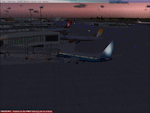
This scenery is an update to v1.0 of the FSX Frankfurt/Main airport package and was designed using ADE v1.40.
This update now features additional jetways, vehicle roadways around Terminal 2, up-to-date airline mapping to gates and additional taxiway and CAT II/III signs. ** Gates have been resized and added as per current layout ** Additional fuel trucks & support vehicle roads built around the airport ** 3 helipad start locations added ** B Gates now contain double jetways ** The control tower view has been moved to the south side and aprons have been remodelled ** In addition the ILS for Rwy25R has been updated to reflect the new frequency change from 109.50 to 111.55Mhz as of June 2009.
| Filename: | Frankfurt_Main_Airport_with_new_25R_ILS_approach_v.zip |
| License: | Freeware |
| Added: | 4th November 2009, 19:49:58 |
| Downloads: | 1,370 |
| Author: | Mark Aldridge |
| Size: | 3.06 MB |
| Category: Navigation and ATC - Navigation | |
| Whitehorse Sectional Chart Chunks Optimized For Moving Map Application |
|
File Description:
Sectional chart chunks made from the August 2009 Sectional charts at the original scale, formatted in the WGS84 lat/lon geographic coordinate system for GPS, moving map application for flight simulation use.
These chart chunks were converted to the JPEG format for compatibility and size. Coverage is the full Sectional area North and South divided into JPEG tiles. They are about 3k x 3k pixels at 2.5mb with coverage of 90nm x 130nm per tile. Included is also the projection files and world files.
Note: This type of map is a equal grid and no further calibration is needed, only the two points referenced in the world file. Example: for users of FSM Moving Map, just mass import, done.
| Filename: | Whitehorse_Sectional_Chart_Chunks_Optimized_For_Mo.zip |
| License: | Freeware |
| Added: | 28th February 2010, 06:29:44 |
| Downloads: | 145 |
| Author: | David Myers |
| Size: | 16.1 MB |
| Category: Navigation and ATC - Navigation | |
| Western Aleutian Islands Sectional Chart Chunks Optimized For Moving Map Application |
|
File Description:
Sectional chart chunks made from the August 2009 Sectional charts at the original scale, formatted in the WGS84 lat/lon geographic coordinate system for GPS, moving map application for flight simulation use.
These chart chunks were converted to the JPEG format for compatibility and size. Coverage is the full Sectional area North and South divided into JPEG tiles. They are about 3k x 3k pixels at 2.5mb with coverage of 90nm x 130nm per tile. Included is also the projection files and world files.
Note: This type of map is a equal grid and no further calibration is needed, only the two points referenced in the world file. Example: for users of FSM Moving Map, just mass import, done.
| Filename: | Western_Aleutian_Islands_Sectional_Chart_Chunks_Op.zip |
| License: | Freeware |
| Added: | 28th February 2010, 06:32:04 |
| Downloads: | 166 |
| Author: | David Myers |
| Size: | 7.82 MB |


© 2001-2026 AVSIM Online
All Rights Reserved
Privacy Policy |