
Where Flight Simulation Enthusiasts Gather from Around the World!
AVSIM Library - Search Results

| Category: Prepar3D V1-4 - Scenery | |
| KJFK - John F. Kennedy International Airport - New York (NY), USA |

|
File Description:
Prepar3D Scenery--John F. Kennedy International Airport (KJFK), New York (NY), USA. This file updates Ray Smith's KJFK scenery previously uploaded for use with FSX. Ray has given me permission to adapted his scenery for Prepar3Dv2 and replaces file Prepar3d_rwc_kjfk.zip This airport update incorporates two optional files, one version with the Crosswind runways activated and in full operation where all 4 runways will be used for takeoff/landing and one version as the default runway operation: assigned parking now updated as per their website including gates for the A380, Terminal 3 demolished, Delta has now moved much of its operations to T4 as well as using T2, the new terminal extension added to T4 concourse B and allocated only for Delta connection, taxiways and taxi signs updated to the latest charts, the freeway traffic that crosses taxiways A and B now ends before these taxiways, Autogen around the water edges of the airport removed, support vehicle roads rebuilt and many other improvements, airport views are from the roof of the control tower (when in tower view) please view the readme before installation. By Robert Catherall.
| Filename: | KJFK__John_F_Kennedy_International_Airport__New_Yo.zip |
| License: | Freeware |
| Added: | 9th October 2015, 19:10:40 |
| Downloads: | 24,196 |
| Author: | Robert Catherall |
| Size: | 2.91 MB |
| Category: Flight Simulator 2004 - Scenery | |
| LUKK Chisinau 2016 DEMO |
|
Images related to this file:
File Description:
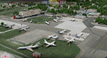
LUKK Chisinau 2016 DEMO features a highly detailed representation of LUKK Chisinau International Airport in Moldova. This product is compatible with FS2004.
It's a fully functional DEMO version of the commercial payware product. It features same airport layout as in the full version but with limited 3D objects and low resolution textures. Using this free demo ensures no problems with online (VATSIM, IVAO, multiplayer etc.) flying in case some users use the payware scenery and some don't.
Chisinau International Airport is Moldova's main international airport, located 13 km (8.1 mi) southeast of the centre of Chisinau. Currently airport features one 3580m concrete, ILS-equipped runway, able to accommodate airliners of any type, including B747. Nowadays 19 airlines operate flights to 33 destinations and the most popular destination is Moscow.
It's equipped with an automatic installer, which means that the scenery will be automatically added to the Flight Simulator Scenery Library.
Please uninstall all previous versions of this airport you may have installed before. Please make also sure that no duplicated AFCAD files are installed!
Enjoy your virtual flying with Drzewiecki Design!
| Filename: | LUKK_Chisinau_2016_DEMO.zip |
| License: | Commercial demo |
| Added: | 10th April 2016, 19:51:52 |
| Downloads: | 951 |
| Author: | Drzewiecki Design |
| Size: | 10.8 MB |
| Category: Flight Simulator X - Scenery | |
| HALA - Hawassa Intl. - Hawassa, Ethiopia |
|
Images related to this file:
File Description:
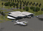
This project adds the booming city of Hawassa, Ethiopia, creates the new international airport (HALA), moves (and rebuilds) the downtown airport (recoded to HALX), and includes AI flight plans for the Ethiopian Airlines service that began April 2016. Tested in both the default FSX: Acceleration and with FTX Global/Vector, accurate coastlines, lakes, road data, and SRTMGL1 (30m) mesh, as well as corrected landclass are provided based on the latest available satellite imagery. The Hawassa International Airport was created using information from the current satellite footprint and the promotional video from Ethiopian Airports Enterprise (EAE). Although there is still very little published data on the airport, it is fully functional.
Updates were created or rebuilt in a manner which carefully aligns airport data with current satellite imagery. Scenery was created using Airport Design Editor X v1.70.6042, SBuilderX 3.13, and the FSX Object Placement Tool. Scenery objects were added and modified from stock FSX scenery to resemble as closely as possible the actual airports. The FSX apron lights included are from the set created by Jim Dhaenens. Thanks to Ron Blehm for bringing this part of the world to my attention.
| Filename: | HALA__Hawassa_Intl___Hawassa_Ethiopia.zip |
| License: | Freeware |
| Added: | 20th July 2016, 09:06:40 |
| Downloads: | 1,020 |
| Author: | Carlyle Sharpe |
| Size: | 10.41 MB |
| Category: X-Plane - Scenery | |
| BR SP SBGP - Gaviao Peixoto Embraer Airport v1.0.0 |
|
Images related to this file:
File Description:
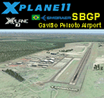
This is an X-Plane 11 and X-Plane 10 scenery package for Embraer Unidade Gavião Peixoto Airport (ICAO: SBGP, no IATA code) is a private airport located in a rural area near Gavião Peixoto and Araraquara, in Brazil. It is owned and operated by Embraer and used as for testing civil and military aircraft. Additionally, this scenery also includes a grass airstrip (SJAW Fazenda Citrica Airfield), a rural citrical farm facility for agricultural aviation. You can try landing there with your favorite prop aircraft. It's located around 1nm or 2nm northeast of SBGP airport. It includes corrected aprons, ramps, gates, taxiways, lighting system, Araraquara city buildings, ortho-photoscenery for the airfield area, and (XP11 only) airport ground services (like push back). This scenery was tested and is operational (as of March 18, 2017) in "X-Plane 11 Public Beta #15 64 bit", Windows 10 Home. It was also tested and is also operational (as of March 18, 2017) in "X-Plane 10.51 64 bit", Windows 10 Home. Only the default X-Plane 11 libraries, by Laminar Research, are needed. No third party libraries are used.
| Filename: | BR_SP_SBGP__Gaviao_Peixoto_Embraer_Airport_v100.zip |
| License: | Freeware |
| Added: | 19th March 2017, 08:13:27 |
| Downloads: | 95 |
| Author: | Rui Mesquita |
| Size: | 21.63 MB |
| Category: X-Plane - Scenery | |
| US MI KBTL - WK Kellogg Airport Battle Creek v2.0.0 |
|
Images related to this file:
File Description:
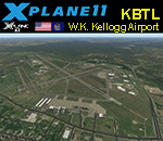
This is an X-Plane 11 and X-Plane 10 scenery package for the W.K. Kellogg Airport (IATA: BTL, ICAO: KBTL, FAA LID: BTL), which is a city owned, public use, joint civil-military airport located three nautical miles (6 km) west of the central business district of Battle Creek, a city in Calhoun County, Michigan, United States. v2.0.0 completely replaces the KBTL v1.0.2, with a brand new scenery, including orthophoto and city building for downtown Battle Creek. For better performance, only the default X-Plane libraries, by Laminar Research, are needed. No third party libraries are used. It includes corrected aprons, ramps, gates, taxiways, lighting system, city downtown buildings, ortho-photoscenery for the airfield area, and (XP11 only) airport ground services (like push back). This scenery was tested and is operational (as of March 20, 2017) in "X-Plane 11 Public Beta #15 64 bit", Windows 10 Home. It was also tested and is also operational (as of March 20, 2017) in "X-Plane 10.51 64 bit", Windows 10 Home. Only the default X-Plane libraries, by Laminar Research, are needed. No third party libraries are used.
| Filename: | US_MI_KBTL__WK_Kellogg_Airport_Battle_Creek_v200.zip |
| License: | Freeware |
| Added: | 22nd March 2017, 00:06:30 |
| Downloads: | 70 |
| Author: | Rui Mesquita |
| Size: | 22.38 MB |
| Category: Flight Simulator X - Scenery | |
| East Coast Victoria v2 for ORBX v2 YLKE Lakes Entrance YGRL Great Lakes Airport YORB Orbost YMCO Mallacoota |
|
Images related to this file:
File Description:
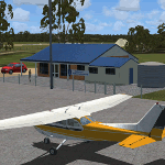
'East Coast Victoria v2' is made to match ORBX Australia v2 scenery. For ORBX v1 or no ORBX use 'East Coast Victoria'. There are 4 airports. YLKE Lakes Entrance YGRL Great Lakes Airport YORB Orbost YMCO Mallacoota. ORBX has done 2 of these (YORB, YMCO) as they have done every airport included with FSX in Australia to a reasonable standard. If I had not already done them for ORBX V1 I would not have bothered. However these are better than ORBX because the surroundings have been modified to match real life. Towns have been added or shifted. Forests cut down or added. There are also custom accurate versions of the terminal buildings. Included is an AI traffic files that covers the airports (little or no traffic from ORBX). In short a lot more time spent by me as I did not have to do every airport in Australia! These files are for Flight Simulator X. Made using Airport Design Editor using some objects borrowed from Robert Budd's excellent Baccus Marsh. REQUIRED The scenery is designed to interface with ORBX FTX_AU V2 scenery for Australia (payware).
| Filename: | East_Coast_Victoria_v2____for_ORBX_v2____YLKE_Lake.zip |
| License: | Freeware |
| Added: | 16th September 2019, 16:27:48 |
| Downloads: | 388 |
| Author: | Colin Jeffery |
| Size: | 6.32 MB |
| Category: Flight Simulator X - Scenery | |
| West Coast Victoria v2 for ORBX v2 YWBL Warrnambool YPOD Portland YPFA Port Fairy |
|
Images related to this file:
File Description:

'West Coast Victoria v2' is made to match ORBX Australia v2 scenery. Use 'West Coast Victoria' for ORBX v1 or no ORBX. There are 3 airports YWBL Warrnambool YPOD Portland YPFA Port Fairy. ORBX has done 2 of these (YWBL, YPOD) as they have done every airport included with FSX in Australia to a reasonable standard. If I had not already done them for ORBX V1 I would not have bothered. However these are better than ORBX because the surroundings have been modified to match real life. Towns have been added or shifted. Forests cut down or added. There are also custom accurate versions of the actual terminal buildings. Included are AI traffic files that cover all 3 airports + YHML Hamilton nearby (little or no traffic from ORBX). In short a lot more time spent. ORBX had to do every airport has in Australia! Recommend installing the excellent YHML Hamilton (by Anthony Lynch). These files are for Flight Simulator X. Made using Airport Design Editor using some objects borrowed from Robert Budd's excellent Baccus Marsh and 'Static aircrafts' by Jean-Pierre Fillion. REQUIRED The scenery is designed to interface with ORBX FTX_AU V2 scenery for Australia (payware).
| Filename: | West_Coast_Victoria_v2_for_ORBX_v2____YWBL_Warrnam.zip |
| License: | Freeware |
| Added: | 8th October 2019, 20:00:14 |
| Downloads: | 321 |
| Author: | Colin Jeffery |
| Size: | 8.56 MB |
| Category: Flight Simulator 2004 - Scenery | |
| Buckland PABL in Alaska |
|
Images related to this file:
File Description:
Buckland is a village on a small river, around 45 miles east of Deering and 15 miles inland from the river mouth. Like Deering, the population of 420 live from fishing and the land. The airfield is close by and has a gravel runway aligned 10-24 and 3,300 feet long with VASI at both ends. Apart from the airfield itself, and it's buildings, this scenery modifies the local (mostly treeless) land class, adds village buildings while reducing the village size to reality, and creates a new airfield background. Bering Air flies into Buckland from Kotzebue and is included in the AI. A note here about my scenery making. This is post number 505 and there will not be many more to follow this as I am almost at the end of the photos I either took or found for scenery purposes. There is a limit to what can be located online and I have already been making use of the little there is; eg Unalakleet. So, if you are near an airport (preferably Canadian or Alaskan) and have a camera..... Let me know.
| Filename: | Buckland_PABL_in_Alaska.zip |
| License: | Freeware, limited distribution |
| Added: | 10th August 2019, 18:51:45 |
| Downloads: | 145 |
| Author: | Roger Wensley |
| Size: | 4.11 MB |
| Category: Flight Simulator X - Scenery | |
| Murray river and SE Victoria v2 for ORBX v2. YRIO Robinvale YBRN Balranald YDLQ Deniliquin YLEG Leongatha YYRM Yarram |
|
Images related to this file:
File Description:
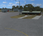
'Murray and SE Victoria v2' is made to match ORBX Australia v2 scenery. Use 'Murray + SE Victoria airports' for ORBX v1 or no ORBX. There are 5 airports. 3 airports near the Murray river in Victoria and NSW - YRIO Robinvale, YBRN Balranald, YDLQ Deniliquin. 2 airports in SE Victoria - YLEG Leongatha, YYRM Yarram. ORBX has done these as they have done every airport included with FSX in Australia to a reasonable standard. If I had not already done them for ORBX V1 I would not have bothered. However these are better than ORBX because the surroundings have been modified to match real life. Towns have been added or shifted. Forests cut down or added. Race courses, sewage treatment ponds and other stuff added. Local obstacles (towers etc) added. There are Included are 2 AI traffic files that cover the airports. These files are for Flight Simulator X. Made using Airport Design Editor using some objects borrowed from Robert Budd's excellent Baccus Marsh and 'Static aircrafts' by Jean-Pierre Fillion. REQUIRED The scenery is designed to interface with ORBX FTX_AU V2 scenery for Australia (payware).
| Filename: | Murray_river_and_SE_Victoria_v2_for_ORBX_v2_YRIO_R.zip |
| License: | Freeware |
| Added: | 15th December 2019, 19:06:10 |
| Downloads: | 315 |
| Author: | Colin Jeffery |
| Size: | 10.06 MB |
| Category: Flight Simulator 2004 - Scenery | |
| Colville Lake CEB3 in Northwest Territories Canada |
|
Images related to this file:
File Description:
Colville Lake is a small village of around 150 Dene, located to the northwest of the Great Bear Lake and east of the Mackenzie River, 120 miles north of Norman Wells. The village and the airfield are next to each other and to the lake shore. I recently discovered which of the standard terminal buildings had been used there and this, along with information I already had, enabled me to now make the scenery, which is based on an approximate 2010 date. The gravel runway is lit and around 2,800 feet long, aligned 10-28. North Wright Air serves the village from it's headquarters at Norman Wells with daily flights by de Havilland Twin Otters, or "twotters" as they were quickly named among the northern Canadian airline personnel when they were first produced. The approximate time of this scenery is 2010. While testing this scenery I discovered that Tulita (previously called Fort Norman) which is another Mackenzie River airfield to the south of Norman Wells, needs to be reposted due to a terrain fault. If you find an error here then email me please, and note that my email address has been changed to rogwens at Gmail dot com.
| Filename: | Colville_Lake_CEB3_in_Northwest_Territories_Canada.zip |
| License: | Freeware, limited distribution |
| Added: | 31st July 2021, 18:23:48 |
| Downloads: | 69 |
| Author: | Roger Wensley |
| Size: | 4.51 MB |


© 2001-2026 AVSIM Online
All Rights Reserved
Privacy Policy |