
Where Flight Simulation Enthusiasts Gather from Around the World!
AVSIM Library - Search Results

| Category: Flight Simulator X - Scenery | |
| EDFW - Wuerzburg Schenkenturm airfield - Bayern, Germany |

|
File Description:
EDFW Wuerzburg Schenkenturm is an airfield near the town Wuerzburg in Germany for small aircraft up to 2000 kgs. The scenery contains several buildings on the airfield, hangars, tower and a restaurant. It is compatible with FSX (DirectX 10 with some minor issues) and works fine with Prepar3D.
| Filename: | EDFW__Wuerzburg_Schenkenturm_airfield__Bayern_Germ.zip |
| License: | Freeware, limited distribution |
| Added: | 10th September 2015, 00:57:01 |
| Downloads: | 941 |
| Author: | Thorsten Gross |
| Size: | 1.87 MB |
| Category: Prepar3D V1-4 - Scenery | |
| HTKJ Kilimanjaro International Airport |
|
Images related to this file:
File Description:
This is an update of the AFCAD for the Kilimanjaro X scenery made by Jacques Botha and Frits Beyer.
It has been updated with a new AFCAD to match the state of the airport acording to AIRAC 2103 and includes new taxi designators, corrected runway markings and a new parking layout.
| Filename: | HTKJ_Kilimanjaro_International_Airport.zip |
| License: | Freeware, limited distribution |
| Added: | 6th April 2021, 18:04:52 |
| Downloads: | 300 |
| Author: | Joakim Zenk |
| Size: | 76.25 KB |
| Category: Flight Simulator 2004 - Scenery | |
| Vietnam Bases USAF |
|
Images related to this file:
File Description:

Here's an update for George Knowles excellent Vietnam scenery much of which was lost during the hacking of the avsim site. I've added AFCAD files for you ai types, and charts for flying some of my latest Vietnam era planes...Just do a search under my full name....Peter Mercy.
| Filename: | Vietnam_Bases_USAF.zip |
| License: | Freeware |
| Added: | 10th July 2010, 19:29:57 |
| Downloads: | 3,001 |
| Author: | Peter Mercy, George Knowles |
| Size: | 15.9 MB |
| Category: Flight Simulator X - AFCAD Files | |
| WIPA- Sultan Thaha (Taha), Jambi, Indonesia. |
|
File Description:
This is a redesign of WIPA- Sultan Thaha (Taha), Jambi, Indonesia. Google Maps and Jeppesen have been used to provide the correct (as physically possible within FSX and ADE) position, size and type of runway, aprons and buildings. The immediate surrounding scenery has been included. ADE used to compile the design.
| Filename: | WIPA_Sultan_Thaha_Taha_Jambi_Indonesia.zip |
| License: | Freeware |
| Added: | 31st January 2018, 05:21:43 |
| Downloads: | 1,959 |
| Author: | Matthew Ward |
| Size: | 1.61 MB |
| Category: Flight Simulator X - AFCAD Files | |
| WIRR (WIIA / WICB) - Tangerang/Budiarto Airport, Banten, Indonesia. |
|
File Description:
This is a redesign of WIRR (WIIA / WICB) - Tangerang/Budiarto Airport, Banten, Indonesia. Google Maps has been used to provide the correct (as physically possible within FSX and ADE) position, size and type of runway, aprons and buildings. The immediate surrounding scenery has been included. ADE used to compile the design.
| Filename: | WIRR_WIIA__WICB__TangerangBudiarto_Airport_Banten_.zip |
| License: | Freeware |
| Added: | 5th March 2018, 22:29:37 |
| Downloads: | 1,276 |
| Author: | Matthew Ward |
| Size: | 1.19 MB |
| Category: Flight Simulator X - AFCAD Files | |
| Vineland-Downstown Airport (28N), NJ |
|
File Description:
Located 04 miles NE of Vineland, New Jersey on 45 acres of land, Vineland-Downstown Airport is a turf field that mainly services crop dusting operations for the surrounding farms. It also can serve firefighting aircraft - in fact the second runway (12/30) is specifically for that purpose along with agricultural use. This airport as modeled in FSX is kind of inbetween the current layout and the past layout. Based on various images both satellite and other, it seems 28N has undergone some serious expansion since the MSE textures were created. A large paved area to the west of the airport has been built and has parking aprons for up to around 25 aircraft. If you use an add-on traffic program you might want to think about reconfiguring it to assign more flights to this airport because it can certainly handle them now. You can fuel up in your plane by stopping near the fuel tank on the north end of the west tarmac or in your helicopter by landing on the concrete patch north of the runway.
Scenery constructed with use of satellite images/streetview, the author has not been there in person.
This scenery is meant to be used in conjunction with MegaScenery Earth New Jersey/Delaware 004. It is not required, but apron use is minimized to allow satellite scenery to show through as much as possible, and objects are placed based on the MSE textures - lack of it may make scenery look out of place.
| Filename: | VinelandDownstown_Airport_28N_NJ.zip |
| License: | Freeware |
| Added: | 11th October 2010, 06:13:42 |
| Downloads: | 206 |
| Author: | Drew Sikora |
| Size: | 324.96 KB |
| Category: Flight Simulator X - AFCAD Files | |
| Mount Pleasant Landing Strip Airport (67NJ), NJ |
|
File Description:
Located 01 miles S of Hainesburg, New Jersey on 192 acres of land, Mount Pleasant Landing Strip Airport is a private turf field. The strip itself is 2100 feet in length over fairly level ground. There is no hard-surfaced grass runway in place, so setting your mesh to the highest resolution is recommended as you will be landing on bare terrain. Next to Runway 06 is a path through the trees you can taxi along to get to a hangar - although it is not available for transient aircraft and is closed. Collision with the trees along the path near the hangar and the static aircraft parked near it is disabled to make it easier to move through this relatively tight area. Immediately beyond the hangar is a clearing with ample room to turn around to taxi back out. You can also start parked in front of the hangar. The windsock is located a few feet west of the hangar and is not lit. The runway also has no edge lighting so daytime VFR operations only are recommended for this airfield.
Scenery constructed with use of satellite images/streetview/aerial photos - the author has not been there in person.
This scenery is meant to be used in conjunction with MegaScenery Earth New York 007. It is not required, but apron use is minimized to allow satellite scenery to show through as much as possible, and objects are placed based on the MSE textures - lack of it may make scenery look out of place.
| Filename: | Mount_Pleasant_Landing_Strip_Airport_67NJ_NJ.zip |
| License: | Freeware |
| Added: | 7th February 2011, 23:49:26 |
| Downloads: | 198 |
| Author: | Drew Sikora |
| Size: | 468.64 KB |
| Category: Flight Simulator X - AFCAD Files | |
| Greenwood Lake Airport (4N1), NJ |
|
File Description:
Located 01 miles E of West Milford, New Jersey on 150 acres of land, Greenwood Lake Airport is a public asphalt strip that services small to medium GA air traffic. The second runway that used to be there has been re-paved and now serves as extra aircraft parking. You can park anywhere on the closed runway, along the edge of the main tarmac where the terminal building is, or between any two white cones (50 foot max wingspan) that mark tie-down locations in the middle of the main tarmac. A helicopter start is provided as well. For parking, Small GA spaces are for craft with wingspans of less than 50 feet; Medium GA spaces are for craft with wingspans from 50-60 feet. The glide slope for Runway 24 has been adjusted up from 3.5 degrees to 4 degrees as in real life the runway sits higher than the ground the trees grow from so this will give you proper clearance on approach. Fuel is available by stopping near the tank on the main tarmac. Scenery constructed with use of satellite images/streetview/aerial photos - the author has not been there in person. This scenery is meant to be used in conjunction with MegaScenery Earth New York 005. It is not required, but apron use is minimized to allow satellite scenery to show through as much as possible, and objects are placed based on the MSE textures - lack of it may make scenery look out of place.
| Filename: | Greenwood_Lake_Airport_4N1_NJ.zip |
| License: | Freeware |
| Added: | 22nd July 2011, 03:59:26 |
| Downloads: | 479 |
| Author: | Drew Sikora |
| Size: | 1.98 MB |
| Category: Flight Simulator X - AFCAD Files | |
| Salem Airfield Airport (NJ74), NJ |
|
File Description:
Located 01 miles E of Salem, New Jersey on 14 acres of land, Salem Airfield is a private turf strip 2200' in length. The hard surface runway has been removed so have your mesh settings as high as possible to get the most out of landing/taking off on actual terrain. The surrounding area has been highly detailed with as much forestation as possible included to block out the horizon as much as possible considering the many open spaces surrounding the airport. Tie downs are located next to the middle of the runway, look for the marker cones or start in any RAMP_GA_SMALL parking locations. A hangar is available as well, and attendant is on call on NAV2 to open the door. You can start inside the hangar in the DOCK_GA parking spot or outside the hangar in the RAMP_GA parking spot. All parking is for aircraft with wingspans no greater than 40 feet. There is no fuel available. The field is lit for night use, but the windsock is not so check your weather before flying in!
Scenery constructed with use of satellite images/streetview/aerial photos - the author has not been there in person.
This scenery is meant to be used in conjunction with MegaScenery Earth New Jersey/Delaware 004. It is not required, but apron use is minimized to allow satellite scenery to show through as much as possible, and objects are placed based on the MSE textures - lack of it may make scenery look out of place.
| Filename: | Salem_Airfield_Airport_NJ74_NJ.zip |
| License: | Freeware |
| Added: | 10th August 2011, 02:05:51 |
| Downloads: | 176 |
| Author: | Drew Sikora |
| Size: | 910.96 KB |
| Category: Flight Simulator X - Scenery | |
| KAFW Fort Worth Alliance Airport - Texas, US |
|
Images related to this file:
File Description:
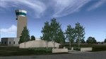
Ft. Worth Alliance Airport opened in 1989 and was billed as the world's first purely industrial airport. It is located around 14 miles North of the central business district of Ft. Worth and is also nearby the Dallas/Ft. Worth International Airport (KDFW). The airport serves general aviation, corporate jet, cargo, and military air traffic on a daily basis and it's proximity to the Texas Motor Speedway (only a few miles) brings extra dense traffic on race weekends. The airport is home to the American Airlines 777 and 767 maintenance base, FedEx Southwest Regional Sort Hub, Bell-Helicopter Training Center, DEA Air Operations Center and DynCorp International. Sadly the American Airlines maintenance base is set to close at the end of 2012 but is being kept alive in FSX!
This scenery features custom 3d buildings and objects bringing you a very accurate rendition of Ft. Worth Alliance Airport. Requires FSX Acceleration for the all scenery objects to display correctly.
Note: These files MUST be installed for the scenery to work correctly (otherwise there will be missing scenery objects at the airport):
-Filename: fsx_lts.zip - Ramp Lighting for FSX by Jim Dhaenens
-Filename: dlfcorelibraries2fsx.zip - Dan French Core Library Vol. 2
-Filename: lightstoo.zip - Jim Dhaenens Airfield Lighting
-Filename: objlib-jgse-fsx.zip - John Stinstrom JGSE Yellow Objects - this newer file replaces the older FS9 libraries with FSX versions
-Filename: objlib-ggse-fsx.zip - John Stinstrom GGSE Green Objects - this file also replaces FS9 libraries with FSX versions
| Filename: | KAFW_Fort_Worth_Alliance_Airport__Texas_US.zip |
| License: | Freeware, limited distribution |
| Added: | 12th December 2012, 16:56:36 |
| Downloads: | 2,935 |
| Author: | Brandon Thetford |
| Size: | 439.24 MB |


© 2001-2026 AVSIM Online
All Rights Reserved
Privacy Policy |