
Where Flight Simulation Enthusiasts Gather from Around the World!
AVSIM Library - Search Results

| Category: Flight Simulator X - Scenery | |
| Detailed Terrain Features for Southern Africa, Update 7 |

|
Images related to this file:
File Description:
Scenery consist of Updated Terrain Vector data concerning Coastlines, rivers, dams, streams, roads, traffic, railroads, power lines and extrusion bridges for Southern Africa countries South of the Equator. A few minor changes was done to the vector data around Moogkgophong and Inhambane were updated by utilizing Satellite image backgrounds. This scenery is important and will be needed with release of Inhambane Airport and Flamingo Bay Resort by Aeroworx. Important to install the previous release fsxWorx01 and updates 1 to 6 before this file.
| Filename: | Detailed_Terrain_Features_for_Southern_Africa_Upda.zip |
| License: | Freeware |
| Added: | 19th September 2013, 21:31:13 |
| Downloads: | 2,802 |
| Author: | Hannes Steyn / Aeroworx |
| Size: | 4.51 MB |
| Category: Flight Simulator 2004 - Scenery | |
| KDYS - Dyess AFB - Abilene, Texas |
|
Images related to this file:
File Description:

Dyess Air Force Base is located approximately 7 miles (11km) southwest of Abilene, Texas. It is home to the 7th Bomb Wing, which consists of four groups of which two squadrons, the 9th and 28th, fly the B-1B. In addition, the 28th Bomb Squadron is the Air Force schoolhouse for all B-1B aircrew members. Scenery contains photo-real all-season ground textures as well as custom objects. Scenery is stand-alone but additional downloads may be useful (see readme.doc for details).
| Filename: | KDYS__Dyess_AFB__Abilene_Texas.zip |
| License: | Freeware, limited distribution |
| Added: | 25th January 2015, 07:13:19 |
| Downloads: | 1,397 |
| Author: | John Stinstrom |
| Size: | 6.82 MB |
| Category: Flight Simulator X - Scenery | |
| Sacrario Monte Grappa |
|
File Description:
The landscape refers to the Memorial of Monte Grappa in Italian at coordinates 45 ° 52 '20 "N, 11 ° 47 '50" E, in memory of the fallen of the First World War. The location and a destination for visitors. In the zip file you will find the Sacrario_Monte_Grappa.zip Sacrario_Monte_Grappa.bgl and Readme.txt files. The installation procedure is very simple just put the files in Sacrario_Monte_Grappa.bgl addon scenery FSX scenery folder and restart the file will be read automatically. Good flight.
| Filename: | Sacrario_Monte_Grappa.zip |
| License: | Freeware |
| Added: | 10th June 2016, 14:30:37 |
| Downloads: | 428 |
| Author: | Pasquale Marrulli |
| Size: | 2.2 KB |
| Category: Prepar3D V1-4 - Scenery | |
| Cividale del Friuli N46.5.31 E13.25.53 and Marian Sanctuaries of Friuli |
|
Images related to this file:
File Description:
Cividale del Friuli N46.5.31 E13.25.53 The city, at the time of the Romans, was called Forum Iulii. Tradition indicates it as founded by Giulio Cesare. You will also find the scenery of the Marian sanctuaries of Friuli: The Blessed Virgin Castelmonte N46.05.40 E13.31.42, Barbana Sanctuary Island Lagoon of Grado N45.42.11 E13.25.22 and the Sanctuary Madonna of Lussari N46.28.65 E13.31.36. Important VFR point for approaching airport Friuli.
Within the downloaded package you will find readme files for scenery installation. Good fly VFR. Pasquale Marrulli.
| Filename: | Cividale_del_Friuli_N46531_E132553_and_Marian_Sanc.zip |
| License: | Freeware |
| Added: | 20th November 2017, 18:28:31 |
| Downloads: | 195 |
| Author: | Pasquale Marrulli |
| Size: | 3.83 KB |
| Category: Flight Simulator X - Scenery | |
| RJFK - Kagoshima Airport - Kagoshima, Japan |
|
Images related to this file:
File Description:
This scenery is for Kagoshima airport and made only for FSX: airlines assigned to their gates as per their website, gates/parking spots numbered in the correct order, taxiways and taxi signs updated to the latest charts, the three Helipads and start locations now in their correct place, fire station included, many other scenery objects added to further enhance this airport, airport views are from the roof of the control tower (when in tower view) please view the readme before installation.
| Filename: | RJFK__Kagoshima_Airport__Kagoshima_Japan.zip |
| License: | Freeware, limited distribution |
| Added: | 19th December 2014, 00:27:51 |
| Downloads: | 13,736 |
| Author: | Craig Scott |
| Size: | 1.26 MB |
| Category: Flight Simulator X - Scenery | |
| EGGW - Luton Airport - London, UK |
|
Images related to this file:
File Description:
This scenery is a very accurate rendition of Luton Airport and made only for FSX: I have assigned the airlines to their gates (to the best of my knowledge) with extra parking, taxiways and taxi signs updated to the latest charts, the terminal and ramps completely rebuilt from scratch, the Cargo ramp also updated, extra fuel trucks and many other scenery objects included, airport views are from inside the control tower (when in tower view) please view the readme before installation.
| Filename: | EGGW__Luton_Airport__London_UK.zip |
| License: | Freeware, limited distribution |
| Added: | 19th March 2016, 12:34:31 |
| Downloads: | 24,128 |
| Author: | Craig Scott |
| Size: | 1.55 MB |
| Category: Flight Simulator X - Scenery | |
| Tindari Geographic Coordinates N 38.08.27 E 15.02.48.Important VFR reference point for planes coming from Palermo and heading to Reggio Calabria |
|
File Description:
I wanted to realize the scenery of the sanctuary of Maria Santissima of Tindari village of Patti, in the province of Messina. It rises on the summit of the homonymous hill and overlooks Marinello's ponds in the homonymous nature reserve. Important VFR reference point for planes coming from Palermo and heading to Reggio Calabria. Geographic Coordinates N 38.08.27 E 15.02.48. For more information on the site search on google. In the Package you will also find instructions for installing the scenery.
| Filename: | Tindari_Geographic_Coordinates_N_380827_E_150248Im.zip |
| License: | Freeware |
| Added: | 24th August 2017, 05:08:31 |
| Downloads: | 255 |
| Author: | Pasquale Marrulli |
| Size: | 1.6 KB |
| Category: Flight Simulator X - Scenery | |
| San Giovanni Rotondo Puglia Italy Coordinate N 41°42 'E 15° 44' |
|
File Description:
San Giovanni Rotondo is an Italian municipality in the province of Foggia in Puglia Italy, rises 1256m above the
promontory of El Gargano, famous in the world for hosting the remains of St. Pius by Pietrelcina, cappuccino friar who
lived long in the homonym city. Geographic coordinates N 41° 42 'E 15° 44'. The scenery is an important VFR point at
1256m for those who want to fly over the Gargano. Within the package you will find instructions for installing the scenery.
| Filename: | San_Giovanni_Rotondo_Puglia_Italy_Coordinate_N_414.zip |
| License: | Freeware |
| Added: | 2nd September 2017, 18:12:17 |
| Downloads: | 370 |
| Author: | Pasquale Marrulli |
| Size: | 1.71 KB |
| Category: Prepar3D V1-4 - Scenery | |
| Civita di Bagnoreggio Umbria Italy N42.37.40 E12.06.48 |
|
File Description:
Civita di Bagnoreggio Umbria Italy N42.37.40 E12.06.48 founded by the Etruscans lies on a tufted cuneiform hill 443 meters above sea level, between the two deep ravines of the Rio Chiaro and Rio Torbido. The scenery offered by the Valle dei Calanchi and the town of Civita di Bagnoregio, forms one of the most extraordinary and unique landscapes in Italy. Important VFR point.
Within the downloaded package you will find readme files for scenery installation. Good fly VFR. Pasquale Marrulli.
| Filename: | Civita_di_Bagnoreggio_Umbria_Italy_N423740_E120648.zip |
| License: | Freeware |
| Added: | 8th May 2018, 20:07:25 |
| Downloads: | 163 |
| Author: | Pasquale Marrulli |
| Size: | 18.2 KB |
| Category: Flight Simulator 2004 - Scenery | |
| Julius Nyerere International Airport V2 |
|
Images related to this file:
File Description:
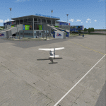
Thanks for downloading Julius Nyerere International Airport (HTDA) Version 2. This is the Largest Airport in Tanzania. The Airport scenery was built from Sketchup, SBUILDER and ADE v1.76 utilizing Google Earth for correct positions. Objects placed with Instant Scenery 3. This is version 2, it includes Terminal 1, Terminal 2, Terminal 3 (underconstruction), VIP trminal, Fire Station and Radar and Control tower in the correct position. and the "correct" afcad. More improvements will come once Terminal 3 is opened . Needs RWY12 Object library.
| Filename: | Julius_Nyerere_International_Airport_V2.zip |
| License: | Freeware |
| Added: | 16th October 2018, 15:36:32 |
| Downloads: | 1,175 |
| Author: | Emmanuel Mwandosya |
| Size: | 102.6 MB |


© 2001-2026 AVSIM Online
All Rights Reserved
Privacy Policy |