
Where Flight Simulation Enthusiasts Gather from Around the World!
AVSIM Library - Search Results

| Category: Flight Simulator X - Scenery | |
| OPNH - Nawabshah Airport - Nawabshah, Sindh, Pakistan |

|
Images related to this file:
File Description:
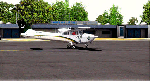
First ever freeware Scenery of PSDG/MSK OPNH Nawabshah Airport FsX/P3D. Our projects will range from major to regional airports and we will strive to add realism and detail to flight locations spanning the entire country. With each new project we will aim to enhance the flight simulation experience by providing familiar terrain in the Pakistani air space for both training as well as recreation purposes. We have embarked upon our first project OPNH airport in Nawabshah, which is currently completed and have included screenshots in the pack Scenery Developed by Sarmad Khan (MSK) & Raihan Shahzad along with supported by Ali Kazimi, Irfan Khan, Omais Khan, Ahmed Arif & Mr. Shahid Iqbal. PSDG (Pakistan Scenery Development Group) was established by Pakistan vACC, a VATSIM division in West Asia region.
| Filename: | OPNH__Nawabshah_Airport__Nawabshah_Sindh_Pakistan.zip |
| License: | Freeware |
| Added: | 1st March 2015, 15:41:50 |
| Downloads: | 809 |
| Author: | M Sarmad Khan |
| Size: | 65.88 MB |
| Category: Flight Simulator X - Scenery | |
| Nomos Irakliou and Lasithiou |
|
Images related to this file:
File Description:
AS REAL AS IT GETS.
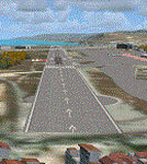
This is a detailed photo-realistic scenery of Nomos Irakliou and Lasithiou.
This upload is the last photo-scenery area containing airports in Greece.
Default FSX airports of Iraklio (LGIR), Sitia (LGST) and Kasteli (LGTL) were completely redone, positioned to their exact location, and many buildings and objects were added in the airport compounds.
New aprons, taxi signs and plenty of aircraft parking.
Also you have the choice of installing the textures of 22 original buildings (sketchup models) of the old Air Base near the town of Gouves. You could see the Base on your left at LGIR final runway 27.
The scenery contains plenty of autogen objects, buildings, vegetation and road traffic near the airports and the surrounding area.
I have also included 3 aircraft traffic files.
| Filename: | Nomos_Irakliou_and_Lasithiou.zip |
| License: | Freeware |
| Added: | 15th October 2011, 02:09:18 |
| Downloads: | 2,956 |
| Author: | Angelo Tassoglou |
| Size: | 245.12 MB |
| Category: Flight Simulator X - Scenery | |
| St. Kitts Island - Federation of Saint Kitts and Nevis |
|
Images related to this file:
File Description:
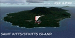
A representation of St. Kitts using photo-real scenery along with hand placed autogen. Robert L. Bradshaw International Airport is an international airport located just northeast of Basseterre, on the island of Saint Kitts, serving the nation of Saint Kitts and Nevis.
New construction started late 2004. Up to 6 wide bodied jets can now be accommodated on the tarmac. The airport can accommodate commercial jumbo jets and handles scheduled non-stop jet flights to Canada and the United States, as well as numerous regional commuter flights from within the Caribbean area. For the best results of this scenery, PWSceneries Volume 5 has to be installed. Features included are custom photo scenery covering the entire island, hand placed autogen, detailed 3D Objects and custom buildings. Works in FSX and P3D.
| Filename: | St_Kitts_Island___Federation_of_Saint_Kitts_and_Ne.zip |
| License: | Freeware |
| Added: | 24th September 2015, 10:57:42 |
| Downloads: | 827 |
| Author: | Kenje Thomas & Jamalje Bassue |
| Size: | 105.56 MB |
| Category: Flight Simulator 2004 - Scenery | |
| DGSI Kumasi, Ghana |
|
Images related to this file:
File Description:
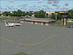
Googly scenery for Kumasi - a small domestic airport in Ghana for which no facilities
are provided in Flight Simulator 2004. These scenery files add taxiways, aprons,
buildings and other airport features, so that you and your "AI" traffic can land,
taxi, park and take off in a realistic manner.
The airport serves the city of Kumasi (capital of the Ashanti region) and sees
regular flights using turboprop airliners operated by Accra based operators
Antrak Air and Citylink.
The scenery does not purport to be ultra-accurate. Based on high-detail satellite
imagery from Google Earth, the layout is proportionally correct but the added
airport features, such as buildings, are built from default Microsoft objects
and add-on libraries so will not look like the real thing.
[File re-uploaded at request of AVSIM]
| Filename: | DGSI_Kumasi_Ghana.zip |
| License: | Freeware |
| Added: | 23rd May 2010, 01:25:23 |
| Downloads: | 1,419 |
| Author: | John Hinson |
| Size: | 80.3 KB |
| Category: Flight Simulator 2004 - Scenery | |
| Treasure_Island |
|
File Description:
FS2004 Treasure Island around late 1920's to the mid 1930's
Scenery by Tha Fox's Hangar.
This is a recreation of Treasure Island in San Fransisco. This
scenery inclueds The Pan Am sea plane base at the south end of
the Island and the Navy airfield at the north end. At the Pan Am
end there was the two big hangars, two smaller hangar side by side
and the Pan American terminal. At the Navy end there was two runways
for a short time, but about the mid 30's the Navy removed one
of the runways and most of the Navy airtrafic consiced of the
airships.
In this scenery addon I included boath runway on at the Navy end
of the airfield and Pan Am's installation at the south end.
| Filename: | Treasure_Island.zip |
| License: | Freeware |
| Added: | 6th February 2009, 09:37:04 |
| Downloads: | 735 |
| Author: | Kenny Fox |
| Size: | 4.83 MB |
| Category: Flight Simulator 2004 - Scenery | |
| Laguna del Sauce Airport, Punta del Este (SULS), Uruguay |
|
Images related to this file:
File Description:
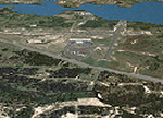
Photorealistic scenery of Laguna del Sauce / Curbelo (SULS) International Airport in Maldonado, Uruguay, version 1. This is the airport that serves the well-known beach resort of Punta del Este. This scenery package includes the airport facilities with the passenger terminal, general aviation area and the naval airbase on the banks of Laguna del Sauce lake. Several buildings and vehicles belonging to the airport have been recreated. Also included is the area around the airport recreated as photorealistic terrain with seasonal variations at a 4. 75 m/pixel resolution. Certain parts of the airport have been recreated with a 2 m/pixel photorealistic terrain. The aim of this scenery is to simulate flying to and around the airport under instrument flight rules (IFR) and also visual flight rules (VFR).
| Filename: | Laguna_del_Sauce_Airport_Punta_del_Este_SULS_Urugu.zip |
| License: | Freeware |
| Added: | 9th June 2010, 02:48:12 |
| Downloads: | 1,471 |
| Author: | "A Vuelo de Pajaro" / "As the Bird Flies" Design Group members: Diego Altgenug, Daniel Gazzano, Alan Pereira Pierce, Juan Pablo Simonet |
| Size: | 13.81 MB |
| Category: Prepar3D V1-4 - Scenery | |
| ENFG_Fagernes/Leirin, Norway for P3DV4 |
|
Images related to this file:
File Description: The airport ENFG is situated about 4 kilometers northeast of the city of Fagernes in the municipal of Nord-Aurdal, Oppland, about 120 miles northeast from Oslo.
The altitude of ENFG is 822 m / 2,697 ft. The airport is very close to the imposant rocks of Jutunheimen. The senery has a photo background that covers all four seasons: spring, summer, autumn and winter. The surroundings are made via new landclasses which fit mostly the reality. Also all lakes and rivers are updated. The buildings in this scenery are mostly taken from the fantastic XPlane scenery made by Hans Kristian Braaten Olsen, who kindly gave me permission to use his buildings in this scenery. I prepared them for FSX and partly reworked them a bit.
| Filename: | ENFG_FagernesLeirin_Norway_for_P3DV4.zip |
| License: | Freeware |
| Added: | 5th October 2019, 18:03:21 |
| Downloads: | 477 |
| Author: | Wolfgang Allers |
| Size: | 245.14 MB |
| Category: Flight Simulator X - Scenery | |
| ENFG_Fagernes/Leirin, Norway for FSX |
|
Images related to this file:
File Description: The airport ENFG is situated about 4 kilometers northeast of the city of Fagernes in the municipal of Nord-Aurdal, Oppland, about 120 miles northeast from Oslo.
The altitude of ENFG is 822 m / 2,697 ft. The airport is very close to the important rocks of Jutunheimen. The senery has a photo background that covers all four seasons: spring, summer, autumn and winter. The surroundings are made via new landclasses which fit mostly the reality. Also all lakes and rivers are updated. The buildings in this scenery are mostly taken from the fantastic XPlane scenery made by Hans Kristian Braaten Olsen, who kindly gave me permission to use his buildings in this scenery. I prepared them for FSX and partly reworked them a bit.
| Filename: | ENFG_FagernesLeirin_Norway_for_FSX.zip |
| License: | Freeware |
| Added: | 5th October 2019, 18:01:05 |
| Downloads: | 482 |
| Author: | Wolfgang Allers |
| Size: | 245.88 MB |
| Category: Flight Simulator 2004 - Scenery Design | |
| EZ-Decorative Shrubs |
|
File Description:
This is a collection of decorative shrubs and flowers that can be placed in planters or on the ground. This is a standard FS9 object library and can be used with EZ-Scenery or any other program that allows you to place such objects in your FS9 scenery. These are plane objects, meaning they are 2-dimensional. Each shrub or flower object comes in two versions, static and rotational. The static version will stay in whatever direction it is facing when you place it in your scenery. The rotational version will rotate so that it is always facing you. Static versions are best for placing against walls, sides of buildings, etc. You can tell which version is which by the name. Flowers_01_s is static and flowers_01_r is rotational.
| Filename: | EZDecorative_Shrubs.zip |
| License: | Freeware |
| Added: | 11th June 2006, 02:02:22 |
| Downloads: | 4,252 |
| Author: | Sidney Schwartz |
| Size: | 1.13 MB |
| Category: X-Plane - Scenery | |
| BR SP SBSP - Congonhas Airport v1.1.0 |
|
Images related to this file:
File Description:

This is an X-Plane 11 and X-Plane 10 scenery package for Sao Paulo's Congonhas Airport (IATA: CGH, ICAO: SBSP), one of the four commercial airports serving São Paulo, Brazil. It includes corrected aprons, ramps, taxiways, lighting system, city buildings, ortho photoscenery for the airport area, and (XP11 only) ground services (like push back). This scenery was tested and is operational (as of March 30, 2017) in "X-Plane 11.00 Release Candidate #1 64 bit", Windows 10 Home. It was also tested and is also operational (as of March 30, 2017) in "X-Plane 10.51 64 bit", Windows 10 Home. Only the default X-Plane 11 libraries, by Laminar Research, are needed. No third party libraries are used. v1.1.0 adds ortho photo scenery for the airport area. Everything else is unchanged from v1.0.0.
| Filename: | BR_SP_SBSP__Congonhas_Airport_v110.zip |
| License: | Freeware |
| Added: | 1st April 2017, 17:53:17 |
| Downloads: | 184 |
| Author: | Rui Mesquita |
| Size: | 21.94 MB |


© 2001-2026 AVSIM Online
All Rights Reserved
Privacy Policy |