
Where Flight Simulation Enthusiasts Gather from Around the World!
AVSIM Library - Search Results

| Category: Flight Simulator 2004 - Flight Plans | |
| AL_EX Extreme Flight 01 |

|
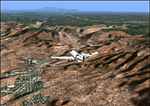
File Description:
Get to Simon Bolivar Intl before Rio Amazonas (Ecuador). Rio Amazonas is located to one old crater!. Use default King-Air 350.
| Filename: | AL_EX_Extreme_Flight_01.zip |
| License: | Freeware |
| Added: | 23rd December 2003, 21:59:08 |
| Downloads: | 800 |
| Author: | Jean-Jacques Parel |
| Size: | 52.85 KB |
| Category: Orbiter - Miscellaneous Files | |
| Ceraunius / Uranius Area Scenery v.1.0 |
|
File Description:
The Ceraunius & Uranius Area on Mars, features the:
Ceraunius Tholus, Ceraunius Patera, Uranius Tholus, Uranius Patera (coming in next version), Paros Crater.
| Filename: | Ceraunius__Uranius_Area_Scenery_v10.zip |
| License: | Freeware |
| Added: | 2nd October 2002, 12:27:44 |
| Downloads: | 2,154 |
| Author: | Robert Stettner (Foxtrot) |
| Size: | 308.21 KB |
| Category: Flight Simulator 2004 - Scenery | |
| PHOG - Kahului Airport, Hawaii |
|
Images related to this file:
File Description:

FS2004 Scenery for Kahului Airport Hawaii (PHOG). Kahului Airport is the primary airport on the island of Maui and receives both overseas and inter island flights. On Maui you'll find beautiful beaches, exciting water sports, Haleakala Crater, the old whaling town of Lahaina, blue skies, great dining and the Aloha spirit. We look forward to welcoming you to the Valley Island. Scenery contains photoground cover for the airport, custom FSDS scenery objects, and custom AI aircraft.
| Filename: | PHOG__Kahului_Airport_Hawaii.zip |
| License: | Freeware, limited distribution |
| Added: | 5th April 2015, 23:58:16 |
| Downloads: | 1,771 |
| Author: | John Stinstrom |
| Size: | 5.91 MB |
| Category: Prepar3D V1-4 - Scenery | |
| Maniitsoq Greenland City N65.24.45 W52.56.22" |
|
File Description:
Maniitsoq Greenland N65.24.45 W52.56.22" City and BGMQ one of the most difficult airports is open from May to September. Maniitsoq became important in 2012 when a 100km diameter crater was discovered, caused by a meteorite thousands of years ago.
If you want to look in youtube Maniitsoq or press this link
https://youtu.be/C3n1Din7Fis
Happy Flight VFR to all.
Within the downloaded package you will find readme files for scenery installation. Good fly VFR. Pasquale Marrulli.
| Filename: | Maniitsoq_Greenland_City__N652445_W525622.zip |
| License: | Freeware |
| Added: | 3rd January 2018, 16:28:22 |
| Downloads: | 150 |
| Author: | Pasquale Marrulli |
| Size: | 2.88 KB |
| Category: Flight Simulator 2004 - Scenery | |
| Polikhnitos |
|
File Description:
The default Polikhnitos airport isn't placed correctly and causes "plateaus" problems with high resolution mesh. A plateaus problems is when you have a default airport badly placed and mesh installed that has a higher resolution than the default mesh you will have airports at the bottom of a crater or on a "Ayers rock". This scenery fixes the problem and allows you to use meshes up to 38m. Not tested with higher resolution, I don't think meshes of 19m exist for that region.
| Filename: | Polikhnitos.zip |
| License: | Freeware |
| Added: | 14th July 2007, 10:20:16 |
| Downloads: | 617 |
| Author: | Jean-paul Marchetti |
| Size: | 896.7 KB |
| Category: Fly! II - TerraScene | |
| Sedona, AZ Area TerraScene Project Pack |
|
Images related to this file:
File Description:
This TerraScene 2.1 Project pack covers all of global tile 176,154, with Sedona anchoring it just left of center. It extends from Sunset Crater in the NE southwest through Flagstaff, Sedona, Red Rock, and Prescott. This pack includes updated Tiger Census (2000) shapefile data, adding new water areas, new highways, and other details. All scenery data files are included: USGS data, shapefiles, an adapted texture set and a complete water mask. Requires TerraScene 2.1 and Fly!II patched to v230 or later.
| Filename: | Sedona_AZ_Area_TerraScene_Project_Pack.zip |
| License: | Freeware |
| Added: | 13th May 2010, 09:09:47 |
| Downloads: | 254 |
| Author: | Randall Rocke |
| Size: | 48.69 MB |
| Category: Flight Simulator 2004 - Scenery | |
| Olympus Mons Fictional Terrain Mesh |
|
File Description:
moves olympus mons (biggest vulcano of the solar system) into the sahara desert (to N030E000). heres a few data to impress you mortals:
base diameter round about 550 kilometers, altitude of base cliff round about 3 kilometers, summit altitude round about 27 kilometers, diameter of summit caldera (crater) 20 kilometers
| Filename: | Olympus_Mons_Fictional_Terrain_Mesh.zip |
| License: | Freeware |
| Added: | 14th November 2003, 15:54:19 |
| Downloads: | 823 |
| Author: | Thomas Ruth |
| Size: | 287.17 KB |
| Category: Flight Simulator 2004 - Scenery | |
| Israel SRTM 90m Mesh Ver. 1.0 |
|
File Description:
Finally, VFR/CVFR pilots are able to enjoy the tall peaks of the Hermon mountain, the Golan heights and the ravines of the Western slopes of the Carmel mountains, the road to Jerusalem and the sub-sea level features of the Sea of Galilee and the famous Dead Sea.
The Negev Desert can finally show off its fascinating topography which includes, among others, the Small Crater and Ramon Crater whose features are clearly visible from space. There are many canyons, ravines, dry streams and other dramatic ground landscapes which can make a Negev Dessert VFR Expedition quite exciting. The trip could end at Eilat. Now you can see this well known touristic resort, bordered on the West and East by the tall and rugged mountains which have been among its more typical features.
| Filename: | Israel_SRTM_90m_Mesh_Ver_10.zip |
| License: | Freeware, limited distribution |
| Added: | 23rd April 2004, 12:54:03 |
| Downloads: | 12,086 |
| Author: | Alexander Lawrence |
| Size: | 7.26 MB |
| Category: Flight Simulator 2004 - Scenery | |
| Canlaon Volcano Eruption Scenery |
|
File Description:
Canlaon Volcano is located at the center of Negros Island,Philippines.The twin-peaked massif of Canlaon Volcano (aka Mt. Kanlaon) rises 2,465 meters above the island of Negros just 40-km southwest of the capital Bacolod.This file will add the crater to Canlaon Volcano and will enhance the Landclass surrounding the crater.The crater is real with water.This also adds Visual Effects such as steam,volcanic ashes and lava that will erupt every now and then.Ash falls will fall in the vulnerable surrounding villages of Pula, Malaiba, and Lumanao.The last volcanic activity of Canlaon Volcano recorded by Phivolcs was on June 1-18,2003.
Fly from Bacolod City(RPVB)to Tagbilaran City(RPVT)or Mactan(RPVM) and pass through the highest point of the Island of Negros and behold the beauty of the Canlaon Volcano eruption.
Special steam,ash,and lava effects are visible at daytime and at nighttime.The new Philippine Mesh by Jacques Marie is recommended for achieving realistic topography.You may find it here at avsim,too.
| Filename: | Canlaon_Volcano_Eruption_Scenery.zip |
| License: | Freeware |
| Added: | 10th December 2003, 22:41:38 |
| Downloads: | 3,876 |
| Author: | Ver Walter L. Gulfan |
| Size: | 5.04 KB |
| Category: Orbiter - Miscellaneous Files | |
| Face On Mars |
|
File Description:
In July, 1976, Viking Orbiter 1 was acquiring images of the Cydonia region of Mars as part of the search for potential landing sites for Viking Lander 2. On 25 July, 1976, it photographed a region of buttes and mesas along the escarpment that separates heavily cratered highlands to the south from low lying, relatively crater-free, lowland plains to the north. Among the hills was one that, to the Viking investigators scrutinizing the images for likely landing sites, resembled a face.
| Filename: | Face_On_Mars.zip |
| License: | Freeware |
| Added: | 20th July 2002, 15:22:38 |
| Downloads: | 2,488 |
| Author: | jtiberius |
| Size: | 377.88 KB |
© 2001-2026 AVSIM Online
All Rights Reserved
Privacy Policy |