
Where Flight Simulation Enthusiasts Gather from Around the World!
AVSIM Library - Search Results

| Category: Flight Simulator 2004 - Scenery | |
| GERMANY 2004 SRTM MESH SCENERY |

|
File Description:
Based on SRTM 3 arc.sec data.
Unfortunately SRTM DATA have many holes and data loss, so I made a resampling and an oversampling with other data with lower resolution, but with better coverege (like data from swiss topographic federal istitute or from italian IGM, and finally with DTED Level 0.) with geo cad software like Grass and GlobalMapper for projection convertion.
Compression and conversion to bgl with MS Flight simulator SDK at LOD 9
This scenery cover the entire Germany teritory, the part of Swiss and Austria territories not included in my Italian scenery. Parts of Belgium and Netherlands and Luxembourg are included too (Till E005); next quite the whole territory of Czech Republic and part of Poland till E017.
| Filename: | GERMANY_2004_SRTM_MESH_SCENERY.zip |
| License: | Freeware |
| Added: | 23rd November 2003, 23:18:46 |
| Downloads: | 25,895 |
| Author: | Pietro Mauri |
| Size: | 62.08 MB |
| Category: Flight Simulator X - Scenery | |
| The Dry Tortugas Photo Scenery |
|
Images related to this file:
File Description:
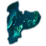
Where are the Dry Tortugas? Should you be wondering, at the western end of the Florida Keys. Located 68 miles west of Key West, they are accessible only by boat and of course via your favorite seaplane.
Source Data: National Agriculture Imagery Program (NAIP) Orthoimagery, 1 meter per pixel resolution. The scenery package also corrects the MS-FSX Island and Lighthouse position errors overlooked by UTX-USA and UTX-TAC.
For your finest virtual experience it is highly recommended you download, install and use with: South Florida and The Bahamas Water Class scenery. (S-FL_Bahamas_WC.zip)
Enjoy your flight and don't forget your Scuba Gear or the sunscreen! - Wally-Bob
| Filename: | The_Dry_Tortugas_Photo_Scenery.zip |
| License: | Freeware, limited distribution |
| Added: | 23rd August 2014, 11:08:17 |
| Downloads: | 918 |
| Author: | Walter Roberts |
| Size: | 50.9 MB |
| Category: Flight Simulator X - Scenery | |
| FSX Scenery - ISS over KPAM |
|
File Description:
The International Space Station placed directly over
KPAM (Tyndall AFB) at 900k ft (175 miles) -
this scenery is intended as companion scenery to
my Shuttle Atlantis. capable of reaching 600k ft on it's own,
but you'll need to use slew to make it the rest of the way up
- and it's a short de-orbit to KSC when your ready to come down
For FSX ONLY by Bruce Fitzgerald - [email protected]
| Filename: | FSX_Scenery__ISS_over_KPAM.zip |
| License: | Freeware |
| Added: | 26th January 2008, 03:06:54 |
| Downloads: | 2,252 |
| Author: | Bruce Fitzgerald |
| Size: | 495.56 KB |
| Category: Flight Simulator 2004 - Scenery | |
| South America Pack1 Soaring Scenery |
|
File Description:
FS2002/2004 South America Pack1 Soaring Scenery
This file add some thermals to default Microsoft scenery for South America Region:
1.Argentina:
.Aeroclube Dolores - Dolores City.
.Club Argentino de Planeadores Albatros - San Andrés de Giles City.
.Club de Planeadores Zárate - Zárate City.
.Buenos Aires - Ezeiza Airport(SAEZ)
2.Uruguai - Montevideo City(SUNU)
3.Paraguai - Assuncion City(SGAS)
4.Venezuela _ Caracas City(SVMP)
5.Bolivia - La Paz City(SLLP)
6.Peru - Lima City(SPIM)
7.Chile - Club de Planeadores de Santiago - Lo Castillo Airfield - Santiago City(SCEL)
8.Colombia - Bogotá City(SKBO)
9.British Guianne - Georgetown City(SYCJ)
10.Suriname - Paramaribo City(SMZO)
11.French Guianne - Cayenne City(SOCA)
12.Ecuador - Quito City(SEQU)
It is freeware.
By Francisco Vargas.
E-mail:[email protected]
| Filename: | South_America_Pack1_Soaring_Scenery.zip |
| License: | Freeware |
| Added: | 16th November 2005, 16:19:11 |
| Downloads: | 4,913 |
| Author: | Francisco Augusto Vargas Carneiro |
| Size: | 581.31 KB |
| Category: Flight Simulator 2004 - Scenery | |
| FS2004 Scenery UBTT-Zabrat Heli |
|
File Description:
FS2004 Scenery UBTT-Zabrat Heli
Based on open photos available. Please see Install notes for necessary object files and enjoy.
| Filename: | FS2004_Scenery_UBTTZabrat__Heli.zip |
| License: | Freeware |
| Added: | 16th August 2024, 23:11:32 |
| Downloads: | 35 |
| Author: | Bernd Barsch |
| Size: | 2.3 MB |
| Category: Flight Simulator 2004 - Scenery | |
| Canaima National Park Mesh Scenery |
|
File Description:
Covers over 3 million hectares in south-eastern
Venezuela. Roughly 65% of the park is covered
by table mountain (tepui) formations. Include
Angel Falls, the world's tallest waterfall
(1000 m). Made from GOTOPO30 DEM using Microsoft
Terrain SDK Tools, with a resolution of 3,75
arc sec using graphical interpolation techniques.
Also works great in FS2002.
By David Maldonado - September, 2003
| Filename: | Canaima_National_Park_Mesh_Scenery.zip |
| License: | Freeware |
| Added: | 21st September 2003, 19:02:25 |
| Downloads: | 4,184 |
| Author: | David Maldonado |
| Size: | 922.91 KB |
| Category: Flight Simulator 2004 - Scenery | |
| Paris Orly 1966 Scenery (LFPO) |
|
Images related to this file:
File Description:

We proudly present this scenery of the airport of Paris-Orly (LFPO) as it was around 1966. We have produced this scenery to provide taxiways and details as they were around this period. We have also included new parking to allow the AI aircraft to taxi correctly at the new (old!) airport. Although we did not always have enough photos and information we tried to come as close as possible. Our goal was to reflect something of the atmosphere and feel of that period, prior to the all-jet era of today. You also will find a moving crash tender at the airport. The major difference between the 1961 and 1966 scenery is the new control tower. Updated zip file with correctly named Setup file.
| Filename: | Paris_Orly_1966_Scenery_LFPO.zip |
| License: | Freeware, limited distribution |
| Added: | 1st December 2013, 20:42:03 |
| Downloads: | 1,135 |
| Author: | Harry Biard, Nikko Yaginuma, Jaap de Baare, Wolfgang Gersch, Tom Gibson and Bernard Leuenberger |
| Size: | 7.06 MB |
| Category: Flight Simulator X - Scenery | |
| South America Mesh Scenery, MeshX_E4 |
|
File Description:
Mesh terrain scenery for the whole continental South America, based on SRTM 90m
dem geotiff files (at: ftp://ftp.glcf.umiacs.umd.edu/glcf/SRTM/Degree_Tiles/),
resampled to 76 meter of horizontal resolution (LOD 9). The new files have
improved the vertical resolution from 16m to 10m, resulting in more details
and accuracy over previous versions. There are 50 files, compatible with FS 9
and FS X, identified in a map by column letter and line number, covering the
contiguous countries and states. Boundaries: N = 5º 37.5' S; S = 11º 15' S;
E = 41º 15' W; W = 48º 45' W;
| Filename: | South_America_Mesh_Scenery_MeshX_E4.zip |
| License: | Freeware |
| Added: | 28th October 2006, 05:55:47 |
| Downloads: | 1,528 |
| Author: | Oséas Dourado and José Lôbo |
| Size: | 38.91 MB |
| Category: Flight Simulator X - AFCAD Files | |
| Toulouse-Blagnac Airport Scenery (LFBO) |
|
Images related to this file:
File Description:

This is an FSX addon scenery of the Toulouse-Blagnac Airport (LFBO). It has been made using the excellent freeware tool ADE. It includes the new terminal gates, the A380 production line (using Lagardere) at the north of the airport, the new delivery center called Aire Ziegler where the brand new A380s are delivered. I modified taxiways and parking to make them look like in the reality. There are two landing pads for helicopters like in reality. I have changed the parking assignment to make sure that the usual traffic will park on the parkings E, F D AB, V and U, as it is on the reality. Finally, the close surroundings of the airport were modified to display the Airbus facilities as far as possible with generic buildings.
| Filename: | ToulouseBlagnac_Airport_Scenery_LFBO.zip |
| License: | Freeware |
| Added: | 13th June 2011, 03:32:00 |
| Downloads: | 1,387 |
| Author: | Jose Mauriz |
| Size: | 220.42 KB |
| Category: Flight Simulator X - Scenery | |
| EIDW - Dublin Airport, Ireland Scenery |
|
File Description:
This file updates the scenery in Dublin Airport. The file includes Pier D, West Apron, All new gates (numbered correctly using charts), New taxiways, New ILS freq. for RWY 28/11 (111.35) and includes Charts for Dublin Aerodrome and Parking.
| Filename: | EIDW__Dublin_Airport_Ireland_Scenery.zip |
| License: | Freeware |
| Added: | 3rd July 2008, 14:22:18 |
| Downloads: | 6,884 |
| Author: | Neil Keane |
| Size: | 1.52 MB |


© 2001-2026 AVSIM Online
All Rights Reserved
Privacy Policy |