
Where Flight Simulation Enthusiasts Gather from Around the World!
AVSIM Library - Search Results

| Category: Prepar3D V1-4 - Scenery | |
| GVSF - São Filipe Airport |

|
File Description:
P3Dv4 - São Filipe Airport (Portuguese: Aeródromo de São Filipe, also: Aeródromo do Fogo) (IATA: SFL, ICAO: GVSF) is Cape Verde's fifth most-used airport, located in the island of Fogo.
It is located 2 km southeast of the town of São Filipe, near the Atlantic Ocean. It is used for domestic flights only.
The airport was completed in 1997,replacing a smaller airfield at the same location. Its runway measures 1,350 metres (4,430 ft) by 30 metres (98 ft) wide. The maximum single-wheel load is 20 tonnes
| Filename: | GVSF__So_Filipe_Airport.zip |
| License: | Freeware |
| Added: | 3rd May 2022, 00:56:33 |
| Downloads: | 128 |
| Author: | Eduardo Puelker |
| Size: | 4.84 MB |
| Category: Flight Simulator X - Scenery | |
| GVAC AmiÂlcar Cabral International Airport |
|
Images related to this file:
File Description:
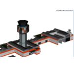
AmÃlcar Cabral International Airport (IATA: SID, ICAO: GVAC), also known as Sal International Airport or AmiÂlcar Cabral Airport, is the principal international airport of Cape Verde. The airport is named after the revolutionary leader AmiÂlcar Cabral.
It is located 2 km (1.3 miles) west-southwest from Espargos on Sal Island. Until September 2005, it was the only airport in Cape Verde to serve international flights. (Cape Verde's other international airports are near Praia on Santiago Island,
on São Vicente near the capital of Mindelo and on Boavista.)
| Filename: | GVAC_Amilcar_Cabral_International_Airport.zip |
| License: | Freeware |
| Added: | 24th August 2011, 12:57:05 |
| Downloads: | 6,716 |
| Author: | Miguel Diaz |
| Size: | 29.89 MB |
| Category: Flight Simulator 2004 - Sounds | |
| Gear, wind and groundroll sounds for Boeing 767 |
|
File Description:
Gear, wind and groundroll sounds for Boeing 767 ** made specially for the Level D Sim's 767.
Contains: (for any 767 in general) Authentic 767 groundroll from the flightdeck, Authentic 767 Wind from the flightdeck. (for LDS 767 Only) Gear up with tire spin stop, Authentic 767 GEAR noise from the flightdeck, Customized geardown sound for gearnoise. ***2 sounds will work for any 767's, and the other 3 are made for the LDS 767 only!*** Visit http://www.mynameispreston.com/767/ to hear what these sound like in the sim.
| Filename: | Gear_wind_and_groundroll_sounds_for_Boeing_767.zip |
| License: | Freeware |
| Added: | 24th November 2005, 14:49:30 |
| Downloads: | 7,354 |
| Author: | Preston Nirattisai |
| Size: | 5.73 MB |
| Category: Flight Simulator 2004 - Aircraft Repaints, Textures and Modifications | |
| Antonov Virtual Airlines An-124 UR-82072 |
|
File Description:
This is an improvement on Tomasz Elantkowski's repaint for Antonov Airlines' AN-124-100 tail number UR-82072. The improvements include: 1. Better company information, including email address, and company logo. 2. Better looking Tail number at rear of fuselage. 3. Improved and better looking company information on the underside of the nose. 4. Added missing "Stage III" logos on the engines. 5. Replaced the tail texture with the original. 5. Included painted wing with aircraft number. 6. And International Red Cross logo (on selected model). Requires the An-124 by Thomas Ruth.
| Filename: | Antonov_Virtual_Airlines_An124__UR82072.zip |
| License: | Freeware |
| Added: | 2nd March 2005, 03:52:21 |
| Downloads: | 1,722 |
| Author: | Ray Brower |
| Size: | 6.55 MB |
| Category: Flight Simulator X - Scenery | |
| KHPN - Westchester County Airport - White Plains, New York |
|
Images related to this file:
File Description:
This scenery is for Westchester County Airport and made only for FSX with 2 optional files: one version with the Crosswind runway activated and in full operation where both runways will be used for takeoff and landing and one version as the default runway operation: terminal remodeled, new hangars added around the airport, taxiways and taxi signs updated to the latest charts, new control tower, extra fuel trucks and many other scenery additions, airport views are from the roof of the control tower (when in tower view) please view the readme before installation.
| Filename: | KHPN__Westchester_County_Airport__White_Plains_New.zip |
| License: | Freeware, limited distribution |
| Added: | 23rd February 2014, 01:22:41 |
| Downloads: | 8,308 |
| Author: | Craig Scott |
| Size: | 676.43 KB |
| Category: Flight Simulator 2004 - Scenery | |
| Project Mexico Real LOD10 File 3 of 11 |
|
Images related to this file:
File Description:
Re-upload. File 3rd of 11 of a Terrain Mesh that covers the entirety of Mexican Territory and related bordering U.S., Guatemala and Belice areas, part of the "Proyecto Mexico Real" project, compiled at LOD10 (1.24 arcseconds in latitude and 1.65 arcseconds in longitude) resolution from INEGI data. Intended to enhance the virtual flying experience complementing the LOD8 and LOD9 versions compiled from the same data. Compatible backwards with Flight Simulator 2000, Flight Simulator 2002 and Combat Flight Simulator 2. Refer to the file contents about the cover area to this compressed file.
| Filename: | Project_Mexico_Real_LOD10_File_3_of_11.zip |
| License: | Check within download |
| Added: | 8th June 2010, 03:17:03 |
| Downloads: | 3,255 |
| Author: | Juan Jose Galvan Bautista |
| Size: | 73.67 MB |
| Category: Flight Simulator 2004 - Scenery | |
| Project Mexico Real LOD10 File 10 of 11 |
|
Images related to this file:
File Description:
Re-upload. File 10th of 11 of a Terrain Mesh that covers the entirety of Mexican Territory and related bordering U.S., Guatemala and Belice areas, part of the "Proyecto Mexico Real" project, compiled at LOD10 (1.24 arcseconds in latitude and 1.65 arcseconds in longitude) resolution from INEGI data. Intended to enhance the virtual flying experience complementing the LOD8 and LOD9 versions compiled from the same data. Compatible backwards with Flight Simulator 2000, Flight Simulator 2002 and Combat Flight Simulator 2. Refer to the file contents about the cover area to this compressed file.
| Filename: | Project_Mexico_Real_LOD10_File_10_of_11.zip |
| License: | Check within download |
| Added: | 5th September 2010, 20:55:05 |
| Downloads: | 3,062 |
| Author: | Juan Jose Galvan Bautista |
| Size: | 70.54 MB |
| Category: Flight Simulator 2004 - Scenery | |
| Project México Real LOD10 File 4 of 11 |
|
File Description:
File 4th of 11 of a Terrain Mesh that covers the entire Mexican Territory and related areas bordering the U.S., Guatemala and Belice areas. Part of the "Proyecto México Real" project, compiled at LOD10 (1.24 arcseconds in latitude and 1.65 arcseconds in longitude) resolution from INEGI data. Intended to enhance the virtual flying experience complementing the LOD8 and LOD9 versions compiled from the same data. Compatible backwards with Flight Simulator 2000, Flight Simulator 2002 and Combat Flight Simulator 2. Refer to the file contents about the cover area to this compressed file.
| Filename: | Project_Mxico_Real_LOD10_File_4_of_11.zip |
| License: | Check within download |
| Added: | 6th June 2006, 00:58:59 |
| Downloads: | 3,067 |
| Author: | Juan José Galván Bautista |
| Size: | 74.49 MB |
| Category: Flight Simulator 2004 - Scenery | |
| Project México Real LOD10 File 6 of 11 |
|
File Description:
File 6th of 11 of a Terrain Mesh that covers the entire Mexican Territory and related areas bordering the U.S., Guatemala and Belice areas. Part of the "Proyecto México Real" project, compiled at LOD10 (1.24 arcseconds in latitude and 1.65 arcseconds in longitude) resolution from INEGI data. Intended to enhance the virtual flying experience complementing the LOD8 and LOD9 versions compiled from the same data. Compatible backwards with Flight Simulator 2000, Flight Simulator 2002 and Combat Flight Simulator 2. Refer to the file contents about the cover area to this compressed file.
| Filename: | Project_Mxico_Real_LOD10_File_6_of_11.zip |
| License: | Check within download |
| Added: | 6th June 2006, 01:07:16 |
| Downloads: | 3,024 |
| Author: | Juan José Galván Bautista |
| Size: | 71.63 MB |
| Category: Flight Simulator 2004 - Scenery | |
| Project México Real LOD10 File 11 of 11 |
|
File Description:
File 11th of 11 of a Terrain Mesh that covers the entirety of Mexican Territory and related bordering U.S., Guatemala and Belice areas, part of the "Proyecto México Real" project, compiled at LOD10 (1.24 arcseconds in latitude and 1.65 arcseconds in longitude) resolution from INEGI data. Intended to enhance the virtual flying experience complementing the LOD8 and LOD9 versions compiled from the same data. Compatible backwards with Flight Simulator 2000, Flight Simulator 2002 and Combat Flight Simulator 2. Refer to the file contents about the cover area to this compressed file.
| Filename: | Project_Mxico_Real_LOD10_File_11_of_11.zip |
| License: | Check within download |
| Added: | 6th June 2006, 01:52:33 |
| Downloads: | 3,098 |
| Author: | Juan José Galván Bautista |
| Size: | 69.98 MB |


© 2001-2026 AVSIM Online
All Rights Reserved
Privacy Policy |