
Where Flight Simulation Enthusiasts Gather from Around the World!
AVSIM Library - Search Results

| Category: Navigation and ATC - Navigation | |
| Los Angeles Sectional Chart Chunks for Aerosoft's FSMap |

|
File Description:
Sectional chart chunks made from the August 2009 Sectional charts at the original scale, formatted in the WGS84 lat/long geographic coordinate system for the FSMap, moving map application for flight simulation use. The chart chunks are the full sectional divided by 2 tiles (east/west) and converted to baseline 8bit tiffs with packbits compression applied. The images average 6,000x6,000 pixels at about 25mb each, also included is the FSMap fsm Calibration file for importing. No further calibration is needed, just import, save, and enjoy.
| Filename: | Los_Angeles_Sectional_Chart_Chunks_for_Aerosofts_F.zip |
| License: | Freeware |
| Added: | 27th March 2010, 20:58:18 |
| Downloads: | 473 |
| Author: | David Myers |
| Size: | 26.25 MB |
| Category: Navigation and ATC - Navigation | |
| Las Vegas Sectional Chart Chunks for Aerosoft's FSMap |
|
File Description:
Sectional chart chunks made from the August 2009 Sectional charts at the original scale, formatted in the WGS84 lat/long geographic coordinate system for the FSMap, moving map application for flight simulation use. The chart chunks are the full sectional divided by 2 tiles (east/west) and converted to baseline 8bit tiffs with packbits compression applied. The images average 6,000x6,000 pixels at about 25mb each, also included is the FSMap fsm Calibration file for importing. No further calibration is needed, just import, save, and enjoy.
| Filename: | Las_Vegas_Sectional_Chart_Chunks_for_Aerosofts_FSM.zip |
| License: | Freeware |
| Added: | 27th March 2010, 20:58:26 |
| Downloads: | 463 |
| Author: | David Myers |
| Size: | 31.75 MB |
| Category: Flight Simulator X - Miscellaneous Files | |
| Quick Reference for FSCrew 2010 Default FSX 737 |
|
File Description:
A quick barebones reference for FSCrew's Voice Commander 2010, for the default 737 in FSX, all on one page.
| Filename: | Quick_Reference_for_FSCrew_2010_Default_FSX_737.zip |
| License: | Freeware |
| Added: | 24th January 2010, 21:52:38 |
| Downloads: | 295 |
| Author: | Paul Scholey |
| Size: | 3.88 KB |
| Category: Flight Simulator 2002 - Scenery | |
| Terrain Mesh for Canada's Maritime Provinces (2/2) |
|
File Description:
Re-upload. The files in this package contain a new 76m (LOD09) terrain mesh for Canada's Maritime Provinces. The source data is the Shuttle Radar Topography Mission (SRTM-3, 90m). All data were compiled and edited in MicroDEM 6.02, converted with BIGBSQ and resampled to LOD (Level of Detail) 9, or 76.4 meters horizontal resolution, with the Microsoft Terrain Software Developer's Kit (SDK) utilities. Two parts : Maritimes09a.zip and Maritimes09b.zip.
| Filename: | Terrain_Mesh_for_Canadas_Maritime_Provinces_22.zip |
| License: | Freeware, limited distribution |
| Added: | 29th January 2010, 00:42:41 |
| Downloads: | 237 |
| Author: | Gilles Gauthier |
| Size: | 23.59 MB |
| Category: Flight Simulator 2004 - Scenery | |
| Tongass Remote Airfield (RATR) - for "Tongass Fjords" (FS9) |
|
Images related to this file:
File Description:
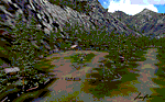
"Tongass Remote Airfield" (RATR) Alaskan scenery (Fictitious)
Tongass Remote Airfield is for Flight Simulator 2004 and for the "Tongass Fjords" (FS9) addon by Holger Sandmann & Bill Womack . You must have "Tongass Fjords" (FS9) for this to work.
Field history and description:
In the early days this area was well known to prospectors and hunters. A small mine was established and later abandoned. Around the late 40���¢��������s a crew was contracted to clear a small landing area to gain easier access for hunters and campers. Due to the extreme remoteness of this area that clearing took several years. The last phase was the approach, clearing by hand a descending glide slope through just the tops of the tall trees. There is now just enough room for a very experienced pilot to get in and out of this field. The airfield is 26 miles north of Petersburg Alaska (PAPG). This is a tricky narrow approach with a left hand dogleg and then an immediate right hand dogleg turn just before the final approach. Not much time to set up your approach, also, it's a very short runway. For experienced pilots only, and make sure that your life insurance is up to date. See enclosed Maps and info. Good luck.
| Filename: | Tongass_Remote_Airfield_RATR__for_Tongass_Fjords_F.zip |
| License: | Freeware, limited distribution |
| Added: | 11th February 2010, 00:49:22 |
| Downloads: | 623 |
| Author: | Jay Langham |
| Size: | 3.51 MB |
| Category: Navigation and ATC - Navigation | |
| Puerto Rico VI TAC Chunks for Aerosoft's FSMap |
|
File Description:
The chart chunks are from the latest Puerto Rico Virgin Islands TAC at the original scale, formatted in the WGS84 lat/long geographic coordinate system for the FSMap, moving map application for flight simulation use.
The chart chunks are baseline 8bit tiffs with packbit compression applied, not for size but for efficiency. The images are 3800x3806 pixels at about 13.5mb each. Also, included is the FSMap fsm Calibration file for importing.
| Filename: | Puerto_Rico_VI_TAC_Chunks_for_Aerosofts_FSMap.zip |
| License: | Freeware |
| Added: | 19th March 2010, 01:17:08 |
| Downloads: | 323 |
| Author: | David Myers |
| Size: | 21.19 MB |
| Category: Navigation and ATC - Navigation | |
| Twin Cities Sectional Chart Chunks for Aerosoft's FSMap |
|
File Description:
Sectional chart chunks made from the August 2009 Sectional charts at the original scale, formatted in the WGS84 lat/long geographic coordinate system for the FSMap, moving map application for flight simulation use.
The chart chunks are the full sectional divided by 2 tiles (east/west) and converted from the geotiffs to baseline 8bit tiffs with packbit compression applied, not for size but for efficiency. The images are about 6,000x6,000 pixels at about 25mb each, also included is the FSMap fsm Calibration file for importing.
**Note: The files in this download are the largest of the split sectionals, 6,000x7,000 due to the Lake of the Woods region extending the northern border. These should work in the gauge just fine, having tested the full sectional area tiff that is 12,000x7,000 at 60mb in size in the gauge the only difference was that the zoom in was limited to 10nm with these larger images (see the notes in the zip file).
| Filename: | Twin_Cities_Sectional_Chart_Chunks_for_Aerosofts_F.zip |
| License: | Freeware |
| Added: | 19th March 2010, 01:17:18 |
| Downloads: | 334 |
| Author: | David Myers |
| Size: | 34.27 MB |
| Category: Navigation and ATC - Navigation | |
| Green Bay Sectional Chart Chunks for Aerosoft's FSMap |
|
File Description:
Sectional chart chunks made from the August 2009 Sectional charts at the original scale, formatted in the WGS84 lat/long geographic coordinate system for the FSMap, moving map application for flight simulation use. The chart chunks are the full sectional divided by 2 tiles (east/west) and converted to baseline 8bit tiffs with packbits compression applied. The images average 6,000x6,000 pixels at about 25mb each, also included is the FSMap fsm Calibration file for importing.
| Filename: | Green_Bay_Sectional_Chart_Chunks_for_Aerosofts_FSM.zip |
| License: | Freeware |
| Added: | 22nd March 2010, 20:40:23 |
| Downloads: | 326 |
| Author: | David Myers |
| Size: | 28.25 MB |
| Category: Navigation and ATC - Navigation | |
| Lake Huron Sectional Chart Chunks for Aerosoft's FSMap |
|
File Description:
Sectional chart chunks made from the August 2009 Sectional charts at the original scale, formatted in the WGS84 lat/long geographic coordinate system for the FSMap, moving map application for flight simulation use. The chart chunks are the full sectional divided by 2 tiles (east/west) and converted to baseline 8bit tiffs with packbits compression applied. The images average 6,000x6,000 pixels at about 25mb each, also included is the FSMap fsm Calibration file for importing.
| Filename: | Lake_Huron_Sectional_Chart_Chunks_for_Aerosofts_FS.zip |
| License: | Freeware |
| Added: | 22nd March 2010, 20:40:41 |
| Downloads: | 337 |
| Author: | David Myers |
| Size: | 32.26 MB |
| Category: Navigation and ATC - Navigation | |
| New York Sectional Chart Chunks for Aerosoft's FSMap |
|
File Description:
Sectional chart chunks made from the August 2009 Sectional charts at the original scale, formatted in the WGS84 lat/long geographic coordinate system for the FSMap, moving map application for flight simulation use. The chart chunks are the full sectional divided by 2 tiles (east/west) and converted to baseline 8bit tiffs with packbits compression applied. The images average 6,000x6,000 pixels at about 25mb each, also included is the FSMap fsm Calibration file for importing.
| Filename: | New_York_Sectional_Chart_Chunks_for_Aerosofts_FSMa.zip |
| License: | Freeware |
| Added: | 22nd March 2010, 20:56:39 |
| Downloads: | 528 |
| Author: | David Myers |
| Size: | 34.43 MB |
© 2001-2026 AVSIM Online
All Rights Reserved
Privacy Policy |