
Where Flight Simulation Enthusiasts Gather from Around the World!
AVSIM Library - Search Results

| Category: Flight Simulator 2004 - Aircraft Repaints, Textures and Modifications | |
| LAN Airlines Airbus A320-233 (CC-COC) with Lighting Effects and Updated FDE |

|
File Description:
LAN Airlines, S.A. was formerly known as LAN Chile and is based Santiago, Chile with its main hub at Arturo Merino Benítez International Airport (SCEL) in Santiago. It also operates hubs in Lima, Peru Buenos Aires, Argentina Miami, Florida USA and Quito and Guayaquil Ecuador. LAN Airlines comprises LAN Chile, LAN Argentina, LAN Peru, LAN Ecuador and LAN Express.
I delayed the release of this aircraft after seeing the recent release by Dave Wilkins of high-quality LAN Airlines AI Aircraft using the EvolveAI models. After downloading and installing them myself, I thought it would be a nice complement if the colors of this A320 matched the colors of David's LAN Airlines AI A320's, A319's and A318. I think the result is quite nice and hope you agree.
This full installation package includes the Project Airbus A320 IAE V2 model and air files, a modified FDE (with permission from Peter Binamira of Project Airbus), A320 lighting enhancements and 32-bit textures. Uses default 737-400 panel and sounds. Please see Install.txt for installation details.
| Filename: | LAN_Airlines_Airbus_A320233_CCCOC_with_Lighting_Ef.zip |
| License: | Freeware, limited distribution |
| Added: | 25th August 2007, 12:46:08 |
| Downloads: | 2,922 |
| Author: | Project Airbus, Jeffrey S. Bryner, Grayson Ottaway |
| Size: | 6.26 MB |
| Category: Flight Simulator 2004 - Scenery | |
| MRE Mara Serena, Kenya |
|
File Description:
Googly scenery for Mara Serena, Kenya, a small airfield serving the Mara Serena
Safari Lodge in the Masai Mara National park. The original metalled runway has
fallen into disuse and these days a rough dirt runway alongside it is used by
the twice daily flights of Air Kenya Express to and from Nairobi and the
occasional light aircraft.
Flight Simulator 2004 has made no provision for traffic with only a runway
provided and this scenery seeks to redress the situation. The airport has no
ICAO code (MRE is the IATA code) but Microsoft Flight Simulator has created an
unofficial ICAO of HK0A.
The scenery does not purport to be ultra-accurate. Based on high quality
satellite imagery from Google Earth, the layout is proportionally correct but the
added airport features, such as buildings, are built from default Microsoft objects
and add-on libraries so will not look exactly like the real thing.
You are not obliged to download and install any additional scenery libraries,
but to enjoy this scenery in its entirety, you may wish to. It will work fine,
with or without.
| Filename: | MRE_Mara_Serena_Kenya.zip |
| License: | Freeware |
| Added: | 16th April 2008, 19:19:33 |
| Downloads: | 988 |
| Author: | John Hinson |
| Size: | 68.01 KB |
| Category: Flight Simulator 2004 - Scenery | |
| CYQR Regina (Regina International Airport and Roland Groome Field) Version 2 |
|
Images related to this file:
File Description:

Regina International Airport can trace its history back to 1919, when Regina airport became the first registered air harbour in Canada. This virtual model of CYQR represents the airport as it was in spring of 2007. CYQR airport is the gateway to southern Saskatchewan, Canada and is situationed in Regina, which is the provincial capital. The airport is served by Air Canada, Air Canada JAZZ, Westjet, West Wind, Express Air, Northwest Airlines and United Airlines. The airport is named for Roland Groome, who was the first registered pilot in Canada.
This scenery is a re-upload of version 2 of the scenery, which was lost in the AVSIM hack. Nothing has changed.
This scenery was constructed using GMAX and includes nearly every airport and commercial building on the airport property. Beyond the airport itself this scenery also includes, as an option, the major landmark buildings in the city of Regina proper and those on the runway approaches. Regina City buildings are meant to enhance the realism of virtual flying in the Regina area.
| Filename: | CYQR_Regina_Regina_International_Airport_and_Rolan.zip |
| License: | Freeware |
| Added: | 7th May 2010, 12:49:25 |
| Downloads: | 6,907 |
| Author: | Gregory Putz |
| Size: | 10.99 MB |
| Category: Flight Simulator X - Scenery | |
| FSX Portland International Airport KPDX |
|
Images related to this file:
File Description:
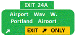
Welcome to Portland International Airport for FSX!
The City of Roses is in the process of revamping KPDX. Many of us have spent time on Concourse A
waiting for our Horizon flight. Many have utilized the ground level walkways on Concourse E to
get to their United Express flight. Both are things of the past.
KPDX is now a primary Alaska Airlines hub. This summer British Airways will start service to London
Heathrow.
The runways have been adjusted to their current length. The taxiways have been corrected (this is
particularly important at the juncture of 10L and 21 which used to overlap). A copy of the current
airport diagram is included.
All the buildings (with the exception of the tower) are custom. Airport vehicles use
the proper vehicle paths and do not use taxiways.To achieve this I had to add a vehicle path that crosses
10R and another that crosses 03.
Three scenery complexity levels are used (normal,dense, and very dense). More eye candy appears with each
increase.
| Filename: | FSX_Portland_International_Airport__KPDX.zip |
| License: | Freeware, limited distribution |
| Added: | 15th January 2020, 05:01:47 |
| Downloads: | 1,787 |
| Author: | Brett Delana |
| Size: | 12.18 MB |
| Category: Prepar3D V1-4 - Aircraft Repaints, Textures and Modifications | |
| Pan Am "Clipper Undaunted" L049 Constellation (N88855) |
|
Images related to this file:
File Description:

PAA Clipper Undaunted. N88855, Lockheed L-049 Constellation, Clipper Invincible, notes: C/n 2055, delivered to Pan Am on 22 April 1946. This Connie also carried the title Clipper Undaunted. TEXTURES ONLY. You need a legal copy of the WOS_L049 by A2A. "Pan American World Airways, known from its founding until 1950 as Pan American Airways[1] and commonly known as Pan Am, was the principal and largest international air carrier in the United States from 1927 until its collapse on December 4, 1991. Founded in 1927 as a scheduled air mail and passenger service operating between Key West, Florida, and Havana, Cuba, the airline became a major company credited with many innovations that shaped the international airline industry, including the widespread use of jet aircraft, jumbo jets, and computerized reservation systems. It was also a founding member of the International Air Transport Association (IATA), the global airline industry association.[3] Identified by its blue globe logo ("The Blue Meatball"), the use of the word "Clipper" in aircraft names and call signs, and the white pilot uniform caps, the airline was a cultural icon of the 20th century. In an era dominated by flag carriers that were wholly or majority government-owned, it was also the unofficial overseas flag carrier of the United States. During most of the jet era, Pan Am's flagship terminal was the Worldport located at John F. Kennedy International Airport in New York City."(Source: Wikipedia)
All logos and texts had to be recreated, since there was nothing usable on the net.
| Filename: | Pan_Am_Clipper_Undaunted_L049_Constellation_N88855.zip |
| License: | Freeware, limited distribution |
| Added: | 17th January 2017, 19:13:40 |
| Downloads: | 1,160 |
| Author: | Eberhard Haberkorn / A2A |
| Size: | 79.32 MB |
| Category: Flight Simulator 2004 - Scenery | |
| OSM World: South America |
|
Images related to this file:
File Description:
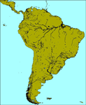
OSM World is a community project! If you wish to help, check the documentation and contact the author!
Welcome to OSM Wold: South America! This is a vector data scenery package covering the South American area. Coastlines, Rivers, lakes, roads, railways, and power lines with detail never before seen! All in an autogen-compatible density! You can see roundabouts, train terminals, harbor areas in a resolution of a point every 10 meters. At this same resolution a vectorial city class places residential (in small and big building variations, depending on surface area) and industrial areas exactly where they are supposed to be. This gives the city areas a resolution far superior to the capacity of FS-2004 default landclass bitmaps, limited to approximately 1 Km x 1 Km squares. OSM World: South America will even give you small roads leading to small towns (even a few houses across)! From big highway intersections, including ramps, to the tiniest rural pathways covering the entire South american area! Wherever in South America you fly, there is something to see!
You can enjoy this scenery near coastlines too! harbor areas and extremely detailed coastal topology (try the southern Chile). This scenery makes sure that the ocean is always flat, you can forget about the climbing water often found around photo-sceneries! This scenery is best paired with a good set of terrain meshes (like the freeware global SRTM mesh by Stephen Rothlisberger , available here: http://simviation.com/1/fs2004terrainmesh).
| Filename: | OSM_World_South_America.zip |
| License: | Freeware |
| Added: | 5th August 2015, 02:31:08 |
| Downloads: | 3,096 |
| Author: | Mario Noriega, Luis Miguel Hernandez |
| Size: | 64.37 MB |
| Category: Flight Simulator 2004 - Miscellaneous Files | |
| Nick's LightFix |
|
File Description:
The concept and the base textures for this package are from Mark Poole and his original light replacement releases. Mark's original Nav Light package has a really good concept and uses light textures which create sharp lens flairs or bursts. I found the lens flair in his packages to be a bit too large and out of scale for my display and taste. Also, I wanted to have an easy way to replace all the FS9 lights in one shot with little or no configuration file editing. With that in mind, this package was created. This release will automatically replace ALL the Flight Simulator aircraft and airport lights with more realistic ones along with better distance visuals of slower flashing radio tower/smoke stack and ground beacons. It also includes replacement lights in scale for the PMDG 737, 747 and for all Project Opensky aircraft offered on their site. It works automatically with Ultimate Traffic and other AI add-ons which use the default Microsoft aircraft lights. I added a diffused halo effect to Mark's original airport_lighting_v2 texture which gives a more realistic look in cloudy or weather conditions and enhances the dynamic directional brightness of the lights. In addition to the navigation lights, I have also created aircraft beacons and strobes which will also install automatically . A restore package is included allowing to you to revert back to default FS9 texture and FX files.
ENJOY!
From Nick Needham
[email protected]
| Filename: | Nicks_LightFix.zip |
| License: | Freeware, limited distribution |
| Added: | 4th April 2006, 21:47:56 |
| Downloads: | 19,322 |
| Author: | Nick Needham |
| Size: | 1.55 MB |
| Category: Flight Simulator 2004 - Scenery | |
| Campbell River floats CAE3 in BC Canada |
|
Images related to this file:
File Description:
Campbell River is a medium sized town on Vancouver Island, some 50 miles north of Vancouver. The base is just north and west of the town on Spit Road. And Ultimate Terrain is required for the cost to be in the right place. The docks are on the south side of the spit, on the (relatively) sheltered river side, though take offs and landings are requested to take place outside the harbour if conditions permit. The base is noted as used and run by Corilair, though in fact there is also another company based there, Vancouver Island Air, who like Coril Air also have two docks, one for boarding passengers and one for maintenance and refuelling tie-ups. At the river mouth there is a small marina, run by the same folks who run the trailer park, and next to that a dock for visiting float planes. There is a seventh dock at the end furthest from the river mouth; I don't know what that is used for but it is next to Vancouver Island Air and might be theirs. At low tide there are numerous sandbanks (and more permanent islands with bushes and trees) in the mouth of the Campbell River and I decided to ignore installing these with all the problems they would cause me. The main buildings and most of the others are modeled specifically for this scenery; minor items like parked cars are RWY12.
| Filename: | Campbell_River_floats_CAE3_in_BC_Canada.zip |
| License: | Freeware, limited distribution |
| Added: | 12th February 2010, 18:45:00 |
| Downloads: | 881 |
| Author: | Roger Wensley |
| Size: | 5.3 MB |
| Category: Flight Simulator X - AFCAD Files | |
| Blairstown Airport (1N7), NJ |
|
File Description:
Located 02 miles SW of Blairstown, New Jersey on 151 acres of land, Blairstown Airport is privately owned by J.D. Air Inc. and is home to a moderate number of small GA planes and gliders. This scenery is not completely up to date, as the MegaScenery Earth textures themselves are outdated. Missing are the added taxiway/parking lot north of the existing north taxiway as well as the second hangar area to the north that it leads to. Parking is available on the south tarmac but if that's all taken there is room just to the west in the taxiway offshoot. Also room on the grass, although stay south of the windsock to avoid interfering with glider operations. Glider pilots that wish to start on the grass, select either Runway East or Runway West. Fuel is available by stopping near the gas tank on the south tarmac.
Scenery constructed with use of satellite images/streetview, the author has not been there in person.
This scenery is meant to be used in conjunction with MegaScenery Earth New York 007. It is not required, but apron use is minimized to allow satellite scenery to show through as much as possible, and objects are placed based on the MSE textures - lack of it may make scenery look out of place.
| Filename: | Blairstown_Airport_1N7_NJ.zip |
| License: | Freeware |
| Added: | 8th October 2010, 20:22:59 |
| Downloads: | 247 |
| Author: | Drew Sikora |
| Size: | 576.39 KB |
| Category: Flight Simulator 2004 - AFCAD Files | |
| KPHX - Phoenix Sky Harbor Airport |
|
File Description:
This is an AFCAD2 for the default Phoenix Sky Harbor airport. My most accurate AFCAD yet. I was able to use the jetway shadows and others objects on the default land mass to accurately place each gate in the exact real life position they were when the photograph was taken. I utilized other satellite images and many photos from airliners.net to help verify exact gate and airline locations. Only difference here unfortuantely is there are no jetways, only jetway shadows. Maybe someone can make some jetways for this KPHX? 99.9% of all gates at the real airport are present in this AFCAD, and properly numbered. I've also included the cargo and military ramp, America West and Southwest maintenance parking, as well as added a few GA gates for you civil flyers. This AFCAD is roughly as of March 2005, so parts of Taxiway Echo near Terminal 4-D are closed and under construction in the AFCAD. I've closed 8/26 for takeoffs and used it with 7R/25L for landings. 7L/25R will be used as the primary takeoff runway. I think that covers everything. If you have time, select the Top-Down view in your sim, and you can see all the jetways from the land mass lined up with each aircraft. Kinda cool, enjoy! :) If there are any errors, let me know. Thanks.
| Filename: | KPHX__Phoenix_Sky_Harbor_Airport.zip |
| License: | Freeware, limited distribution |
| Added: | 12th April 2005, 01:10:49 |
| Downloads: | 3,231 |
| Author: | Jaxan Prier |
| Size: | 18.06 KB |


© 2001-2026 AVSIM Online
All Rights Reserved
Privacy Policy |