
Where Flight Simulation Enthusiasts Gather from Around the World!
AVSIM Library - Search Results

| Category: Flight Simulator X - AFCAD Files | |
| CYKA - Kamloops Airport / Kamloops, British Columbia, Canada (v1.2) |

|
Images related to this file:
File Description:
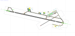
This airport update was made with the latest version of ADE (Airport Design Editor) and made for FSX as a replacement for the stock (default) airport. I've made several changes to the airport which are listed below. All these enchancements are as close to the real airport as I can get with stock library objects. I've used satellite images, terminal photos and maps throughout the whole process so building locations are as accurate as possible. Happy landings in beautiful Canada!
Features:
*Expanded parking apron
*Main terminal building with parking for commercial traffic (renumbered correctly v1.2)
*Seperate parking aprons for GA traffic
*Helipad
*Hangar and other airport buildings added
*Airport vehicles and objects throughout the airport
*Parking lots with static vehicles
*Airport fire station with fire truck
*Static de-icing vehicles & runway plow
*Static aircraft/helicopters
*Corrected communication frequencies (v1.1)
*Recent runway expansion to 8,000ft (v1.2)
*New taxiway Foxtrot,Golf (v1.2)
*New ILS for runway 08 (v1.2)
*Corrected tower elevation bug (v1.2)
(For more information on Endeavourai please visit our site at endeavourai.com or our forums at http://endeavourai.boards.net/)
| Filename: | CYKA__Kamloops_Airport__Kamloops_British_Columbia_.zip |
| License: | Freeware |
| Added: | 9th August 2012, 17:15:56 |
| Downloads: | 737 |
| Author: | Jaison Diaz / Endeavour ai |
| Size: | 127.44 KB |
| Category: Flight Simulator 2004 - Scenery | |
| 5B2 - Saratoga County Airport |
|
Images related to this file:
File Description:
5B2 - Saratoga County Airport v1.0

Located in the foothills of the Adirondack Mountains in upstate NY USA. This facility is owned by Saratoga County, formerly housed Rich Air and currently houses North American Aviation. 5B2 is a non-controlled airfield catering to small engine a/c up to a few private jet daily traffic serving 'The Northcountry' and Saratoga Springs, New York.
All Objects fully designed and completely redone in GMAX using high resolution 32bit photo-real textures. Optional DXT3 textures included. Also includes new AFCAD file, more accurate airport grounds perimeter, satellite photo-real grounds, custom taxiways, taxi-signs and taxi lights, area roads, animated hangar doors, and near area landclass. Some GA AI traffic tracks included with this release, afcad also designed to support general AI. Rwy12 objects (Lars Extra Object Library) required for a few static parking lot cars. All textures mipmapped for performance. By EdGeneer Cox.
| Filename: | 5B2__Saratoga_County_Airport.zip |
| License: | Freeware, limited distribution |
| Added: | 24th February 2012, 19:24:19 |
| Downloads: | 1,537 |
| Author: | EdGeneer Cox |
| Size: | 103.26 MB |
| Category: Flight Simulator X - Scenery | |
| KOAK - Metro Oakland Intl |
|
Images related to this file:
File Description:
This is a reasonably accurate and up-to-date version of Metro Oakland Intl airport with two optional files and made only for FSX users, do not use in P3D: There is one version with the Crosswind runways operating where all 4 runways will be used for takeoff/landing and one version as the default airport runway operation.
This update removes the "jfk jetways" mainly for those who have had issues installing the textures to get these Jetway to display, these have now been replaced by Jetway extensions that are more like the real world, Terminals 1 and 2 rebuilt with something better than the stock airport, assigned parking as per their website with extra parking, the Fedex and UPS ramps and buildings replaced, all taxiways and taxi signs updated to the latest charts, support vehicle roads rebuilt, extra fuel trucks, Helipad added to the GA apron and many other scenery improvements and objects added, airport views are from inside the control tower (when in tower view) please view the readme before installation.
| Filename: | KOAK__Metro_Oakland_Intl.zip |
| License: | Freeware, limited distribution |
| Added: | 29th January 2020, 01:05:10 |
| Downloads: | 44,385 |
| Author: | Ray Smith |
| Size: | 8.78 MB |
| Category: Prepar3D V1-4 - Scenery | |
| ZGGG - Baiyun Intl Airport, Guangzhou, China |
|
Images related to this file:
File Description:
This is Ray Smith's FSX file. Ray has given me permission to modify his file for P3Dv4 and is an accurate and up-to-date version of Baiyun Intl Airport. The new Terminal 2 is now added and when opened it will be home to China Southern Airlines as well as other SkyTeam member airlines such as China Eastern Airlines, Xiamen Airlines, Air France and Korean Airlines. The new runway 2R/20L added with ILS and transitions included for it. All runways now have their correct numbers and the approaches corrected for them. Assigned parking as per their website with extra parking including the overnight aprons plus gates added for the A380 The FedEx ramp and buildings updated. The STAG maintenance ramp and buildings also included. The GA ramp now moved to the south of the airport. Taxiways and taxi signs updated to the latest charts. Xtra fuel trucks, support vehicle roads rebuilt, fuel tank farm and many other scenery objects and improvements included for a more realistic look.
| Filename: | ZGGG__Baiyun_Intl_Airport_Guangzhou_China.zip |
| License: | Freeware |
| Added: | 21st March 2018, 16:22:16 |
| Downloads: | 25,770 |
| Author: | Robert Catherall |
| Size: | 3.03 MB |
| Category: Flight Simulator 2004 - Original Aircraft | |
| Dornier Do27 |
|
File Description:
Re-upload. Dornier Do27 (Germany)
Four to six seat STOL utility light aircraft manufactured in the mid 1950's to 1960 and initially designed for military purposes. A total of 577 Dornier Do27 were produced in their various manifestations.
It has a wide and relatively roomy cabin, wide track undercarriage and excellent STOL performance. The STOL performance in particular suited the Do 27 for use in undeveloped countries, and several have seen service in Africa and Papua New Guinea.
This has been modelled with Gmax v1.2 and has animated ailerons, flaps, elevators and rudder. It has 4 LOD models and a single texture file and is extremely frame rate friendly.
It is designed specifically to enhance the AI aircraft population and to use with the marvellous GA-Traffic program by Markus Brunner . It is also quite fun to fly as a normal aircraft but you will need to install a suitable panel for this.
Three textures and a paintkit are included.
Special thanks to Steven Grant for his kind permission to use his FDE for this aircraft
| Filename: | Dornier_Do27.zip |
| License: | Freeware, limited distribution |
| Added: | 3rd June 2010, 03:21:17 |
| Downloads: | 1,990 |
| Author: | Mike Cronin |
| Size: | 239.72 KB |
| Category: Flight Simulator X - AFCAD Files | |
| TKPK - Robert L. Bradshaw International Airport / Saint Kitts and Nevis |
|
Images related to this file:
File Description:
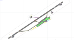
This airport update was made with the latest version of ADE (Airport Design Editor) and made for FSX as a replacement for the stock (default) airport. I've made several changes to the airport which are listed below. All these enchancements are as close to the real airport as I can get with stock library objects. I've used satellite images, terminal photos and maps throughout the whole process so building locations are as accurate as possible. Happy landings in sunny Saint Kitts and Nevis!
Features:
*Expanded parking apron
*Main terminal building with parking area for commercial traffic (Gates 1-9)
*St. Kitts airport sign
*Seperate parking area for GA traffic
*Parking stand for cargo (Gate 9)
*Misc airport buildings added
*Airport vehicles and objects throughout the airport
*Fuel tanks and station
*Airport fire station
*Windsocks added
*Birds flying near runway (beware)
*Palm trees/vegitation added near terminal
*Taxiway signs
*Taxiways Bravo and Charlie properly assigned
*New taxiway Alpha added
(For more information about Endeavourai please visit our site at endeavourai.com)
| Filename: | TKPK__Robert_L_Bradshaw_International_Airport__Sai.zip |
| License: | Freeware |
| Added: | 1st September 2012, 21:23:20 |
| Downloads: | 819 |
| Author: | Jaison Diaz / Endeavour ai |
| Size: | 87.92 KB |
| Category: Flight Simulator X - Scenery | |
| Baiyun Intl Airport (ZGGG) Guangzhou, China |
|
Images related to this file:
File Description:
This is an accurate and up-to-date version of Baiyun Intl Airport and made only for FSX, do not use in P3D: The new Terminal 2 now added, when Terminal 2 opens it will be home to China Southern Airlines as well as other SkyTeam member airlines such as China Eastern Airlines, Xiamen Airlines, Air France and Korean Airlines, the new runway 2R/20L added with ILS and transitions included for it, all runways now have their correct numbers and the approaches corrected for them, assigned parking as per their website with extra parking including the overnight aprons plus gates added for the A380, the FedEx ramp and buildings updated, the STAG maintenance ramp and buildings also included, the GA ramp now moved to the south of the airport, taxiways and taxi signs updated to the latest charts, extra fuel trucks, support vehicle roads rebuilt, fuel tank farm and many other scenery objects and improvements included for a more realistic look, airport views are from inside the control tower (when in tower view) please view the readme before installation.
| Filename: | Baiyun_Intl_Airport_ZGGG_Guangzhou_China.zip |
| License: | Freeware, limited distribution |
| Added: | 19th February 2018, 23:13:51 |
| Downloads: | 28,627 |
| Author: | Ray Smith |
| Size: | 3.14 MB |
| Category: Flight Simulator 2004 - Scenery | |
| Alaska South Slope 4; Selawik PASK |
|
Images related to this file:
File Description:
There are four main northwestern Alaska towns which are serviced by Alaska Airlines, and from which local flights spread out. The northernmost is Barrow. Southwest of Barrow is Kotzebue, then Nome, and the furthest south is Bethel. This series is for the flights from and around Kotzebue, mostly on the South Slope of the Brooks Range of mountains. There will be further additions. Selawik is a village (population now around 760) around 75 miles east of Kotzebue on three of the delta islands of the Selawik River where it flows into Selawik Lake. The delta forms part of the Selawik National Wildlife Refuge for migratory birds. The airfield is just next to the village, with two runways, 3,450 feet of lit gravel aligned 03-21 and 3,100 feet of gravel aligned 09-27. There are scheduled flights by Era (now renamed Ravn) and by Bering Air, both of them originating in Kotzebue and routing east to Noorvik, Kiana, Selawik, etc, and then back again. The AI includes these flights along with Everts Air and GA.
| Filename: | Alaska_South_Slope_4_Selawik_PASK.zip |
| License: | Freeware, limited distribution |
| Added: | 9th October 2016, 04:17:52 |
| Downloads: | 214 |
| Author: | Roger Wensley |
| Size: | 4.34 MB |
| Category: Flight Simulator 2004 - Scenery | |
| Alaska South Slope 8; Shishmaref PASH |
|
Images related to this file:
File Description:
There are four main northwestern Alaska towns which are serviced by Alaska Airlines, and from which local flights spread out. The northernmost is Barrow. Southwest of Barrow is Kotzebue, then Nome, and the furthest south is Bethel (not yet made). This is the first in a series for flights from Nome, and it is Shishmaref, 125 miles north of Nome on the far side of the Seward Peninsula.
Shishmaref is a village on one of a string of islands off the northern shore of the Seward Peninsula, with a population of around 560. Like other similarly-sited villages (Kivalina, for instance) it is feeling the effects of coastal erosion and there are plans for a relocation, eventually. The airfield is just beside the village, with a runway of just under 5,000 feet of lit asphalt aligned 05-23, with PAPI on both ends. There are scheduled flights by Era (now renamed Ravn) and by Bering Air, both of them originating in Nome. The AI includes these flights along with Everts Air and GA.
| Filename: | Alaska_South_Slope_8_Shishmaref_PASH.zip |
| License: | Freeware, limited distribution |
| Added: | 20th October 2016, 04:37:02 |
| Downloads: | 213 |
| Author: | Roger Wensley |
| Size: | 2.32 MB |
| Category: Flight Simulator 2004 - Scenery | |
| CZFM - Fort McPherson - Northwest Territories, Canada |
|
Images related to this file:
File Description:
This is the first of a series of airfields that follow (approximately) that early access route to the Canadian northern shore, the Mackenzie River. At the far northern end of the river and on the eastern side of the delta there is Tuktoyaktuk, then 80 miles south is Inuvik (both already posted). 70 miles south of Inuvik is Fort McPherson, on the east bank of the Peel River, 20 miles west of the junction with the Mackenzie and on the Dempster Highway. The town has a population of around 830, and (as usual in the north!) was the site of a Hudson Bay trading post, the main post for the Mackenzie delta area for over 50 years. The airport is less than 2 miles to the south of the town, and has 3,500 feet of gravel runway. AI is two ga flights and a Buffalo Airways delivery trip that hops north and south from field to field; this will change with further posts. There is no fuel available.
| Filename: | CZFM__Fort_McPherson__Northwest_Territories_Canada.zip |
| License: | Freeware, limited distribution |
| Added: | 4th July 2014, 05:33:03 |
| Downloads: | 289 |
| Author: | Roger Wensley |
| Size: | 2.3 MB |


© 2001-2026 AVSIM Online
All Rights Reserved
Privacy Policy |