
Where Flight Simulation Enthusiasts Gather from Around the World!
AVSIM Library - Search Results

| Category: Flight Simulator 2004 - Scenery | |
| Coolangatta International |

|
File Description:
Coolangatta Airport(YBCG) aka Gold Coast Airport, Queensland, AUSTRALIA.
This is an expanding and busy airport servicing all capitals and regional centres within Australia as well as international flights to New Zealand. The GA area is also busy particularly when international events such as Indy are being staged.
This revised scenery now works perfectly with Ross Cassey's excellent SE Qeensland landclass. Included is a subset of Ross's landclass with an extra landclass of my own extending the South Gold Coast suburbs. If you do not have the full version of Ross's SEQ landclass you should make it your next download - it brings new dimensions to this area. Full night lighting is included and I recommend you try a night flight the Gold Coast looks very realistic with the new land classes. A new control tower has been added with rotating night time beacon.
AFCAD files and AI traffic files are included.
| Filename: | Coolangatta_International.zip |
| License: | Freeware |
| Added: | 5th February 2004, 16:32:00 |
| Downloads: | 8,987 |
| Author: | John Ross |
| Size: | 10.23 MB |
| Category: Flight Simulator X - AFCAD Files | |
| KBTV - Burlington International Airport / Burlington, VT |
|
Images related to this file:
File Description:
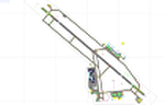
This airport update was made with the latest version of ADE (Airport Design Editor) and made for FSX as a replacement for the stock (default) airport. I've made several changes to the airport which are listed below. All these enchancements are as close to the real airport as I can get with stock library objects. I've used satellite images, terminal photos and maps throughout the whole process so building locations are as accurate as possible. Happy landings in the winter wonderland of Vermont!
Features:
*Expanded parking apron
*Taxiways properly desginated
*Completely redesigned main terminal building with accurate airline assigned gates
*Seperate parking areas for GA traffic
*Misc airport buildings added
*Airport vehicles and objects throughout the airport
*Fuel tanks and vehicles
*Fire station and vehicles
*De-icing trucks
*Static aircraft
*Vermont Air National Guard ramps on the north side of the airport
*Airport vehicle paths added
| Filename: | KBTV__Burlington_International_Airport__Burlington.zip |
| License: | Freeware |
| Added: | 31st December 2012, 00:57:11 |
| Downloads: | 1,041 |
| Author: | Jaison Diaz / Endeavour ai |
| Size: | 148.32 KB |
| Category: Flight Simulator 2004 - Original Aircraft | |
| Rockwell Aero Commander 500S |
|
File Description:
Re-upload. Rockwell Aero Commander 500S
The Rockwell Aero Commander began life in 1948 and evolved through numerous models up to turboprop.
This is the 500S as used by NOAA, and has twin Lycoming piston engines and seats four passengers.
While it has been made for AI purposes it is actually a pleasant aircraft to fly so there is a link to a panel to allow you to gain some flying pleasure from it.
This has been modelled with Gmax v1.2 using a mininum number of polygons (1980 for the main model), and is fully animated - landing gear, ailerons, flaps, elevators and rudder. It has 5 LOD models and a single texture set and is extremely frame rate friendly.
It is designed specifically to enhance the AI aircraft population and to use with the marvellous GA-Traffic program by Markus Brunner .
Three textures and a paintkit are included.
| Filename: | Rockwell_Aero_Commander_500S.zip |
| License: | Freeware, limited distribution |
| Added: | 3rd June 2010, 03:22:29 |
| Downloads: | 2,645 |
| Author: | Mike Cronin |
| Size: | 360.76 KB |
| Category: Flight Simulator 2004 - AFCAD Files | |
| Syamsudin Noor, Banjarmarsin, Indonesia (WAOO/BDJ) |
|
File Description:
Googlyafcad A&F Data file for WRBB Banjarmasin/Syamsudin Noor/Ulin in Kalimantan, Indonesia based on Google Earth satellite data. Unfortunately, Microsoft have provided very limited facilities at this important Indonesian domestic airport, served by over twenty-five flights a day by Adam Air, Airfast, Bali International, Batavia Air, Bouraq, Garuda, Indonesia Air Transport, Lion Airlines, Mandala Airlines, Merpati Nusentara
and Sriwijaya Air jets and smaller craft. This upgrade redresses the subject by supplementing the GA parking with gates so that you, and your "AI" traffic can land, taxi, park and take off realistically. Whilst this file improves the layout of the airport, it is not a full scenery upgrade and does not attempt correct building locations, landclass, taxiway signs or those stupid over-sized filling stations that Microsoft loves to put in annoying places. Regrettably the satellite data currently available is not of sufficient quality to do so.
| Filename: | Syamsudin_Noor_Banjarmarsin_Indonesia_WAOOBDJ.zip |
| License: | Freeware |
| Added: | 17th March 2007, 11:06:39 |
| Downloads: | 1,075 |
| Author: | John Hinson |
| Size: | 59.7 KB |
| Category: Flight Simulator X - AFCAD Files | |
| EGLL - London Heathrow - London, UK |
|
File Description:
This is an up to date Afcad file as of June 2015 for Mega Airport Xtended Heathrow airport. Updates from the original AFX include recent terminal movements including TAM and some British Airways flights to T3, EL AL and Transaero to T4 and Icelandair moving to T2. T1 is now closed (as of 30th June) so no planes will park at T1 gates anymore. GA parking has been changed to where they would normally park and cargo parking updated. Other improvements such as Terminal 4 departures taxiing to 27L using the correct taxiways instead of crossing the active runway in the original AFX file and aircraft taking of from 27L no longer take a long time to line up and depart.
To be used with Aerosoft Mega Airport Heathrow Xtended only (http://en.shop.aerosoft.com/eshop.php?action=article_detail&s_supplier_aid=11982&s_design=DEFAULT&shopfilter_category=Flight+Simulation&s_language=english).
| Filename: | EGLL__London_Heathrow__London_UK.zip |
| License: | Freeware |
| Added: | 10th June 2015, 21:34:23 |
| Downloads: | 1,189 |
| Author: | Olly Pollard |
| Size: | 19.87 KB |
| Category: Flight Simulator 2004 - Utilities | |
| RPP_FPGen Flightplans Generator v1.0 |
|
File Description:
RPP_FPGen is MS Excel based FS utility that ... will generate those nasty AI flightplans for you!
This is THE generator, where you can design both military and GA traffic plans but all tedious job is done by the software itself. You just choose a home base, set a destination list and AI aircraft list ... and run macro. You get three txt files, which you manually compile using Lee Swordy’s Traffic Tools (for FS9). Then you get a traffic BGL file, just where you need this.
RPP_FPGen runs on a random probability, taking into account Probability Profiles, defining flight probability for each hour of a day in a week. Almost every decision made is random but your concepts are respected.
RPP_FPGen can generate flightplans for FS2004, as well as for FSX.
Special thanks to Barry Taylor for thorough testing, ideas and a quick guide.
See User's Manual for details.
| Filename: | RPP_FPGen_Flightplans_Generator_v10.zip |
| License: | Freeware, limited distribution |
| Added: | 18th April 2008, 21:39:13 |
| Downloads: | 6,773 |
| Author: | Rysiek Winawer |
| Size: | 1.45 MB |
| Category: Flight Simulator X - AFCAD Files | |
| TTPP - Piarco International Airport / Trinidad and Tobago |
|
Images related to this file:
File Description:
TTPP - Piarco International Airport / Trinidad and Tobago
This airport update was made with the latest version of ADE (Airport Design Editor) and made for FSX as a replacement for the stock (default) airport. I've made several changes to the airport which are listed below. All these enchancements are as close to the real airport as I can get with stock library objects. I've used satellite images, terminal photos and maps throughout the whole process so building locations are as accurate as possible. Happy landings in festive Trinidad and Tobago!
Features:
*Expanded parking apron
*Taxiway improvements
*Minor runway corrections
*Completely redesigned main terminal building with accurate gate numbering and jetways
*Old south terminal redesigned and now handles cargo and executive flying
*GA ramp
*Misc airport buildings added
*Airport vehicles and objects throughout the airport
*Fuel vehicles
*Fire station and vehicles
*Static aircraft
*CAUTION: Birds in vicinity of runway
| Filename: | TTPP__Piarco_International_Airport__Trinidad_and_T.zip |
| License: | Freeware |
| Added: | 29th January 2013, 00:37:14 |
| Downloads: | 1,220 |
| Author: | Jaison Diaz / Endeavour ai |
| Size: | 127.93 KB |
| Category: Flight Simulator 2004 - Scenery | |
| PABV - Birchwood airfield - Anchorage, Alaska - USA |
|
Images related to this file:
File Description:
Birchwood PABV is in Alaska, some 20 miles northeast of Anchorage, on the south shore of Knik Arm. It is a smaller version of Merrill Field, almost entirely for just GA aircraft and the maintenance shops that a gathering of such aircraft attracts. The main runway is just over 4,000 feet long, aligned L01-R19 and asphalted and lit; this last is even more important in Alaska with short winter days. There is also a shorter and parallel runway that is gravel and which receives no winter maintenance; this is for winter use by planes that are on skis, rather than wheel/skis. This is not unusual and is found at other Alaska airfields. This scenery provides a place to fly to from my previous posts of Merrill Field and Lake Hood close to Anchorage. There will be others in this series, on the northern side of Knik Arm.
| Filename: | PABV__Birchwood_airfield__Anchorage_Alaska__USA.zip |
| License: | Freeware, limited distribution |
| Added: | 7th October 2014, 19:41:37 |
| Downloads: | 616 |
| Author: | Roger Wensley |
| Size: | 22.21 MB |
| Category: Flight Simulator 2004 - Scenery | |
| Nome PAOM on the northwestern coast of Alaska |
|
Images related to this file:
File Description:
There are four main northwestern Alaska towns which have good airports and are serviced by Alaska Airlines. From these airports local flights connect to nearby villages, "nearby" in Alaska meaning up to 200 miles away. The northernmost is Barrow. Southwest of Barrow is Kotzebue, then Nome, and the furthest south is Bethel. The town of Nome is south of the Bering Strait on the southern coast of the Seward Peninsula, around 185 miles south of Kotzebue, with a population of about 3,800. It is the town that led to the creation of the most famous dogsledge race in the world, the Iditarod, which is based on the delivery to Nome of diphtheria serum during the blizzard conditions of the winter of 1925. The Nome airport (it currently has no other name) was originally built as the last of the refuelling airfields for planes being ferried to Russia during WW2. It has two runways, aligned 09-27 and 02-20 in FS9 (the wandering magnetic north has recently renamed the magnetic headings) and both of them around 6,000 feet with an ILS on 27. There is a modern airport layout diagram included showing taxiway names etc. Alaska Airlines, ERA, and Bering Air (which is headquartered in Nome), along with the shared cargo terminal for Northern Air Cargo and Everts Air, are all on the southern apron. The northern apron is mainly for GA, along with maintenance facilities, a garage building that also houses a weather bureau, and at the far northern end of runway 02-20 an apron and hanger for the Alaska Air National Guard. All AI aircraft in FS9 much prefer to use a runway that has an ILS and so will continue to use 09-27 even if the wind is from the north or south, right up until it reaches 30+ knots, so for AI realism in FS9 a permanent wind from the west would be the most realistic on a daily basis. There is also a small gravel strip just north of the town and this is included (94Z), as are some old line-of-sight radio communication reflectors on the hills above the town. There is a note about making adjustments to Ultimate Terrain Alaska-Canada regarding both realistic road lighting and also auto-generation.
| Filename: | Nome_PAOM_on_the_northwestern_coast_of_Alaska.zip |
| License: | Freeware, limited distribution |
| Added: | 18th October 2016, 02:38:42 |
| Downloads: | 487 |
| Author: | Roger Wensley |
| Size: | 22.65 MB |
| Category: Flight Simulator 2004 - Scenery | |
| PAEN, PAEX, 3AK4, 30AK, 52AK - Alaska, USA |
|
Images related to this file:
File Description:
The town of Kenai is on the east coast of Cook Inlet, 60 miles southwest of Anchorage. The airport is in the northern part of the town, with a runway aligned 1-19, 7,550 feet long and 150 feet wide (with an ILS on 19). A second runway is gravel, 2,000 feet long and for winter use by ski planes. There is also a water runway, and all three are aligned the same and called "1 left-19 right" (the main runway) "1 right-19 left" (gravel) and "1 water-19 water". The taxiways are extensive and designed for a far larger traffic than the airport has today, though even now the airport is fairly busy. In FS9 a water runway for AI cannot work with an ATC control tower; the water part of PAEN has therefore been separated into another call sign PAEX which has ONLY the water runway; the tower will therefore direct the plane that makes contact to use the water runway. The PAEN airport runway has taxiway connections at each end and also two intermediates; at the northern end there are in fact two so a total of 5; B, C, D, E, and F; there is an airport diagram included. GA traffic goes to one of two parking aprons, both at the southern end, and at the far southern end there is the hangar for the Civil Air Patrol. The AI includes aircraft from my previous Alaska posts, as Kenai is where I sent them when they departed from, for instance, Palmer. Airlines and cargo companies that operate from and to Kenai are included in the AI: ERA (which has recently changed it's name), Grant Aviation, Air North, Wings of Alaska, North Star Air, and a small local company Air Supply Alaska, along with Fedex, UPS, Everts, and Northern Air Cargo. There is also GA and float AI. Nearby smaller airfields are included, partly because one of them was dramatically misaligned in FS9.
| Filename: | PAEN_PAEX_3AK4_30AK_52AK___Alaska_USA.zip |
| License: | Freeware, limited distribution |
| Added: | 26th December 2015, 15:33:19 |
| Downloads: | 485 |
| Author: | Roger Wensley |
| Size: | 23.08 MB |


© 2001-2026 AVSIM Online
All Rights Reserved
Privacy Policy |