
Where Flight Simulation Enthusiasts Gather from Around the World!
AVSIM Library - Search Results

| Category: Flight Simulator 2004 - Aircraft Repaints, Textures and Modifications | |
| JAL Group Pack #13 |

|
File Description:
The JALGroup consists of Japan Airlines, JALWays, Japan Asia Airways, Japan Transocean Air, JAL Express, J-Air, Japan Air Commuter, Harlequin Air, and the newly merged Japan Air System. This pack represents the fifth release of the JALGroup fleet. This is Pack #13. This release contains JALWays.
Contents of the packs include textures (one night texture per aircraft type/developer) only. Aircraft models are by PAI and can be obtained on the PAI site. Repaints are by Frank Bass.
| Filename: | JAL_Group_Pack_13.zip |
| License: | Freeware |
| Added: | 3rd September 2004, 01:05:22 |
| Downloads: | 1,000 |
| Author: | Frank Bass |
| Size: | 591.64 KB |
| Category: Flight Simulator 2004 - Scenery | |
| Airborne Airpark KILN |
|
File Description:
FS2004 Scenery Airborne Airpark (KILN) Wilmington, Oh. The airport serves Wilmington and Clinton County and is owned by DHL (Was formerly owned by Airborne Express Inc.. The airport has more than one runway. The longest is a paved runway extending 10701 feet. The facility is at an elevation of 1077 feet at a distance of about 2 miles from Wilmington. Designed entirely with Rwy_12 and EZ Scenery. New AFCAD2 file and AI Traffic. By John B. Loney, Jr.
| Filename: | Airborne_Airpark_KILN.zip |
| License: | Freeware |
| Added: | 11th June 2006, 05:00:33 |
| Downloads: | 1,936 |
| Author: | John B. Loney, Jr. |
| Size: | 381.11 KB |
| Category: Flight Simulator 2004 - AI Flight Plans | |
| Japan Airlines(JAL) FlightPlans (Domestic) 2009Espring |
|
File Description:
Hello.
This flight plan was made based on an actual timetable. Domestic flight (spring of April of 2009 May)
The flight plan of JAL group JAL express(JAX), Japan Transocean(JTA), Japan Air Commute(JAC), J-Air, Hokkaido Air System(HAC), and Ryukyu Air Commuter(RAC) is contained besides JAL.
The recommendation: Please .."Traffic View Board" ..highest masterpiece Utilities development of Mr. Hans-Juergen Merkel.... enjoy using tutorial in the round. (tvb_tut.zip)
Then, a wonderful flight.
| Filename: | Japan_AirlinesJAL_FlightPlans_Domestic_2009Espring.zip |
| License: | Freeware |
| Added: | 21st April 2009, 22:47:06 |
| Downloads: | 747 |
| Author: | Kazu Ando |
| Size: | 123.89 KB |
| Category: Flight Simulator 2004 - AI Flight Plans | |
| Royal Air Maroc - Summer 2011 |
|
Images related to this file:
File Description:

Royal Air Maroc is the flag carrier of Morocco, operating scheduled international flights to Africa, Asia, Europe (mostly France) and North America as well as many domestic and charter services. In addition to a large fleet of Boeing 737, it is using several Airbus A321, ATR 72, Boeing 767 and a single Boeing 747. This flightplan package also includes all flights of Royal Air Maroc Cargo and Royal Air Maroc Express (formerly Regional Air Lines). Have fun!
| Filename: | Royal_Air_Maroc__Summer_2011.zip |
| License: | Freeware |
| Added: | 25th September 2011, 14:40:18 |
| Downloads: | 1,171 |
| Author: | Christian Hegewald |
| Size: | 27.25 KB |
| Category: Flight Simulator 2004 - Scenery | |
| PABA - Barter Island (Kaktovik) - Alaska North Slope 8 |
|
Images related to this file:
File Description:
The town of Barrow is in the far north of Alaska, and these are coastal villages or radar installations to the west, south, and now east of Barrow. There will be further additions. Barter Island is a DEW station Air Force base 310 miles east of Barrow and 75 miles east of Bullen Point. The runway is just under 5,000 feet of gravel and aligned 06-24 on a spit of land at the northeast corner of the island. The big hangar is still there on the apron. Most of the DEW buildings have now been removed but this scenery is dated around 2005 when there were more of them still there. Between the DEW station and the airstrip is the village of Kaktovik, with a population of some 300 mainly traditional Inupiat. The village was first pioneered when the DEW station was built in the 1950's and grew as the years passed. The FS9 error discovered when making this scenery was that FS9 had mistakenly "placed" Kaktovik at Bullen Point (not physically, it was just wrongly stated as the local town); this is now only partly corrected as FS9 refused to accept my Bullen Point revision but allowed me to associate Kaktovik with Barter Island. Kaktovik is definitely on Barter Island. I could also mention that the runway was in the sea, but there isn't much point in that as Bill would say it was all the fault of Ultimate Terrain, so I won't bother. The next DEW station to the east is in Canada and called Komakuk; this has already been made and posted. The next in this series will be far to the west. The AI has daily flights by ERA, plus Northern Air Cargo, and some GA.
| Filename: | PABA__Barter_Island_Kaktovik__Alaska_North_Slope_8.zip |
| License: | Freeware, limited distribution |
| Added: | 19th July 2016, 17:49:16 |
| Downloads: | 208 |
| Author: | Roger Wensley |
| Size: | 3.42 MB |
| Category: Flight Simulator 2004 - Scenery | |
| Alaska South Slope 12; Teller K54 |
|
Images related to this file:
File Description:
There are four main northwestern Alaska towns which are serviced by Alaska Airlines, and from which local flights spread out. The northernmost is Barrow. Southwest of Barrow is Kotzebue, then Nome, and the furthest south is Bethel (not yet made). This is the fifth in a series for local flights from Nome, and it is on the coast around 55 miles east of Wales and 55 miles northwest of Nome. There are two other airfields around a large lagoon that is almost totally enclosed from the sea, and Teller is on the easten shore, just 15 miles east of Port Clarence and 5 miles southeast of Brevig Mission, both already posted. Teller has a populaton of around 230, down from the 5,000 or so in the early 1900's after the Bluestone Placer Mine struck gold. Tollef Brevik was a Lutheran missionary who was both a pastor and teacher for the Inuit in the area from 1894 onward, travelling from community to community but based in Teller, where the Teller Mission Church was later renamed the Brevig Mission. The name was later appropriated and used for the curent village of that name; he was surely very well regarded by the local population. Unusually, it is possible to drive from Nome to Teller in summer, on a dirt road. Conversely, the road that shows in FS9 to the north towards Brevig Mission (courtesy of Ultimate Terrain) does not in fact exist except in winter, when it is estabished on the snow by the tyre tracks of users. The airstrip is southeast and 2 miles by road from the main part of the village on the spit, with a gravel runway 02-25 which is 3,500 feet of gravel. The AI is the usual for this area, Bering and ERA with some GA and cargo by Everts.
| Filename: | Alaska_South_Slope_12_Teller_K54.zip |
| License: | Freeware, limited distribution |
| Added: | 25th October 2016, 21:21:14 |
| Downloads: | 235 |
| Author: | Roger Wensley |
| Size: | 2.96 MB |
| Category: Flight Simulator 2004 - Scenery | |
| Glacier Bay - Alaska/Canada, Version 2, Part 1 of 2 |
|
Images related to this file:
File Description:
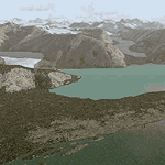
Glacier Bay v2 is a complete replacement of the default FS2004 landscape and scenery of more than 90,000 square kilometers (36,000 sq miles) of Southeast Alaska and adjacent areas of Yukon and British Columbia. File 1 of 2 (also requires glbayv2b.zip)
Landscape enhancements include high-resolution terrain mesh, detailed shorelines, rivers, lakes, and glaciers, and accurate land cover data with custom seasonal ground textures. Inland water bodies can be made to "freeze over" via an on/off switch. Other landmarks include the settlements of Juneau, Haines, Skagway, Yakutat, Atlin, and Carcross as well as road and railroad networks, cabins, lodges, and lighthouses. We modeled or enhanced 16 main airfields (plus one fictitious airstrip), 20 unlisted airstrips, 16 seaplane bases, and seven heliports. We've also included AI ship traffic in various locations as well as optional flightplans for GA and floatplane AI traffic.
Glacier Bay v2 is fully compatible with other third-party add-ons, including terrain mesh (FSGlobal, FS Genesis, etc.), ground textures (Ground Environment, BEV, FScene, etc.), and landscape enhancements (Ultimate Terrain Canada/Alaska, Misty Fjords, Tongass Fjords, Freight Dogs). A configurator panel (requires .Net Framework!) allows users to set compatibility options and to choose levels of scenery detail. We provide an autoinstaller and detailed documentation with a sectional map of the coverage area and a list of weblinks to real-world information.
For feedback and questions, please visit the Glacier Bay v2 support forum at http://forums.fsaddon.eu/viewforum.php?f=10. This project is a collaboration of nine FS developers from Germany, Austria, USA, and Canada, logging more than 1000 hours of work over the past 14 months. We acknowledge the kind support of FSAddon.com. However, this project is independent of any commercial company or product. Enjoy!
| Filename: | Glacier_Bay__AlaskaCanada_Version_2_Part_1_of_2.zip |
| License: | Freeware, limited distribution |
| Added: | 28th May 2010, 19:34:54 |
| Downloads: | 41,281 |
| Author: | Holger Sandmann, Rainer Duda, Michael Eder, Scot Fraser, Manfred Herz, Jay Langham, Jon Patch, Larry Silsbee, and Jim Vile |
| Size: | 56.46 MB |
| Category: Flight Simulator 2004 - Scenery | |
| Glacier Bay - Alaska/Canada, Version 2, Part 2 of 2 |
|
Images related to this file:
File Description:

Glacier Bay v2 is a complete replacement of the default FS2004 landscape and scenery of more than 90,000 square kilometers (36,000 sq miles) of Southeast Alaska and adjacent areas of Yukon and British Columbia. File 2 of 2 (also requires glbayv2a.zip)
Landscape enhancements include high-resolution terrain mesh, detailed shorelines, rivers, lakes, and glaciers, and accurate land cover data with custom seasonal ground textures. Inland water bodies can be made to "freeze over" via an on/off switch. Other landmarks include the settlements of Juneau, Haines, Skagway, Yakutat, Atlin, and Carcross as well as road and railroad networks, cabins, lodges, and lighthouses. We modeled or enhanced 16 main airfields (plus one fictitious airstrip), 20 unlisted airstrips, 16 seaplane bases, and seven heliports. We've also included AI ship traffic in various locations as well as optional flightplans for GA and floatplane AI traffic.
Glacier Bay v2 is fully compatible with other third-party add-ons, including terrain mesh (FSGlobal, FS Genesis, etc.), ground textures (Ground Environment, BEV, FScene, etc.), and landscape enhancements (Ultimate Terrain Canada/Alaska, Misty Fjords, Tongass Fjords, Freight Dogs). A configurator panel (requires .Net Framework!) allows users to set compatibility options and to choose levels of scenery detail. We provide an autoinstaller and detailed documentation with a sectional map of the coverage area and a list of weblinks to real-world information.
For feedback and questions, please visit the Glacier Bay v2 support forum at http://forums.fsaddon.eu/viewforum.php?f=10. This project is a collaboration of nine FS developers from Germany, Austria, USA, and Canada, logging more than 1000 hours of work over the past 14 months. We acknowledge the kind support of FSAddon.com. However, this project is independent of any commercial company or product. Enjoy!
| Filename: | Glacier_Bay__AlaskaCanada_Version_2_Part_2_of_2.zip |
| License: | Freeware, limited distribution |
| Added: | 28th May 2010, 19:36:31 |
| Downloads: | 40,553 |
| Author: | Holger Sandmann, Rainer Duda, Michael Eder, Scot Fraser, Manfred Herz, Jay Langham, Jon Patch, Larry Silsbee, and Jim Vile |
| Size: | 85.99 MB |
| Category: Flight Simulator 2004 - AFCAD Files | |
| Zurich v2 (LSZH) Switzerland |
|
File Description:
This file is an update of my previous version for the default airport (my previous version not required) a big thanks to Lee Swordy's latest version of AFCAD2 which i used here with 77 gates/parking/cargo parking
improvments are: concrete areas around the airport realigned with the buildings, the gravel around the northern terminal has been replaced with concrete and is used even if M/S gave it a cargo building, and all taxiways/aprons and runways now have improved lighting the displaced threshold for runway 34 is now in the correct position the 3 helipads have been moved slightly and have also been given lighting (fully tested with Ultimate Traffic but not required)
| Filename: | Zurich_v2_LSZH_Switzerland.zip |
| License: | Freeware |
| Added: | 11th December 2003, 23:50:46 |
| Downloads: | 3,936 |
| Author: | Ray Smith |
| Size: | 13.22 KB |
| Category: Flight Simulator 2004 - Scenery | |
| Ryan Airfield KRYN |
|
File Description:
FS2004 Scenery - Ryan Airfield (ICAO: KRYN, FAA LID: RYN), is a general aviation reliever airport located 12 miles west of Tucson International Airport at the intersection of Ajo Way and Valencia Road. The field was created in the 1940s as a training camp for the Army Air Corps. After the war, the state of Arizona approached the Tucson Airport Authority, who also manages Tucson International, about operating the airfield. The Authority and the state entered into a long-term lease agreement and over the years Ryan Airfield has become a busy and popular airfield. Scenery is compatible with both default FS and Ultimate Terrain. AFCAD file by Ray Lunning. Created with Instant Scenery by John B. Loney, Jr.
| Filename: | Ryan_Airfield_KRYN.zip |
| License: | Freeware, limited distribution |
| Added: | 3rd May 2010, 00:59:53 |
| Downloads: | 1,810 |
| Author: | John B. Loney, Jr. |
| Size: | 5.36 MB |


© 2001-2026 AVSIM Online
All Rights Reserved
Privacy Policy |