
Where Flight Simulation Enthusiasts Gather from Around the World!
AVSIM Library - Search Results

| Category: Flight Simulator 2004 - Scenery | |
| Datong Beijiazao Airport (ZBDT) |

|
Images related to this file:
File Description:
Scheduled operators at ZBDT: Air China, China Express, China Eastern, China Southern, & China United Airlines.
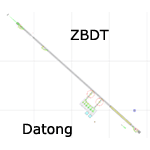
A basic "Google Earth" based scenery for the new Datong Beijiazao Airport (ZBDT) which is missing in FS9 stock version.
All airport features are accurately placed/shaped according to sat imagery. Navaids valid as AIRAC 1110.
It features basic default terminal, tower, and taxi signs.
ILS 32 & VOR 14 approaches coded for AI & UI.
| Filename: | Datong_Beijiazao_Airport_ZBDT.zip |
| License: | Freeware, limited distribution |
| Added: | 8th January 2012, 07:49:37 |
| Downloads: | 726 |
| Author: | Yohann Baptiste |
| Size: | 384.79 KB |
| Category: Flight Simulator 2004 - AI Aircraft | |
| Air France Regionals Pack 1998 |
|
File Description:
This pack contains all of the Air France regional aircraft that were in use in 1998. Included are paints for Brit Air, Regional Airlines, CityJet, Jersey European, Eurowings, L'Aeropostale, Air Guadeloupe, Proteus Airlines, and Air France Express, for the ATR42, ATR72, 737-300, Beech 1900D, BAe 146, CRJ-200, Do-328, ERJ-145, and Saab 2000. Textures only, requires respective models and recommended for use with Chasen Richardson's Air France 1998 flight plans.
| Filename: | Air_France_Regionals_Pack_1998.zip |
| License: | Freeware, limited distribution |
| Added: | 5th December 2020, 15:01:20 |
| Downloads: | 416 |
| Author: | Chris Gorodetzky |
| Size: | 16.06 MB |
| Category: Miscellaneous Files - Demos from Commercial Vendors | |
| Virtual Sailor 6.5 |
|
File Description:
Virtual Sailor simulates the whole sailing experience, it's main features are:
Accurate wave dynamics above sea and below.
Accurate sailboat and motorboat dynamics.
Accurate and dynamic sailing sounds.
Fully adjustable weather and sea conditions by day and night.
Photorealistic land and sea based on real topographic data.
Diverse and adjustable marine life.
Global land and sea area allows global navigation and sailing.
Simulates saileboat racing including wind shadow effects.
Multiplayer online sailing and racing over the net.
Uses the latest DirectX8 technology in 3D graphics, sound and multiplay.
Advanced and simple to use virtual environment.
Fully interactive 3D instrument panel for boats.
Advanced and simple to use program.
Built to expand, allowing third party sceneries and boats.
Full documentation for making all files of scenery and boats.
New features in version 6.5
Deep ocean waves model added, based upon measured sea spectrum.
Sea graphics is more advanced and containes more options.
Fully functional GPS based upon an actual instrument.
Fully functional RADAR screen based upon a simple radar.
Fully functional EchoSounder which detects land, animals and objects.
New contour map added, shows depth contours and navigation aids in scenery.
Submarines have better dive model and also a true flight model.
Autopilot improved for better handling of sailboats and navigation.
Support for hydrofoil boats added.
Support for smoke sources on boats added.
Support for multiple types of navigation aids in scenery added.
Improved user inteface with more panels and options.
Improved panel activation, and boat changing during play.
Improved joystick input supports additional joystick types.
| Filename: | Virtual_Sailor_65.zip |
| License: | Commercial demo |
| Added: | 23rd May 2003, 10:34:37 |
| Downloads: | 1,094 |
| Author: | Ilan Papini |
| Size: | 5.82 MB |
| Category: Flight Simulator X - Scenery | |
| Tandragee airfield, home of "Kernan Aviation" - Northern Ireland - v1.00 |
|
Images related to this file:
File Description:

Tandragee airfield Northern Ireland, home of "Kernan Aviation" for FSX SP2/Accel/P3D. by Vassilios Dimoulas v1.00 6-10-2014br>
Kernan Aviation (http://www.kernanaviation.co.uk/) operates a fleet of microlight aircraft out of a home strip about two miles north of the town of Tandragee, Northern Ireland. The field is as described in their site, a home strip. There is a 300m long gravel runway with just 3.5m width. The runway intersects a road and has a generally North-South direction (actually 355-175 magnetic). There is an equivalent length grass runway to the east just over the small stream where students practice grass tngs and emergency landings. The field sports a roomy hangar, a clubhouse and a briefing house, as well as outdoor seating and barbecue facilities.
The scenery uses photoreal background and is made to match the FTX Northern Ireland region by ORBX. It will work best with that region activated. Seasonal variations are included for all seasons, including hard winter with snow (January). In order however to cater for those not having this scenery I have provided alternative background bgls for two more options, i.e. ORBX Global textures and GEX textures. The alternative bgls do not have the hard winter option as this is a feature only of FTX NI. The scenery will have also no problem to fit with UTX and Global vector. All buildings were custom made from photos of the original. The scenery has been tested and found to work also in P3D v2.3.
| Filename: | Tandragee_airfield_home_of_Kernan_Aviation__Northe.zip |
| License: | Freeware |
| Added: | 7th October 2014, 12:38:14 |
| Downloads: | 1,094 |
| Author: | Vassilios Dimoulas |
| Size: | 240.38 MB |
| Category: Flight Simulator X - Utilities | |
| skyLOGX v2.0 ** UPDATE ** |
|
Images related to this file:
File Description:
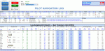
skyLOGX is a virtual navigation log (PLOG) coded in Microsoft Excel VBA to ease your preflight workload before you hop in bush wilderness aboard the selected general aviation aircraft - currently supported are A2A Cessna 172R, A2A Cessna 182T, and SibWings Antonov An-2. Although with slight modification in programming code, the logic can be applied to any GA aircraft.
It can also convert your native FSX/P3D flight plans or those created in Plan-G (in PLN format) to Google Earth KML and/or SkyVector format. The reversed conversion between flight plan formats is also possible.
| Filename: | skyLOGX_v20__UPDATE_.zip |
| License: | Freeware |
| Added: | 6th June 2015, 13:48:42 |
| Downloads: | 802 |
| Author: | Vuqar Quliyev |
| Size: | 13.75 MB |
| Category: Flight Simulator X - AFCAD Files | |
| KSEE - Gillespie Field - El Cajon, California - USA |
|
File Description:
This is a rework of KSEE Gillespie Field a GA airport in El Cajon, California just east of San Diego, California.
Displaced thresholds are adjusted on all runways, added parking spaces and helipads, aprons, runup areas, scenery objects (FSX stock for the most part, I hope) changed the fuel spot to the correct location, and shifted and added buildings and hangers to make it look more like the real airport. The default runway is now 9L-27R as that is the one that is most used at the real airport. AI will not use the others.
| Filename: | KSEE__Gillespie_Field__El_Cajon_California__USA.zip |
| License: | Freeware |
| Added: | 5th March 2016, 11:59:32 |
| Downloads: | 369 |
| Author: | Johannes Long |
| Size: | 696.32 KB |
| Category: Flight Simulator 2002 - AFCAD Files | |
| Additional Gates – Colorado Springs Muni (KCOS) v1.2 |
|
File Description:
This AFCAD file increases the number of parking spaces from 9 to 70. It allows for Small, Med., and Large GA Aircraft (46), Small, Med., Large commercial jets (17), plus add's (7) cargo parking spaces. This file will allow runways 35R/17L for landing, and 35L/17R for departures. KCOS is a wonderful up and coming airport. It offers two runways of more than 11,000ft., quite suitable for heavy jet traffic. KCOS is home to the longest runway (35R/17L) in the state of Colorado at 13,500 ft. (2.5 miles). Landing and departing offer spectacular views of the surrounding Rocky Mountains.
| Filename: | Additional_Gates__Colorado_Springs_Muni__KCOS_v12.zip |
| License: | Freeware, limited distribution |
| Added: | 18th October 2002, 18:55:28 |
| Downloads: | 1,720 |
| Author: | Josh Liste |
| Size: | 48.19 KB |
| Category: Flight Simulator 2002 - Scenery | |
| Redcliffe, Queensland, Australia Version 2 |
|
File Description:
This is a rebuild of my original version of Redcliffe Airport situated in the northern suberbs of Brisbane, Queensland, Australia.This version is a fairly close representation of the real thing which is the home of 2 flying schools. Many ga and also sport aircraft are hangered here. Watch out for the swamp at either end of the runway.... quite a few aircraft over the years have landed there by accident! Redcliffe is also notorious for crosswinds which can make takeoffs and landings interesting at this airport.
Also included is an AI Traffic file for those that want AI Traffic, requires AFCAD and Traffictools.
| Filename: | Redcliffe_Queensland_Australia_Version_2.zip |
| License: | Freeware |
| Added: | 28th September 2002, 12:57:57 |
| Downloads: | 640 |
| Author: | Steve James |
| Size: | 1.17 MB |
| Category: Flight Simulator 2004 - AFCAD Files | |
| Ronaldsway Improvements |
|
File Description:
Ronaldsway Improvements:
This airport is fairly quiet in FS2004. Since it is close to Liverpool, Prestwick, Dublin and Belfast, it's ideally located for small and short hops over the Irish Sea. I have removed some apron and taxi space which go nowhere in the default AFCAD file. I changed the small GA gates to large to cater for turbo-propliners and add some Helicopter pads for anyone wanting militart flights to and from Valley AB or Aldergrove AB in Belfast. A new feature I added was a small service road around the airport. I hope you enjoy these improvements.
| Filename: | Ronaldsway_Improvements.zip |
| License: | Freeware |
| Added: | 19th June 2004, 17:02:07 |
| Downloads: | 510 |
| Author: | René Bruun |
| Size: | 29.35 KB |
| Category: Flight Simulator 2004 - AFCAD Files | |
| Sept-Iles Airport (CYZV) |
|
File Description:
An AFCAD2 File for Sept-Iles Airport (CYZV), Quebec, Canada. This AFCAD2 completely reconfigures the default airport with more apron space, new taxiways, lighting, Gates, Cargo Area and GA parking. Rwy 09/27 has been extended to 7250FT and rwy 13/31 is now 7200FT. The out of use rwy 05/23 is now utilised as a taxiway. A tower frequency and a tower view have also been added. Airline Gate allocations are included, based on published airline schedules. This file is for the default FS2004 scenery. This is an AFCAD2 project only, no buildings have been added.
| Filename: | SeptIles_Airport_CYZV.zip |
| License: | Freeware |
| Added: | 31st December 2004, 04:55:38 |
| Downloads: | 780 |
| Author: | Lee Brompton |
| Size: | 18.84 KB |


© 2001-2026 AVSIM Online
All Rights Reserved
Privacy Policy |