
Where Flight Simulation Enthusiasts Gather from Around the World!
AVSIM Library - Search Results

| Category: Flight Simulator X - Scenery | |
| TNCB - Flamingo Airport (Bonaire) |

|
File Description:
Welcome to one of the 3 ABC's beautifull dutch island, Bonaire.
Flamingo Intl. is an international airport located at Kralendijk, Bonaire, Netherlands Antilles. Flamingo Airport serves as a connecting
point for flights of KLM to some destinations in South America. It once served as a hub for BonaireExel, BonaireExpress,CuraçaoExel,
CuraçaoExpress and now serves Dutch Antilles Express as it's secondary hub & also "EZAir" serves Bonaire as its main airline, although
the airline itself is based at Curaçao.
It is the 3rd largest airport in the Netherlands Antilles behind St.Maarten's Princess Juliana International Airport & Curaçao's Hato
International Airport and is the 4th largest between the islands of the Dutch Kingdom behind the already mention St. Maarten,
Curaçao & Aruba's Queen Beatrix International Airport. Arkefly, Continental, Delta & KLM are currently the largest airline operators
that operate flights to Bonaire.
The airport is large enough to accommodate most international widebody airliners such as the Boeing 747, the Boeing 777 and the
Airbus A340, although the largest widebody type to operate to Bonaire today is the MD11. It can also accommodate medium sized
aircraft such as the Boeing 737 and Airbus A310 as well as small aircraft such as the de Havilland Dash 8, ATR 42 and other such
turboprop aircraft.
| Filename: | TNCB__Flamingo_Airport__Bonaire.zip |
| License: | Freeware |
| Added: | 13th April 2009, 08:00:18 |
| Downloads: | 2,343 |
| Author: | Daniel Louvet |
| Size: | 1.01 MB |
| Category: Flight Simulator X - Aircraft Repaints, Textures and Modifications | |
| FS2004/FSX/P3D Project OpenSky V4 Japan Airlines JA8089 Boeing 747-446 |
|
Images related to this file:
File Description:

(TEXTURES ONLY)
(ONLY TESTED IN FSX: STEAM EDITION)
So I made a slight mistake in my last add-on (The Northwest Orient Cargo 747-200SF one) where I provided the resources required for advanced animations to be enabled in the POSKY 747 from Rikoooo, since in they default they did not include it. In there, I accidentally added the wrong "Contact Points" line that causes the 2 inner main landing gears to be slightly tilted when on the ground. I fixed it here. To apply the fix, just copy and paste the contact lines inside the aircraft.cfg file, that's it.
I originally supposed to be making 1 single livery for this exact aircraft, which is the 2002 Colors wearing the "Thank you for 41 Years" Sticker, but then went into a rabbit hole and found about the small Yokoso! Japan Sticker in the 2000s, the "BIG express" Decal in the 90s, and also the "Nippon Love Goal" Sticker. So I just had to do it.
I also improved the windows by using the windows from the CLS 747 Paint Kit, and re-arranged them.
Instructions and more information are included in the readme file.
| Filename: | FS2004FSXP3D_Project_OpenSky_V4_Japan_Airlines_JA8.zip |
| License: | Freeware |
| Added: | 19th March 2026, 14:09:48 |
| Downloads: | 64 |
| Author: | Ryubunao |
| Size: | 409.76 MB |
| Category: Flight Simulator 2004 - Scenery | |
| Fort Simpson Island CET4 - Northwest Territories, Canada |
|
Images related to this file:
File Description:
Fort Simpson Island is the fifth in a series of airfields that follow (approximately) in a southward direction the Mackenzie River. At the far northern end of the river there is Tuktoyaktuk, then Inuvik, Fort McPherson, Fort Good Hope, Deline, and then Wrigley, all posted. Fort Simpson Island is at 405 feet asl and on the west bank of the the Mackenzie, around 110 miles south of Wrigley at the junction of the Mackenzie and the Liard rivers. The town of Fort Simpson is on an island, and has a population of 1,250 or so folks. The Hudson Bay trading post was established here in 1822. The airport is right next to the town, and has 3,000 feet of gravel runway, though with a displaced threshold of 1,000 feet at each end (unmarked, on gravel) this is effectively 2,000 feet for landing. The Canada Flight Supplement lists the runway as being 100 feet wide; the gravel is definitely far less and the 100 refers to the width in the winter when you are landing on snow and don't care if there is gravel or grass underneath. There are no scheduled flights as these go to the nearby Fort Simpson CYFS. There is a mandatory radio frequency which is for both CYFS and CET4 and in this case I have set the "tower" to "manned" so you will report position and obey instructions. Runway 13 has right hand circuits. I have modified the Ultimate Terrain route for the Mackenzie Highway so that it remains on the west side of the river and does not wander randomly from one side to the other north of Fort Simpson.
| Filename: | Fort_Simpson_Island_CET4__Northwest_Territories_Ca.zip |
| License: | Freeware, limited distribution |
| Added: | 6th July 2014, 02:56:05 |
| Downloads: | 208 |
| Author: | Roger Wensley |
| Size: | 2.46 MB |
| Category: Flight Simulator 2004 - Scenery | |
| Sproat Lake CAA9 on Vancouver Island in British Columbia, Canada |
|
Images related to this file:
File Description:
Sproat Lake is in the middle of southern Vancouver Island, 6 miles west of the town of Port Alberni and 30 miles directly south of Comox Valley Airport. It is some 14 miles long and around the eastern shores has a large number of houses with docks and boats. Plus, in the offshoot called Upper Sproat Lake, it has the Sproat Lake Tankerbase CAA9, home to two rather large Martin Mars firefighting planes. Their history is interesting, and their capacity for carrying water for dousing forest fires during the summer months has kept them in use since their construction in the 1940's. They have finally been retired from fighting fires in 2013, having been first retired from military service in 1958. This scenery is made for use with Ultimate Terrain; there was another version made several years ago which either predated or ignored UT. This scenery is for the month when a Mars was being repainted before retiring to a museum as a military plane, date unkown but perhaps 2013? If it is a time when there were three in existance then it is sometime in the 1960's; take your pick. Because of hills adjacent to the lake the landing of the AI Mars may or may not take place, depending on wind direction and whether or not it flies into rock before landing. Take off and departure seem to be more reliable than landing on a daily basis. The Mars flies to Vancouver Harbour, but only in theory; it does not land and park as there is no parking available for such a large aircraft. The AI follows in the second post.
| Filename: | Sproat_Lake_CAA9_on_Vancouver_Island_in_British_Co.zip |
| License: | Freeware, limited distribution |
| Added: | 11th December 2016, 06:44:50 |
| Downloads: | 261 |
| Author: | Roger Wensley |
| Size: | 14.88 MB |
| Category: Flight Simulator 2004 - Gauges | |
| FS2004 GPS Map View Gauge v3.0 |
|
File Description:
The ultimate gauge. The Map will show: Airports details (Runways ID's, length & ILS), VOR's and NDB's frequencies,
Intersections and waypoints, Airspaces, Approaches and flight routes. You can toggle the view
you require for your flight. Also you can zoom in/out to see the nearest airports, vor's and
ndb's. The map will indicate A/C heading flightplan title and waypoints ID's.
Version 3 includes more enhancements such as the ability to input the ICAO code or name of any airport and the map will
show all the frequencies of that airport including ATIS, ILS, AND COM. In addition, the map will show the active
runway designations, length and width.
You can also input ICAO code of any VOR/NDB and the map will show their frequencies.
There was a bug in v2.0, in which if you enter ( click on ENT )the ICAO code of an airport, you will lose the flight
plan loaded. Now you can go back to the flight plan and with the NEXT/PREV buttons you have the choice of where to start
your FP.
The gauge will show Flight Plan Title, originating and destination airports, active waypoint, waypoint index and FP
crusing altitude.
I addition, the gauge will show various useful information, such as, Runway IDs, lenght, width and approach magnetic heading,
Airport name, city, and type. NAV1/2 names, codes, distances and ETA's, ADF1/2 names and codes.
Finally, the gaugee will show other information, such as, magvar, indicated airspeed, mach, ground velocity, ambient
wind velocity and direction, bank angle , and a/c altitude ( radio height ).
All the information above and much more on a single gauge window.
| Filename: | FS2004_GPS_Map_View_Gauge_v30.zip |
| License: | Freeware, limited distribution |
| Added: | 14th September 2005, 14:19:46 |
| Downloads: | 10,837 |
| Author: | Talal Alhaj |
| Size: | 710.05 KB |
| Category: Flight Simulator 2004 - Scenery | |
| Frozen Canadian & USA Rivers & Lakes Revision |
|
Images related to this file:
File Description:
This "freezes" all lakes and rivers for winter flying and means they can be landed on with skis or wheels; it is meant for low level flying rather than high level jet flights. This edition is complete in itself and now really covers all of Canada and parts of the USA along the border, including large parts of Michigan, Wisconsin, Minnesota, North Dakota, and Montana. It is reversible with an "untick" in the FS scenery library. The revision is the addition of frozen sea in the area of Baffin Island (where I and Sid & Pete have recently posted all of the Baffin Island airfields) as I missed this area last time. Sorry about that. I have spent some time making sure that the sea and the inlets along the coast in the south do not get frozen too, and also some of the lakes that are close to the coast and rarely get cold enough to freeze over. The Great Lakes do not usually totally freeze, but this is an either ON or OFF modification and partial freezing cannot be convincingly simulated, so I went for total ice. Along the north shore I went for the peak of the winter with sea ice all the way to the permanent polar cap; this is not totally realistic as there is usually a partially open lead along the coast, but as with the Great Lakes...... It will work without Ultimate Terrain, but as UT is what gets all the lakes and rivers there and in the right place (except in the far north) it is obviously much improved with UT. The pics show Rockcliffe in the winter with the frozen Ottawa River for real and in FS for comparison; without UT the river would not be in the right place.
| Filename: | Frozen_Canadian__USA_Rivers__Lakes_Revision.zip |
| License: | Freeware, limited distribution |
| Added: | 6th September 2011, 00:42:43 |
| Downloads: | 622 |
| Author: | Roger Wensley |
| Size: | 1.2 MB |
| Category: Flight Simulator 2004 - Scenery | |
| Glacier Bay - Alaska/Canada, Version 2, Part 1 of 2 |
|
Images related to this file:
File Description:
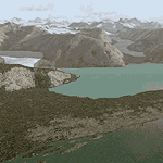
Glacier Bay v2 is a complete replacement of the default FS2004 landscape and scenery of more than 90,000 square kilometers (36,000 sq miles) of Southeast Alaska and adjacent areas of Yukon and British Columbia. File 1 of 2 (also requires glbayv2b.zip)
Landscape enhancements include high-resolution terrain mesh, detailed shorelines, rivers, lakes, and glaciers, and accurate land cover data with custom seasonal ground textures. Inland water bodies can be made to "freeze over" via an on/off switch. Other landmarks include the settlements of Juneau, Haines, Skagway, Yakutat, Atlin, and Carcross as well as road and railroad networks, cabins, lodges, and lighthouses. We modeled or enhanced 16 main airfields (plus one fictitious airstrip), 20 unlisted airstrips, 16 seaplane bases, and seven heliports. We've also included AI ship traffic in various locations as well as optional flightplans for GA and floatplane AI traffic.
Glacier Bay v2 is fully compatible with other third-party add-ons, including terrain mesh (FSGlobal, FS Genesis, etc.), ground textures (Ground Environment, BEV, FScene, etc.), and landscape enhancements (Ultimate Terrain Canada/Alaska, Misty Fjords, Tongass Fjords, Freight Dogs). A configurator panel (requires .Net Framework!) allows users to set compatibility options and to choose levels of scenery detail. We provide an autoinstaller and detailed documentation with a sectional map of the coverage area and a list of weblinks to real-world information.
For feedback and questions, please visit the Glacier Bay v2 support forum at http://forums.fsaddon.eu/viewforum.php?f=10. This project is a collaboration of nine FS developers from Germany, Austria, USA, and Canada, logging more than 1000 hours of work over the past 14 months. We acknowledge the kind support of FSAddon.com. However, this project is independent of any commercial company or product. Enjoy!
| Filename: | Glacier_Bay__AlaskaCanada_Version_2_Part_1_of_2.zip |
| License: | Freeware, limited distribution |
| Added: | 28th May 2010, 19:34:54 |
| Downloads: | 41,280 |
| Author: | Holger Sandmann, Rainer Duda, Michael Eder, Scot Fraser, Manfred Herz, Jay Langham, Jon Patch, Larry Silsbee, and Jim Vile |
| Size: | 56.46 MB |
| Category: Flight Simulator 2004 - Scenery | |
| Glacier Bay - Alaska/Canada, Version 2, Part 2 of 2 |
|
Images related to this file:
File Description:

Glacier Bay v2 is a complete replacement of the default FS2004 landscape and scenery of more than 90,000 square kilometers (36,000 sq miles) of Southeast Alaska and adjacent areas of Yukon and British Columbia. File 2 of 2 (also requires glbayv2a.zip)
Landscape enhancements include high-resolution terrain mesh, detailed shorelines, rivers, lakes, and glaciers, and accurate land cover data with custom seasonal ground textures. Inland water bodies can be made to "freeze over" via an on/off switch. Other landmarks include the settlements of Juneau, Haines, Skagway, Yakutat, Atlin, and Carcross as well as road and railroad networks, cabins, lodges, and lighthouses. We modeled or enhanced 16 main airfields (plus one fictitious airstrip), 20 unlisted airstrips, 16 seaplane bases, and seven heliports. We've also included AI ship traffic in various locations as well as optional flightplans for GA and floatplane AI traffic.
Glacier Bay v2 is fully compatible with other third-party add-ons, including terrain mesh (FSGlobal, FS Genesis, etc.), ground textures (Ground Environment, BEV, FScene, etc.), and landscape enhancements (Ultimate Terrain Canada/Alaska, Misty Fjords, Tongass Fjords, Freight Dogs). A configurator panel (requires .Net Framework!) allows users to set compatibility options and to choose levels of scenery detail. We provide an autoinstaller and detailed documentation with a sectional map of the coverage area and a list of weblinks to real-world information.
For feedback and questions, please visit the Glacier Bay v2 support forum at http://forums.fsaddon.eu/viewforum.php?f=10. This project is a collaboration of nine FS developers from Germany, Austria, USA, and Canada, logging more than 1000 hours of work over the past 14 months. We acknowledge the kind support of FSAddon.com. However, this project is independent of any commercial company or product. Enjoy!
| Filename: | Glacier_Bay__AlaskaCanada_Version_2_Part_2_of_2.zip |
| License: | Freeware, limited distribution |
| Added: | 28th May 2010, 19:36:31 |
| Downloads: | 40,552 |
| Author: | Holger Sandmann, Rainer Duda, Michael Eder, Scot Fraser, Manfred Herz, Jay Langham, Jon Patch, Larry Silsbee, and Jim Vile |
| Size: | 85.99 MB |
| Category: Flight Simulator 2004 - Scenery | |
| KIAH - Houston Intercontinental Airport v3.0 |
|
File Description:
Flightlevel390 is proud to present to you KIAH-Houston's George Bush Intercontinental Airport version 3.0.This scenery was created using EZ-Scenery object placer & Flightones' Instant Scenery.This scenery WILL NOT work in FS X.This will work with Default FS9 terrain,although it is optimized for use with ultimate terrain...This will be the final project under the FL390 brandname,all projects hereafter will be with BSMP...
Includes the Main terminals,Continental Maintenence Base,FedEx cargo ramp,UPS cargo ramp,City cargo ramp,fuel farm by 15R,CFR building further down 15R,CFR Building along Rwy 9-27 taxiway,FBOs on both sides of the 33s,including the big Landmark Aviation FBO,static ground equipment & some custom made signs.Also includes full ramp night lighting,aircraft gate outline markings at each gate.
This version adds some more stuff and fixing some stuff that was noted in previous versions.This also fixes the blurries that some people had reported.
Features a very good and super accurate AFCAD file and decent rendition of the real airport layout.***
Most of the objects in this scenery are all default with some of our own custom made stuff and some objects from some 3rd party EZ Object Libraries and RWY12 Object Libraries.
***You will need to download the EZ-Scenery & RWY12 Object Libraries which can be had at avsim,flightsim.com and our own website available as single downloads instead of multiple seperate downloads.I also recomend that you install our recently released EZ-Object Library Installer which is available at flightsim.com and our own website in the downloads section.File name on flightsim.com is ( EZOLIv33.zip )....
Downloading the installer will ensure that you will have all of the fixed default textures from Sid Schwartz's default libraries....As always...Enjoy!!
| Filename: | KIAH__Houston_Intercontinental_Airport_v30.zip |
| License: | Freeware |
| Added: | 15th June 2008, 17:39:45 |
| Downloads: | 8,410 |
| Author: | Joe DeGregorio |
| Size: | 3.08 MB |
| Category: Flight Simulator 2004 - Scenery | |
| Alaska South Slope 12; Teller K54 |
|
Images related to this file:
File Description:
There are four main northwestern Alaska towns which are serviced by Alaska Airlines, and from which local flights spread out. The northernmost is Barrow. Southwest of Barrow is Kotzebue, then Nome, and the furthest south is Bethel (not yet made). This is the fifth in a series for local flights from Nome, and it is on the coast around 55 miles east of Wales and 55 miles northwest of Nome. There are two other airfields around a large lagoon that is almost totally enclosed from the sea, and Teller is on the easten shore, just 15 miles east of Port Clarence and 5 miles southeast of Brevig Mission, both already posted. Teller has a populaton of around 230, down from the 5,000 or so in the early 1900's after the Bluestone Placer Mine struck gold. Tollef Brevik was a Lutheran missionary who was both a pastor and teacher for the Inuit in the area from 1894 onward, travelling from community to community but based in Teller, where the Teller Mission Church was later renamed the Brevig Mission. The name was later appropriated and used for the curent village of that name; he was surely very well regarded by the local population. Unusually, it is possible to drive from Nome to Teller in summer, on a dirt road. Conversely, the road that shows in FS9 to the north towards Brevig Mission (courtesy of Ultimate Terrain) does not in fact exist except in winter, when it is estabished on the snow by the tyre tracks of users. The airstrip is southeast and 2 miles by road from the main part of the village on the spit, with a gravel runway 02-25 which is 3,500 feet of gravel. The AI is the usual for this area, Bering and ERA with some GA and cargo by Everts.
| Filename: | Alaska_South_Slope_12_Teller_K54.zip |
| License: | Freeware, limited distribution |
| Added: | 25th October 2016, 21:21:14 |
| Downloads: | 235 |
| Author: | Roger Wensley |
| Size: | 2.96 MB |


© 2001-2026 AVSIM Online
All Rights Reserved
Privacy Policy |