
Where Flight Simulation Enthusiasts Gather from Around the World!
AVSIM Library - Search Results

| Category: Flight Simulator 2004 - Scenery | |
| Exploring Mt Rainier Natl Park 1.0 |

|
File Description:
A complete remapping of Mount Rainier National Park in Washington State. Based upon commercial topographic maps, the designed scenery includes, every hiking trail drawn in meticulous detail including every real life switchback; every lake and small alpine pond 20 feet in diameter and over, modified landclass of alpine, forest & rock; every perennial and many intermittent creeks, all steams and rivers (many braided), a complete glacier mapping of every glacier with custom textures and ice fields on the mountain, a complete mapping of all rock faces and rock, moraine rock deposits, glacier outwash area, mudflows, roads, swamp and marsh areas. Includes some effects. Designed to compliment UT USA and any LOD 9 or 10 mesh. Works well with FS Genesis LOD 10 mesh and Birds Eye View Textures.
| Filename: | Exploring_Mt_Rainier_Natl_Park_10.zip |
| License: | Freeware, limited distribution |
| Added: | 6th February 2006, 01:43:43 |
| Downloads: | 3,227 |
| Author: | Bryan Wallis |
| Size: | 9.22 MB |
| Category: Flight Simulator 2004 - Scenery | |
| Exploring Mt Rainier Natl Park v1.1 |
|
File Description:
Exploring Mt Rainier Natl Park v1.1
UPDATE! Includes missing textures which resulted in some users experiencing CTD and freezes. A complete remapping of Mount Rainier National Park in Washington State. Based upon commercial topographic maps, the designed scenery includes, every hiking trail drawn in meticulous detail including every real life switchback; every lake and small alpine pond 20 feet in diameter and over, modified landclass of alpine, forest & rock; every perennial and many intermittent creeks, all steams and rivers (many braided), a complete glacier mapping of every glacier with custom textures and ice fields on the mountain, a complete mapping of all rock faces and rock, moraine rock deposits, glacier outwash area, mudflows, roads, swamp and marsh areas. Includes some effects. Designed to compliment UT USA and any LOD 9 or 10 mesh. Works well with FS Genesis LOD 10 mesh and Birds Eye View Textures. By Bryan Wallis and Lou Frost.
| Filename: | Exploring_Mt_Rainier_Natl_Park_v11.zip |
| License: | Freeware, limited distribution |
| Added: | 18th February 2006, 23:14:40 |
| Downloads: | 4,149 |
| Author: | Bryan Wallis & Lou Frost |
| Size: | 11.61 MB |
| Category: Flight Simulator X - Scenery | |
| Abel Tasman National Park Photoreal Scenery - New Zealand |
|
Images related to this file:
File Description:
This Freeware Version of "Abel Tasman National Park" covers approx 320 sq miles of the Abel
Tasman National Park on the Northern tip of the "South Island" of New Zealand.
| Filename: | Abel_Tasman_National_Park_Photoreal_Scenery__New_Z.zip |
| License: | Freeware |
| Added: | 24th July 2010, 04:58:15 |
| Downloads: | 2,392 |
| Author: | Michael Allen-Andrews |
| Size: | 94.01 MB |
| Category: Flight Simulator 2004 - Scenery | |
| Grand Teton National Park |
|
File Description:
Grand Teton National Park in Wyoming with additional/corrected roads, rivers and lakes. Addon 38.2m mesh such as the excellent FSGenesis Rocky Mountains freeware is necessary to properly view these modifications
| Filename: | Grand_Teton_National_Park.zip |
| License: | Freeware |
| Added: | 4th July 2004, 17:24:44 |
| Downloads: | 2,466 |
| Author: | Victor West |
| Size: | 132.68 KB |
| Category: Flight Simulator 2004 - Scenery Design | |
| Yellowstone National Park, Wyoming |
|
File Description:
This package DOES NOT contain finished FS scenery products! Instead, the three bitmaps (N44.2-45.4 W110.2-111.2) are meant to be used for FS landscape scenery design with Ground2K4 (by Christian Fumey) or similar utilities. Source data are public domain Landsat 7 ETM+ satellite images, at 15-m and 30-m ground resolution. I used professional GIS software for the geographic transformation to lat/long-WGS84 projection, and photo processing software for channel merging and image enhancements. Each image has been tested in Ground2K4 for accurate placement. Note: These images have been ECW-compressed and need special (free) software for decompressing (instructions included).
| Filename: | Yellowstone_National_Park_Wyoming.zip |
| License: | Freeware, limited distribution |
| Added: | 27th April 2004, 15:36:03 |
| Downloads: | 434 |
| Author: | Holger Sandmann |
| Size: | 17.09 MB |
| Category: Flight Simulator 2002 - Scenery | |
| Saguaro National Park East. |
|
File Description:
This is a scenery of Saguaro National Park East, located at the eastern edge of Tucson, Arizona, next to the Rincon Mountains. There are photoreal macros of the Visitor Center, Toll Booth, and Saguaro's created with EOD and digital photos from the park. I have provided a fictional helio pad, and also a fictional airstrip, Tanque Verde Airstrip TVA, with AFCAD file, to provide easy access to the scenery. All Textures included. By Robert Palmer
| Filename: | Saguaro_National_Park_East.zip |
| License: | Freeware, limited distribution |
| Added: | 11th April 2003, 23:49:38 |
| Downloads: | 909 |
| Author: | Robert Palmer |
| Size: | 2.57 MB |
| Category: Flight Simulator X - Scenery | |
| Canaima National Park - Venezuela |
|
Images related to this file:
File Description:
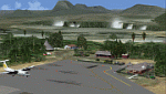
This package includes Canaima Airport-SVCN,
Angel Falls (created by Jean St-Cyr)
and camp Kavak-SVKV (new in FSX).
With photo-terrain scenery from satellite imagery
of Google Earth.
Not compatible with versions prior to FSX.
This scenery includes terminal building with realistic
textures from images obtained from Internet.
Also includes a friendly Auto-Install.
| Filename: | Canaima_National_Park__Venezuela.zip |
| License: | Freeware |
| Added: | 3rd September 2012, 02:05:52 |
| Downloads: | 2,724 |
| Author: | David Maldonado |
| Size: | 50.02 MB |
| Category: Flight Simulator 2004 - Scenery | |
| Arches National Park, Moab (KCNY), Utah, Photo-Scenery (FSX too) |
|
File Description:
This scenery covers another beautiful National Park: Arches National Park near Moab in Utah. It contains the park itself, Moab, the La Sal Moutains and the northern part of Canyonlands National Park, which will be covered in an upcoming package. The total area is 3.500 sq km and comes in 4.7m/pix quality. To explore the scenery depart from Canyonlands Field Airport (KCNY) and head south. YourDonation@Work: Dedicated to Hector, William and Jerald. Thanks!
| Filename: | Arches_National_Park_Moab_KCNY_Utah_PhotoScenery_F.zip |
| License: | Freeware, limited distribution |
| Added: | 5th January 2009, 19:31:11 |
| Downloads: | 3,710 |
| Author: | Gottfried Razek - www.blueskyscenery.com |
| Size: | 94.68 MB |
| Category: Flight Simulator X - AFCAD Files | |
| Kasaba Bay airport (FLKY) - Nsumbu National Park (Lake Tanganyika), Zambia |
|
Images related to this file:
File Description:
FSX Kasaba Bay airport [FLKY], Nsumbu National Park [Lake Tanganyika], Zambia - AFCAD. An improvement over the FSX default version. Kasaba Bay Airport is the gateway to Nsumbu National Park in Northern Zambia [on the shores of Lake Tanganyika].
| Filename: | Kasaba_Bay_airport_FLKY__Nsumbu_National_Park_Lake.zip |
| License: | Freeware |
| Added: | 22nd January 2012, 22:19:39 |
| Downloads: | 194 |
| Author: | Bashir Ismail |
| Size: | 405.02 KB |
| Category: Flight Simulator X - AFCAD Files | |
| FLNA - Ngoma Airstrip, Kafue National Park |
|
File Description:
Ngoma Airstrip, Kafue National Park. An improvement over the default FSX Version.
| Filename: | FLNA__Ngoma_Airstrip_Kafue_National__Park.zip |
| License: | Freeware |
| Added: | 5th January 2012, 19:13:43 |
| Downloads: | 162 |
| Author: | Bashir Ismail |
| Size: | 1.97 MB |
© 2001-2026 AVSIM Online
All Rights Reserved
Privacy Policy |