
Where Flight Simulation Enthusiasts Gather from Around the World!
AVSIM Library - Search Results

| Category: Flight Simulator 2004 - Scenery | |
| Chateau Airfield NZ22, & Chateau Hotel Village, Mount Ruapehu, New Zealand. |

|
File Description:
Welcome to the Chateau Airfield, the home of Mountain Air. The airfield is located on the foothills
of Togariro National Park's, Mount Ruapehu in the central North Island of New Zealand.
This scenery includes not only the airfield, but the Chateau Hotel and Village halfway up the mountain.
The scenery also features some custom buildings and signs (textures included).
For those that like to arrive for their ski-ing holday in style, there is a helipad (NZ20, ficticious), right
beside the Chateau Hotel, or alternatively, you can follow the road opposite the airfield, which leads directly
up to the Chateau Hotel and Village. Requires some EZ Scenery Object sets (see INSTALL instructions for details). Special thanks to Mike Andrews (creator2003) for giving his kind permission to use his custom Chateau Hotel building in this scenery.
*Requires some EZ Scenery Object sets.*
| Filename: | Chateau_Airfield_NZ22__Chateau_Hotel_Village_Mount.zip |
| License: | Freeware, limited distribution |
| Added: | 5th December 2008, 15:29:38 |
| Downloads: | 1,456 |
| Author: | Lawrie Roache |
| Size: | 2.98 MB |
| Category: Flight Simulator X - Scenery | |
| KMHV Mojave Airport v2.0 |
|
File Description:
This remote former World War II desert airfield has developed some very interesting and unusual features. It is a center for civilian aviation R&D, a major aircraft storage and scrap yard (possibly the largest nonmilitary one in the country), a busy film site, and is the home of the National Test Pilot School, the largest civilian test pilot school in the world. Also located here is Burt Rutan's Scaled Composites company, where many innovative aircraft designs have been conceived and constructed. Mojave Airport is also where many commercial carriers store surplus or otherwise in- limbo airliners. There are currently around 90 airplanes waiting to be sold, repaired or reused here, including several 747s. This file has been designed to work on both FS2004 and FS-X platforms. Requires RWY 12 Object Placer program (available at www.avsim.com) for full enhancement.
| Filename: | KMHV_Mojave_Airport_v20.zip |
| License: | Freeware |
| Added: | 12th November 2006, 22:19:46 |
| Downloads: | 2,610 |
| Author: | Brian C. Selb |
| Size: | 377.72 KB |
| Category: Flight Simulator X - Scenery | |
| WashDCX beta for FSX |
|
File Description:
WashDCX beta is a complete upgrade to the default FSX Washington D.C. scenery. You will find included in this download: Satellite images; traffic files; and additional significant landmarks and buildings surrounding the downtown National Mall area. See the Readme file for a complete list. I have imported several models from Google Sketchup taking great care to minimize drawcalls for each one. Although all models may not appear "perfect" in the beta version, I have shown it can be done and it is something that can be improved on. You will find a drastic improvement of flying over Washington D.C. when compared to the default FSX scenery. This is the first beta release. I encourage feedback, comments, suggestions, and collaboration on this project if you wish. Please visit my website: www.myflightsimblog.com and leave me an email at [email protected] .
Enjoy!
LARRY
| Filename: | WashDCX_beta_for_FSX.zip |
| License: | Freeware |
| Added: | 21st December 2010, 14:34:19 |
| Downloads: | 992 |
| Author: | lkrobbins |
| Size: | 49.4 MB |
| Category: Flight Simulator 2004 - Scenery | |
| KCRW - Charleston-Yeager 2014 |
|
Images related to this file:
File Description:
Yeager Airport KCRW in Charleston, West Virginia, is a mid-size airport surrounded by beautiful terrain (see the section on Optional Mesh). The terminal can easily accommodate 737 class airliners as well as commuter turboprops, and there are GA and West Virginia National Guard ramps. This scenery reflects the current single runway configuration, the former second runway having been converted into taxiway C. It is a complete rebuild with all custom buildings and some photo ground textures. I have also redone the instrument approaches to match the current real ones, and they will automatically be listed and displayed on your GPS. Instrument Approach Plates are included.
This work is entirely my own, but I would like to thank Brandon DePalo for his very well done earlier version of KCRW. Without that, I would not have known about this airport.
| Filename: | KCRW__CharlestonYeager_2014.zip |
| License: | Freeware |
| Added: | 26th April 2014, 07:05:30 |
| Downloads: | 648 |
| Author: | Sidney Schwartz |
| Size: | 7.29 MB |
| Category: Flight Simulator X - Scenery | |
| KLAW - Fort Sill Regional / Lawton Muni - Oklahoma, USA |
|
Images related to this file:
File Description:
FSX Scenery - Lawton Fort Sill Regional Airport (IATA: LAW[2], ICAO: KLAW, FAA LID: LAW) is a city owned airport two miles south of Lawton, in Comanche County, Oklahoma. It is used for military aviation from nearby Fort Sill and Sheppard Air Force Base and is served by American Eagle. Allegiant Air runs occasional charters to various destinations in the western United States. The National Plan of Integrated Airport Systems for 2011-2015 categorized it as a primary commercial service airport. Federal Aviation Administration records say the airport had 77,533 passenger boardings (enplanements) in calendar year 2008, 71,389 in 2009 and 68,054 in 2010. The 2013 Federal sequester will result in the closure of the airport's control tower and will require pilots to rely on air traffic controllers from other area airports. For your flying pleasure by John B. Loney, Jr.
| Filename: | KLAW__Fort_Sill_Regional__Lawton_Muni__Oklahoma_US.zip |
| License: | Freeware, limited distribution |
| Added: | 19th August 2015, 20:58:38 |
| Downloads: | 599 |
| Author: | John B. Loney, Jr. |
| Size: | 12.61 MB |
| Category: Flight Simulator 2004 - Scenery | |
| Colorado Lakes Project III |
|
File Description:
This project features the lakes of Southwest Colorado, replaces the default Navajo Lake on the Colorado-New Mexico border, and adds over 300 highly detailed lakes to Colorado. They fit seamlessly with my "Colorado Lakes Project II" (colorado_lakes_project_2.zip) and "Colorado Lakes Project I" (colorado_lakes_project_1.zip) lakes. The original "Colorado Lakes Project I" is recommended to complete this package, as it contains McPhee, Lemon, and Vallecito Reservoirs.
These lakes are specifically designed to show off their photo realistic detail when used in combination with "FSGenesis-The Rockies 38.2m Terrain Mesh-Colorado" available as "fsg_dem38m_usrk_co.zip" at avsim.com, or comparable mesh. The free FSGenesis US National Landclass Project Beta 6 also adds beautifully to the landscape. These lakes work equally as well with the default mesh.
All lake information was projected from satellite imagery and compiled with a beta version of Jim Keir's "Slartibartfast" utility.
| Filename: | Colorado_Lakes_Project_III.zip |
| License: | Freeware |
| Added: | 3rd June 2004, 21:54:46 |
| Downloads: | 5,016 |
| Author: | Carlyle Sharpe |
| Size: | 444 KB |
| Category: Flight Simulator 2004 - Scenery | |
| Colorado Lakes Project IV |
|
File Description:
This project features the lakes of North Central Colorado, replaces all of the prominent reservoirs and lakes of the region (Dillon, Green Mountain, Granby, Williams Fork, and more), and adds over 500 highly detailed lakes to Colorado. They fit seamlessly with my "Colorado Lakes Project III" (colorado_lakes_project_3.zip), "Colorado Lakes Project II" (colorado_lakes_project_2.zip) and "Colorado Lakes Project I" (colorado_lakes_project_1.zip) lakes.
These lakes are specifically designed to show off their photo realistic detail when used in combination with "FSGenesis-The Rockies 38.2m Terrain Mesh-Colorado" available as "fsg_dem38m_usrk_co.zip" at avsim.com, or comparable mesh. The free FSGenesis US National Landclass Project Beta 6 also adds beautifully to the landscape. These lakes work equally as well with the default mesh.
All lake information was projected from satellite imagery and compiled with a beta version of Jim Keir's "Slartibartfast" utility.
| Filename: | Colorado_Lakes_Project_IV.zip |
| License: | Freeware |
| Added: | 10th June 2004, 04:27:10 |
| Downloads: | 4,837 |
| Author: | Carlyle Sharpe |
| Size: | 743.4 KB |
| Category: Flight Simulator 2004 - Scenery | |
| Wunstorf AB - Germany |
|
Images related to this file:
File Description:
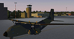
Wunstorf Air Base was originally opened in 1936 for the National Socialist Luftwaffe. Like most German airfields it did arduous duty during the Second World War. When the allies finally concluded their occupation the field was eventually returned to German control and hosted it's first German transport unit flying the Nord Atlas. This aircraft was replaced in 1971 with the current Transall 160 aircraft. With the recent adoption of the Airbus A400M by the Luftwaffe, Wunstorf is undergoing some significant remodeling including lengthening of runway 8-26 as well as construction of two new modern hangars and associated support buildings. This scenery is intended to be used with the great Transall 160 package by Ray Parker (available at Avsim.net as (gaf_c-160_transall.zip) but will of course accomodate any aircraft and is in itself a complete scenery package.
| Filename: | Wunstorf_AB__Germany.zip |
| License: | Freeware, limited distribution |
| Added: | 13th April 2014, 14:08:22 |
| Downloads: | 1,512 |
| Author: | John Stinstrom |
| Size: | 6.58 MB |
| Category: Miscellaneous Files - General Utilities | |
| Wx2pfpx v2.6.4 |
|
Images related to this file:
File Description:
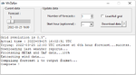
A simple weather data provider for the discontinued Professional Flight Plan X software. The script fetches raw weather data, METAR and TAF data from the NOAA, US national weather service, which is then compiled to a single file that can be imported in PFPX. More than 15000 reference stations (airports) from PFPX are used and wind/temperature data is provided for each of them. When available, METAR and TAF data is also provided for more than 5000 airports. The original data source is updated 4 times a day, and can provide forecasts for every 3 following hours up to 16 days. *** A new script can trigger antivirus analysis as it's unknown, you can ignore it.*** V2: Great precision improvement, possibility of importing the whole NOAA dataset grid, a bit of documentation. V2.6: Repaired due to API change.
| Filename: | Wx2pfpx_v264.zip |
| License: | Freeware, limited distribution |
| Added: | 27th September 2025, 15:55:08 |
| Downloads: | 94 |
| Author: | John Smith |
| Size: | 21.97 MB |
| Category: Flight Simulator 2002 - AI Flight Plans | |
| Air Koryo AI Traffic Version 1.10 |
|
File Description:
This is the AI schedule for
the national carrier of the Democratic
People's Republic of Korea (otherwise
known as "North Korea.") All regularly
scheduled flights as listed in the OAG
Worldwide Flight Guide November 2002
are included. Non-scheduled domestic
flights between Pyongyang and Chongjin,
Hamhung, Kilju, Kanggye, Sinuiju, and
Wonsan are not in this package as well
as international charter flights.
Pyongyang's Sunan Intl Airport is the
only facility which exists by default
in FS2002 anyway.
"Traffic Tools" from Lee Swordy is
required for installation.
Models and repaints of Air Koryo
aircraft can be found by searching
on most major sites.
Air Koryo currently operates an all
Soviet-made fleet consisting of AN-24,
Il-18, IL-61 (VIP), IL-62M, Tu-134B,
Tu-154B, IL-76 (cargo). Few people have
the opportunity to see this carrier
land at their local airport!
| Filename: | Air_Koryo_AI_Traffic_Version_110.zip |
| License: | Freeware |
| Added: | 28th February 2003, 13:46:09 |
| Downloads: | 1,259 |
| Author: | Franklin Vale |
| Size: | 1.98 KB |


© 2001-2026 AVSIM Online
All Rights Reserved
Privacy Policy |