
Where Flight Simulation Enthusiasts Gather from Around the World!
AVSIM Library - Search Results

| Category: Flight Simulator X - Scenery | |
| X2MB - RAF Membury - Berkshire, England |

|
File Description:
RAF Membury (ICAO X2MB) is a former Royal Air Force station built in the civil parish of Lambourn in Berkshire, England. The airfield is located approximately 4.6 miles (7.4 km) mi north-northwest of Hungerford, at the Membury services stop of the M4 motorway; about 60 miles (97 km) miles west-southwest of London. The airfield also lies immediately next to the Iron Age hill fort of Membury Camp.
Opened in 1942, it was used by both the Royal Air Force (RAF) and United States Army Air Forces (USAAF). During the war it was used by several combat units with varying missions. It was also a major supply and maintenance depot. After the war, it was a private airport until the construction of the M4 motorway in the 1960s when it was closed.
Today the remains of the airfield are located on private property with the former technical site now being an industrial estate (Membury Business Park).
Source: Wikipedia
| Filename: | X2MB__RAF_Membury__Berkshire_England.zip |
| License: | Freeware |
| Added: | 7th April 2016, 17:26:37 |
| Downloads: | 126 |
| Author: | Terry Boissel |
| Size: | 1.63 MB |
| Category: Flight Simulator 2004 - AFCAD Files | |
| Nairobi/Jomo Kenyatta Airport, Kenya (HKJK) |
|
File Description:
Whenever I have searched for files relating to HKJK, I have been rather dissapointed with the outcomes. Most other AF2 files of this airport are severely incorrect. As the North Terminal (Embasaki) is no longer operational for Commercial Flight, I have moved all the gates to the only operational terminal to the south of the runway. General Aviation aircraft now park at "Embasaki".
As Kenya Airways (KQ) is Africa's second largest carrier, I have added many ficticious "small" gates to accomodate all the traffic. I have also added several heavy gates to accomodate the steady stream of heavy planes that land at HKJK also. Previously, all these planes would have disappeared upon landing.
Finally I have included thin aprons either side of the runway as they would appear in real life.
With this file, Jomo Kenyatta Airport will look more like the busy international airport that it is, and less like the rather lifeless airport that it is commonly portrayed as.
| Filename: | NairobiJomo_Kenyatta_Airport_Kenya_HKJK.zip |
| License: | Freeware |
| Added: | 30th March 2005, 22:38:19 |
| Downloads: | 1,832 |
| Author: | Matthew Kimemia |
| Size: | 159.99 KB |
| Category: Flight Simulator 2004 - Flight Plans | |
| SIDSTARS New York/La Guardia (KLGA) |
|
File Description:
Procedures based on FAA Digital Terminal Procedures for current cycle (0701 eff 15Feb-15Mar). The single published departure LGA1 is a vectors-only procedure, but I have included this with the Rwy 13 Climbs (CONEY, FLUSHING, MASPETH & WHITESTONE) if you are using ATC vectors (e.g., VATSIM). I have also included twelve non-published departures for routing to all of the departure fixes used by turbojets for use without ATC vectors. Fixes included ELIOT, GAYEL, PARKE etc, and the Runway 13 Climb is included based on actual ground tracks observed at Flightaware. All (turbojet) arrivals are included in both "as published" for use with ATC vectors and with routing to final approach fixes for use without ATC vectors. The two arrivals from the South/West include routing via the charted River Visual Rwy 13 approach, which does a flyby of the Statue of Liberty then up the Hudson River past Central Park followed by a right turn to short final. Truly a scenic arrival.
| Filename: | SIDSTARS_New_YorkLa_Guardia_KLGA.zip |
| License: | Freeware, limited distribution |
| Added: | 20th February 2007, 05:16:22 |
| Downloads: | 418 |
| Author: | Dan Downs |
| Size: | 13.65 KB |
| Category: Flight Simulator X - Scenery | |
| Deer Valley FC Resort & Roosevelt Lake |
|
File Description:
Deer Valley Resort at Roosevelt Lake Scenery. -
This is a fictious Resort at Roosevelt Lake by Grapevine AZ USA.
Its basically a fly-in resort for the Deer Valley Flying Club members to relax, do some fishing, go to the Amusement Park and have a general great time. But the resort is now open to the public. If you dont want to spend the big bucks, there is a small campground located nearby.
I suggest a float plane or helocopter for the trip out and back. If you're a competent bush pilot, you might be able to land on the grass runway, but its a very difficult strip. Fly a STOL plane or you wil not make it.
Acknowledments:
Microsoft: FS X Sdk Scenery function of the Mission builder.
Abacus: Scenery shortcut tool.
Lee Swordy: AFCAD Ver 2.21.
NOTE: This scenery is frame rate friendly, but I would highly suggest turning off ground shadows.
| Filename: | Deer_Valley_FC_Resort__Roosevelt_Lake.zip |
| License: | Freeware |
| Added: | 18th January 2007, 05:20:29 |
| Downloads: | 1,219 |
| Author: | Bob Caparoula |
| Size: | 4.16 MB |
| Category: Flight Simulator 2004 - Scenery | |
| Boulder (KBDU) / Longmont / Loveland, Colorado, Photo-Scenery (FS9 & FSX) |
|
Images related to this file:
File Description:

Boulder is situated where the Rocky Mountains meet the Great Plains. Just west of the city are imposing slabs of sedimentary stone tilted up on the foothills, known as Flatirons. Located at the base of the foothills is Boulder's main campus of the University of Colarado which is clearly visible from the sky. Longmont is home of the Denver ARTCC (Air Route Traffic Control Center) which controls all flights in the upper airspace of most of Colorado and parts of adjoining states. To explore the scenery depart from Boulder (KBDU) and head northeast. Extends my Rocky Mountain Park scenery to the east and my Denver scenery to the north. Provides another 3.500 sq km in 4.7m/pix quality. High resolution versions for FS9 and FSX (much sharper, but larger and multiple downloads) are available at www.blueskyscenery.com/GNB_East.html . The screenies are taken from the high-res versions, so expect this version to be slightly more blurry. YourDonation@Work: Dedicated to Senges and Eric.
| Filename: | Boulder_KBDU__Longmont__Loveland_Colorado_PhotoSce.zip |
| License: | Freeware, limited distribution |
| Added: | 28th December 2009, 20:14:09 |
| Downloads: | 2,388 |
| Author: | Gottfried Razek - blueskyscenery.com |
| Size: | 94.26 MB |
| Category: Flight Simulator X - Scenery | |
| YKAE Kalannie, Western Australia |
|
File Description:
YKAE Kalannie, about 300km north-east of Perth, lies in some of the best wildflower country in Australia and at the heart of WA���¢������s largest wheat producing area. The district also claims more species of wattle (acacias) than anywhere else in the world. Kalannie is also situated approximately 30 mins from Dalwallinu in what is called the northern wheatbelt region and is within the Dalwallinu Shire and hence council administration for the area is managed from Dalwallinu. Kalannie has a population of approximately 300 people in the town and immediate region around Kalannie. There is no accommodation at Kalannie except for the Caravan Park. The airstrip is gravel with a windsock and is marked with white plough disks. REQUIRES Blencowe_LibraryKit.zip
REQUIRES blencowe_librarykit_309494.zip (Available HERE)
| Filename: | YKAE_Kalannie_Western_Australia.zip |
| License: | Freeware |
| Added: | 28th February 2013, 13:51:08 |
| Downloads: | 212 |
| Author: | Alan Blencowe |
| Size: | 2.31 MB |
| Category: Flight Simulator 2004 - Scenery | |
| LTBM Isparta, Turkey |
|
Images related to this file:
File Description:
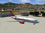
Googly scenery for LTBM Isparta, Turkey - a small airport for which nothing more than a runway has been provided in Flight Simulator 2004. These scenery files add the apron, taxiways, buildings and other airport features so that you and your "AI" traffic can land, taxi, park and take off in a realistic manner.
The airport appears to used mainly for occasional tourism flights, particularly traffic to and from Iran.
The scenery does not purport to be ultra-accurate. Based on high-detail satellite imagery from Google Earth, the layout is proportionally correct but the added airport features, such as buildings, are built from default Microsoft objects and add-on libraries so will not look like the real thing.
You are not obliged to download and install any additional scenery libraries, but to enjoy this scenery in its entirety, you may wish to. It will work fine, with or without.
[File re-uploaded at request of AVSIM]
| Filename: | LTBM_Isparta_Turkey.zip |
| License: | Freeware |
| Added: | 26th June 2010, 13:53:59 |
| Downloads: | 1,559 |
| Author: | John Hinson |
| Size: | 88.64 KB |
| Category: Flight Simulator X - AFCAD Files | |
| Australian Capital Cities & Regional Airports |
|
File Description:
This is a basic update of FSX default Australian Capital City & Regional Airports BGL airport files.
Many gates have been resized where possible to enable larger aircraft such as b747s, A380s park in the international terminals. I have also added several gates to a number of airports and assigned ATC (airline) parking codes to all the parking spots. These parking codes have been aligned to the correct terminals. Military parking spots have also been added to many airports.
Note Melbourne airport (YMML) has also been updated from my last posting.
The airports included in this pack include:
Melbourne Intl - YMML; Canberra - YSCB (includes military); Sydney Intl - YSSY; Brisbane Intl - YBBN; Darwin Intl - YPDN (includes military); Perth Intl - YPPH; Adelaide Intl - YPAD; Hobart Intl - YMHB; Albury - YMAY; Cairns Intl - YBSC; Townsville - YBTL (includes military); Gold Coast - YBCG; Launceston - YMLT; Devonport - YDPO; East Sale (Military) - YMES
These BGL AFCAD files has been tested with VOZ, PAI and RAAF AI aircraft.
There are 15 BGL AFCAD files in this download.
| Filename: | Australian_Capital_Cities__Regional_Airports.zip |
| License: | Freeware |
| Added: | 13th October 2007, 10:38:57 |
| Downloads: | 6,363 |
| Author: | Garry Appleby |
| Size: | 2.09 MB |
| Category: Flight Simulator 2004 - Scenery | |
| CYEG Edmonton International |
|
File Description:
Re-upload. Based on aerial and ground photos. The main terminal and cargo area buildings were all replaced. The aprons were modified to be more accurate and the smaller cargo area taxiway was added. All the usual goodies are included. V2 is a complete replacement for V1. Due to a nasty bug in EZ-Scenery (since eradicated), the entire V1 scenery was misaligned. That has been fixed. Incorrectly sized objects on the cargo ramps have been fixed. The commuter airline parking at the north side of the main terminal has been corrected to make it more like the real thing. V1.1, which contained just the ramp lighting, has been incorporated into V2.
One significant change is that there are now two versions of the scenery, V2 and V2a. V2, like V1, has static aircraft parked at the cargo ramps. In V2a the static aircraft have been removed so ai cargo planes can park at the cargo ramps. V2a of the AFCAD file has cargo parking spaces added.
| Filename: | CYEG_Edmonton_International.zip |
| License: | Freeware |
| Added: | 21st June 2010, 11:09:00 |
| Downloads: | 12,735 |
| Author: | Sidney Schwartz |
| Size: | 2.49 MB |
| Category: Flight Simulator X - Aircraft Repaints, Textures and Modifications | |
| Douglas C-47 (79001) Swedish Air Force |
|
Images related to this file:
File Description:
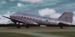
This folder contains a repaint for version 3.14 of the Douglas C-47 by Manfred Jahn and colleagues in the colors of C-47B 79001 of the Swedish Air Force that was at the start of the Catalina affair (Swedish: Catalinaaffären), a military confrontation and Cold War-era diplomatic crisis in June 1952, in which Soviet fighter jets shot down two Swedish aircraft over international waters in the Baltic Sea. The first aircraft to be shot down was an unarmed Swedish Air Force Tp 79, a derivative of the Douglas DC-3, carrying out radio and radar signals intelligence-gathering for the National Defence Radio Establishment. None of the crew of eight was rescued. The second aircraft to be shot down was a Swedish Air Force Tp 47, a Catalina flying boat, involved in the search and rescue operation for the missing DC-3. The Catalina's crew of five was saved. The Soviet Union publicly denied involvement until its dissolution in 1991. The aircraft was manufactured in 1943 with original US serial number 42-5694, and was delivered to USAAF 15th Troop Carrier Squadron (61st Troop Carrier Group). It saw action in northern Africa before being stationed at RAF Barkston Heath. On June 13, 1952, it disappeared east of the isle of Gotska Sandön while carrying out signals intelligence-gathering operations for the Swedish National Defence Radio Establishment. Both aircraft were located in 2003, and the DC-3 was salvaged, and the wreckage is currently on display in the Swedish Air Force Museum near Linköping. Repaint by Jan Kees Blom for Manfred Jahn's C-47 version 3.14, based on the paintkit by Gman5250.
| Filename: | Douglas_C47_79001_Swedish_Air_Force.zip |
| License: | Freeware |
| Added: | 17th August 2018, 16:34:03 |
| Downloads: | 238 |
| Author: | Jan Kees Blom |
| Size: | 11.55 MB |


© 2001-2026 AVSIM Online
All Rights Reserved
Privacy Policy |