
Where Flight Simulation Enthusiasts Gather from Around the World!
AVSIM Library - Search Results

| Category: Flight Simulator 2004 - Scenery | |
| Lake Hood LHD and Z41 in Anchorage Alaska UPDATED |

|
Images related to this file:
File Description:
This is an updated version that is complete in itself and which greatly upgrades Lake Hood Airstrip Z41 and also makes minor modifications to LHD. Lake Hood is right next door and to the north of Ted Stevens Anchorage International Airport, and there is a second airfield on the north side of the lake called Lake Hood Airstrip. The airstrip is coded Z41, the International is PANC, and Lake Hood itself is LHD. You will need Ultimate Terrain Alaska Canada for this to work, and you should also download and install Anchorage International (verson 4?) by William Morgan of FRFStudio. LHD/Z41 includes a fair proportion of the 780 float planes that are based there and which make Lake Hood the largest and busiest float plane base in the world, averaging 190 flights per day during the year and a lot more than that per day during the summer months. There is fuel at two places on the lake, and a lot of maintenance help available. The documentation showing the VFR routes to Lake Hood is also included in the Lake Hood VFR procedures folder, and basically, if you listen to the ATC chatter, planes either route via the Ball Park or the Gravel Pit, which gets abbreviated to something like "You want the park or the gravel?" which wouldn't mean a whole lot to an unrehearsed stranger. Unfortunately FS doesn't reach that level of sophistication, but you can still take the right route. There is a google marked map showing the locations of the checkpoints.
| Filename: | Lake_Hood_LHD_and_Z41_in_Anchorage_Alaska_UPDATED.zip |
| License: | Freeware, limited distribution |
| Added: | 18th July 2010, 08:16:48 |
| Downloads: | 984 |
| Author: | Roger Wensley |
| Size: | 9.25 MB |
| Category: Flight Simulator X - Flight Plans | |
| SIDSTAR for KJFK John F Kennedy Intl, New York |
|
File Description:
SIDSTAR Procedure File for KJFK for Cycle 1204/1205 (05APR12-31MAY12) based on FAA National Data from National Flight Data Center, issued every 56d (Two Navigraph Cycles). These procedures include the following enhancements: All procedures are included as-published by the FAA and they are expanded to replace VECTORS with realistic route segments for use in a non-ATC environment (ie not using VATSIM or other service). All STARs include routing from the arrival to the final approach fix of the approach and all SIDs are expanded to include routing from the runway to the departure gate, except where noted in the file header. Each procedure file includes a text header that provides information on all the procedures for that location.
The KJFK procedure file includes all published SIDs plus routes to often filed departure gates such as BAYYS, BERGH, COATE, CUTOX DIXIE GAYEL LINND NEION and RBV. All published STARs are included and routes are provided to all ILS as well as GPS13L and Visual 22L. All published approaches are provided including two Charted Visual Approaches BELMONT VIS22L and PARKWAY VIS13L/R.
For PMDG 737NG/737NGX/747-400/747-400X/MD-11FS9/MD-11FSX/BAeJS41
| Filename: | SIDSTAR_for_KJFK_John_F_Kennedy_Intl_New_York.zip |
| License: | Freeware |
| Added: | 21st April 2012, 22:21:49 |
| Downloads: | 351 |
| Author: | Dan Downs |
| Size: | 14.09 KB |
| Category: Flight Simulator 2004 - AFCAD Files | |
| CYZD |
|
File Description:
Downsview Airport or Toronto/Downsview Airport, (IATA: YZD, ICAO: CYZD), is located in Toronto, Ontario and has been exclusively used and owned as a testing facility by Bombardier Aerospace since 1994. Downsview Airport has its own fire service (Bombardier Emergency Services) which covers airport operations (using two airport fire rescue vehicles) and plant operations (using two SUV emergency vehicles). Bombardier Emergency Services employs robust employees who are trained as fire fighters, paramedics, and as peace officers (despite being a private airport, its security force is sworn in as Peace Officers per Canadian Airport Standards as well as being sworn fire fighters under the authority of the Ontario Fire Marshall).
The Downsview Airport was developed in 1939 as an airfield next to an aircraft manufacturing plant operated by de Havilland Canada. In 1947, the Department of National Defence purchased property surrounding the airfield and expanded it, creating RCAF Station Downsview to provide an air base for Royal Canadian Air Force units. The base was renamed Canadian Forces Base Toronto (Downsview) in 1968 and retained this name until its closure in 1994.
Since 1998, the property has been administered by a civilian Crown corporation Parc Downsview Park, which co-manages the airfield with Bombardier Aerospace (the successor to de Havilland Canada). In recent years the property has been undergoing various landscape usage plans and some redevelopment has taken place.
The airfield was used in recent years to host the 1984 and 2002 Papal visits by Pope John Paul II, as well as to host the 2003 SARS concert headlined by the Rolling Stones.
The airfield has also served as a test site for several famous aircraft produced by de Havilland, including the Beaver, the Twin Otter, and the Dash 8. The airport is available to pilots only with prior permission.
Discription By Wikipedia.
| Filename: | CYZD.zip |
| License: | Freeware, limited distribution |
| Added: | 30th May 2007, 01:11:04 |
| Downloads: | 812 |
| Author: | Max Udaskin |
| Size: | 346.78 KB |
| Category: Flight Simulator 2004 - Scenery | |
| MNPC Puerto Cabezas, Nicaragua |
|
Images related to this file:
File Description:
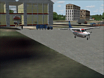
Googly scenery for MNPC Puerto Cabezas - a small international
airport in Nicaragua for which no facilities are provided in Microsoft Flight
Simulator 2004. These scenery files create the airport and add taxiways, aprons,
buildings and other airport features, so that you and your "AI" traffic can land,
taxi, park and take off in a realistic manner.
The airport, with its new Rigoberto Cabezas terminal opened in 2000, serves the
city of Puerto Cabezas and is surrounded by beautiful beaches and lush scenery.
Unfortunately, the country of Nicaragua has been embroiled in civil unrest almost
continuously since it became an independent republic in 1838, most of which is funded and fuelled by other countries seeking to interfere with Nicaragua's politics. For this reason, the country has no national airline or international flights of its own - the major powers refuse to accept its currency - and commercial traffic is confined to local flights operated by small craft from adjoining countries like those of Atlantic Airlines de Honduras and TACA Regional.
Fortunately, in Flight Simulator you do not need to worry about world politics
and you will be assured of a "virtual" welcome when you call in here. Please
say a small prayer for world peace when you do.
The scenery does not purport to be ultra-accurate. Based on high-detail satellite
imagery from Google Earth, the layout is proportionally correct but the added
airport features, such as buildings, are built from default Microsoft objects
and add-on libraries so will not look exactly like the real thing.
You are not obliged to download and install any additional scenery libraries,
but to enjoy this scenery in its entirety, you may wish to. It will work fine,
with or without. [File re-uploaded at request of AVSIM]
| Filename: | MNPC_Puerto_Cabezas_Nicaragua.zip |
| License: | Freeware |
| Added: | 28th May 2010, 20:36:10 |
| Downloads: | 1,150 |
| Author: | John Hinson |
| Size: | 67.63 KB |
| Category: Flight Simulator 2004 - AFCAD Files | |
| A&F Data For South Australia airfields v2 |
|
Images related to this file:
File Description:
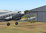
This set of 76 AFCAD2 files are for use with the free add-on scenery from Roger Leupold (fs9sav1.zip) are not suitable for the default FS2004 airfields. They will allow the scenery (designed for FS2002) to become more useable in FS2004. They will allow you to plan routes, and take off and land at some 76 airfields featuring in the scenery, with ATC routing you appropriately.
AI aircraft can now land, taxi, park and take off in the correct locations, and you can introduce your own AI traffic, too, if you wish. Every aifield has at least one parking space (even the tiniest airstips) but airfields featuring hangers and other scenery have more.
[File re-uploaded at request of AVSIM]
| Filename: | AF_Data_For_South_Australia_airfields_v2.zip |
| License: | Freeware |
| Added: | 13th May 2010, 09:58:39 |
| Downloads: | 914 |
| Author: | John Hinson |
| Size: | 84.15 KB |
| Category: Flight Simulator X - AFCAD Files | |
| Emmanuel Airport (04NJ), NJ |
|
File Description:
Located 03 miles W of Elmer, New Jersey, Emmanuel Airport is a privately-owned turf airstrip. This scenery properly aligns the turf strip and adds surrounding trees and houses. You can park in the open hangar by the house on the west end of the airport. Trees are summer ONLY.
Scenery constructed with use of satellite images/streetview, the author has not been there in person.
This scenery is meant to be used in conjunction with MegaScenery Earth New Jersey/Delaware 004. It is not required, but apron use is minimized to allow satellite scenery to show through as much as possible, and objects are placed based on the MSE textures - lack of it may make scenery look out of place.
| Filename: | Emmanuel_Airport_04NJ_NJ.zip |
| License: | Freeware |
| Added: | 21st October 2010, 23:23:23 |
| Downloads: | 169 |
| Author: | Drew Sikora |
| Size: | 321.87 KB |
| Category: Flight Simulator X - Scenery | |
| RAF Atcham |
|
File Description:
Royal Air Force Atcham or more simply RAF Atcham is a former Royal Air Force station located 5.0 miles (8.0 km) east of Shrewsbury, Shropshire, England, on the north eastern boundary of Attingham Park.
Initially built for RAF Fighter Command, during the Second World War its primary use was by the United States Army Air Forces (USAAF) Eighth Air Force. It was mainly the home of the 495th Fighter Training Group, where pilots were trained to fly Republic P-47 Thunderbolts although a few also were trained to fly twin-engined Lockheed P-38 Lightnings for both Eighth and Ninth Air Force units. Atcham continued to see use as a training base until it was returned to the RAF in March 1945.
Source:Wikipedia
| Filename: | RAF_Atcham.zip |
| License: | Freeware |
| Added: | 7th February 2017, 21:22:53 |
| Downloads: | 139 |
| Author: | Terry Boissel |
| Size: | 82.57 MB |
| Category: Fly! II - TerraModels | |
| NY Metro GA Airports v2 |
|
File Description:
This is a collection of 19 general aviation airports from the NY sectional chart. It is a consolidation of 2 previous airport packs called ScottsNY1 and ScottsNY2. This consolidation now uses an scf coverage map for the whole area.
This pod contains: TEB (Teterboro, NJ), MMU (Morristown, NJ), CDW (Caldwell, NJ), 4N1 (Greenwood Lake, NJ), N07 (Lincoln Park, NJ), HPN (White Plains, NY), POU (Poughkeepsie, NY), SWF (Stewart INTL, NY), MSV (Sullivan County, NY), ALB (Albany, NY), SCH (Schenectady, NY), BDR (Bridgeport, CT), HVN (New Haven, CT), GON (Groton, CT), BDL (Hartford Bradlee, CT), HFD (Hartford Brainard, CT), DXR (Danbury, CT), OXC (Oxford/Waterbury, CT), MMK (Meriden, CT). Requires my NY Metro SHARED.pod, A Terramodels pod (TM21_128.pod or TM21_256.pod), and Biber's AllModels (BiberAll.pod).
| Filename: | NY_Metro_GA_Airports_v2.zip |
| License: | Freeware, limited distribution |
| Added: | 12th September 2002, 01:21:25 |
| Downloads: | 543 |
| Author: | Scott Cannizzaro |
| Size: | 3.19 MB |
| Category: Flight Simulator 2004 - Scenery | |
| KPCW Keller, Port Clinton, Ohio |
|
File Description:
Keller Field in Port Clinton Ohio is another feild that needs some more GA aircraft using it. this is not an acruate represntation but just a descent way to add some traffic. This scenery includes some RWY12 objects, while not required it looks alitte better with some hangers you can park you plane in. I have included an Afcad, Traffic file (adds a C208B making rounds at local fields), and the traffic text files for you to add your own planes to this field. Rwy 12 and all three scenery libraries needed to see the objects,also afcad and traffic tools are needed to adjust the traffic and parking to your personal taste. Look in the zip dive for images.
| Filename: | KPCW_Keller_Port_Clinton_Ohio.zip |
| License: | Freeware, limited distribution |
| Added: | 28th January 2006, 04:26:31 |
| Downloads: | 492 |
| Author: | Steve Juliano |
| Size: | 1.57 MB |
| Category: Flight Simulator 2004 - Scenery | |
| The Borg Attack |
|
File Description:
The Borg the baddest of the evil aliens from many Star Trek episodes and films have invaded the world of FS9.
A fleet of massive ships are laying waste to Sydney, ships
so large you can land and park 100 Boeing 777's in each.
The special effects cause explosions as you fly through
these landable models that are larger than anything you have ever seen in Flight Sim, they look on screen like you are flying in a movie and provide a perfect backdrop for any of those space models you may have downloaded.
This scenery was produced by the VJPL at WestCoastATC.com for a special multiplayer session Saturday Sept 24
further info and screenshots at http://www.westcoastATC.com/events/hl3.shtml
| Filename: | The_Borg_Attack.zip |
| License: | Freeware |
| Added: | 22nd September 2005, 16:20:48 |
| Downloads: | 742 |
| Author: | Chuck Jodry - VJPL |
| Size: | 127.5 KB |


© 2001-2026 AVSIM Online
All Rights Reserved
Privacy Policy |