
Where Flight Simulation Enthusiasts Gather from Around the World!
AVSIM Library - Search Results

| Category: Flight Simulator 2004 - AI Aircraft | |
| Cassutt Sport and Racer |

|
File Description:
Something a little more "hot and bothered" than my recent microlight uploads, these shiny little aircraft can be used to liven up the ai traffic at your local airfield. Two low polygon-count models, the Racer having a narrower wing-span than the Sport, but otherwise more or less identical, each model includes three LOD models and a reduced-detail shadow model, for improved visual performance. Also included is a basic repaint template, so you can re-colour the aircraft to your own taste should you wish.
| Filename: | Cassutt_Sport_and_Racer.zip |
| License: | Freeware, limited distribution |
| Added: | 26th June 2007, 20:39:52 |
| Downloads: | 362 |
| Author: | Chris Eve |
| Size: | 231.52 KB |
| Category: Flight Simulator 2004 - Aircraft Repaints, Textures and Modifications | |
| United Airlines Star Alliance Boeing 737-700 WL (N13720) |
|
Images related to this file:
File Description:
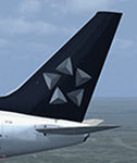
TDS Boeing 737-700(WL) United Airlines Star Alliance (N13720). United is a founding member of the Star Alliance network. The airline has a rich history in aviation, tracing its roots to 1926 when a small Swallow biplane owned by Walter T. Varney carried airmail to Nevada from Pasco, Washington - a flight that marked the true beginning of commercial air transportation and the birth of United Airlines. Model design by Hiroshi Igami. Flight dynamics design by Nick Wilkinson and David Biggar. Master textures by Kyle Schurb.
| Filename: | United_Airlines_Star_Alliance_Boeing_737700_WL_N13.zip |
| License: | Freeware, limited distribution |
| Added: | 20th May 2015, 14:48:14 |
| Downloads: | 355 |
| Author: | Danny Cummings |
| Size: | 7.33 MB |
| Category: Flight Simulator 2004 - Scenery | |
| Lutselk'e CYLK in the Northwest Territories, Canada |
|
Images related to this file:
File Description:
Lutselk'e is a village on the southern shore of the Great Slave Lake, at the eastern end and about 120 miles east of Yellowknife. The Hudson Bay trading company established a post there in 1925, and the current school opened in 1960. The population is in the region of 330. There is no road access, but the government runs a freight shipping service during the ice-free period of the Summer. The airfield is a mile or so east of the village, with a runway of around 3,500 feet of gravel aligned 08-26 with PAPI at both ends and lit, with lights atop traffic cones. There are scheduled flights from Yellowknife by Air Tindi, included in the AI, as is a once a week freight flight by Buffalo Airways. You will need to have downloaded and installed my runway and taxiway lighting library from recent posts. A note here about my scenery making. There will not be many more to follow this as I am almost at the end of the photos I either took or found for scenery purposes, plus I expect to move on from FS9 at some point during next year.
| Filename: | Lutselke_CYLK_in_the_Northwest_Territories_Canada.zip |
| License: | Freeware, limited distribution |
| Added: | 9th December 2019, 18:04:52 |
| Downloads: | 107 |
| Author: | Roger Wensley |
| Size: | 3.25 MB |
| Category: Flight Simulator X - Scenery | |
| NZWV - Waihi Beach Airfield, New Zealand |
|
Images related to this file:
File Description:
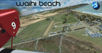
Waihi Beach (ICAO: NZWV) is a small airstrip north of Tauranga and near the small beach settlement of the same name, in the Bay of Plenty of New Zealand. It is a grass strip with offset thresholds giving usable landing lengths of 640m and 517m for RWY 13 and 31 respectively, a width of 55m and a group rating of 5. No night lighting or fuel is available. A very basic airstrip, there is only one recently built hanger and the airstrip is slowly being encroached on by
new housing developments. The airstrip itself is usually very sodden due to its low elevation but is a nice stop over for sightseeing from Tauranga and up the Coromandel peninsula.
The FSX model includes custom textures and models placed on a high resolution aerial image and a 15m mesh. It makes extensive use of items from the free VLC object libraries which are required to be installed (Available from www.vectorlandclass.co.nz Downloads menu). This scenery and
the VLC libraries have been funded by sales of VectorLandClass and although you do not need VLC to use it, your purchase helps further development.
| Filename: | NZWV__Waihi_Beach_Airfield_New_Zealand.zip |
| License: | Freeware, limited distribution |
| Added: | 1st November 2012, 10:01:38 |
| Downloads: | 1,006 |
| Author: | Tim Barnes / VectorLandClass |
| Size: | 11.13 MB |
| Category: Flight Simulator X - Utilities | |
| NpC - Numpad Control for FSX v2.2.1 |
|
File Description:
NpC v2.21 - some small changes from v2.2 including a script you can use to switch autopilot input from Nav to GPS and instructions on moving and re-sizing and re-positioning the NpC message window.
NumPad Control (NpC) is a program for entering Com, Nav and ADF radio frequencies, Transponder codes, VOR OBS/CRS settings, Auto-throttle airspeed, and Autopilot altitude, vertical speed, and heading values in FSX using the keyboard number-pad instead of mouse click spots. NpC is programmed primarily for aircraft with default FSX avionics (radios, transponders, and autopilots that were developed within standard FSX programming guidelines). However, this updated version of NpC also supports a number of third party add-on aircraft such as the PMDG 737NGX / B777, Flight1 King Air B200 and the A2A Cherokee 180. NpC is a set of Lua scripts and thus requires a registered copy of FSUIPC4 to work.
An installation and configuration manual is also included in the file set.
For a video that gives an overview of NpC function see: https://www.youtube.com/watch?v=P2p6CHxMOl8&list=PL_NnG_PN8zwnEI59uGxlhgp11rJQbQ_gJ&index=2
| Filename: | NpC__Numpad_Control_for_FSX_v221.zip |
| License: | Freeware |
| Added: | 4th December 2015, 20:03:34 |
| Downloads: | 698 |
| Author: | Al Klayton, Dan Sullivan |
| Size: | 801.63 KB |
| Category: Flight Simulator 2004 - Scenery | |
| Alaska South Slope 6; Shungnak SHG |
|
Images related to this file:
File Description:
There are four main northwestern Alaska towns which are serviced by Alaska Airlines, and from which local flights spread out. The northernmost is Barrow. Southwest of Barrow is Kotzebue, then Nome, and the furthest south is Bethel (not yet made). This is a continuation of the series for the flights from Kotzebue, 150 miles to the east where Shungnak is on the bank of the Kobuk River. The next addition will be a few miles further east, Kobuk and a strip just to the north of Kobuk. Shungnak is a small village, like Ambler, with a population of around 260 beside the Kobuk River, the river being the reason for the existance of the villages as it served (and still does) as both a source of food and a transport route. The airfield is just beside the village, with a runway around 4,000 feet of lit gravel and aligned 09-27, with PAPI on both ends. There are scheduled flights by Era (now renamed Ravn) and by Bering Air, both of them originating in Kotzebue and routing east to Ambler, Shungnak, Kobuk, and then back again. The AI includes these flights along with Everts Air and GA.
| Filename: | Alaska_South_Slope_6_Shungnak_SHG.zip |
| License: | Freeware, limited distribution |
| Added: | 12th October 2016, 23:18:32 |
| Downloads: | 210 |
| Author: | Roger Wensley |
| Size: | 1.99 MB |
| Category: Orbiter - Spaceships | |
| Stanford Torus Space Colony v1.0 |
|
File Description:
What will future space colonization realistically look like? What is it like to approach a rotating station almost 2km in diameter?
The Stanford Torus is based on a design created during a 10 week program in 1975 held at NASA’s Ames Research Center and Stanford University. The project participants considered how to create a practicable permanent colony in space using existing technology at minimum cost.
The habitat is over 1800m in diameter and spins at 1 rpm to provide 1g of pseudo-gravity.
Package includes a scenario to fly from the ISS up to a GEO rendez-vous with Stanford, as well as documentation on the station itself. I am looking for a texture artist to do the station justice, since my textures are pretty sad. Please contact me at [email protected] if you are interested.
INSTALLATION: You need Vinka's spacecraft.dll to use this add-on. A link is provided in the documentation.
1. Unzip files into your Orbiter directory, preserving the directory structure in the zipfile.
2. Load up the Stanford scenario in the Stanford directory in the Orbiter start window.
3. Enjoy the trip!
| Filename: | Stanford_Torus_Space_Colony_v10.zip |
| License: | Freeware |
| Added: | 25th January 2005, 16:07:13 |
| Downloads: | 438 |
| Author: | Steven Ouellette |
| Size: | 9.44 MB |
| Category: Orbiter - Spaceships | |
| Stanford Torus Space Colony v1.0 |
|
File Description:
What will future space colonization realistically look like? What is it like to approach a rotating station almost 2km in diameter?
The Stanford Torus is based on a design created during a 10 week program in 1975 held at NASA’s Ames Research Center and Stanford University. The project participants considered how to create a practicable permanent colony in space using existing technology at minimum cost.
The habitat is over 1800m in diameter and spins at 1 rpm to provide 1g of pseudo-gravity.
Package includes a scenario to fly from the ISS up to a GEO rendez-vous with Stanford, as well as documentation on the station itself. I am looking for a texture artist to do the station justice, since my textures are pretty sad. Please contact me at [email protected] if you are interested.
INSTALLATION: You need Vinka's spacecraft.dll to use this add-on. A link is provided in the documentation.
1. Unzip files into your Orbiter directory, preserving the directory structure in the zipfile.
2. Load up the Stanford scenario in the Stanford directory in the Orbiter start window.
3. Enjoy the trip!
| Filename: | Stanford_Torus_Space_Colony_v10.zip |
| License: | Freeware |
| Added: | 26th January 2005, 14:32:11 |
| Downloads: | 370 |
| Author: | Steven Ouellette |
| Size: | 2.07 MB |
| Category: Flight Simulator 2004 - Miscellaneous Files | |
| Air Ambulance Aviator for B200 |
|
File Description:
This is a spreadsheet that models a fictitious air ambulance company based in the North East of the USA. You are a Junior Captain who has started working for an air ambulance company called MedEvac Services. With a home base at Albany, NY, this company operates a single B200 to some 64 destination airfields in the North East of the USA. The company uses just one captain (you) and several co-pilots. All pilots earn salaries based on an hourly rate but only you get an additional profits-related bonus.
The spreadsheet will randomly create a variety of assignments at different times of day, with two- or three-leg operations involving patient transfers and organ transplant transits plus a host of operational and financial challenges thrown in. Your aim is to fulfil your assignments and fly your aircraft as well as possible in order to earn money and gain points. As your points increase, so will your rank, hourly rate and bonus percentage. Either you can see how quickly you can attain the most senior rank or see how much money you can earn in a set period of time. The challenge is up to you!
| Filename: | Air_Ambulance_Aviator_for_B200.zip |
| License: | Freeware |
| Added: | 16th January 2007, 17:17:28 |
| Downloads: | 413 |
| Author: | Owen Hanmer |
| Size: | 83.62 KB |
| Category: Flight Simulator 2004 - Utilities | |
| FS2004 - AI Flight Creator Version 1.7.5 |
|
File Description:
FS2004 - AI Flight Creator Version 1.7.5
AI Flight Creator is a utility designed to create AI FlightPlans for Microsoft's Flight Simulator FS2004. Built in support for Traffic Tools. The most difficult part of creating a new FlightPlan is to convert local time into GMT (UTC) to have the flights depart on time, both locally and internationally. AI Flight Creator allows you to select any Time Zone in the world, enter a local departure time and it will automatically convert the local time to GMT (UTC) time for your FlightPlan. Also supports Daylight Saving Time (DST). AI Flight Creator also has the ability to filter FlightPlans and display only the Departures or Arrivals for a selected Airport. It can randomly generate Aircraft Registration numbers with a user-defined prefix. Also provides support for Weekly departures and Touch and Go's. You'll need a copy of Lee Swordy's Traffic Tools to compile your new FlightPlans. Version 1.7.5 corrects a problem that can occur when loading flightplans. AI FlightPlan Creator is a companion utility to the AI FlightPlan Utilities package (AIFPE154.zip) available here at Flightsim. The previous version (1.7.4) had 1611 downloads.
Freeware - Dave Westbury
| Filename: | FS2004__AI_Flight_Creator_Version_175.zip |
| License: | Freeware, limited distribution |
| Added: | 19th October 2008, 19:33:56 |
| Downloads: | 6,021 |
| Author: | Dave Westbury |
| Size: | 1.77 MB |


© 2001-2026 AVSIM Online
All Rights Reserved
Privacy Policy |