
Where Flight Simulation Enthusiasts Gather from Around the World!
AVSIM Library - Search Results

| Category: Flight Simulator 2004 - Scenery | |
| Vadodara International Airport (VABO) |

|
Images related to this file:
File Description:
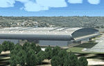
Vadodara International Airport (VABO) for FSX and FS2004.
Virtual aviation community stands basically on the grounds of what happens in the real world aviation and simulates the real thing, virtually. So that means they always have to be a step ahead and we follow. But my friend, we have a chance to make them follow us. Thats right! The proposed (final) integrated terminal at Vadodara shall have its construction commenced in mid of 2013 (the time can be altered, as real dudes define the situation). The design is finalized and here it is ..... the airport is basically " A basin kind".
Vadodara Airport or Civil Airport Harni (IATA: BDQ, ICAO: VABO) is a civilian airport located in the north-east of Vadodara, Gujarat, India in the suburb of Harni. A domestic airport until now, Vadodara Airport will become an international airport once the proposed new terminal is operational.
| Filename: | Vadodara_International_Airport_VABO.zip |
| License: | Freeware, limited distribution |
| Added: | 7th September 2010, 11:32:31 |
| Downloads: | 1,884 |
| Author: | Ashish Singh |
| Size: | 25.19 MB |
| Category: Flight Simulator 2004 - Flight Plans | |
| The flight of Frigate Bird II |
|
File Description:
By 1951 the final ocean to be traversed for air travel was the South Pacific between Australia and South America.
On 13 March 1951 Cpt. P.G. Taylor set off from the flying boat base at Rose Bay in Sydney with a crew of four. They made a shakedown flight to Grafton, NSW, landing on the Clarence River, and next morning headed east for South America. Stops were made at Noumea; Fiji; Samoa; Cook Islands; Tahiti; and Mangareva, French Oceania and then Easter Island before arriving in Valparaiso on 26th. March 1951.
The aircraft was subsequently presented to Captain Taylor by the then Prime Minister, Sir Robert Menzies, in recognition of the first air-crossing of the South Pacific Ocean and other pioneering flights.
| Filename: | The_flight_of_Frigate_Bird_II.zip |
| License: | Freeware |
| Added: | 12th January 2006, 14:44:25 |
| Downloads: | 605 |
| Author: | Bruce Kennewell |
| Size: | 497.41 KB |
| Category: Flight Simulator X - Aircraft Repaints, Textures and Modifications | |
| RAS2008 Spitfire PR.XIX Contra-Prop PS890 |
|
File Description:
A repaint of the RealAir Spitfire 2008 Contra-Prop MkXIV as a PR.XIX Spitfire A well-travelled aircraft, PS890 was originally delivered to RAF Benson in 1945. In 1954 it was transferred to the Royal Thai Air Force, then in 1962 was donated by King Bhumibel to the Air Museum at Claremont, California. During its rebuild its wings were clipped and it was fitted with a Shackleton engine with contra-rotating props, then flown by Planes of Fame in Chino. In 2005 it was sold to the French collector, Christophe Jacquard, who took it to Duxford to have the wing tips replaced. It is now based at Dijon-Darois, airport, France. Some say that the Spitfire XIX is "the most beautiful aircraft of them all".
| Filename: | RAS2008_Spitfire_PRXIX_ContraProp_PS890.zip |
| License: | Freeware |
| Added: | 10th May 2008, 16:51:43 |
| Downloads: | 852 |
| Author: | Grant MacLean |
| Size: | 6.83 MB |
| Category: Flight Simulator 2004 - Scenery | |
| Rangiroa 2004 |
|
File Description:
FS2004 Scenery TAHITI RANGIROA SCENERY Ver.3.0
These files improve specific scenerys (Rangiroa
Islands, Tahiti, French Polynesia) of FS2004.
Rangiroa located About 200 miles northeast of
Tahiti Island. Rangiroa is the largest atoll in
the Tuamotu Archipelago. The lagoon is very very
beautiful!!! I tried my best to make the model of
this beautiful Islands. Especially I invented
penetration processing of the beautiful
coastline of Rangiroa. This scenery including
Kia-Ora Village, Avatoru and Tiputa.
Included atolls: Rangiroa, Tikehau, Mataiva, Manihi and Ahe.
This scenery has a quite long visibility
(approximately 100Km) with using LVR( Long Visual
Range Tool ). You can look around the whole
Rangiroa atoll. Furthermore you can see Tikehau
islands from Rangiroa, and Mataiva islands from
Tikehau.
| Filename: | Rangiroa_2004.zip |
| License: | Freeware, limited distribution |
| Added: | 18th May 2004, 22:42:50 |
| Downloads: | 9,189 |
| Author: | Kazuo Kawamura |
| Size: | 20.58 MB |
| Category: Flight Simulator 2004 - Scenery | |
| South America Pack1 Soaring Scenery |
|
File Description:
FS2002/2004 South America Pack1 Soaring Scenery
This file add some thermals to default Microsoft scenery for South America Region:
1.Argentina:
.Aeroclube Dolores - Dolores City.
.Club Argentino de Planeadores Albatros - San Andrés de Giles City.
.Club de Planeadores Zárate - Zárate City.
.Buenos Aires - Ezeiza Airport(SAEZ)
2.Uruguai - Montevideo City(SUNU)
3.Paraguai - Assuncion City(SGAS)
4.Venezuela _ Caracas City(SVMP)
5.Bolivia - La Paz City(SLLP)
6.Peru - Lima City(SPIM)
7.Chile - Club de Planeadores de Santiago - Lo Castillo Airfield - Santiago City(SCEL)
8.Colombia - Bogotá City(SKBO)
9.British Guianne - Georgetown City(SYCJ)
10.Suriname - Paramaribo City(SMZO)
11.French Guianne - Cayenne City(SOCA)
12.Ecuador - Quito City(SEQU)
It is freeware.
By Francisco Vargas.
E-mail:[email protected]
| Filename: | South_America_Pack1_Soaring_Scenery.zip |
| License: | Freeware |
| Added: | 16th November 2005, 16:19:11 |
| Downloads: | 4,916 |
| Author: | Francisco Augusto Vargas Carneiro |
| Size: | 581.31 KB |
| Category: Flight Simulator X - Scenery | |
| Quebec city 2.0 |
|
Images related to this file:
File Description:

Quebec city version 2.00 for Flight Simulator X.
FSX Scenery--Quebec City 2.0, Canada. Quebec city (Ville de Quebec in French) is the capital of the Canadian province of Quebec. This highly detailed scenery include more than 135 custom buildings. Come and see what Quebec City looks likes with its major landmarks in your flight simulator. Many new FSX features have been used to build this great scenery like animations and custom special effects. Also, see the CYQB airport scenery by Gilles Boily then enjoy flying in Quebec City. By Jean St-Cyr, Gilles Boily, Gilles Gauthier and Jean-Pierre Fillion.
This is and update version of Quebec city fsx scenery. Keep the first version since it is intended for low-end computers.
Thanks
Jean St-Cyr
| Filename: | Quebec_city_20.zip |
| License: | Freeware, limited distribution |
| Added: | 31st October 2009, 00:17:10 |
| Downloads: | 12,898 |
| Author: | Jean St-Cyr, Gilles Boily, Gilles Gauthier and Jean-Pierre Fillion |
| Size: | 65.2 MB |
| Category: Flight Simulator X - Aircraft Repaints, Textures and Modifications | |
| Supermarine Spitfire Mk.IX RR201 RCAF 411 Sqn DB-G |
|
Images related to this file:
File Description:
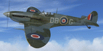
This folder contains a repaint for the Supermarine Spitfire Mk.IX by Real Air. It shows Spitfire IXc RR201 DB-G of RCAF 411 squadron based B88, near Heesch, the Netherlands. French Canadian ace Richard "Dick" Audet was serving with No. 411 "Grizzly Bear" Sq. when he opened his account in spectacular fashion on December 29, 1944, by downing five aircraft in quick succession during his first encounter with the enemy. In the month that followed, he gained several other victories before being killed on March 3, 1945, when his aircraft was hit by flak during a strafing mission. His score stood at ten claims at this time, including two Me-262's. Repaint by Jan Kees Blom, based on the paintkit by RealAir.
| Filename: | Supermarine_Spitfire_MkIX_RR201_RCAF_411_Sqn_DBG.zip |
| License: | Freeware |
| Added: | 10th July 2018, 17:40:47 |
| Downloads: | 91 |
| Author: | Jan Kees Blom |
| Size: | 3.14 MB |
| Category: Flight Simulator 2004 - AI Flight Plans | |
| Air Mediterranee AI Flightplans Summer 2010 |
|
Images related to this file:
File Description:

Air Mediterranee is a big french charter operator with aircraft based in Paris CDG, Lyon and Nantes.
Their own fleet operate a large number of flights mainly to the Mediterranean but also beyond. This schedule depicts with high accuracy
a peak period activity. I have included flights operated by EC-LHL as the aircraft was operating during the entire period on behalf of Air Mediterranee.
More flights were operated during this period for which the airline wet leased various aircraft from other operators. As those leases were punctual, I have not included them in my schedule.
Additionaly, Air Mediterranee's aircraft seem to be operating some flights to Corsica on behalf of CCM Airlines. Those flights are included in the flightplan.
| Filename: | Air_Mediterranee_AI_Flightplans_Summer_2010.zip |
| License: | Freeware |
| Added: | 22nd August 2010, 16:19:37 |
| Downloads: | 527 |
| Author: | Dimitri Tousmanof |
| Size: | 55.17 KB |
| Category: Flight Simulator 2004 - Miscellaneous Files | |
| Tutoriel pour PMDG B736/737/738 and 739 en français / Tutorial for PMDG B736/737/738 and 739 in French |
|
File Description:
PMDG 737-700 Full pack version (3 documents)
You'll discover how to fly this complex addon
from a cold and dark cockpit at LFPG to a
cold and dark cockpit at LFRB. There is two
"end" in order to understand how to use it
with ATC or FMC guidance. This document is
regularily released. Due to this,it's offered
from download directly on mypersonal page and
not from this server.Proceeding this way, I
can ensure an acurrate update process.
available in French at http://drk.free.fr.
(Ce pack complet de 3 documents ultra détaillés vous permettra de profiter pleinement de cet addon complexe en partant d'un cockpit froid à LFPG jusuq'à ce même cockpit froid à LFRB. Deux arrivées (gudage FLC / guidage ATC) sont prévues ainsi que l'utilisation du mode FLARE. Disponible en téléchargement http://drk.free.fr)
| Filename: | Tutoriel_pour_PMDG_B736737738_and_739__en_franais_.zip |
| License: | Freeware, limited distribution |
| Added: | 18th October 2005, 17:31:30 |
| Downloads: | 1,209 |
| Author: | Jean-Michel MABILLE |
| Size: | 56.65 KB |
| Category: Flight Simulator X - Aircraft Repaints, Textures and Modifications | |
| Centurion Cargo "Frank Fine" McDonnell-Douglas MD-11F (N985AR) |
|
Images related to this file:
File Description:
Centurion Cargo is a privately owned company founded in 2001. Based at
Miami International Airport, it currently operates a fleet of ten MD-11F,
and has an impressive 550,000 square foot warehouse, divided into two
different sections, a 159,000 square foot cooler and 391,000 square foot
Dry Cargo Area. The Centurion Cargo Center is by far the largest privately
owned all cargo airline facility in North America.
Centurion is one of the leading cargo airlines operating to and from
Latin America and is No. 1 in the handling of live animals and perishable
goods. Centurion has recently expanded its network to include 4 weekly flights
from Amsterdam, The Netherlands. We also offer worldwide charter, handling, and
security services among others.
FSX McDonnell-Douglas MD-11F repaint textures for the real world
Centurion Cargo N985AR "Frank Fine", but with the freeware version's Pratt and
Whitney engines. She is named after the late Miami aviation pioneer Frank Fine,
who started in aviation as Agro Air Associates and later lead both Fine Air
and Arrow Air. For the freeware SMS Overland MD-11 with P&W 4460 engines, which
you must have previously installed in FSX. I installed the freeware
(SMS-MD-11_Dutch_Package.zip) with VC which works well with this repaint.
Also includes engine exhaust smoke coordinates which you can add to
your "aircraft.cfg" if you wish. Screenshots enclosed. Easy installation.
Repaint by Tom Tiedman.
| Filename: | Centurion_Cargo_Frank_Fine_McDonnellDouglas_MD11F_.zip |
| License: | Freeware |
| Added: | 20th July 2013, 07:19:42 |
| Downloads: | 254 |
| Author: | Tom Tiedman / SMS Overland |
| Size: | 8.28 MB |


© 2001-2026 AVSIM Online
All Rights Reserved
Privacy Policy |