
Where Flight Simulation Enthusiasts Gather from Around the World!
AVSIM Library - Search Results

| Category: Flight Simulator 2004 - Scenery | |
| Prudhoe Bay area on Alaska North Slope US |

|
Images related to this file:
File Description:
The Prudhoe Bay area of the Alaska north slope is dominated by all the equipment and machinery that is necessary for the extraction of oil and its transfer by the pipeline that reaches south to Valdez. Prudhoe Bay airport is now closed, and its replacement just to the south is Deadhorse PASC, with numerous storage, maintenance, and accomodation areas immediately to the north of the apron, and others adjacent to the road between the two. The runway is just under 6,500 feet with approach lights at both ends and ILS on 04 (true heading of 75 degrees). This scenery reflects the overall situation in 2011 and oil production facilities and buildings are included here. The airport buildings and those close to the airport are replicas of the real life buildings; while as distance increases the accuracy fades somewhat there are everywhere replica trucks and cross country vehicles that are true to life. Deadhorse handles around 7,000 passengers per month as staff are rotated in and out on Alaska Air and ERA flights and by oil company private flights. There are also freight flights to complement the trucking effort up the Dalton Highway. The Alaska Airlines terminal building and ERA (the red buildings nearby) are at one end of the apron, while at the other end is a very large and new green terminal, storage, hangar building built by the airport authority. All of the airport components, runways, taxiways, and aprons, are built up on a gravel base to raise them above the surrounding terrain that floods with melting snow, freezes, or dries out, according to the seasons. There are other new airstrips included here that serve the oil industry. Around 33 miles to the east is Badami PABP airport servicing a subsiduary oil producing area, with 5,000 feet of gravel runway. Some 28 miles to the west of Deadhorse is Ugnu-Kuparuk UBW with just over 6,000 feet of gravel (gravel in 2011, it is now asphalted) servicing oil production by Conoco Phillips, which uses 737's to fly staff in and out. A further 32 miles west is Alpine AK15 with 5,400 feet of gravel and also served by the Conoco Phillips 737's. To the south of Alpine and connected by road is the village of Nuiqsut. To the north of Alpine and reachable only by air in the delta of the Sagavanirktok River is CD-3, an oil collection and pump station area with another gravel runway of 3,000 feet. Other airstrips that were prviously posted are now updated, Nuiqsut and Oliktok. I experimented, but decided against trying to reproduce the several hundred miles of pipelines. The are new AI aircraft, and there are notes regarding downloading. There is a new "cement" texture (not its name, but used as that by SBuilder) for the built up gravel bases. It is slightly darker than the original but not so much that any previous use will be spoilt. You may wish to download my "Alaska Frozen Rivers and Lakes" which freezes lakes and the northern sea and makes them landable on wheels.
| Filename: | Prudhoe_Bay_area_on_Alaska_North_Slope_US.zip |
| License: | Freeware, limited distribution |
| Added: | 19th December 2017, 00:38:06 |
| Downloads: | 586 |
| Author: | Roger Wensley |
| Size: | 28.54 MB |
| Category: Flight Simulator 2004 - Scenery | |
| US North Cascades Mountains and Northwest Washington Coast |
|
File Description:
The files in this package completely replace the FS default landscape of the North Cascades Mountains and coastal areas of northwestern Washington State. Between Bellingham and Arlington (N-S), Orcas Island and Lake Chelan (W-E) you can now enjoy your VFR flights with accurate locations of coastlines, lakes, rivers, streams, roads, railroads, and power lines, as well as land use type (landclass) and terrain (add-on mesh). Also added are the larger glaciers of the majestic North Cascades volcanoes and peaks as well as several forestry roads and clearcuts outside the National Park and Wilderness areas. Made mostly with Christian Fumey's "Ground2K4" and Jim Keir's "Slartibartfast". Fully compatible with the recent freeware LOD10 add-on meshes of the western US. Mesh and landclass files will work in FS2002 but not the special scenery enhancements.
| Filename: | US_North_Cascades_Mountains_and_Northwest_Washingt.zip |
| License: | Freeware, limited distribution |
| Added: | 18th May 2004, 23:12:57 |
| Downloads: | 14,320 |
| Author: | Holger Sandmann |
| Size: | 12.72 MB |
| Category: Flight Simulator X - Scenery | |
| AI Ship Traffic for US East Coast V1 |
|
Images related to this file:
File Description:
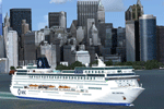
This package contains AI ship traffic files for the US East Coast to be used with my packages "63 AI Ships and AI Ship Traffic for Europe and South America" and "75 AI Ships and AI Ship Traffic". With the three packages installed you will have a total of 138 ships travelling along the US East Coast from Fort Lauderdale to the Gulf of St. Lawrence.
The ships visit among other places Fort Lauderdale, Freeport, Jacksonville, Savannah, Charleston, Wilmington, Norfolk, Baltimore, Philadelphia, New York, Boston, Portland, Providence, Halifax, Saint Pierre et Miquelon and more.
To make this package work you must first download and install in this sequence:
"63 AI Ships and AI Ship Traffic for Europe and South America",
"75 AI Ships and AI Ship Traffic", and
"Patch for 75 AI Ships and AI Ship Traffic" (If you install this patch you do not need the "Patch for 63 AI Ships and AI Ship Traffic")
This package has been developed with contributions from among others Jean-Pierre Fillion, Didier "Lagaffe" Puentes and "Robystar". I would like to thank these three as well as everybody who have encouraged and supported the project or participated in the beta testing.
| Filename: | AI_Ship_Traffic_for_US_East_Coast_V1.zip |
| License: | Freeware |
| Added: | 1st September 2013, 08:47:12 |
| Downloads: | 8,381 |
| Author: | Henrik Nielsen |
| Size: | 1.08 MB |
| Category: Navigation and ATC - Navigation | |
| US IFR/VFR Low Altitude Planning Chart, East |
|
File Description:
This is a scan of the East side of the US Government IFR/VFR Low Altitude Planning Chart, 13th Edition, effective 8 JUN 2006.
| Filename: | US_IFRVFR_Low_Altitude_Planning_Chart_East.zip |
| License: | Freeware |
| Added: | 4th March 2007, 20:46:32 |
| Downloads: | 904 |
| Author: | Wayne Conrad |
| Size: | 28.72 MB |
| Category: Navigation and ATC - Navigation | |
| US IFR/VFR Low Altitude Planning Chart, West |
|
File Description:
This is a scan of the West side of the US Government IFR/VFR Low Altitude Planning Chart, 13th Edition, effective 8 JUN 2006.
| Filename: | US_IFRVFR_Low_Altitude_Planning_Chart_West.zip |
| License: | Freeware |
| Added: | 4th March 2007, 20:43:15 |
| Downloads: | 744 |
| Author: | Wayne Conrad |
| Size: | 24.38 MB |
| Category: Navigation and ATC - Navigation | |
| Flight Manager charts for Ten Major US Airports |
|
File Description:
Flight Manager charts for ten major US
airports. Contains 230 SID, STAR and Approach
charts for KATL, KBOS, KDEN, KJFK, KLAS,
KLAX, KMIA, KORD, KSEA and KSFO, plus 100
enroute charts and flightplans linking each
of these airports with all the others.
Utilizes all real world procedures. Includes
files to enable dual runway use at all these
airports.Requires Flight Manager.
| Filename: | Flight_Manager_charts_for_Ten_Major_US_Airports.zip |
| License: | Freeware, limited distribution |
| Added: | 4th September 2002, 19:48:52 |
| Downloads: | 1,294 |
| Author: | Björn Hall |
| Size: | 3.82 MB |
| Category: Flight Simulator X - Aircraft Repaints, Textures and Modifications | |
| US Air National Guard (New York) LC-130 |
|
File Description:
This repaint depicts an US Air National Guard (New York) LC-130. It is 100% ACE compliant and requires Captain Sims payware "C-130 X-perience, Extra Pack II. Any comments welcome via my email address.
| Filename: | US_Air_National_Guard_New_York_LC130.zip |
| License: | Freeware |
| Added: | 8th July 2008, 23:44:13 |
| Downloads: | 1,100 |
| Author: | David (Dax) Sweetman & Captain Sim |
| Size: | 2.35 MB |
| Category: Prepar3D V1-4 - Aircraft Repaints, Textures and Modifications | |
| US Navy North American T-6 Texan (N6360G) |
|
Images related to this file:
File Description:

FSX/P3D A2A T6 Texan NAVY N6360G/27637/NK59 (cn88-13132).
This is a repaint for the payware A2A Simulations AT-6 Texan. This repaint depicts the restored SNJ-4 N6360G.
This beautiful plane that was built through the efforts of Dave Vandenberg and a team of incredibly skilled craftsmen is up for sale!
Repaint by Martial FERON.
| Filename: | US_Navy_North_American_T6_Texan_N6360G.zip |
| License: | Freeware |
| Added: | 11th April 2016, 16:13:46 |
| Downloads: | 293 |
| Author: | Martial FERON |
| Size: | 18.01 MB |
| Category: Flight Simulator 2004 - Aircraft Repaints, Textures and Modifications | |
| Blue Smoke Flying Club Cessna Grand Caravan |
|
File Description:
This is a repaint for Microsoft Flight Simulator 2004's Cessna Grand Caravan in the Blue Smoke Flying Club Livery. We do group flights together flying though scenery online. Come and join us!
| Filename: | Blue_Smoke_Flying_Club_Cessna_Grand_Caravan.zip |
| License: | Freeware |
| Added: | 6th December 2005, 02:47:39 |
| Downloads: | 380 |
| Author: | Andrew Underwood and Andrew Nott |
| Size: | 910.98 KB |
| Category: Flight Simulator 2004 - Aircraft Repaints, Textures and Modifications | |
| USair Boeing 737-300 Old Colors Full Package |
|
File Description:
FS2004 USair B737-300 Old Colors Full Package.
Repaint of the FFX Boeing 737-300 in
the old colors of US Air.This package includes
the complete aircraft using default sound and
panel files.
| Filename: | USair_Boeing_737300_Old_Colors_Full_Package.zip |
| License: | Freeware |
| Added: | 14th March 2004, 01:22:17 |
| Downloads: | 1,675 |
| Author: | Paint By Gary D.Jones / Model By Erick Cantu/FFX |
| Size: | 2.12 MB |


© 2001-2026 AVSIM Online
All Rights Reserved
Privacy Policy |