
Where Flight Simulation Enthusiasts Gather from Around the World!
AVSIM Library - Search Results

| Category: Flight Simulator 2004 - Aircraft Repaints, Textures and Modifications | |
| Lockheed Constellation - package of 5 textures sets |

|
Images related to this file:
File Description:
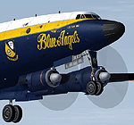
Re-uploaded textures sets for the Alphasim Constellation, this first pack of repaints include 2 Blue Angels colors,
the "Breitling" Super Constellation colors, a fictionnal Aero Union Water Bomber and the Connie of the Historical Aircraft Restoration Society ( see www.hars.org.au )
| Filename: | Lockheed_Constellation__package_of_5_textures_sets.zip |
| License: | Freeware |
| Added: | 11th May 2010, 04:19:10 |
| Downloads: | 2,207 |
| Author: | Repaints by pierre lheureux - Plane by Alphasim |
| Size: | 19.12 MB |
| Category: Flight Simulator X - Utilities | |
| EnbSeries Mod File |
|
Images related to this file:
File Description:
This is my rendition of the popular EnbSeries mod. This file will make subtle enhancements to the way FSX appears. Instructions and comparison screen shots are all included.
As a bonus I have included a modified water constants .xml as well.
| Filename: | EnbSeries_Mod_File.zip |
| License: | Freeware |
| Added: | 20th May 2013, 05:34:44 |
| Downloads: | 2,037 |
| Author: | Bill Honcoop |
| Size: | 3.17 MB |
| Category: Flight Simulator X - Aircraft Repaints, Textures and Modifications | |
| Marianas Martin JRM-3 Mars |
|
Images related to this file:
File Description:
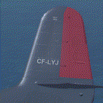
Original Payware Martin Mars required from Virtavia (previously known as Alphasim). This is a snapshot in time of the Marianas Mars during its conversion into a water bomber. Included are two DDS DXT5 versions: One WITHOUT mipmaps and one WITH mipmaps.
| Filename: | Marianas_Martin_JRM3_Mars.zip |
| License: | Freeware |
| Added: | 24th February 2014, 23:49:56 |
| Downloads: | 150 |
| Author: | Tommy Mitomi |
| Size: | 3.15 MB |
| Category: Flight Simulator X - Scenery | |
| Dalmatia coastline revamp |
|
File Description:
Detailed coastline for the southern part of the Dalmatia region of the Adriatic sea. This means islands actually look like islands and not a mess of rectangles. The improved area spans around 4300 km2, though a lot of it is water.
| Filename: | Dalmatia_coastline_revamp.zip |
| License: | Freeware |
| Added: | 11th December 2014, 12:45:23 |
| Downloads: | 271 |
| Author: | Timotej Zuntar |
| Size: | 109.14 KB |
| Category: Fly! II - TerraScene | |
| Maysville (Ohio Project) TerraScene Project Pack |
|
File Description:
This is a TerraScene 2.1 Project pack for southern Ohio and portions of northern Kentucky. It covers all of global tile 196,157 with Maysville, KY in the center. Above the Ohio River, you will find a portion of southern Ohio, with rolling hills and small towns, extending from Portsmouth, OH in the east to just below Cincinnati in the west. This pack includes updated Tiger Census (2000) shapefile data, adding new water areas, new highways, and other details. All scenery data files are included: USGS data, shapefiles, and a complete water mask. Requires TerraScene 2.1 and Fly!II patched to v230 or later.
| Filename: | Maysville_Ohio_Project_TerraScene_Project_Pack.zip |
| License: | Freeware |
| Added: | 4th May 2003, 14:51:31 |
| Downloads: | 174 |
| Author: | Randall Rocke |
| Size: | 61.6 MB |
| Category: Fly! II - TerraScene | |
| Van Wert (Ohio Project) TerraScene Project Pack |
|
File Description:
This is a TerraScene 2.1 Project pack for a narrow piece of NW Ohio and a portion of NE Indiana. It covers all of global tile 195,159 with Van Wert, Ohio situated in the eastern portion. To the west is the city of Fort Wayne, IN - to the SW are Muncie and Anderson, IN. This pack includes updated Tiger Census (2000) shapefile data, adding new water areas, new highways, and other details. All scenery data files are included: USGS data, shapefiles, and a complete water mask. Requires TerraScene 2.1 and Fly!II patched to v230 or later.
| Filename: | Van_Wert_Ohio_Project_TerraScene_Project_Pack.zip |
| License: | Freeware |
| Added: | 11th May 2003, 02:18:46 |
| Downloads: | 144 |
| Author: | Randall Rocke |
| Size: | 27.7 MB |
| Category: Flight Simulator X - Scenery | |
| KDYT - Sky Harbor Airport - Duluth, MN |
|
File Description:
Here is an improved version of the stock Sky Harbor Airport. I adjusted and added aprons, and taxiways to more closely match real life. I replaced default buildings and added additional buildings. I added more AI parking, static vehicles, aircraft, lightpoles, fences and other filler objects. I added a ramp for amphibious planes and docks for seaplanes. There are both land and water runways here.
This is a really interesting airport, located on a sliver of land in Lake Superior. If you're not using
Ultimate Terrain X the objects going into the water may not be placed correctly.
| Filename: | KDYT__Sky_Harbor_Airport__Duluth_MN.zip |
| License: | Freeware |
| Added: | 20th April 2009, 23:11:20 |
| Downloads: | 1,350 |
| Author: | Jim Cook |
| Size: | 4.72 KB |
| Category: Fly! II - TerraScene | |
| Ashtabula (Ohio Project) TerraScene Project Pack |
|
File Description:
This is a TerraScene 2.1 Project pack for northeastern Ohio. It covers all of global tile 198,160 with Ashtabula in the NE. It extends from Cleveland/Cuyahoga in the NW to Youngstown in the SE and from Erie, PA in the NE to Ravenna in the SSW. The far eastern edge extends through Meadville, PA. This pack includes updated Tiger Census (2000) shapefile data, adding new water areas, new highways, and other details. All scenery data files are included: USGS data, shapefiles, and a complete water mask. Requires TerraScene 2.1 and Fly!II patched to v230 or later.
| Filename: | Ashtabula_Ohio_Project_TerraScene_Project_Pack.zip |
| License: | Freeware |
| Added: | 26th May 2010, 00:57:56 |
| Downloads: | 416 |
| Author: | Randall Rocke |
| Size: | 59.19 MB |
| Category: Fly! II - TerraScene | |
| Hilton Head (Carolinas Project) TerraScene Project Pack |
|
Images related to this file:
File Description:
Re-upload. This TerraScene 2.1 Project pack covers all of global tile 198,152, extending the coastline from Charleston to the northern portion of Savannah, GA. Along the coast you will find such beautiful areas as Pritchards Island, Beaufort, and the famous Hilton Head Island. To the north is Walterboro, SC. The Savannah area includes Savannah International Airport. This pack includes updated Tiger Census (2000) shapefile data, adding new water areas, new highways, and other details. All scenery data files are included: USGS data, shapefiles, and a complete custom water mask. Requires TerraScene 2.1 and Fly!II patched to v230 or later.
| Filename: | Hilton_Head_Carolinas_Project_TerraScene_Project_P.zip |
| License: | Freeware |
| Added: | 27th May 2010, 03:02:58 |
| Downloads: | 185 |
| Author: | Randall Rocke |
| Size: | 55.06 MB |
| Category: Fly! II - TerraScene | |
| Rocky Mount (Carolinas Project) TerraScene Project Pack |
|
Images related to this file:
File Description:
Re-upload. This TerraScene 2.1 Project pack covers all of global tile 200,155, adjoining Raleigh to the west and the Edenton area to the east. Rocky Mount is near the center, with Pitt-Greenville near the eastern border. The beautiful John H. Kerr Reservoir runs from Virginia down near Henderson, NC, continuing to the east to Roanoke Rapids Lake. This pack includes updated Tiger Census (2000) shapefile data, adding new water areas, new highways, and other details. All scenery data files are included: USGS data, shapefiles, and a complete water mask. Requires TerraScene 2.1 and Fly!II patched to v230 or later.
| Filename: | Rocky_Mount_Carolinas_Project_TerraScene_Project_P.zip |
| License: | Freeware |
| Added: | 13th June 2010, 01:58:01 |
| Downloads: | 157 |
| Author: | Randall Rocke |
| Size: | 70.19 MB |


© 2001-2026 AVSIM Online
All Rights Reserved
Privacy Policy |