
Where Flight Simulation Enthusiasts Gather from Around the World!
AVSIM Library - Search Results

| Category: Flight Simulator 2004 - Scenery | |
| VFR of Lario - Como lake, Italy |

|
Images related to this file:
File Description:
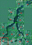
This is the first of the expected seventeen sceneries in the "VFR of Lario" project, that will include the full view of the Como Lake, made with photorealistic terrain (multiseason & night) and with 3D GMax realistic objects, including some motions. Further the Como seaplane airport, the project will include some other virtual ones, and all the piers of NLC (Navigation Lake Como). The project will be completed with a related AI seaplane traffic.
The "VFR of Lario" project REQUEST the installation of the scenery "Itcoast2.zip" & the related "ITAC2_P1.zip", both available for free download from different libraries.
Information: Como is the main and beautifull city on the namesake lake (called Lario), placed in the north of Italy, closed to the Helvetic border. It includes the AeroClub Como seaplanes international airport, with his own flight school. Como has the headseat of NLC, the fleet management for connection of forty Lario's piers. This first scenery covers approximately an area of 7.5x6 kmt.
Contents: airport water track with hangar and static seaplanes; breackwater and stadium lake front, war memorial monument, Volta's temple and lighthouse, main Cathedral, Social theater, city old towers and wall, villa Olmo, square Cavour's buildings, NLC main pier and some minor others, Como-Brunate's funicolar connection (animated), lake fountain, Tavernola shipyard, Baradello's castle, Valduce hospital; motor ships (animated), steamer, hydrofoils and other minor boats; several other buildings (GenericBuilding system), trees and lights widespread all over the scenery.
| Filename: | VFR_of_Lario__Como_lake_Italy.zip |
| License: | Freeware |
| Added: | 22nd December 2011, 23:30:47 |
| Downloads: | 3,550 |
| Author: | Aldo Della Vedova, Daniele Lanfranchi, Diego Caligiuri |
| Size: | 25.33 MB |
| Category: Flight Simulator 2004 - Scenery | |
| Maurice Bishop TGPY on Grenada in the Caribbean |
|
Images related to this file:
File Description:
Grenada island is 17 miles south of the southernmost island of the Grenadines, Carriacou; there are some smaller islands between the two. Grenada is 18 miles long and around 8 miles wide, has an estimated population of 110,000, and produces a very large part of the world's annual nutmeg harvest. The capital, St Georges, is by far the largest town and is at the southern end of the island, with the airport close by.
The airport is now called Maurice Bishop, but for some years was called Point Salines. The runway is just over 9,000 feet long and oriented 10/28. Point Salines replaced Pearl Airport, which is on the east coast 12 miles northeast of St Georges and was difficult to expand as the runway had mountains at one end and the sea at the other. Pearl is now closed; it is included here but only as a visual landmark with "closed" markings. There are regular international flights from North America and Europe, some of which are seasonal only (Air Canada for instance) and local connecting flights by LIAT and SVG. I retained the default control tower as it is some distance away. In real life it is also some distance away and on a hill northwest of the terminal. Which is why I did not take photos from which I would have made the real one. The hill does not feature in FS9.
| Filename: | Maurice_Bishop_TGPY_on_Grenada_in_the_Caribbean.zip |
| License: | Freeware, limited distribution |
| Added: | 11th June 2013, 23:28:17 |
| Downloads: | 825 |
| Author: | Roger Wensley |
| Size: | 7.38 MB |
| Category: Prepar3D V1-4 - AFCAD Files | |
| Taipei Taoyuan Airport, Taiwan (RCTP) |
|
Images related to this file:
File Description:
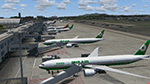
Updated AFCAD for PacSim's Taipei Taoyuan RCTP Scenery. Optimized gates with correct radius, and airline parking codes for each concourse. Default moving jetways placed at each gate.
| Filename: | Taipei_Taoyuan_Airport_Taiwan_RCTP.zip |
| License: | Freeware |
| Added: | 15th July 2017, 07:21:58 |
| Downloads: | 1,178 |
| Author: | PacSim, Kevin Boydston |
| Size: | 23.16 KB |
| Category: Prepar3D V1-4 - Scenery | |
| WTZL Airport Weeze v1.1 FIX |
|
File Description:
.
| Filename: | WTZL_Airport_Weeze_v11_FIX.zip |
| License: | Freeware, limited distribution |
| Added: | 2nd August 2017, 16:59:48 |
| Downloads: | 1,490 |
| Author: | Rouven Weitzel |
| Size: | 14.04 KB |
| Category: Prepar3D V1-4 - AFCAD Files | |
| ESNS Skelleftea Airport (AIRAC 1708) |
|
File Description:
Skelleftea 2017 for Prepar3D
Skelleftea is a small, regional airport in mid-northern Sweden. It has year-round service to Stockholm Arlanda via SAS and NAX, as well as seasonal service to Rhodes, Split, and Gran Canaria.
Airport is represented as it is in 1708 charts.
NOTE that the charts show a turning bay at the 10 side of the runway that is not there in real life.
| Filename: | ESNS_Skelleftea_Airport_AIRAC_1708.zip |
| License: | Freeware |
| Added: | 8th August 2017, 14:55:47 |
| Downloads: | 220 |
| Author: | Brady McCay |
| Size: | 4.95 KB |
| Category: Flight Simulator X - AFCAD Files | |
| P10 - Polacca Airport, Polacca, Arizona. |
|
File Description:
This is a redesign of P10 - Polacca Airport, Polacca, Arizona. Google Maps and Skyvector have been used to provide the correct (as physically possible within FSX and ADE) position, size and type of runway, aprons and buildings. The immediate surrounding scenery has been included. ADE used to compile the design.
| Filename: | P10__Polacca_Airport_Polacca_Arizona.zip |
| License: | Freeware |
| Added: | 11th December 2017, 20:27:05 |
| Downloads: | 152 |
| Author: | Matthew Ward |
| Size: | 146.7 KB |
| Category: Flight Simulator X - Scenery | |
| KSNS, Salinas Municipal Airport, California |
|
Images related to this file:
File Description:
Complete new ADE setup from top-down images as base. Salinas Municipal Airport is an important destination for business aviation on the California Central Coast and services general aviation.
| Filename: | KSNS_Salinas_Municipal_Airport_California.zip |
| License: | Freeware |
| Added: | 13th December 2017, 15:46:59 |
| Downloads: | 401 |
| Author: | Tim van Ringen |
| Size: | 450.04 KB |
| Category: Flight Simulator X - AFCAD Files | |
| Epitalion airport (ICAO: LGEP), Greece |
|
File Description:
Epitalion, is a small airport in west Peloponnesus, that operates occasionally in the summer months as a base for a
Greek air force firefighting aircrafts Dromader PZL. AFCAD update of stock Epitalion LGEP airport.
I made it with last version of ADEX, the 1,76 Beta version.
| Filename: | Epitalion_airport_ICAO_LGEP_Greece.zip |
| License: | Freeware |
| Added: | 13th December 2017, 16:19:43 |
| Downloads: | 377 |
| Author: | Giannis Dedes |
| Size: | 610.57 KB |
| Category: Prepar3D V1-4 - Scenery | |
| MMCG - Nuevo Casas Grandes Airport |
|
Images related to this file:
File Description:
Nuevo Casas Grandes Mexico Airport for prepar3d v4 , should also work with prepar3d , if you have any suggestion please let me know ; enjoy the scenery
| Filename: | MMCG__Nuevo_Casas_Grandes_Airport.zip |
| License: | Freeware |
| Added: | 7th January 2018, 22:46:21 |
| Downloads: | 224 |
| Author: | Jesus Joseq Lopez Aguilar |
| Size: | 105.64 MB |
| Category: Flight Simulator X - Scenery | |
| KROA, Roanoke-Blacksburg Regional Airport |
|
Images related to this file:
File Description:
Completely new setup done with ADE. Roanoke Airport is a regional airfield in the heart of the state of Virginia in the Roanoke valley. Complete with taxiway shoulders, taxisigns, terminal apron, GA parking, heliport, and cargoramp. Rwy06 has an offset ILS.
See my short Youtube impression: https://www.youtube.com/watch?v=8hTgJdVWW0g
| Filename: | KROA_RoanokeBlacksburg_Regional_Airport.zip |
| License: | Freeware |
| Added: | 8th November 2017, 15:03:00 |
| Downloads: | 634 |
| Author: | Tim van Ringen |
| Size: | 717.35 KB |


© 2001-2026 AVSIM Online
All Rights Reserved
Privacy Policy |