
Where Flight Simulation Enthusiasts Gather from Around the World!
AVSIM Library - Search Results

| Category: Flight Simulator X - AFCAD Files | |
| RJFR - Kitakyushu Airport - Fukuoka, Japan |

|
Images related to this file:
File Description:
Kitakyushu Airport (RJFR) is an airport in Kokuraminami-ku, Kitakyushu, Fukuoka Japan. It is built on an artificial island in the western Seto Inland Sea, 3 km (1.9 mi) away from the main body of the city. It opened on March 16, 2006 to replace the old airport in the city.
It is the fourth airport in Japan to begin operating 24 hours a day.
Using ADEx 1.67, SBuilderX 3.14, Aeronautical maps and Google Earth this new airport was built from scratch and is on par with today's appearence.
| Filename: | RJFR__Kitakyushu_Airport__Fukuoka_Japan.zip |
| License: | Freeware |
| Added: | 10th February 2016, 14:36:49 |
| Downloads: | 753 |
| Author: | Menno C. Robert |
| Size: | 2.44 MB |
| Category: Flight Simulator 2004 - Scenery | |
| Merrill C Meigs Field Airport KCGX |
|
Images related to this file:
File Description:
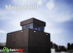
Meigs Feild Airport is finally back to FS9. This package is a full reproduction of the original airport including 1999 and 2003 airport versions, two taxiway texture sets, configuration utility, correct taxiway layout, correct building placement and type, fully custom textured buildings, detailed taxiways and taxiway edges, night lighting, perimeter fence, and much much more. A special feature within this package is the ability to step forward in time to the 2003 version of the airport. The airport was spontaneously closed. Large Xs were cut preventing aircrafts from departing or arriving.
| Filename: | Merrill_C_Meigs_Field_Airport_KCGX.zip |
| License: | Freeware |
| Added: | 14th March 2010, 00:38:51 |
| Downloads: | 4,485 |
| Author: | Flyscenery.org Development Group |
| Size: | 24.06 MB |
| Category: Flight Simulator X - Scenery | |
| FCBB - Maya-Maya Airport - Brazzaville, Republic of the Congo |
|
File Description:
Maya-Maya Airport (IATA: BZV, ICAO: FCBB) is an airport located in Brazzaville, the capital of the Republic of the Congo. In 2004, the airport served 447,699 passengers. In 2010, a new runway 3300m long (05L/23R) and a new terminal, with 3 air bridges was opened. The older runway (05R/23L) was repaired and now is used as a taxiway. Airport runways were corrected also the jetways, aprons and buildings. Airport charts courtesy of www.ais-asecna.org/en/ad/ad2.htm
This work is dedicated to West Wind Airlines.
| Filename: | FCBB__MayaMaya_Airport__Brazzaville_Republic_of_th.zip |
| License: | Freeware |
| Added: | 2nd June 2013, 22:33:32 |
| Downloads: | 2,732 |
| Author: | Anwar Gonzalez |
| Size: | 4.03 MB |
| Category: Flight Simulator X - Scenery | |
| SLIX - Ixiamas Airport - Ixiamas, Bolivia |
|
File Description:
New Airport (Not included in FSX).
Ixiamas Airport (ICAO: SLIX) is a public use airport located near Ixiamas and close to Reserve Natural of Madidi National Park Madidi, one of the largest protected areas in the world, La Paz, Bolivia. The airport resides at an elevation of 725 ft (221 m) above mean sea level. It has one runway designated 18/36 with an asphalt surface measuring 7,874 by 98 ft (2,400 m by 30 m). This new airport is recently operational since May 2015.
Compatible with both FSX and P3D.
| Filename: | SLIX__Ixiamas_Airport__Ixiamas_Bolivia.zip |
| License: | Freeware |
| Added: | 29th July 2015, 11:22:41 |
| Downloads: | 443 |
| Author: | Marcos A. Rivas Torrez |
| Size: | 8.55 MB |
| Category: Flight Simulator X - Scenery | |
| W90 - New London Airport - Virginia |
|
Images related to this file:
File Description:
New London Airport (FAA LID: W90) is a public-use airport located six miles (10 km) southwest of the central business district of Forest, a town in Bedford County, Virginia, United States. It is privately owned by Associated Wheels Inc. It is a public airport, but usually involves GA aircraft only. On Sundays during the summer and early fall, the runway is used as a dragstrip. Originally built in 1957 as a 1/4 mile dragstrip, airport operations were added in 1961 and the facility has served a dual-purpose since. Having been under the continued guidance of Rucker Tibbs, the airport changed hands in December 2005. Changes were made based on Google Maps. Created with Airport Design Editor by ScruffyDuck Software using current FAA documentation and Google Earth measurements, this package offers a replacement for FSX's stock airport. All these enhancements are as close to the real airport as I can get with stock library objects and custom buildings.
| Filename: | W90__New_London_Airport__Virginia.zip |
| License: | Freeware |
| Added: | 20th September 2014, 17:31:45 |
| Downloads: | 253 |
| Author: | Wayne Roberts |
| Size: | 233.02 KB |
| Category: Flight Simulator X - AFCAD Files | |
| CYKF - Region of Waterloo Intl Airport / Waterloo Region, Ontario, Canada |
|
Images related to this file:
File Description:
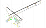
This airport update was made with the latest version of ADE (Airport Design Editor) and made for FSX as a replacement for the stock (default) airport. I've made several changes to the airport which are listed below. All these enchancements are as close to the real airport as I can get with stock library objects. I've used satellite images, terminal photos and maps throughout the whole process so building locations are as accurate as possible. Happy landings in beautiful Canada!
Features:
*Main parking apron shape corrected
*Main terminal building with parking area for commercial traffic
*Accurate location for most buildings
*Control tower updated to more closely match real world version
*Seperate parking areas for GA traffic
*Misc airport buildings and hangars added
*Airport vehicles and objects throughout the airport
*Fuel tanks and vehicles
*Runway 7/25 updated/renamed 8/26
*Helipad
(For more information on Endeavourai please visit our site at endeavourai.com or our forums at http://endeavourai.boards.net/)
| Filename: | CYKF__Region_of_Waterloo_Intl_Airport__Waterloo_Re.zip |
| License: | Freeware |
| Added: | 18th August 2012, 23:38:11 |
| Downloads: | 645 |
| Author: | Jaison Diaz / Endeavour ai |
| Size: | 149.52 KB |
| Category: Flight Simulator X - Scenery | |
| KMRY - Monterey Regional Airport - California, USA |
|
Images related to this file:
File Description:
FSX Scenery - Monterey Regional Airport (IATA: MRY, ICAO: KMRY, FAA LID: MRY) is three miles (5 km) southeast of Monterey, in Monterey County, California, USA. It was created in 1936 and was known as the Monterey Peninsula Airport until the board of directors renamed it on September 14, 2011. The airport is owned by the several municipalities that make up the Monterey Peninsula Airport District. It is a public entity and its five-member board of directors is publicly elected. The airport has its origins with flights from the polo field of the Hotel Del Monte in 1910. In 1941, local communities formed the Monterey Peninsula Airport District and acquired land to build an airport. World War II intervened, and the U.S. Navy leased the land, opening Naval Auxiliary Air Station Monterey on May 23, 1943. The Navy remained at the airport until 1972. For your flying pleasure by John B. Loney, Jr.
| Filename: | KMRY__Monterey_Regional_Airport__California_USA.zip |
| License: | Freeware, limited distribution |
| Added: | 5th June 2016, 12:11:50 |
| Downloads: | 592 |
| Author: | John B. Loney, Jr. |
| Size: | 39.38 MB |
| Category: Flight Simulator X - AFCAD Files | |
| Tamchy Airport Kyrgyzstan (UAFL) |
|
File Description:
Tamchy Airport (ICAO: UAFL) is an airport in Kyrgyzstan.
This AFCAD file for FSX adds a taxiway, apron, 3 parking spots and some generic buildings and other airport objects to the standard FSX Tamchy airport.
Although this airport has been designed roughly from looking at Google Earth/Maps, this is by no means 100% realistic. The buildings are all placed randomly by me, just to make it more interesting. Same story for the fuel tanks, trees, and vehicles. However, I did keep the proportions realistic, i.e. you won't land or park an A380 here.
In FSX, this is an awesome airport, right next to the massive Issyk-Kul lake which is one of the largest in the world. The scenery (even the standard FSX scenery) is just awesome. Hop into a turboprop plane, plan a flight between this airport and Bishkek or Almaty, and off you go.
This airport is served by Central Asian Airlines VA - www.flycentralasian.com
| Filename: | Tamchy_Airport_Kyrgyzstan_UAFL.zip |
| License: | Freeware |
| Added: | 22nd March 2012, 04:07:05 |
| Downloads: | 254 |
| Author: | Peter Wouters |
| Size: | 3.41 KB |
| Category: Navigation and ATC - Navigation | |
| Los Angeles ARTCC charts from AIRAC 0505 - Volume 3 of 5 |
|
File Description:
This collection of US Terminal Procedures has been assembled to provide a complete set of charts for flight simulation use within the Los Angeles ARTCC region, on behalf of VATSIM's Los Angeles ARTCC (ZLA), whose website can be found at http://www.laartcc.org
**THIS IS VOLUME 3 OF 5** Charts are in Adobe PDF format.
Volume 3 = ZLA_AIRAC0505_CA_OUTLYING.ZIP
Features procedure charts for all appropriate California airports outside the combined Southern California Terminal Radar Approach Control facility "SoCAL", but under the limited ATC responsibility of the Los Angeles Center facility, and includes amongst others:
KSBA - Santa Barbara Airport (Class C)
KPSP - Palm Springs Airport (TRSA)
KBFL - Bakersfield Meadows Field (Class D)
KCMA - Camarillo Airport (Class D)
KOXR - Oxnard Airport (Class D)
KSMX - Santa Maria Public / Hancock Field (Class D)
KSBP - San Luis County Regional (Class D)
KMHV - Mohave Airport (Class D)
KVCV - Victorville Airport (Class D)
KTRM - Jacqueline Cochran Regional Airport
L35 - Big Bear Airport
16 other California outlying fields in LA Center airspace.
| Filename: | Los_Angeles_ARTCC_charts_from_AIRAC_0505____Volume.zip |
| License: | Freeware |
| Added: | 15th May 2005, 18:05:53 |
| Downloads: | 499 |
| Author: | Mark Coldwell |
| Size: | 27.18 MB |
| Category: Flight Simulator X - AFCAD Files | |
| PADU - Unalaska Airport, Alaska |
|
File Description:
The airport is sometimes referred to as Dutch Harbor Airport. In 2002, the State of Alaska renamed it Tom Madsen Airport in honor of Charles Thomas Madsen Sr., a bush pilot who was killed in an airplane accident that year. However, the Federal Aviation Administration still refers to it as Unalaska Airport.
Moved aprons, added additional parking and buildings. Adjusted and added taxiway lights. Changes are based on 2012 construction plans.
| Filename: | PADU__Unalaska_Airport_Alaska.zip |
| License: | Freeware |
| Added: | 3rd January 2013, 01:53:15 |
| Downloads: | 873 |
| Author: | Wayne Roberts |
| Size: | 136.52 KB |


© 2001-2026 AVSIM Online
All Rights Reserved
Privacy Policy |