
Where Flight Simulation Enthusiasts Gather from Around the World!
AVSIM Library - Search Results

| Category: Flight Simulator X - Scenery | |
| Grati Pacitan Airport (WARD) |

|
Images related to this file:
File Description:
Grati Airport (WARD), formally known as R.E.B.O Tjokroadiredjo Airport is an Indonesian Navy Base Located in Pasuruan District, East Java, 34 miles South East of Surabaya. Grati was opened in October 10 2016. This airport serves VFR flight only.
| Filename: | Grati_Pacitan_Airport_WARD.zip |
| License: | Freeware |
| Added: | 20th March 2021, 16:26:51 |
| Downloads: | 57 |
| Author: | Sangwang Amarapati |
| Size: | 587.27 KB |
| Category: Flight Simulator X - Scenery | |
| Rio Vista Municipal Airport 2015 |
|
Images related to this file:
File Description:
FSX Scenery-Rio Vista Municipal Airport (FAA LID: O88) is a public airport located three miles (4.8 km) northwest of Rio Vista, serving Solano County, California, USA. This general aviation airport covers 273 acres (110 ha) and has two runways and one helipad. The airport is the current base of operations for the Travis AFB Aero Club. It opened in 1993, replacing the original Rio Vista Airport which closed in 1995. By John B. Loney, Jr.
| Filename: | Rio_Vista_Municipal_Airport_2015.zip |
| License: | Freeware, limited distribution |
| Added: | 18th May 2015, 12:53:28 |
| Downloads: | 240 |
| Author: | John B. Loney, Jr. |
| Size: | 6.43 MB |
| Category: Flight Simulator 2004 - Scenery | |
| Rio Vista Municipal Airport 2015 |
|
Images related to this file:
File Description:
FS2004 Scenery-Rio Vista Municipal Airport (FAA LID: O88) is a public airport located three miles (4.8 km) northwest of Rio Vista, serving Solano County, California, USA. This general aviation airport covers 273 acres (110 ha) and has two runways and one helipad. The airport is the current base of operations for the Travis AFB Aero Club. It opened in 1993, replacing the original Rio Vista Airport which closed in 1995. By John B. Loney, Jr.
| Filename: | Rio_Vista_Municipal_Airport_2015.zip |
| License: | Freeware, limited distribution |
| Added: | 18th May 2015, 12:53:35 |
| Downloads: | 217 |
| Author: | John B. Loney, Jr. |
| Size: | 5.52 MB |
| Category: Prepar3D V1-4 - Scenery | |
| KPVG Hampton Roads Executive Airport Scenery for P3Dv4 |
|
File Description:
[P3Dv4] Hampton Roads Executive Airport.
Scenery for the Hampton Roads Executive Airport in Chesapeake, VA. The Hampton Roads Executive Airport (ICAO: KPVG) is a general aviation airport serving the Hampton Roads area in coastal Virginia. This addon reflects the current (as of 2020) state of the airport, including a new terminal and new Runway 10/28 with precision approaches. All custom 3D buildings and ground polygons with accurate pavement and markings. Scenery by Er-Jin Jang.
| Filename: | KPVG_Hampton_Roads_Executive_Airport_Scenery_for_P.zip |
| License: | Freeware |
| Added: | 9th December 2020, 15:02:13 |
| Downloads: | 289 |
| Author: | Er-Jin Jang |
| Size: | 195.29 MB |
| Category: Flight Simulator 2004 - Scenery Design | |
| Designing and building an airport |
|
File Description:
I am a freeware airport scenery designer. When I was originally trying to learn how to design and build an airport, I struggled to find a simple-to-understand, all-in-one airport design tutorial. Utilising only easy-to-use and freeware software, this document walks you through the process of creating an airport for FS2004. Everything is explained in layman's terms and you will be designing and building your own airport(s) in no time.
| Filename: | Designing_and_building_an_airport.zip |
| License: | Freeware |
| Added: | 27th July 2005, 23:19:51 |
| Downloads: | 7,046 |
| Author: | Tim Clayton |
| Size: | 7.74 KB |
| Category: Flight Simulator 2004 - Scenery | |
| EHRD - Rotterdam Texture Update |
|
Images related to this file:
File Description:
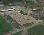
This is an Unofficial Texture Update for NL2000 V3 Rotterdam The Hague Airport.
These textures fix the following issues:
* The transparent Terminalbuilding at Rotterdam The Hague Airport is fixed,
Now with day/night textures that make the windows look more natural.
* The airport name on the terminal roof is changed in real life,
This is fixed from "Rotterdam" to "Rotterdam The Hague Airport".
USE THIS ONLY IF YOU ARE USING FS2004 + NL2000V3 ROTTERDAM THE HAGUE AIRPORT!
| Filename: | EHRD__Rotterdam__Texture_Update.zip |
| License: | Freeware |
| Added: | 11th May 2014, 05:33:34 |
| Downloads: | 855 |
| Author: | Diego Varela Rodriguez / NL2000 Team |
| Size: | 526.47 KB |
| Category: Flight Simulator X - Scenery | |
| LIEE 2013 for FSX\P3D |
|
Images related to this file:
File Description:
Airport LIEE 2013 for FSX\P3D. Liee is the most important Sardinia's airport for number of passengers. The island is in the Mediterranean sea, in Italy. The low cost traffic encourages European Tourists to come on the island. This is LIEE 2013 airport. It is update to August 2013 and reproduce near 100% the real airport. This file includes also Cagliari with its monuments and interesting zones. Traffic and animation are enclosed on this airport.
Enjoy and have fun.
| Filename: | LIEE_2013_for_FSXP3D.zip |
| License: | Freeware |
| Added: | 9th September 2013, 17:07:41 |
| Downloads: | 4,871 |
| Author: | Andrea Deplano |
| Size: | 42.97 MB |
| Category: Flight Simulator 2004 - AFCAD Files | |
| Belfast Aldergrove (EGAA) |
|
File Description:
Belfast Aldergrove is a joint civil and military aerodrome 18 miles NW of Belfast. The civil airport (now known as Belfast International) is the main passenger airport in the Province and handles practically all air cargo. RAF Aldergrove is the only remaining military airfield in Ulster. Details at http://www.raf.mod.uk/rafaldergrove.
This AFCAD file corrects many of the inaccuracies of the FS2004 default airport. The corrections are based on information from the aerodrome chart, Google Earth, and personal observations. None of the changes are strictly accurate to scale. An apron area for helicopters and the occasional RAF transport aircraft has been provided for the military base. The cargo area has also been enlarged and parking provided for up to eight aircraft. Additional parking places have also been provided on the main passenger apron and on the GA apron off taxiway A. A holding area adjacent to taxiway C near the threshold of Rwy 17 has been removed. Various other improvements have been made to taxiways and holding areas on the military side of the airfield. Much of the original base is now disused hence the large number of closed taxiways.
| Filename: | Belfast_Aldergrove_EGAA.zip |
| License: | Freeware |
| Added: | 3rd April 2009, 18:54:38 |
| Downloads: | 513 |
| Author: | John Hubbard |
| Size: | 9.25 KB |
| Category: Flight Simulator X - Scenery | |
| Goma Intl (FZNA) DRC and Gisenyi (HRYG) Rwanda |
|
Images related to this file:
File Description:
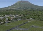
This project includes the neighboring Goma Intl (FZNA) and Gisenyi (HRYG) airports. After Goma's only runway was severely damaged by the eruption of Mount Nyiragongo in 2002, the runway, originally 3000m long, was reduced to 1800m of serviceable pavement after lava flowed onto the northern part runway and through the city center. In 2013, German NGO Welthungerhilfe ("World Hunger Aid") signed a contract to rehabilitate 500m of runway damaged by the lava flow. Goma resumed scheduled international flights in 2015, and this project reflects the airport as of March 2016, with runway 18/36 renumbered to 17/35. SRTMGL1 (30m) mesh brings the volcanoes in the area into much greater detail. This scenery is complimented by the Kigali Intl (HRYR) scenery (FSX_HRYR_Kigali_2016.zip).
Updates were created or rebuilt in a manner which carefully aligns airport data with current satellite imagery. Scenery was created using Airport Design Editor X v1.70.6042, SBuilderX 3.13, and the FSX Object Placement Tool. Scenery objects were added and modified from stock FSX scenery to resemble as closely as possible the actual airports. The FSX apron lights included are from the set created by Jim Dhaenens.
| Filename: | Goma_Intl_FZNA_DRC_and_Gisenyi_HRYG_Rwanda.zip |
| License: | Freeware |
| Added: | 4th August 2016, 21:11:20 |
| Downloads: | 2,284 |
| Author: | Carlyle Sharpe |
| Size: | 5.25 MB |
| Category: Prepar3D V1-4 - Scenery | |
| GMTT - Tangier Ibn Battuta Airport |
|
File Description:
Tangier Ibn Battuta Airpor (French: Aéroport de Tanger-Ibn Battouta), IATA: TNG, ICAO: GMTT, is an international airport serving Tangier (Tanger in French), the capital city of the Tanger-Tetouan-Al Hoceima region in Morocco. A new airport terminal building was opened in 2008 to provide for many more flights and increased passenger capability, as Tangier has grown rapidly and modernised.
Aircraft parking space of 40,640 square metres (437,445 sq ft) supports up to four Boeing 737s and one Boeing 747.
For small craft two dedicated sections are assigned. The air terminal is 12,000 m2 (129,167 sq ft) and designed to handle 1,250,000 passengers per year. The cargo terminal is 529 m2 (5,694 sq ft) of covered space.
The 3500 meter long runway 10/28 is open and is capable of handling all sizes of aircraft up to the size of a Boeing 747 and Airbus A380-800.
The airport has an ILS status (Loc – Glide – DME) and offers the following radionavigational aids: VOR – DME – NDB. PAPI lighting available for runway 10/28 for approaches from either direction.
| Filename: | GMTT__Tangier_Ibn_Battuta_Airport.zip |
| License: | Freeware |
| Added: | 9th June 2021, 00:08:54 |
| Downloads: | 790 |
| Author: | Eduardo Puelker |
| Size: | 10.22 MB |


© 2001-2026 AVSIM Online
All Rights Reserved
Privacy Policy |