
Where Flight Simulation Enthusiasts Gather from Around the World!
AVSIM Library - Search Results

| Category: Flight Simulator 2004 - Scenery | |
| Etna Volcano seasonal effects, Sicily, Italy, Photo Real |

|
Images related to this file:
File Description:
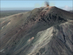
This scenery covers the summit of Etna Volcano with seasonal variation (Winter, Summer, Spring, Fall and night texture).
Use it ONLY in association of Etna photoreal scenery (see AVSIM library - etna_photoreal.zip). NOTE: place Etna_season scenery with higher priority than Etna_photoreal in scenery library (see readme text).
| Filename: | Etna_Volcano_seasonal_effects_Sicily_Italy_Photo_R.zip |
| License: | Freeware |
| Added: | 1st June 2010, 20:43:12 |
| Downloads: | 9,754 |
| Author: | Fulvio Mazzokan |
| Size: | 36.43 MB |
| Category: Flight Simulator X - Aircraft Repaints, Textures and Modifications | |
| ATR 72-500 American Eagle Repaint (Photo Real) |
|
Images related to this file:
File Description:

Here is my first Repaint of the Flight One ATR 72-500 in American Eagle Colors. Repaint was constructed using real photographs only. Instructions included along with a thumbnail to use for your FSX Menu. Enjoy and Happy Flying.
| Filename: | ATR_72500_American_Eagle_Repaint_Photo_Real.zip |
| License: | Freeware |
| Added: | 6th June 2010, 03:22:36 |
| Downloads: | 2,138 |
| Author: | Alex Hollis |
| Size: | 19.65 MB |
| Category: Flight Simulator 2004 - Scenery | |
| Project Mexico Real LOD9 File 4 of 4 |
|
Images related to this file:
File Description:
File 4th of 4 of a Terrain Mesh that covers the entirety of Mexican Territory and related bordering U.S., Guatemala and Belice areas, part of the "Proyecto M�©xico Real" project, compiled at LOD9 (2.48 arcseconds in latitude and 3.3 arcseconds in longitude) resolution from INEGI data. Intended to enhance the virtual flying experience with the more detailed LOD10 version and complement the LOD8 version compiled from the same data. Compatible backwards with Flight Simulator 2000, Flight Simulator 2002 and Combat Flight Simulator 2. Refer to the file contents about the cover area to this compressed file. (Re-upload due to AVSIM hack)
| Filename: | Project_Mexico_Real_LOD9_File_4_of_4.zip |
| License: | Check within download |
| Added: | 6th June 2010, 08:50:44 |
| Downloads: | 2,727 |
| Author: | Juan Jose Galvan Bautista |
| Size: | 54.82 MB |
| Category: Flight Simulator 2004 - Scenery | |
| Project Mexico Real LOD10 File 2 of 11 |
|
Images related to this file:
File Description:
File 2nd of 11 of a Terrain Mesh that covers the entirety of Mexican Territory and related bordering U.S., Guatemala and Belice areas, part of the "Proyecto M�©xico Real" project, compiled at LOD10 (1.24 arcseconds in latitude and 1.65 arcseconds in longitude) resolution from INEGI data. Intended to enhance the virtual flying experience complementing the LOD8 and LOD9 versions compiled from the same data. Compatible backwards with Flight Simulator 2000, Flight Simulator 2002 and Combat Flight Simulator 2. Refer to the file contents about the cover area to this compressed file. (Re-upload due to AVSIM hack)
| Filename: | Project_Mexico_Real_LOD10_File_2_of_11.zip |
| License: | Check within download |
| Added: | 7th June 2010, 08:52:32 |
| Downloads: | 3,317 |
| Author: | Juan Jose Galvan Bautista |
| Size: | 76.38 MB |
| Category: Flight Simulator 2004 - Scenery | |
| Project Mexico Real LOD10 File 1 of 11 |
|
Images related to this file:
File Description:
File 1st of 11 of a Terrain Mesh that covers the entirety of Mexican Territory and related bordering U.S., Guatemala and Belice areas, part of the "Proyecto Mexico Real" project, compiled at LOD10 (1.24 arcseconds in latitude and 1.65 arcseconds in longitude) resolution from INEGI data. Intended to enhance the virtual flying experience complementing the LOD8 and LOD9 versions compiled from the same data. Compatible backwards with Flight Simulator 2000, Flight Simulator 2002 and Combat Flight Simulator 2. Refer to the file contents about the cover area to this compressed file. (Re-upload due to AVSIM hack)
| Filename: | Project_Mexico_Real_LOD10_File_1_of_11.zip |
| License: | Check within download |
| Added: | 6th June 2010, 09:05:59 |
| Downloads: | 4,165 |
| Author: | Juan Jose Galvan Bautista |
| Size: | 73.44 MB |
| Category: Flight Simulator 2004 - Scenery | |
| Project Mexico Real LOD10 File 7 of 11 |
|
Images related to this file:
File Description:
File 7th of 11 of a Terrain Mesh that covers the entirety of Mexican Territory and related bordering U.S., Guatemala and Belice areas, part of the "Proyecto Mexico Real" project, compiled at LOD10 (1.24 arcseconds in latitude and 1.65 arcseconds in longitude) resolution from INEGI data. Intended to enhance the virtual flying experience complementing the LOD8 and LOD9 versions compiled from the same data. Compatible backwards with Flight Simulator 2000, Flight Simulator 2002 and Combat Flight Simulator 2. Refer to the file contents about the cover area to this compressed file. (Re-upload due to AVSIM hack)
| Filename: | Project_Mexico_Real_LOD10_File_7_of_11.zip |
| License: | Check within download |
| Added: | 23rd August 2010, 00:40:35 |
| Downloads: | 2,866 |
| Author: | Juan Jose Galvan Bautista |
| Size: | 74.25 MB |
| Category: Flight Simulator 2004 - Scenery | |
| Project Mexico Real LOD10 File 9 of 11 |
|
Images related to this file:
File Description:
File 9th of 11 of a Terrain Mesh that covers the entirety of Mexican Territory and related bordering U.S., Guatemala and Belice areas, part of the "Proyecto Mexico Real" project, compiled at LOD10 (1.24 arcseconds in latitude and 1.65 arcseconds in longitude) resolution from INEGI data. Intended to enhance the virtual flying experience complementing the LOD8 and LOD9 versions compiled from the same data. Compatible backwards with Flight Simulator 2000, Flight Simulator 2002 and Combat Flight Simulator 2. Refer to the file contents about the cover area to this compressed file. (Re-upload due to AVSIM hack)
| Filename: | Project_Mexico_Real_LOD10_File_9_of_11.zip |
| License: | Check within download |
| Added: | 29th August 2010, 23:24:57 |
| Downloads: | 1,197 |
| Author: | Juan Jose Galvan Bautista |
| Size: | 76.35 MB |
| Category: Flight Simulator 2004 - Scenery | |
| Project Mexico Real LOD10 File 10 of 11 |
|
Images related to this file:
File Description:
Re-upload. File 10th of 11 of a Terrain Mesh that covers the entirety of Mexican Territory and related bordering U.S., Guatemala and Belice areas, part of the "Proyecto Mexico Real" project, compiled at LOD10 (1.24 arcseconds in latitude and 1.65 arcseconds in longitude) resolution from INEGI data. Intended to enhance the virtual flying experience complementing the LOD8 and LOD9 versions compiled from the same data. Compatible backwards with Flight Simulator 2000, Flight Simulator 2002 and Combat Flight Simulator 2. Refer to the file contents about the cover area to this compressed file.
| Filename: | Project_Mexico_Real_LOD10_File_10_of_11.zip |
| License: | Check within download |
| Added: | 5th September 2010, 20:55:05 |
| Downloads: | 3,062 |
| Author: | Juan Jose Galvan Bautista |
| Size: | 70.54 MB |
| Category: Flight Simulator 2004 - Scenery | |
| Project Mexico Real LOD10 File 3 of 11 |
|
Images related to this file:
File Description:
Re-upload. File 3rd of 11 of a Terrain Mesh that covers the entirety of Mexican Territory and related bordering U.S., Guatemala and Belice areas, part of the "Proyecto Mexico Real" project, compiled at LOD10 (1.24 arcseconds in latitude and 1.65 arcseconds in longitude) resolution from INEGI data. Intended to enhance the virtual flying experience complementing the LOD8 and LOD9 versions compiled from the same data. Compatible backwards with Flight Simulator 2000, Flight Simulator 2002 and Combat Flight Simulator 2. Refer to the file contents about the cover area to this compressed file.
| Filename: | Project_Mexico_Real_LOD10_File_3_of_11.zip |
| License: | Check within download |
| Added: | 8th June 2010, 03:17:03 |
| Downloads: | 3,255 |
| Author: | Juan Jose Galvan Bautista |
| Size: | 73.67 MB |
| Category: Flight Simulator 2004 - Scenery | |
| Project Mexico Real LOD10 File 8 of 11 |
|
Images related to this file:
File Description:
File 8th of 11 of a Terrain Mesh that covers the entirety of Mexican Territory and related bordering U.S., Guatemala and Belice areas, part of the "Proyecto M�©xico Real" project, compiled at LOD10 (1.24 arcseconds in latitude and 1.65 arcseconds in longitude) resolution from INEGI data. Intended to enhance the virtual flying experience complementing the LOD8 and LOD9 versions compiled from the same data. Compatible backwards with Flight Simulator 2000, Flight Simulator 2002 and Combat Flight Simulator 2. Refer to the file contents about the cover area to this compressed file. (Re-upload due to AVSIM hack)
| Filename: | Project_Mexico_Real_LOD10_File_8_of_11.zip |
| License: | Check within download |
| Added: | 29th August 2010, 04:15:59 |
| Downloads: | 1,174 |
| Author: | Juan Jose Galvan Bautista |
| Size: | 73.7 MB |


© 2001-2026 AVSIM Online
All Rights Reserved
Privacy Policy |