
Where Flight Simulation Enthusiasts Gather from Around the World!
AVSIM Library - Search Results

| Category: Prepar3D V1-4 - Scenery | |
| Warsaw City X DEMO |

|
Images related to this file:
File Description:
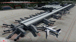
WARSAW CITY X DEMO is a sophisticated scenery package, featuring a detailed scenery of Warsaw city in Poland with surrounding airports, fully compatible with P3Dv1, P3Dv2 and P3Dv3.
This product is a fully functional DEMO version of the commercial payware product. It features same layouts as in the full version but with limited 3D objects and low resolution textures. Using this free demo ensures no problems with online (VATSIM, IVAO, multiplayer etc.) flying in case some users use the payware scenery and some don't.
Warsaw is the capital and the largest city of Poland located on the Vistula (Wisla) River. Warsaw City 2015 gives you a possibility to fly over an extremely large area of Warsaw city. We have included a photoreal ground textures of about 5200 square km. The city centre has hundreds of custom buildings modeled, there are all VFR-important landmarks on the whole included area too. We have also created 13 variously detailed airports and heliports for the project: Modlin EPMO, Babice EPBC, Chrcynno/Nasielsk, Sobienie EPSJ, Goraszka EPGO, Konstancin-Jeziorna, Konstancin Heliport, Reczaje (lite), Kroczewo (lite), Trebki Nowe (lite), Wincentow 1 (lite), Wincentow 2 (lite), Zabia Wola (lite).
The product is equipped with an automatic installer, which means that the scenery will be automatically added to the Flight Simulator Scenery Library. Please uninstall all previous versions of similar sceneries you may have installed before. Please make also sure that no duplicate AFCAD files are installed.
Enjoy your virtual flying with Drzewiecki Design!
| Filename: | Warsaw_City_X_DEMO.zip |
| License: | Freeware, limited distribution |
| Added: | 27th October 2015, 12:24:06 |
| Downloads: | 739 |
| Author: | Drzewiecki Design |
| Size: | 36.95 MB |
| Category: Dovetail Games Flight Sim World - Scenery | |
| NEW YORK AIRPORTS X V2 DEMO |
|
Images related to this file:
File Description:
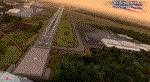
NEW YORK AIRPORTS X V2 DEMO is a package containing 6 airports located in New York metropolitan areas - KJFK Kennedy, KEWR Newark and KLGA LaGuardia + 3 business & general aviation airports - KTEB Teterboro, KCDW Essex County and KLDJ Linden.
This package is fully compatible with FSX/FSX:SE/P3Dv1/P3Dv2/P3Dv3/P3Dv4/FSW and with New York City X by Drzewiecki Design (v2.3 and higher), Manhattan X by Aerosoft, all ORBX products, all PILOT’S products and all Megascenery products.
This is a fully functional freeware scenery, perfectly aligned with the full payware version. This ensures no problems with online (VATSIM, IVAO and multiplayer) flying in case some users have the payware scenery and some don't. The demo gives you all the terminals with low resolution textures and non-animated jetways plus a 4.8m/pix resolution photoreal ground for all 6 airports.
John F. Kennedy International Airport (JFK/KJFK) - the busiest international air passenger gateway in the United States. Newark Liberty International Airport (EWR/KEWR) was the first major airport in the United States. LaGuardia Airport (LGA/KLGA) is a hub for Delta Air Lines and a focus city for American Airlines and regional affiliate American Eagle.
It's equipped with an automatic installer, which means that the scenery will be automatically added to the Flight Simulator Scenery Library.
Please uninstall all previous versions of the airports you may have installed before. Please make also sure that no duplicated AFCAD files are installed.
Enjoy your virtual flying with Drzewiecki Design!
| Filename: | NEW_YORK_AIRPORTS_X_V2_DEMO.zip |
| License: | Freeware, limited distribution |
| Added: | 21st February 2018, 23:30:26 |
| Downloads: | 218 |
| Author: | Drzewiecki Design |
| Size: | 39.35 MB |
| Category: Miscellaneous Files - Demos from Commercial Vendors | |
| Virtual Sailor 6.5 |
|
File Description:
Virtual Sailor simulates the whole sailing experience, it's main features are:
Accurate wave dynamics above sea and below.
Accurate sailboat and motorboat dynamics.
Accurate and dynamic sailing sounds.
Fully adjustable weather and sea conditions by day and night.
Photorealistic land and sea based on real topographic data.
Diverse and adjustable marine life.
Global land and sea area allows global navigation and sailing.
Simulates saileboat racing including wind shadow effects.
Multiplayer online sailing and racing over the net.
Uses the latest DirectX8 technology in 3D graphics, sound and multiplay.
Advanced and simple to use virtual environment.
Fully interactive 3D instrument panel for boats.
Advanced and simple to use program.
Built to expand, allowing third party sceneries and boats.
Full documentation for making all files of scenery and boats.
New features in version 6.5
Deep ocean waves model added, based upon measured sea spectrum.
Sea graphics is more advanced and containes more options.
Fully functional GPS based upon an actual instrument.
Fully functional RADAR screen based upon a simple radar.
Fully functional EchoSounder which detects land, animals and objects.
New contour map added, shows depth contours and navigation aids in scenery.
Submarines have better dive model and also a true flight model.
Autopilot improved for better handling of sailboats and navigation.
Support for hydrofoil boats added.
Support for smoke sources on boats added.
Support for multiple types of navigation aids in scenery added.
Improved user inteface with more panels and options.
Improved panel activation, and boat changing during play.
Improved joystick input supports additional joystick types.
| Filename: | Virtual_Sailor_65.zip |
| License: | Commercial demo |
| Added: | 23rd May 2003, 10:34:37 |
| Downloads: | 1,095 |
| Author: | Ilan Papini |
| Size: | 5.82 MB |
| Category: Flight Simulator 2004 - Scenery | |
| Deering PADE in Alaska |
|
Images related to this file:
File Description:
Deering is a coastal village around 55 miles southwest of Kotzebue, living from fishing and the land and with a population of around 130. The airfield is inland from the coast and has two gravel runways, 11-29 of just under 3,000 feet and 2-20 of 3,700 feet; the US is the only country that names runways with single numerals, hence 2-20 that in Canada would be 02-20. And Canada, which is a metric country and gives speed limits on roads in kilometres per hour, flies in feet and not metres for runway lengths and flight levels. The two runways could have something to do with there being a National Guard Armoury in the village, and perhaps personnel being flown in for exercises in the local countryside. Apart from the airfield itself, and it's buildings, this scenery modifies the local (mostly treeless) land class, reduces the village size to reality, and creates a new airfield background. Bering Air flies into Deering from Kotzebue and is included in the AI. A note here about my scenery making. This is post number 504 and there will not be many more to follow this as I am almost at the end of the photos I either took or found for scenery purposes. There is a limit to what can be located online and I have already been making use of the little there is; eg Unalakleet. So, if you are near an airport (preferably Canadian or Alaskan) and have a camera..... Let me know.
| Filename: | Deering_PADE_in_Alaska.zip |
| License: | Freeware, limited distribution |
| Added: | 7th August 2019, 16:37:12 |
| Downloads: | 139 |
| Author: | Roger Wensley |
| Size: | 4.32 MB |
| Category: Flight Simulator 2004 - Scenery | |
| Warsaw City 2015 DEMO |
|
Images related to this file:
File Description:

WARSAW CITY 2015 DEMO is a sophisticated scenery package, featuring a detailed scenery of Warsaw city in Poland with surrounding airports, fully compatible with FS2004.
This product is a fully functional DEMO version of the commercial payware product. It features same layouts as in the full version but with limited 3D objects and low resolution textures. Using this free demo ensures no problems with online (VATSIM, IVAO, multiplayer etc.) flying in case some users use the payware scenery and some don't.
Warsaw is the capital and the largest city of Poland located on the Vistula (Wisla) River. Warsaw City 2015 gives you a possibility to fly over an extremely large area of Warsaw city. We have included a photoreal ground textures of about 5200 square km. The city centre has hundreds of custom buildings modeled, there are all VFR-important landmarks on the whole included area too. We have also created 13 variously detailed airports and heliports for the project: Modlin EPMO, Babice EPBC, Chrcynno/Nasielsk, Sobienie EPSJ, Goraszka EPGO, Konstancin-Jeziorna, Konstancin Heliport, Reczaje (lite), Kroczewo (lite), Trebki Nowe (lite), Wincentow 1 (lite), Wincentow 2 (lite), Zabia Wola (lite).
The product is equipped with an automatic installer, which means that the scenery will be automatically added to the Flight Simulator Scenery Library. Please uninstall all previous versions of similar sceneries you may have installed before. Please make also sure that no duplicate AFCAD files are installed.
Enjoy your virtual flying with Drzewiecki Design!
| Filename: | Warsaw_City_2015_DEMO.zip |
| License: | Commercial demo |
| Added: | 2nd September 2015, 22:23:02 |
| Downloads: | 933 |
| Author: | Drzewiecki Design |
| Size: | 23.41 MB |
| Category: Prepar3D V1-4 - Scenery | |
| NEW YORK AIRPORTS X V2 DEMO |
|
Images related to this file:
File Description:
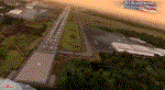
NEW YORK AIRPORTS X V2 DEMO is a package containing 6 airports located in New York metropolitan areas - KJFK Kennedy, KEWR Newark and KLGA LaGuardia + 3 business & general aviation airports - KTEB Teterboro, KCDW Essex County and KLDJ Linden.
This package is fully compatible with FSX/FSX:SE/P3Dv1/P3Dv2/P3Dv3/P3Dv4/FSW and with New York City X by Drzewiecki Design (v2.3 and higher), Manhattan X by Aerosoft, all ORBX products, all PILOT’S products and all Megascenery products.
This is a fully functional freeware scenery, perfectly aligned with the full payware version. This ensures no problems with online (VATSIM, IVAO and multiplayer) flying in case some users have the payware scenery and some don't. The demo gives you all the terminals with low resolution textures and non-animated jetways plus a 4.8m/pix resolution photoreal ground for all 6 airports.
John F. Kennedy International Airport (JFK/KJFK) - the busiest international air passenger gateway in the United States. Newark Liberty International Airport (EWR/KEWR) was the first major airport in the United States. LaGuardia Airport (LGA/KLGA) is a hub for Delta Air Lines and a focus city for American Airlines and regional affiliate American Eagle.
It's equipped with an automatic installer, which means that the scenery will be automatically added to the Flight Simulator Scenery Library.
Please uninstall all previous versions of the airports you may have installed before. Please make also sure that no duplicated AFCAD files are installed.
Enjoy your virtual flying with Drzewiecki Design!
| Filename: | NEW_YORK_AIRPORTS_X_V2_DEMO.zip |
| License: | Freeware, limited distribution |
| Added: | 21st February 2018, 23:29:10 |
| Downloads: | 1,323 |
| Author: | Drzewiecki Design |
| Size: | 39.35 MB |
| Category: Flight Simulator X - Scenery | |
| NEW YORK AIRPORTS X V2 DEMO |
|
Images related to this file:
File Description:
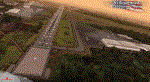
NEW YORK AIRPORTS X V2 DEMO is a package containing 6 airports located in New York metropolitan areas - KJFK Kennedy, KEWR Newark and KLGA LaGuardia + 3 business & general aviation airports - KTEB Teterboro, KCDW Essex County and KLDJ Linden.
This package is fully compatible with FSX/FSX:SE/P3Dv1/P3Dv2/P3Dv3/P3Dv4/FSW and with New York City X by Drzewiecki Design (v2.3 and higher), Manhattan X by Aerosoft, all ORBX products, all PILOT’S products and all Megascenery products.
This is a fully functional freeware scenery, perfectly aligned with the full payware version. This ensures no problems with online (VATSIM, IVAO and multiplayer) flying in case some users have the payware scenery and some don't. The demo gives you all the terminals with low resolution textures and non-animated jetways plus a 4.8m/pix resolution photoreal ground for all 6 airports.
John F. Kennedy International Airport (JFK/KJFK) - the busiest international air passenger gateway in the United States. Newark Liberty International Airport (EWR/KEWR) was the first major airport in the United States. LaGuardia Airport (LGA/KLGA) is a hub for Delta Air Lines and a focus city for American Airlines and regional affiliate American Eagle.
It's equipped with an automatic installer, which means that the scenery will be automatically added to the Flight Simulator Scenery Library.
Please uninstall all previous versions of the airports you may have installed before. Please make also sure that no duplicated AFCAD files are installed.
Enjoy your virtual flying with Drzewiecki Design!
| Filename: | NEW_YORK_AIRPORTS_X_V2_DEMO.zip |
| License: | Freeware, limited distribution |
| Added: | 21st February 2018, 23:28:33 |
| Downloads: | 6,301 |
| Author: | Drzewiecki Design |
| Size: | 39.35 MB |
| Category: Flight Simulator X - Scenery | |
| Carnes Farm |
|
Images related to this file:
File Description:
These are the files that I talked about in the Prepar3d forums. I created these objects for Fs9, then upgraded them to the scenery SDK for FSX. They were created 10 years ago in GMAX, and I have used them successfully ever since in Prepared 1.4 as well.
For some reason the individual farmhouse and other objects that I created are not showing up in Prepar3d version 2.0.
That's where you guys come in! These files are free to use in anyway you want as long as proper attribution is given, but, I would like you guys who have both Prepar3d 1.4 and 2.0 to try them out in both and report back to me as to whether you have the same problems that I do. That's your only fee. And I'd like you guys to give it a shot in both, or all four( I am not sure that they will work in FS9 anymore, but try it out. Unfortunately I can't recompile my FSX SDK Files back to FS9 if it doesn't work).
What's included:
1. Photo real scenery of Barbourville, 10 miles to the north west of stinking Creek where we live, and;
2. Photo real scenery of the farm area and stinking Creek, upon which I have placed my GMAX objects;
A. The farm house.Carnes Farm From the Bridge at 500 AGL.jpg
B. The barn, shed and the RV in back of the farmhouse.
C. A two-story long structure the top of which is an apartment but the bottom of which is a re-creation of Mama Carne's store, along with all the real wood floors shelves and original contents.. It is also o n Google earth in 3-D as it is here with further description .
... A little note on Gmax.. Mama Carne's store was one the first structures that I built in Gmax. It was just a box. Later, I added the true architectural features that you see including the steps and rails which took about as long to create as it would have to Saw and fit and hammer the real rails, risers and steps.
D. K-6, my little 2300 foot strip for runways 03 and 21. It has VOR - (117.55), ILS(110.1), and NDB(222).
E. Gerald Bingham's house, 1/4 mile up Warriors Path North from us.( mostly dirt road with gravel topping).
F. Dewitt Baptist Church.
Off property Knox county
G.Escoe's Store and Post Office complete with great prices for gas at the included pumps.
Escoes.jpg
H. Rex allen's killer corner...sheds and farm equipment on the sharpest bend on Stinking Creek...my son went off it with a flat tire, unscathed, but more than several have lost their lives on that curve... there may be several iterations of the sheds...just delete or rename the wrong ones...I was experimenting with ModelConverterX, Arno Gerretsen's wonderful model and object scenery tool.
I. sitting on top of the Barbourville Photo real scenery Barbourville PhotoReal over the shopping center.jpg is the Barbourville P3D Shopping Center2.jpg shopping center all the stores and all the storefronts ... it's on 25 E. as you head into Barbourville.
Recreated, is the entire shopping center with the now outmoded Wal-Mart sign. Probably my magnum opus.
note on the Gmax scenes.
All of the scenery was either directly measured and if not practical for a such a long measuring device, walked off, as in the Stinking Creek Bridge and shopping center. All of the objects were then photographed, in 360° where possible and saved as texture for inclusion in the Gmax model.
Enjoy!
...oh... how do you get there? Wellllll.... situate yourself at Middlesboro (1a6), and tune your Nav radio to K-69's VOR, 117.55, take off and climb to 3500 feet...grinnnnn
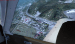
Welcome to Knox County Kentucky!
| Filename: | Carnes_Farm.zip |
| License: | Freeware |
| Added: | 2nd December 2013, 05:34:20 |
| Downloads: | 454 |
| Author: | Chas Honce |
| Size: | 91.13 MB |
| Category: Flight Simulator 2004 - Utilities | |
| Destination Finder for FS9 v1.1 |
|
File Description:
In this program, you enter the ICAO code of your start airport, the distance you wish to fly, and the heading on which you wish to fly. The program will search through all the stock airports in FS9, and will compile a list of airports nearest to your desired destination. For extra flexibility, you can also leave the heading and/or the distance unspecified. Alternatively, the program can now read your aircraft’s position in all versions of FS, and use that as the starting point of the search. You can optionally specify a maximum and/or minimum length for the runway, whether the runway must have an ILS, a maximum elevation for the destination airport, the runway surface (hard or soft or water) and whether the airport should be civil or military or either. The program can be useful for planning your own flight or for drawing up AI flightplans. It is a standalone program, and uses FS9 airport and runway data, but, with that limitation in mind, it can equally be used with other versions of FS. Version 1.1 has a much improved formula for calculating longitude and latitude over longer distances, and is now very accurate over all distances. Version 1.1 also incorporates a number of new features suggested by user feedback. The upgrade is recommended for all users. Needs the .NET Framework 2.0.
| Filename: | Destination_Finder_for_FS9_v11.zip |
| License: | Freeware |
| Added: | 24th January 2008, 00:17:07 |
| Downloads: | 4,880 |
| Author: | Martin Gleeson |
| Size: | 1.69 MB |
| Category: Flight Simulator X - Scenery | |
| Slovenia - LOD11 (19 meters resolution) Mesh |
|
Images related to this file:
File Description:
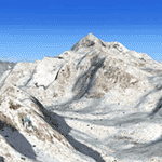
Slovenia, no matter how small, is a country with wide variety of landscapes.
From flat lands in the North-Eastern part one can see lovely rolling hills in
southern regions and razor sharp edges of 8500 ft peaks of the Alps in the
North-Western region.
SRTM elevation data that was used and is provided as default FS X terrain simply
can't cope with the task of representing our terrain in at least a little close
to reality manner, shapes and altitudes of some of our nicest peaks are deformed
beyond recognition, our highest mt. Triglav is with 38 meters SRTM mesh falling
short by almost 3000 ft!
So Slovenia Scenery Team developed this 19 meters resolution using FSX compatible
tools for it's payware scenery, but after development of even finer mesh with 10
meters resolution, we decided to offer the original 19 meters mesh to general
fligt simulation public. Mesh is FS X only and is not compatible with FS9.
Even if released as freeware, this files were uploaded to only some selected
flight simulation sites and redistribution of this scenery is not allowed without
written permission from the authors.
File is packed into a convenient installer that should perform all of the actions
automatically, but, please, do read the License agreement and "Read me" file
included in the installation.
| Filename: | Slovenia__LOD11_19_meters_resolution_Mesh.zip |
| License: | Freeware, limited distribution |
| Added: | 15th May 2012, 19:03:19 |
| Downloads: | 2,216 |
| Author: | SST - Slovenia Scenery Team |
| Size: | 45.15 MB |


© 2001-2026 AVSIM Online
All Rights Reserved
Privacy Policy |