
Where Flight Simulation Enthusiasts Gather from Around the World!
AVSIM Library - Search Results

| Category: Flight Simulator 2004 - Scenery | |
| Mary River CMR2 on Baffin Island in Nunavut Canada |

|
Images related to this file:
File Description:
This is a very early version of an airfield in Nunavut built to serve an iron ore mine some 100 miles south of Pond Inlet on Baffin Island. In 2004 the airstrip was just being built, with a very basic camp set up for the construction crew who then went on to develop the roads etc in the immediate area. The original plan was for an opencast mine, with ore being transported south on a new (and expensive) railroad link to a new port on the south shore of Baffin Island. This plan was later changed to a (much cheaper) road to Milne Inlet, north of Mary River. And there my story rests, as although production has now started I have no further information about the operating mine. Nolinor currently flies regular supply flights into the camp; the AI here is for the early days. The gravel runway is 4,800 feet long and 150 feet wide, aligned 124T-304T as all runway headings in the north are given as true rather than the unreliable magnetic, which would be 12-30. Runway lighting and PAPI was installed early on and is included here; signage is not and the apron is the early version.
| Filename: | Mary_River_CMR2_on_Baffin_Island_in_Nunavut_Canada.zip |
| License: | Freeware, limited distribution |
| Added: | 18th August 2018, 02:57:19 |
| Downloads: | 136 |
| Author: | Roger Wensley |
| Size: | 4.82 MB |
| Category: Flight Simulator 2004 - Aircraft Repaints, Textures and Modifications | |
| Italian Air Force, Lockeed F-104G "Starfighter" |
|
Images related to this file:
File Description:
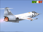
Lockheed's F-104 "Starfighter" was sleek, sexy, and difficult to fly. Essentially a J-79 turbojet with tiny wings and a place for the pilot to sit, it had a poor turning radius and very unpredictable behavior at high angles of attack along with very high takeoff and landing speeds. Its strength was never in its agility, but rather in its speed. The type was the only aircraft in existence at the time that could sustain speeds of over Mach 2.0, and it had a stellar rate of climb.
The "Starfighter" was an icon among jet interceptors throughout the 1970s. It was built also in Italy (G version), under licence. The first Italian F-104G flown during the end of 1962 and the last one (S version) was retired from active service in 2004 (42 Years !!!).
Textures only for two "Starfighters" of the 9 Gruppo of 4 Aerobrigata of the Aeronautica Militare Italiana (Italian Air Force), the first unit to receive the "Starfighter", based on Grosseto Airport, Italy, 1963/64. These textures require a legal copy of the payware Alphasim F-104G. The paints were done with the paintkit provided by Alphasim/Frank Safranek and the metal base textures provided by Henry William. Repaint by Manuele Villa.
| Filename: | Italian_Air_Force_Lockeed_F104G_Starfighter.zip |
| License: | Freeware |
| Added: | 4th June 2010, 11:28:46 |
| Downloads: | 599 |
| Author: | Manuele Villa |
| Size: | 6.05 MB |
| Category: Flight Simulator 2004 - Scenery | |
| SSJA Joaçaba, Brazil |
|
Images related to this file:
File Description:
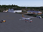
Googly scenery for SSJA Joaçaba - a small domestic airport
in the state of Santa Caterina, Brazil, that is poorly provided for in Flight
Simulator 2004. These scenery files add taxiways, aprons, buildings and other
airport features, so that you and your "AI" traffic can land, taxi, park and
take off in a realistic manner.
The small but prosperous city of Joaçaba was originally established in 1917 as
Cruzeiro and later known as Limeira and Cruzeiro do Sol, but in 1943 adopted
the current name following the introduction of legislation prohibiting cities
in Brazil using the same name - not a bad idea really. Joaçaba has a high
quality medical centre serving the state of Santa Caterina and a renowned
university which both bring traffic to the airport which is served by mainly
by LET410 aircraft of local airline NHT Linhas Aéreas.
The scenery does not purport to be ultra-accurate. Based on high-detail satellite
imagery from Google Earth, the layout is proportionally correct but the added
airport features, such as buildings, are built from default Microsoft objects
and add-on libraries so will not look exactly like the real thing.
[File re-uploaded at request of AVSIM]
| Filename: | SSJA_Joaccedilaba_Brazil.zip |
| License: | Freeware |
| Added: | 14th May 2010, 04:47:22 |
| Downloads: | 1,263 |
| Author: | John Hinson |
| Size: | 65.83 KB |
| Category: Flight Simulator 2004 - Scenery | |
| VGEG Chittagong/Shah Amanat International, Bangladesh |
|
Images related to this file:
File Description:

Googly scenery for VGEG Chittagong/Shah Amanat International (known as M A
Hannan until 2005) - an important airport in Bangladesh that is poorly provided
for in Flight Simulator 2004. These scenery files add taxiways, aprons,
buildings and other airport features, including the military area at the north
end and the general aviation ramps, so that you and your "AI" traffic can land,
taxi, park and take off in a realistic manner.
The city of Chittagong and its port are served regularly by jets ranging in size
from the Fokker 28 to the Douglas DC10 from operators like Air Arabia, Air Asia,
Biman Bangladesh Airlines, Oman Air, Thai Airways International, and turboprops of
GMG Airlines, United Airways and Zoom Airways.
The scenery does not purport to be ultra-accurate. Based on high-detail satellite
imagery from Google Earth, the layout is proportionally correct but the added
airport features, such as buildings, are built from default Microsoft objects
and add-on libraries so will not look like the real thing.
You are not obliged to download and install any additional scenery libraries,
but to enjoy this scenery in its entirety, you may wish to. It will work fine,
with or without.
[File re-uploaded at request of AVSIM]
| Filename: | VGEG_ChittagongShah_Amanat_International_Banglades.zip |
| License: | Freeware |
| Added: | 14th May 2010, 05:10:02 |
| Downloads: | 3,079 |
| Author: | John Hinson |
| Size: | 71.7 KB |
| Category: Flight Simulator 2004 - Sounds | |
| FS2004/FSX Boeing 737 Next-Generation (600-900ER) CFMI CFM56-7B Soundpack |
|
File Description:
This sound is intended for use on Project Opensky's models, but they'll work pretty good I am sure on other freeware and payware planes. After month's of hard precision work, I present to you my new realistic and accurate 737NG CFM56-7B soundpack for Microsoft Flight Simulator 2004 and X. The interior sounds are mainly from a passenger perspective. Once you load your aircraft with these sounds, you'll hear the APU System and Fans in the cabin. You hear the humming sound of the CFM56-7B at idle after you have started the engines. You spool up the engines at takeoff then hear the buzzsaw-like sound of the CFM56-7B engine's fans. Once you lift off and put up the landing gear you will hear a chime from the cabin. It features realistic cockpit sounds like the autopilot deactivation sound, stall clicker, overspeed clicker, gear up warning sound buzzer, flaps lever, rolling whine, and touch-down. I am sure that if you are a frequent Boeing 737 Next-Generation aircraft flyer, or if you're a pilot or flight crew onboard a 737NG aircraft, that you'll pretty impressed by these sounds. Give this soundpack a try, I am sure you won't be disappointed!
| Filename: | FS2004FSX_Boeing_737_NextGeneration_600900ER_CFMI_.zip |
| License: | Freeware |
| Added: | 15th July 2010, 01:38:47 |
| Downloads: | 9,290 |
| Author: | Adam Murphy - SkyHigh Sound Systems |
| Size: | 55.26 MB |
| Category: Flight Simulator 2004 - Scenery | |
| HCMI Berbera, Somalia |
|
Images related to this file:
File Description:
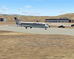
Googly scenery for HCMI Berbera, Somalia - an airport largely overlooked in
Flight Simulator 2004 with just a runway and tower provided at what is actually
the country's largest airport. At one time it had two active runways and a
strong military presence but today activity is limited to occasional
civilian flights. These scenery files add taxiways, aprons, buildings and
other airport features (and remove the non-existent tower that Microsoft
put there) so that you and your "AI" traffic can land, taxi, park and take
off in a realistic manner. This desert-surrounded airport is served three times per week by Douglas DC-9 jets of Kenyan airline African Express Airways.
The scenery does not purport to be ultra-accurate. Based on high-detail satellite
imagery from Google Earth, the layout is proportionally correct but the added
airport features, such as buildings, are built from default Microsoft objects
and add-on libraries so will not look like the real thing.
You are not obliged to download and install any additional scenery libraries,
but to enjoy this scenery in its entirety, you may wish to. It will work fine,
with or without. [File re-uploaded at request of AVSIM]
| Filename: | HCMI_Berbera_Somalia.zip |
| License: | Freeware |
| Added: | 29th May 2010, 09:26:33 |
| Downloads: | 1,317 |
| Author: | John Hinson |
| Size: | 62.07 KB |
| Category: Flight Simulator X - Scenery | |
| Iguassu Falls - Save The Planet |
|
Images related to this file:
File Description:
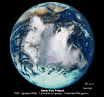
The Iguassu Falls, Itaipu Hydroelectric Power Plant, Foz do Iguassu City and Land Class Package for FSX
Save The Planet is my version of the Iguassu Falls, Itaipu Dam, bridges and landclass scenery for FSX.
Differently from my other version for MSFS 2004, I created a mesh of 5 meter resolution for Iguassu Falls area
to give me some idea how I could proceed. So, I decided to use on this addon
an image background avaliable at server (VirtualEarthSatellite). Thanks Microsoft.
Non-Airport Scenery - ICAO (SBFI). coming soon at www.Terra-Brasilis.org
Portuguese: Cataratas do Iguassu,
Spanish: Cataratas del Iguazu are waterfalls of the Iguassu River located on the border of the Brazilian state of Parana (in the Southern
Region) and the Argentinian Province of Misiones.
The Falls are shared between the Iguazu National Park (Argentina) and Iguacu
National Park (Brazil). The parks were designated UNESCO World Heritage Sites.
The Itaipu Hydroelectric Power Plant is located in the Parana River, in the stretch of the frontier between Brazil and Paraguay, 14 km north of the Friendship Bridge.
The area of the project extends from Foz do Iguassu, in Brazil, and Ciudad del Este, in Paraguay, in the south, up to Guaira (Brazil) and the Guaira Falls (Paraguay), in the north.
Enjoy FSX Iguassu Falls Scenery!
| Filename: | Iguassu_Falls__Save_The_Planet.zip |
| License: | Freeware |
| Added: | 9th December 2010, 01:57:00 |
| Downloads: | 2,849 |
| Author: | Cicero Costa |
| Size: | 31.71 MB |
| Category: Flight Simulator 2004 - Aircraft Repaints, Textures and Modifications | |
| Air Pink Cessna Citation Excel XLS+ (YU-BZM) |
|
Images related to this file:
File Description:

I am proud to present this detailed repaint of the Aryus Works freeware model of the Cessna Citation Excel XLS+, registration YU-BZM, in Air Pink's elegant black, gray and white livery. Air Pink is a private business jet charter airline based in in Belgrade, Serbia, established in 2004 as part of Pink International Company. It is based at Belgrade Nikola Tesla International Airport. Its fleet consists of this single Citation XLS+, 2 Cessna Citation II's, 2 Cessna Citation 550 Bravos and 1 Cessna Citation CJ2. Air Pink flies to destinations in Europe, the Middle East and North Africa. There are a lot of curves on this aircraft and I paid attention to painting their detail and creating as realistic a repaint as possible on this work. The textures in this repaint are 32-bit. This is a complete install; Aryus Works Citation Excel XLS+ model and air files are included. Panel and sound are from the default Lear45. PLEASE NOTE: I recreated several textures in this repaint out of respect for EagleSoft Development's texture Copyright. These EagleSoft textures were released in Aryus Works original Excel paintkit and were used without permission from EagleSoft Development. See Readme file for more details.
| Filename: | Air_Pink_Cessna_Citation_Excel_XLS_YUBZM.zip |
| License: | Freeware, limited distribution |
| Added: | 30th October 2010, 21:49:32 |
| Downloads: | 1,728 |
| Author: | Jeffrey S. Bryner, Aryus Works |
| Size: | 5.33 MB |
| Category: Flight Simulator 2004 - Scenery | |
| RAF Middleton St. George |
|
Images related to this file:
File Description:
Representative scenery of RAF Middleton St. George in County Durham.
The airfield began its life as Royal Air Force Station Goosepool, and in 1941 became RAF Middleton St. George. The aerodrome opened as a Bomber Command station in 1941. In 1943 it was allocated to No. 6 Group, Royal Canadian Air Force. A sub-station was located at RAF Croft, Yorkshire. Squadrons based here include: 76 Squadron, which flew Halifaxes, 78 Squadron, which flew Whitleys, 419 Squadron RCAF, which flew Wellingtons, Halifaxes, and Lancasters, 420 Squadron RCAF, which flew Wellingtons, and 428 Squadron RCAF, which flew Wellingtons, Halifaxes, and Lancasters.
After the war, the aerodrome served various squadrons and units including No. 13 Operational Training Unit (OTU), No. 2 Air Navigation School, No. 4 Flight Training School, 226 OCU and squadrons that used Meteors, Hunters, Javelins and Lightnings.
The RAF left the station in 1964, but the aerodrome was reopened in 1966 as a civil airport. The airfield was named Teesside International Airport in the 1960s, and was renamed Durham Tees Valley Airport in 2004.
This scenery has been made using various scenery libraries, mainly from MAIW. Full listing in the docs.
| Filename: | RAF_Middleton_St_George.zip |
| License: | Freeware, limited distribution |
| Added: | 22nd June 2014, 18:31:59 |
| Downloads: | 1,182 |
| Author: | Brian Clarke; Daryl Payne |
| Size: | 3.84 MB |
| Category: X-Plane - Scenery | |
| WXPJ Susi Air Puncak Jaya Mining Airstrip v1.0.0 |
|
Images related to this file:
File Description:
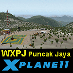
This is an X-Plane 11 scenery for Puncak Jaya Mining Airstrip (WXPJ) in the Puncak Jaya mountain region of Papua, Indonesia. This is a fictitious airfield, located in a high altitute mining location in Papua. At 4884 metres (16024 ft) above sea level, the Puncak Jaya peak, next to the mining location, is the highest mountain in Indonesia, on the island of New Guinea (which consists of the Indonesian West Papua region plus Papua New Guinea). This fictitious airfield may serve as a high altitute mining location challenge while flying the airstrips in Papua, as one of the destinations for "PT ASI Pujiastuti Aviation", operating as Susi Air, an Indonesia airlines established in late 2004 by Mrs. Susi Pudjiastuti. This scenery was tested and is operational (as of January 20, 2017) in "X-Plane 11 Public Beta #6 64 bit", Windows 10 Home. It was also tested and is partially operational (as of January 20, 2017) in "X-Plane 10.51 64 bit", Windows 10 Home. The issue with XP10 is the mesh again: there is no mine mesh, just a whole. The feel is very different from XP11, but it is still operational in XP10 to fly in and out.
| Filename: | WXPJ_Susi_Air_Puncak_Jaya_Mining_Airstrip_v100.zip |
| License: | Freeware |
| Added: | 21st January 2017, 18:42:35 |
| Downloads: | 58 |
| Author: | Rui Mesquita |
| Size: | 2.2 MB |


© 2001-2026 AVSIM Online
All Rights Reserved
Privacy Policy |