
Where Flight Simulation Enthusiasts Gather from Around the World!
AVSIM Library - Search Results

| Category: Flight Simulator X - Scenery | |
| Wynoochee Lake WA - (Bob's Fly-in Cabin) |

|
File Description:
Wynoochee Lake WA (Bob's Fishing Cabin) - Airport ID: BOB (FSX). - -
This is a fictitious fly-in lodge that I created for a quiet spot to fly into for weekend trips from the Seattle area. My cabin is located about 40 miles due south of Port Angeles, WA and about 50 miles due west of Seattle. - -
Wynoochee Lake is a real location, but my scenery around the lake is fictitious. - -
You will find my dirt airstrip to be quite challenging, although completely fly-able. My location is even more challenging at dawn or dusk with Weather. There are no approach lights, its just a rugged bush strip. - -
It is extra challenging with crash detection turned on - watch out for those birds, they're everywhere and that old tree just of the side of the dirt strip - don't get too close! - -
This is freeware. I hope you enjoy it. - -
Designed with the FS X Sdk Scenery function of the Mission builder,Abacus Scenery shortcut tool and Lee Swordy's AFCAD. - -
This scenery is frame rate friendly. - - Please read the "readme" - -
by Bob Caparoula
www.flydeervalley.com
| Filename: | Wynoochee_Lake_WA___Bobs_Flyin_Cabin.zip |
| License: | Freeware |
| Added: | 2nd February 2007, 21:10:37 |
| Downloads: | 1,457 |
| Author: | Bob Caparoula |
| Size: | 4.64 KB |
| Category: Flight Simulator 2004 - AI Aircraft | |
| Microlights- Vol.2 |
|
File Description:
Three more low-polygon count models for AI use in F2004, all tail-draggers, one based on the AirBike, with two seats, the second based on the Weedhopper, the third based on the Affordaplane. I've only included one or two texture sets for each aircraft, but I have included basic repaint templates for the Airbike and the Weedhopper, so you can generate a multitude of brightly-coloured aircraft to your own taste in a few minutes.
Each model includes three LOD models and a reduced-detail shadow model, for improved visual performance, and to this end I have also included updated models for my previous "Microlights for AI" upload (required for the textures if you want these aircraft). Although the model file size will be bigger, because FS only loads the LOD model it requires for the given range of the aircraft, once the aircraft is more than a few hundred feet away from the viewpoint, it will affect the frame-rate less than the originals.
Please see the enclosed text file for further details.
| Filename: | Microlights_Vol2.zip |
| License: | Freeware, limited distribution |
| Added: | 24th June 2007, 21:49:45 |
| Downloads: | 523 |
| Author: | Chris Eve |
| Size: | 607.56 KB |
| Category: Flight Simulator X - Scenery | |
| Essweiler Gliderfield, Germany Ver. 1.0 |
|
Images related to this file:
File Description:
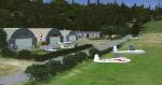
Essweiler is actually a classic glider field, but also engine aircrafts up to 2t are approved.
The field is situated in the region Rheinland-Pfalz/Germany at a hillside eastly of the village Essweiler, approximately 7,5 nautical miles north of the well known US-Airbase Ramstein.
The environment of the airfield is adapted by land classes. Surrounding villages and major roads are initially implemented.
As well the field is covered by a photo background, which includes four different images , each for one of the four seasons: spring, summer, autumn and winter. The buildings in this scenery should match quite good the originals. But also a lot of objects from three very popular freeware libraries are used.
If these libraries are not installed, many objects are not visible!
The following libraries are used:
1. FS-Piloten_Objektlibrary:
http://www.fs-piloten.de/thread.php?threadid=1063
2. FSX_FlightPortLib
http://www.flightport.de/libraries/flightport-library/
3: 3d People Library
http://library.avsim.net/download.php?DLID=192454
| Filename: | Essweiler_Gliderfield_Germany_Ver_10.zip |
| License: | Freeware |
| Added: | 29th November 2016, 19:15:50 |
| Downloads: | 607 |
| Author: | Wolfgang Allers |
| Size: | 168.18 MB |
| Category: Flight Simulator 2004 - Scenery Design | |
| Simple Instructions for Modifying Land Class |
|
File Description:
Simple Instructions for Modifying Land Class
Land classification, or land class (NOT "landclass"), is how Flight Simulator depicts the ground textures. For much of the FS world, the ground is not representative of the real thing, however. There have been complaints because of this from those who do not understand the cause of the problem.
This document explains the basic concepts behind the land class system, why it is inevitably inaccurate for most of the world, and the very easy-to-use tools with which to fix this.
Also includes instructions for modifying water class.
This is an html document for universal compatibility.
You do not have to be a computer programmer in order to change the land class. Anyone can do it quickly and easily.
So, why complain about it? Do something!
Very sorry - no support of any kind is offered for this document. Please consult the AvSim Scenery Design forum for any questions.
| Filename: | Simple_Instructions_for_Modifying_Land_Class.zip |
| License: | Freeware |
| Added: | 6th February 2005, 04:24:20 |
| Downloads: | 5,075 |
| Author: | Luis, scenery design forum |
| Size: | 2.18 MB |
| Category: Flight Simulator 2004 - Original Aircraft | |
| North American F-86E/F Sabre |
|
Images related to this file:
File Description:
SECTIONF8 North-American F-86E/F 'slatted-wing' Sabre. A complete aircraft model, photoreal inside and outside, fully functional 2D panel and Dynamic VC, custom gauges and custom soundsuite, countless XML programmed goodies including droppable fuel tanks, automatic wing slats operation depending on speed and attitude, dynamic engine damage and flame-out simulation, authentic start-up procedure including fuel regulation and power cart, working guns with tracer bullets and muzzle flash effects, working ( or not working.... ) hydraulics system, parked mode with wheel chocks, fluttering RBF flags, in- and outlet covers, pilot flightgear on wing, etc., and so on.
This base package includes only two skin texture sets. Additional skin textures available with a seperate package 'sf86skns.zip', also available here. SECTIONF8 is a new FS add-on development team dedicated to produce almost every version and variant of the venerable F-86 Sabre including its seagoing sisters FJ-2, FJ-3, and FJ-4 Fury. More info at www.sectionf8.com.
| Filename: | North_American_F86EF_Sabre.zip |
| License: | Freeware, limited distribution |
| Added: | 26th October 2008, 15:08:59 |
| Downloads: | 39,767 |
| Author: | SECTIONF8: Jan Visser, Hansjoerg Naegele, Rob Young, Cliff Presley |
| Size: | 51.48 MB |
| Category: Flight Simulator 2004 - Utilities | |
| Traffic View Board Version 2.1 |
|
File Description:
Traffic View Board is a new AI view gauge file that will give you an overview of the AI traffic without the need of external programs. This package works like a regular user aircraft and must be installed in the FS "Aircraft" folder. Instead of a regular aircraft model, this model is invisible, and the regular panel is replaced with a traffic board (similar to those found at any airport). When powered on you may choose between "Arrival", "Departure", "In flight" and "On ground". Each flight in the traffic board list represents an AI aircraft in FS2004. By clicking on a flight form the list, that particular aircraft is selected. When activating the "Follow aircraft" button the user aircraft are mapped to the AI aircraft position. This little trick allows you to spot that AI aircraft from any view in FS2004. FS2004 is still "looking" towards the user aircraft, but as the user aircraft are mapped to the AI aircraft FS2004 is "looking" towards the AI aircraft as well.
| Filename: | Traffic_View_Board_Version_21.zip |
| License: | Freeware |
| Added: | 29th October 2004, 22:38:48 |
| Downloads: | 54,526 |
| Author: | Arnt Helge Haland |
| Size: | 479.8 KB |
| Category: Flight Simulator X - Aircraft Repaints, Textures and Modifications | |
| Curtiss P-40N Warhawk (NL540TP) |
|
Images related to this file:
File Description:

A repaint only for the payware Flight Replicas P-40N Warhawk. This repaint depicts the restored P-40N 42-105306, registered NL540TP. The aircraft originally served in the Pacific with the 7th FS, 49th FG, and was one of a few P-40's flown by Lt. Ray Melikian. Later, while being flown by Lt. Marion Hawke, the aircraft was substantially damaged when it collided with a P-47 while attempting to land at the Iron Range Repair Depot in Queensland, Australia. The aircraft remained abandoned at the old airfield until being recovered in 1973. The airframe passed through several notable hands over the years before finally being purchased by Chris Prevost in 2000, who had the aircraft shipped to the Sonoma Valley airport where the restoration to airworthy began. Doing much of the work himself, over almost a decade, Prevost flew the aircraft for the first time in January 2009. Fitted with dual controls, the aircraft's original pilot, Ray Melikian, was able to fly the aircraft again. Included with this repaint is a set of updated files for my "Little Jeanne" repaint.
| Filename: | Curtiss_P40N_Warhawk_NL540TP.zip |
| License: | Freeware |
| Added: | 31st July 2013, 15:26:43 |
| Downloads: | 176 |
| Author: | John Terrell |
| Size: | 13.14 MB |
| Category: Flight Simulator 2004 - Scenery | |
| "Himalayan Peaks" LOD10 Mesh, Volume 8 - Tirich Mir and Pamir |
|
Images related to this file:
File Description:
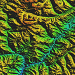
Highly detailed terrain mesh of the Tirich Mir and Pamir areas, N36-39 E71-74. The files in this package are based on Shuttle Radar (SRTM) Version 2 data but with many of the void areas, especially the most significant sections, filled with elevation data generated from topographic maps by Jonathan de Ferranti. While Jonathan's work is unrelated to flight simulation he kindly gave me permission to compile his data for use in FS. The result is a wonderful improvement in detail and accuracy over any existing mesh file, freeware or commercial, based on SRTM or DTED data alone.
Due to the large area of the Himalayas I've compiled the source data as two separate series: the "Himalayan Peaks" series covers prominent mountains and ranges in higher detail and locally overrides any existing LOD9 terrain mesh. In addition, a LOD9 "base mesh" series covering the entire Himalayas will be available for those who do not yet have an add-on terrain mesh of these beautiful mountains.
| Filename: | Himalayan_Peaks_LOD10_Mesh_Volume_8__Tirich_Mir_an.zip |
| License: | Freeware, limited distribution |
| Added: | 29th May 2010, 08:52:47 |
| Downloads: | 9,115 |
| Author: | Holger Sandmann, Jonathan de Ferranti |
| Size: | 47.94 MB |
| Category: Flight Simulator 2004 - Scenery | |
| Himalayas LOD9 Base Mesh, Volume 4 - Kashmir and Jammu |
|
File Description:
Detailed terrain mesh of the Kashmir and Jammu Ranges, N30-39 E76-78. The files in this package are based on Shuttle Radar (SRTM) Version 2 data but with many of the void areas, especially the most significant sections, filled with elevation data generated from topographic maps by Jonathan de Ferranti. While Jonathan's work is unrelated to flight simulation he kindly gave me permission to compile his data for use in FS. The result is a wonderful improvement in detail and accuracy over any existing mesh file, freeware or commercial, based on SRTM or DTED data alone.
Due to the large area of the Himalayas I've compiled the source data as two separate series: the "Himalayan Peaks" series covers prominent mountains and ranges in higher detail and locally overrides any existing LOD9 terrain mesh. In addition, the LOD9 "base mesh" series, with LOD8 and LOD7 "buffer" mesh files, covering the entire Himalayas, is meant for those who do not yet have an add-on terrain mesh of these beautiful mountains.
| Filename: | Himalayas_LOD9_Base_Mesh_Volume_4__Kashmir_and_Jam.zip |
| License: | Freeware, limited distribution |
| Added: | 22nd February 2006, 20:32:50 |
| Downloads: | 7,510 |
| Author: | Holger Sandmann, Jonathan de Ferranti |
| Size: | 29.24 MB |
| Category: Flight Simulator 2004 - Scenery | |
| Himalayas LOD9 Base Mesh, Volume 1 - Southeastern Ranges |
|
Images related to this file:
File Description:
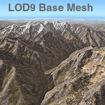
Detailed terrain mesh of the Southeastern Himalayan Ranges, N26-32 E90-98. The files in this package are based on Shuttle Radar (SRTM) Version 2 data but with many of the void areas, especially the most significant sections, filled with elevation data generated from topographic maps by Jonathan de Ferranti. While Jonathan's work is unrelated to flight simulation he kindly gave me permission to compile his data for use in FS. The result is a wonderful improvement in detail and accuracy over any existing mesh file, freeware or commercial, based on SRTM or DTED data alone.
Due to the large area of the Himalayas I've compiled the source data as two separate series: the "Himalayan Peaks" series covers prominent mountains and ranges in higher detail and locally overrides any existing LOD9 terrain mesh. In addition, a LOD9 "base mesh" series, with LOD8 and LOD7 "buffer" mesh files, covering the entire Himalayas, is meant for those who do not yet have an add-on terrain mesh of these beautiful mountains.
| Filename: | Himalayas_LOD9_Base_Mesh_Volume_1__Southeastern_Ra.zip |
| License: | Freeware, limited distribution |
| Added: | 29th May 2010, 09:01:26 |
| Downloads: | 10,310 |
| Author: | Holger Sandmann, Jonathan de Ferranti |
| Size: | 71.82 MB |


© 2001-2026 AVSIM Online
All Rights Reserved
Privacy Policy |