
Where Flight Simulation Enthusiasts Gather from Around the World!
AVSIM Library - Search Results

| Category: Flight Simulator 2004 - Utilities | |
| Traffic View Board Version 2.1 |

|
File Description:
Traffic View Board is a new AI view gauge file that will give you an overview of the AI traffic without the need of external programs. This package works like a regular user aircraft and must be installed in the FS "Aircraft" folder. Instead of a regular aircraft model, this model is invisible, and the regular panel is replaced with a traffic board (similar to those found at any airport). When powered on you may choose between "Arrival", "Departure", "In flight" and "On ground". Each flight in the traffic board list represents an AI aircraft in FS2004. By clicking on a flight form the list, that particular aircraft is selected. When activating the "Follow aircraft" button the user aircraft are mapped to the AI aircraft position. This little trick allows you to spot that AI aircraft from any view in FS2004. FS2004 is still "looking" towards the user aircraft, but as the user aircraft are mapped to the AI aircraft FS2004 is "looking" towards the AI aircraft as well.
| Filename: | Traffic_View_Board_Version_21.zip |
| License: | Freeware |
| Added: | 29th October 2004, 22:38:48 |
| Downloads: | 54,527 |
| Author: | Arnt Helge Haland |
| Size: | 479.8 KB |
| Category: Flight Simulator 2004 - Scenery | |
| Palermo Punta Raisi Area 2013 |
|
Images related to this file:
File Description:
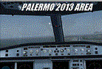
Dear Friends simmer, using the great objects bgl by mr Gianluca Giovannini, I tried to fill with autogen trees / buildings , the urban area near the international airport of Palermo "Falcone Borsellino". With the current integration of scenery i have created the town of Cinisi, Villagrazia di Carini, Torre Muzza and part of the smalls village near Airport.
Warning Very Important: the scenery "is not complete" and to get the best result YOU MUST INSTALL the following files:
-mesh by Pietro mauri (or SIMILAR mesh OF Sicily) (available HERE);
-install the wonderfull scenery LICJ by Francesco Salsano (available HERE);
-the "Palermo Vfr" by Fulvio Mazzokan (available HERE).
Most information inside the read me file. I hope you like this for your eternal fs 2004 and for your flights in Sicily. Best regards from Italy, Fabio Ferrari Castione della Presolana (bg).
| Filename: | Palermo_Punta_Raisi_Area_2013.zip |
| License: | Freeware, limited distribution |
| Added: | 20th February 2013, 21:57:36 |
| Downloads: | 2,721 |
| Author: | Fabio Ferrari |
| Size: | 4.72 MB |
| Category: Flight Simulator 2004 - Scenery | |
| ETUO - RAF Gutersloh AB |
|
Images related to this file:
File Description:
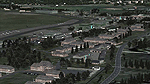
FS 2004 scenery - RAF Gutersloh AB (ICAO: ETUO)
The scenery represents the former airbase of RAF Gutersloh, one of the most populated military bases in West Germany during the Cold War, due to its location near the former East/West border. This scenery reflects the era at the end of the 1980s/beginning of the 90s, when the Harrier GR3 was in operation there, along with Chinook helicopters.
The airfield was built in 1935 and was used by the German Air Force during WW2, flying the Junkers JU-86 and Heinkel H-111. The first British squadrons were stationed there from 1947, with Mosquitos, Vampires and then Canberras.
The first Harrier arrived at Gutersloh in January 1977 and 3 and 4 Squadrons became resident until their farewell in 1993, after the cold war had ended. The airfield is currently used by the British army, but they will leave in 2014 to relinquish the area to the Government of Gutersloh for civil usage.
High detailed scenery by Manfred Schyma and Pete Beeby, supported by the Airfield Construction Group.
| Filename: | ETUO__RAF_Gutersloh_AB.zip |
| License: | Freeware |
| Added: | 10th October 2013, 20:30:01 |
| Downloads: | 1,934 |
| Author: | Manfred Schyma / Pete Beeby |
| Size: | 173.25 MB |
| Category: Flight Simulator 2004 - Scenery | |
| Himalayas LOD9 Base Mesh, Volume 1 - Southeastern Ranges |
|
Images related to this file:
File Description:
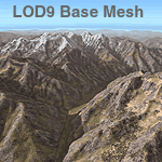
Detailed terrain mesh of the Southeastern Himalayan Ranges, N26-32 E90-98. The files in this package are based on Shuttle Radar (SRTM) Version 2 data but with many of the void areas, especially the most significant sections, filled with elevation data generated from topographic maps by Jonathan de Ferranti. While Jonathan's work is unrelated to flight simulation he kindly gave me permission to compile his data for use in FS. The result is a wonderful improvement in detail and accuracy over any existing mesh file, freeware or commercial, based on SRTM or DTED data alone.
Due to the large area of the Himalayas I've compiled the source data as two separate series: the "Himalayan Peaks" series covers prominent mountains and ranges in higher detail and locally overrides any existing LOD9 terrain mesh. In addition, a LOD9 "base mesh" series, with LOD8 and LOD7 "buffer" mesh files, covering the entire Himalayas, is meant for those who do not yet have an add-on terrain mesh of these beautiful mountains.
| Filename: | Himalayas_LOD9_Base_Mesh_Volume_1__Southeastern_Ra.zip |
| License: | Freeware, limited distribution |
| Added: | 29th May 2010, 09:01:26 |
| Downloads: | 10,313 |
| Author: | Holger Sandmann, Jonathan de Ferranti |
| Size: | 71.82 MB |
| Category: Flight Simulator 2004 - Scenery | |
| Himalayas LOD9 Base Mesh, Volume 4 - Kashmir and Jammu |
|
File Description:
Detailed terrain mesh of the Kashmir and Jammu Ranges, N30-39 E76-78. The files in this package are based on Shuttle Radar (SRTM) Version 2 data but with many of the void areas, especially the most significant sections, filled with elevation data generated from topographic maps by Jonathan de Ferranti. While Jonathan's work is unrelated to flight simulation he kindly gave me permission to compile his data for use in FS. The result is a wonderful improvement in detail and accuracy over any existing mesh file, freeware or commercial, based on SRTM or DTED data alone.
Due to the large area of the Himalayas I've compiled the source data as two separate series: the "Himalayan Peaks" series covers prominent mountains and ranges in higher detail and locally overrides any existing LOD9 terrain mesh. In addition, the LOD9 "base mesh" series, with LOD8 and LOD7 "buffer" mesh files, covering the entire Himalayas, is meant for those who do not yet have an add-on terrain mesh of these beautiful mountains.
| Filename: | Himalayas_LOD9_Base_Mesh_Volume_4__Kashmir_and_Jam.zip |
| License: | Freeware, limited distribution |
| Added: | 22nd February 2006, 20:32:50 |
| Downloads: | 7,512 |
| Author: | Holger Sandmann, Jonathan de Ferranti |
| Size: | 29.24 MB |
| Category: Flight Simulator 2004 - Scenery | |
| Himalayas LOD9 Base Mesh, Volume 2 - Southcentral Ranges |
|
Images related to this file:
File Description:
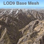
Detailed terrain mesh of the Southcentral Himalayan Ranges, N26-32 E82-90. The files in this package are based on Shuttle Radar (SRTM) Version 2 data but with many of the void areas, especially the most significant sections, filled with elevation data generated from topographic maps by Jonathan de Ferranti. While Jonathan's work is unrelated to flight simulation he kindly gave me permission to compile his data for use in FS. The result is a wonderful improvement in detail and accuracy over any existing mesh file, freeware or commercial, based on SRTM or DTED data alone.
Due to the large area of the Himalayas I've compiled the source data as two separate series: the "Himalayan Peaks" series covers prominent mountains and ranges in higher detail and locally overrides any existing LOD9 terrain mesh. In addition, a LOD9 "base mesh" series, with LOD8 and LOD7 "buffer" mesh files, covering the entire Himalayas, is meant for those who do not yet have an add-on terrain mesh of these beautiful mountains.
| Filename: | Himalayas_LOD9_Base_Mesh_Volume_2__Southcentral_Ra.zip |
| License: | Freeware, limited distribution |
| Added: | 29th May 2010, 09:05:56 |
| Downloads: | 9,458 |
| Author: | Holger Sandmann, Jonathan de Ferranti |
| Size: | 90.25 MB |
| Category: Flight Simulator 2004 - Scenery | |
| Himalayas LOD9 Base Mesh, Volume 3 - Southwestern Ranges |
|
Images related to this file:
File Description:
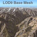
Detailed terrain mesh of the Southwestern Himalayan Ranges, N28-37 E78-82. The files in this package are based on Shuttle Radar (SRTM) Version 2 data but with many of the void areas, especially the most significant sections, filled with elevation data generated from topographic maps by Jonathan de Ferranti. While Jonathan's work is unrelated to flight simulation he kindly gave me permission to compile his data for use in FS. The result is a wonderful improvement in detail and accuracy over any existing mesh file, freeware or commercial, based on SRTM or DTED data alone.
Due to the large area of the Himalayas I've compiled the source data as two separate series: the "Himalayan Peaks" series covers prominent mountains and ranges in higher detail and locally overrides any existing LOD9 terrain mesh. In addition, the LOD9 "base mesh" series, with LOD8 and LOD7 "buffer" mesh files, covering the entire Himalayas, is meant for those who do not yet have an add-on terrain mesh of these beautiful mountains.
| Filename: | Himalayas_LOD9_Base_Mesh_Volume_3__Southwestern_Ra.zip |
| License: | Freeware, limited distribution |
| Added: | 30th May 2010, 10:00:26 |
| Downloads: | 155,815 |
| Author: | Holger Sandmann, Jonathan de Ferranti |
| Size: | 62.16 MB |
| Category: Flight Simulator 2004 - Scenery | |
| Himalayas LOD9 Base Mesh, Volume 5 - Hindu Kush and Pamir |
|
Images related to this file:
File Description:
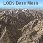
Detailed terrain mesh of the Hindu Kush and Pamir Ranges, N32-40 E70-76. The files in this package are based on Shuttle Radar (SRTM) Version 2 data but with many of the void areas, especially the most significant sections, filled with elevation data generated from topographic maps by Jonathan de Ferranti. While Jonathan's work is unrelated to flight simulation he kindly gave me permission to compile his data for use in FS. The result is a wonderful improvement in detail and accuracy over any existing mesh file, freeware or commercial, based on SRTM or DTED data alone.
Due to the large area of the Himalayas I've compiled the source data as two separate series: the "Himalayan Peaks" series covers prominent mountains and ranges in higher detail and locally overrides any existing LOD9 terrain mesh. In addition, the LOD9 "base mesh" series, with LOD8 and LOD7 "buffer" mesh files, covering the entire Himalayas, is meant for those who do not yet have an add-on terrain mesh of these beautiful mountains.
| Filename: | Himalayas_LOD9_Base_Mesh_Volume_5__Hindu_Kush_and_.zip |
| License: | Freeware, limited distribution |
| Added: | 29th May 2010, 08:57:29 |
| Downloads: | 7,613 |
| Author: | Holger Sandmann, Jonathan de Ferranti |
| Size: | 85.72 MB |
| Category: Flight Simulator 2004 - Scenery | |
| "Himalayan Peaks" LOD10 Mesh, Volume 8 - Tirich Mir and Pamir |
|
Images related to this file:
File Description:
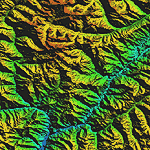
Highly detailed terrain mesh of the Tirich Mir and Pamir areas, N36-39 E71-74. The files in this package are based on Shuttle Radar (SRTM) Version 2 data but with many of the void areas, especially the most significant sections, filled with elevation data generated from topographic maps by Jonathan de Ferranti. While Jonathan's work is unrelated to flight simulation he kindly gave me permission to compile his data for use in FS. The result is a wonderful improvement in detail and accuracy over any existing mesh file, freeware or commercial, based on SRTM or DTED data alone.
Due to the large area of the Himalayas I've compiled the source data as two separate series: the "Himalayan Peaks" series covers prominent mountains and ranges in higher detail and locally overrides any existing LOD9 terrain mesh. In addition, a LOD9 "base mesh" series covering the entire Himalayas will be available for those who do not yet have an add-on terrain mesh of these beautiful mountains.
| Filename: | Himalayan_Peaks_LOD10_Mesh_Volume_8__Tirich_Mir_an.zip |
| License: | Freeware, limited distribution |
| Added: | 29th May 2010, 08:52:47 |
| Downloads: | 9,119 |
| Author: | Holger Sandmann, Jonathan de Ferranti |
| Size: | 47.94 MB |
| Category: Flight Simulator 2004 - Original Aircraft | |
| Ansaldo S.V.A.-5 (V.01) |
|
Images related to this file:
File Description:
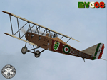
One of the faster airplane of WWI thanks to an innovative design, the S.V.A. was the first airplane conceived and built entirely in Italy. The initials "S.V.A." stand for the names of Savoia and Verduzio, the two engineers that designed it, and of Ansaldo, the firm that built over 2000 of them starting from 1917. The Ansaldo S.V.A. was an entire family of Italian reconnaissance biplane aircraft of World War I and the decade after. Originally conceived as a fighter, the S.V.A. was found inadequate for that role. Nevertheless, its impressive speed, range and operational ceiling made it an excellent reconnaissance aircraft and even light bomber.
The S.V.A. became legendary among pilots for some of its memorable flights; first, above all, the one over Vienna: this flight was an epic action performed by Italian poet and nationalist patriot Gabriele D'Annunzio on 9th August 1918. After the war, thanks to the strong determination of Arturo Ferrarin and Guido Masiero( the pilots), two S.V.A.9s (the two seater version of the S.V.A.-5) flew for 18000Km from Rome to Tokyo (14th February / 31st May 1920). Another S.V.A., piloted by Antonio Locatelli, first flew alone across the Andes (30th July 1919).
Production of the aircraft continued well after the war, with the final examples delivered in 1928. In 1919 some S.V.A.s were used in airmail routes by "Gruppo Sperimentale Comunicazioni Aeree", a group formed by the Italian Army in order to prove the feasibility of commercial air services. The Regia Aeronautica (Royal Italian Air Force, since 1923) employed the S.V.A. in operational units in Italy and North Africa (Lybia) as well as for pilot training. Many war-surplus planes were employed by commercial flying schools.
Complete aircraft, 5 Different Hi-Res GMax models (5 different versions, three S.V.A.-5 and two S.V.A.-9), features the usual moving parts, such as all flight controls. Five different liveries (three WWI and two post-war). VC and 2D Panel. Models, panels and paints by Manuele Villa, Flight dynamics, Handling notes and tutorials by FSAviator.
September 2008. Installation instructions included.
| Filename: | Ansaldo_SVA5_V01.zip |
| License: | Freeware |
| Added: | 6th May 2010, 08:49:53 |
| Downloads: | 3,214 |
| Author: | Manuele Villa |
| Size: | 40.55 MB |


© 2001-2026 AVSIM Online
All Rights Reserved
Privacy Policy |