
Where Flight Simulation Enthusiasts Gather from Around the World!
AVSIM Library - Search Results

| Category: Flight Simulator 2004 - Aircraft Repaints, Textures and Modifications | |
| Updated night lighting for Airbus A320 and A321 |

|
Images related to this file:
File Description:

This an OPTIONAL night light upgrade for the Project Airbus A320 and A321 and includes reshaped and brightened engine landing light reflection. Most important and noticeable upgrade is the wing lights (due to FS limitations, these will turn on with the landing lights, however in real life -depending on airline SOP and pilot preference- these are turned on with the landing lights for takeoff and landing so the effect of doing this is the similar). Wing lights illuminate down wing reflection and the sharklets are also illuminated. I've also now added light reflection on the standard wingtip fence. NOTE: For the FS9 models only but it does work in FSX. A318 and A319 update will come at a later date however, you can simply change the name of the wing and engine texture files to make them work. Textures only, you need the freeware Project Airbus A320 or A321 and any livery you wish to use this on to work.
| Filename: | Updated_night_lighting_for_Airbus_A320_and_A321.zip |
| License: | Freeware |
| Added: | 13th April 2016, 20:23:49 |
| Downloads: | 1,872 |
| Author: | Adam Hamada | Project Airbus |
| Size: | 2.03 MB |
| Category: Flight Simulator X - Scenery | |
| Jersey Airport (EGJJ) |
|
File Description:
Jersey Airport (EGJJ) is located on the island of Jersey in the Channel Islands. I live on the island, so this is a pretty accurate representation of the airport. Features include many parkable hangars, accurate control tower, accurate departure lounge, accurate gates, accurate aero club, many static aircraft, many vehicles, car parks, freight terminal, private aviation terminal, fuel farm, fire-station, surrounding trees, perimeter fencing and more. Many night textures and custom AFCAD file included. The airport is at N49 12 28 and W002 11 43. This scenery is for FSX but should also work under FS2004. It may even work in earlier versions of FS but this is untested. This scenery is dedicated to my father who was a pilot in the Royal Air Force and subsequently worked as an Air Traffic Controller at the airport for over 20 years. He sparked my interest in aviation in the first place and since the original airport was released, he has passed away. He's sorely missed.
| Filename: | Jersey_Airport_EGJJ.zip |
| License: | Freeware, limited distribution |
| Added: | 29th October 2006, 03:15:15 |
| Downloads: | 13,869 |
| Author: | Tim Clayton |
| Size: | 3.68 MB |
| Category: Flight Simulator 2004 - Aircraft Repaints, Textures and Modifications | |
| USAF Douglas SC-54 Rescuemaster Version 1.1 |
|
Images related to this file:
File Description:
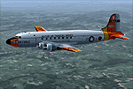
This is a US Air Force SC-54 in the colors of the Military Air Transport Service. This aircraft was used in search and rescue operations and wears the day glo colors typical of air force transports of the period. MATS was a joint service transportation operation combining resources from the Air Force, Army and US Navy into a single coordinated airlift command serving all military branches.
The updated repaint is highly accurate with the exception of the fact that the real aircraft had large blister windows on both sides of the fuselage. I tried creating these with artwork, but its going to take a MDL change to fix! Maybe Jens will be able to address one day!
This skin requires the Jens B. Kristensen JBK DC-4 file (dc4_v21.zip) AND the C-54 cargo version (dc4cgv21.zip). These files may be found on this and other popular FS web sites. You MUST have the cargo version installed.
| Filename: | USAF_Douglas_SC54_Rescuemaster_Version_11.zip |
| License: | Freeware, limited distribution |
| Added: | 7th July 2010, 04:56:52 |
| Downloads: | 665 |
| Author: | Eric Joiner / Jens Kristensen |
| Size: | 4.57 MB |
| Category: Flight Simulator X - Original Aircraft | |
| NASA TU-144LL Test Bed |
|
Images related to this file:
File Description:
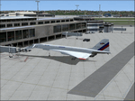
NASA TU-144LL: TU-144D aircraft (CCCP-77114) converted to a flying laboratory for NASA with four Kuznetsov NK-321 afterburning turbofan engines and re-registered RA-77114. The aircraft underwent many upgrades and modifications in its conversion to the "LL" Flying Laboratory, including the installation of more powerful NK-321 augmented-turbofan engines that were originally produced for the Tupolev TU-160 Blackjack bomber. NASA successfully used this aircraft to help in designing the U.S. Space Shuttle. She is no longer flying, nor are any other Soviet versions other than the TU-160. This model represents the maximum test payload and fuel for test flights, and includes real world engine/aero dynamics provided by NASA and further employed in this converted model (cosmetics are original). Study the Readme.txt file before flying this version. Model/Textures: Thomas Ruth. Sounds: Claudio Mussner. Panel: Philippe Wallaert. Aero/Engine Dynamic Corrections by: Douglas E. Trapp, FS Flight Dynamics Engineer, [email protected]. August 2017.
| Filename: | NASA_TU144LL_Test_Bed.zip |
| License: | Freeware |
| Added: | 19th August 2017, 21:20:13 |
| Downloads: | 713 |
| Author: | Douglas E. Trapp |
| Size: | 16.24 MB |
| Category: Flight Simulator 2004 - Scenery | |
| "Himalayan Peaks" LOD10 Mesh, Volume 3 - Namcha Barwa |
|
File Description:
Highly detailed terrain mesh of the Namcha Barwa area, N29°-31° E94°-96°. The files in this package are based on Shuttle Radar (SRTM) Version 2 data but with many of the void areas, especially the most significant sections, filled with elevation data generated from topographic maps by Jonathan de Ferranti. While Jonathan's work is unrelated to flight simulation he kindly gave me permission to compile his data for use in FS. The result is a wonderful improvement in detail and accuracy over any existing mesh file, freeware or commercial, based on SRTM or DTED data alone. Due to the large area of the Himalayas I've compiled the source data as two separate series: the "Himalayan Peaks" series covers prominent mountains and ranges in higher detail and locally overrides any existing LOD9 terrain mesh. In addition, a LOD9 "base mesh" series covering the entire Himalayas will be available for those who do not yet have an add-on terrain mesh of these beautiful mountains.
| Filename: | Himalayan_Peaks_LOD10_Mesh_Volume_3__Namcha_Barwa.zip |
| License: | Freeware, limited distribution |
| Added: | 18th February 2006, 23:15:17 |
| Downloads: | 12,188 |
| Author: | Holger Sandmann and Jonathan de Ferranti |
| Size: | 15.09 MB |
| Category: Flight Simulator 2004 - Scenery | |
| "Himalayan Peaks" LOD10 Mesh, Volume 5 - Garhwal |
|
File Description:
Highly detailed terrain mesh of the Garhwal area, N30°-32° E78°-81°. The files in this package are based on Shuttle Radar (SRTM) Version 2 data but with many of the void areas, especially the most significant sections, filled with elevation data generated from topographic maps by Jonathan de Ferranti. While Jonathan's work is unrelated to flight simulation he kindly gave me permission to compile his data for use in FS. The result is a wonderful improvement in detail and accuracy over any existing mesh file, freeware or commercial, based on SRTM or DTED data alone. Due to the large area of the Himalayas I've compiled the source data as two separate series: the "Himalayan Peaks" series covers prominent mountains and ranges in higher detail and locally overrides any existing LOD9 terrain mesh. In addition, a LOD9 "base mesh" series covering the entire Himalayas will be available for those who do not yet have an add-on terrain mesh of these beautiful mountains.
| Filename: | Himalayan_Peaks_LOD10_Mesh_Volume_5__Garhwal.zip |
| License: | Freeware, limited distribution |
| Added: | 18th February 2006, 23:16:47 |
| Downloads: | 10,134 |
| Author: | Holger Sandmann and Jonathan de Ferranti |
| Size: | 27.72 MB |
| Category: Flight Simulator 2004 - Scenery | |
| "Himalayan Peaks" LOD10 Mesh, Volume 6 - Jammu and Kashmir |
|
Images related to this file:
File Description:
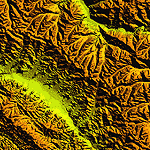
Highly detailed terrain mesh of the Jammu and Kashmir areas, N31-36 E76-78. The files in this package are based on Shuttle Radar (SRTM) Version 2 data but with many of the void areas, especially the most significant sections, filled with elevation data generated from topographic maps by Jonathan de Ferranti. While Jonathan's work is unrelated to flight simulation he kindly gave me permission to compile his data for use in FS. The result is a wonderful improvement in detail and accuracy over any existing mesh file, freeware or commercial, based on SRTM or DTED data alone.
Due to the large area of the Himalayas I've compiled the source data as two separate series: the "Himalayan Peaks" series covers prominent mountains and ranges in higher detail and locally overrides any existing LOD9 terrain mesh. In addition, a LOD9 "base mesh" series covering the entire Himalayas will be available for those who do not yet have an add-on terrain mesh of these beautiful mountains.
| Filename: | Himalayan_Peaks_LOD10_Mesh_Volume_6__Jammu_and_Kas.zip |
| License: | Freeware, limited distribution |
| Added: | 29th May 2010, 08:55:43 |
| Downloads: | 9,666 |
| Author: | Holger Sandmann, Jonathan de Ferranti |
| Size: | 52.19 MB |
| Category: Flight Simulator 2004 - Scenery | |
| "Himalayan Peaks" LOD10 Mesh, Volume 7 - K2 and Karakoram |
|
Images related to this file:
File Description:

Highly detailed terrain mesh of the Karakoram area, N35-37 E73-77. The files in this package are based on Shuttle Radar (SRTM) Version 2 data but with many of the void areas, especially the most significant sections, filled with elevation data generated from topographic maps by Jonathan de Ferranti. While Jonathan's work is unrelated to flight simulation he kindly gave me permission to compile his data for use in FS. The result is a wonderful improvement in detail and accuracy over any existing mesh file, freeware or commercial, based on SRTM or DTED data alone.
Due to the large area of the Himalayas I've compiled the source data as two separate series: the "Himalayan Peaks" series covers prominent mountains and ranges in higher detail and locally overrides any existing LOD9 terrain mesh. In addition, a LOD9 "base mesh" series covering the entire Himalayas will be available for those who do not yet have an add-on terrain mesh of these beautiful mountains.
| Filename: | Himalayan_Peaks_LOD10_Mesh_Volume_7__K2_and_Karako.zip |
| License: | Freeware, limited distribution |
| Added: | 30th May 2010, 09:56:27 |
| Downloads: | 9,480 |
| Author: | Holger Sandmann, Jonathan de Ferranti |
| Size: | 38.58 MB |
| Category: Flight Simulator 2004 - Scenery | |
| Scotports Volume 1 |
|
Images related to this file:
File Description:
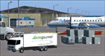
It is well noted that Scottish Airports are very neglected by scenery developers in FS9, mainly the smaller Airports. Therefore I decided to do a little something about it! - Using the wonderful Airport Design Editor (ADE), I have constructed these sceneries from scratch, after deleting all of the disappointing default buildings and objects. The airports included are 99% realistic regarding runways, aprons and taxiways and general airport layout, however there may be a one or two minor discrepancies due to FS limitations. I have also added fictional ILS to runways which don't have ILS in the real world. All scenery objects and textures are by Sidney Schwartz (especially for ADE), of whom, without his long hours of work, none of this would have been possible. Airports in this package are: Campbeltown (EGEC), Eday (EGED), Kirkwall (EGPA), Sumburgh (EGPB), Wick (EGPC), Inverness v2 (EGPE), Islay (EGPI), and Dundee (EGPN). All these airports are served by Loganair.
| Filename: | Scotports_Volume_1.zip |
| License: | Freeware |
| Added: | 3rd November 2011, 19:35:10 |
| Downloads: | 4,354 |
| Author: | Chris Horsfield |
| Size: | 70.7 MB |
| Category: Flight Simulator 2004 - Scenery | |
| Himalayan Peaks LOD10 Mesh, Volume 1 - Mt. Everest and Kula Kangri |
|
File Description:
Highly detailed terrain mesh of the Mt. Everest and Kula Kangri areas, N26°-29° E85°-92°. The files in this package are based on Shuttle Radar (SRTM) Version 2 data but with many of the void areas, especially the most significant sections, filled with elevation data generated from topographic maps by Jonathan de Ferranti. While Jonathan's work is unrelated to flight simulation he kindly gave me permission to compile his data for use in FS. The result is a wonderful improvement in detail and accuracy over any existing mesh file, freeware or commercial, based on SRTM or DTED data alone. Due to the large area of the Himalayas I've compiled the source data as two separate series: the "Himalayan Peaks" series covers prominent mountains and ranges in higher detail and locally overrides any existing LOD9 terrain mesh. In addition, a LOD9 "base mesh" series covering the entire Himalayas will be available for those who do not yet have an add-on terrain mesh of these beautiful mountains.
| Filename: | Himalayan_Peaks_LOD10_Mesh_Volume_1__Mt_Everest_an.zip |
| License: | Freeware, limited distribution |
| Added: | 9th February 2006, 22:13:00 |
| Downloads: | 37,047 |
| Author: | Holger Sandmann and Jonathan de Ferranti |
| Size: | 52.01 MB |


© 2001-2026 AVSIM Online
All Rights Reserved
Privacy Policy |