
Where Flight Simulation Enthusiasts Gather from Around the World!
AVSIM Library - Search Results

| Category: Flight Simulator X - Scenery | |
| Yeu island - LFEY |

|
Images related to this file:
File Description:
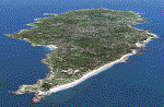
The island of Yeu (LFEY) is located in the west of France, in the south-west of Nantes. Its main runway is located on the wild coast, near the great lighthouse.
It is made up of :
- A new mesh based ASTER compiled in LOD11 and a very local mesh for the airport, compiled in LOD13 to get a good compatibility with the specific payware meshes.
- Photorealistic texture at 0.5 m/pixel based on aerial photography.
- The airfield and runway. The runway is flat, allowing to preserve the AI traffic. The grass strip is modeled with its relief. There is therefore no AI traffic on the grass strip.
- The port of Port-Joinville and several notable buildings made with Gmax (churches, chapel, castle, fort, ruins, beacons, etc)
- Generic or custom objects created with Gmax (boats, buildings).
| Filename: | Yeu_island__LFEY.zip |
| License: | Freeware |
| Added: | 29th December 2012, 04:03:47 |
| Downloads: | 1,719 |
| Author: | marc guitteny |
| Size: | 217.78 MB |
| Category: Flight Simulator X - AFCAD Files | |
| KSVC Grant County Airport - Silver City, New Mexico |
|
File Description:
This scenery updates KSVC Grant County airport located near Silver City, New Mexico. The apron was enlarged, cargo and small airline parking spots were added, apron access taxiways were added, a terminal building, two hangars, water tank, and fire watch tower were added, the airport access road was added, and the approach VASI lights were changed to PAPI lights. An optional landclass file is also included to depict the mining operation to the east of the airport. The scenery was designed with ORBX FTX Global Vector and Pilot's Global Ultimate terrain mesh installed, but it should work OK with the default vector scenery and mesh. This scenery was created using the awesome scenery tool Airport Design Editor by Scruffyduck Software. Please refer to the readme file for more details and installation instructions.
| Filename: | KSVC_Grant_County_Airport__Silver_City_New_Mexico.zip |
| License: | Freeware |
| Added: | 4th February 2017, 18:05:29 |
| Downloads: | 338 |
| Author: | David Midgett |
| Size: | 2.74 MB |
| Category: Flight Simulator 2004 - Scenery Design | |
| Kijik Lake_version2 |
|
File Description:
Version 2_contains the updated AFCAD2 BGL.
Kijik Lake, Alaska is located within the boundaries of the 4 million acre Lake Clark National Park and Preserve. It is 6nm north of Port Alsworth (TPO) on the NW side of Lake Clark. Two new cabins and homey wall tents are provided for hunters, fishermen, campers, hikers and explorers who wish to submerge themselves in the best of Alaska's wilderness scenery. This roadless and trailless wilderness is accessed by air service only. Kijik Lake has a new floatplane dock and a very landable dirt/gravel shoreline airstrip. Plan your next flight to Kijik Lake where you'll find a warm fire, a great meal and unsurpassed hospitality.
Created for FS9's default mesh, but works equally well with Eddie Denney's Alaska 2000 or 2002 mesh.
| Filename: | Kijik_Lake_version2.zip |
| License: | Freeware, limited distribution |
| Added: | 21st March 2004, 22:50:27 |
| Downloads: | 640 |
| Author: | Brent Hricziscse |
| Size: | 1.85 MB |
| Category: Flight Simulator 2004 - Scenery | |
| US North Cascades Mountains and Northwest Washington Coast |
|
File Description:
The files in this package completely replace the FS default landscape of the North Cascades Mountains and coastal areas of northwestern Washington State. Between Bellingham and Arlington (N-S), Orcas Island and Lake Chelan (W-E) you can now enjoy your VFR flights with accurate locations of coastlines, lakes, rivers, streams, roads, railroads, and power lines, as well as land use type (landclass) and terrain (add-on mesh). Also added are the larger glaciers of the majestic North Cascades volcanoes and peaks as well as several forestry roads and clearcuts outside the National Park and Wilderness areas. Made mostly with Christian Fumey's "Ground2K4" and Jim Keir's "Slartibartfast". Fully compatible with the recent freeware LOD10 add-on meshes of the western US. Mesh and landclass files will work in FS2002 but not the special scenery enhancements.
| Filename: | US_North_Cascades_Mountains_and_Northwest_Washingt.zip |
| License: | Freeware, limited distribution |
| Added: | 18th May 2004, 23:12:57 |
| Downloads: | 14,321 |
| Author: | Holger Sandmann |
| Size: | 12.72 MB |
| Category: Flight Simulator 2004 - Scenery | |
| Glacier Bay National Park, Alaska |
|
File Description:
Add-on meshes can greatly improve the detail of the FS terrain but often conflict with the inaccurate placement of the other default FS landscape elements, particularly in coastal and mountainous areas. This project showcases new methods and software that allow for semi-automated development of FS landscapes from accurate source data. The files completely replace the default FS landscape of Southeast Alaska's Glacier Bay National Park and the adjacent Lynn Canal area between Juneau and Skagway (N58-60 W134-138), including shorelines, islands, and lakes, as well as glaciers, landclass, man-made features, and a LOD9 (76-m) terrain mesh. Optional AI floatplane traffic at four seaplane bases is included. A LOD10 (38-m) mesh of the same area is available as a separate optional download. FS2002 users please use fs8glbay.zip instead.
| Filename: | Glacier_Bay_National_Park_Alaska.zip |
| License: | Freeware, limited distribution |
| Added: | 16th February 2004, 03:40:31 |
| Downloads: | 17,193 |
| Author: | Holger Sandmann, Jim Keir |
| Size: | 10.43 MB |
| Category: Flight Simulator 2002 - Scenery | |
| Alaska Bush Scenery: Coghill Lake |
|
File Description:
Situated off College Fiord at the upper end of Prince William Sound, Coghill Lake is conveniently positioned for stopping off en-route between the Anchorage & Valdez areas. It's the actual location of a holiday cabin owned by the US Forest Service which can only be reached by floatplane, however I've added 2 airstrips to the area for extra interest. Coghill's main landing strip is sandy & partially overgrown, but has a good available length of 635m/2100' and some low-intensity edge lights. Ample parking for visitors is provided in a separate ramp area amongst the trees, reached via a basic but lit & signposted taxiway. Adjacent access by floatplane is possible using the small lagoon, as well as by College Fiord itself for larger loads. The other strip, a mile southwest across the river, only gets seasonal use by agricultural aircraft for spraying the local conifer plantations; its narrow gravel runway is slightly shorter at 588m/1930' & is a more challenging proposition with the surrounding trees and heavy brush all encroaching on the landing strip. Includes 2 versions: 1 for Eddie Denney's FS2002 mesh (recommended as this makes the airstrip profiles uneven), and another for both Eddie Denney's FS2000 mesh and the default mesh.
| Filename: | Alaska_Bush_Scenery_Coghill_Lake.zip |
| License: | Freeware, limited distribution |
| Added: | 28th May 2003, 19:07:22 |
| Downloads: | 1,933 |
| Author: | James Belk |
| Size: | 2.98 MB |
| Category: Flight Simulator 2004 - Aircraft Repaints, Textures and Modifications | |
| UKA Boeing 733 G-CELU |
|
File Description:
UKA (United Kingdom Airlines)
Brings you the Boeing 737-300 this aircraft is part of
fligthlife.co.uk and runs routes over Europe .
Fully working flaps rudder and moving wheels
Have a nice flight
| Filename: | UKA_Boeing_733_GCELU.zip |
| License: | Freeware |
| Added: | 7th May 2004, 17:23:05 |
| Downloads: | 192 |
| Author: | Andy medley |
| Size: | 1.5 MB |
| Category: Flight Simulator 2004 - Scenery | |
| Modified SRTM relief 76 m for Slovakia |
|
File Description:
This Slovak terrain mesh 76 m (LOD9) is made from the 3arc-sec SRTM. The voids in the source data were filled by the interpolation. Both the primary processing of the 3arc-sec data and the rendering of the terrain in the FS cause flattening and simplifying of the real shape of the terrain. This phenomenon was partially compensated by the sharpening of the source data.
Made by the programs Surfer (Golden Software) and MS Terrain SDK 2000 and 2002. The relief covers the area N49.9219 E016.1719 to N47.4609 E022.9687 in the boundaries of the LOD9 quadrants. This scenery contains only the elevation data. The other elements of the basic terrain as the landclass, locally used airborne photos, vector roads, rivers and lakes are available in different sceneries by other authors and they are continuously developed.
| Filename: | Modified_SRTM_relief_76_m_for_Slovakia.zip |
| License: | Freeware, limited distribution |
| Added: | 28th May 2010, 19:40:13 |
| Downloads: | 4,606 |
| Author: | Vladimir Stoje |
| Size: | 19.36 MB |
| Category: Flight Simulator 2004 - Scenery | |
| Modified SRTM Relief 76 m for Czech Republic |
|
File Description:
This Czech Republic terrain mesh 76 m (LOD9) is made from the 3arc-sec SRTM. Small voids in the source data were filled by the interpolation. Both the primary processing of the 3arc-sec data and the rendering of the terrain in the FS cause flattening and simplifying of the real shape of the terrain. This phenomenon was partially compensated by the sharpening of the source data. Made by the programs Surfer (Golden Software) and MS Terrain SDK 2000 and 2002. The relief covers the area N51.1523 E011.9531 to N48.5156 E018.9844 in the boundaries of the LOD9 quadrants. This scenery contains only the elevation data. The other elements of the basic terrain as the landclass, locally used airborne photos, vector roads, rivers and lakes are available in different sceneries by other authors and they are continuously developed.
| Filename: | Modified_SRTM_Relief_76_m_for_Czech_Republic.zip |
| License: | Freeware |
| Added: | 22nd December 2003, 21:25:07 |
| Downloads: | 6,722 |
| Author: | Vladimir Stoje |
| Size: | 20.81 MB |
| Category: Flight Simulator 2004 - Scenery | |
| Project Mexico Real LOD10 File 1 of 11 |
|
Images related to this file:
File Description:
File 1st of 11 of a Terrain Mesh that covers the entirety of Mexican Territory and related bordering U.S., Guatemala and Belice areas, part of the "Proyecto Mexico Real" project, compiled at LOD10 (1.24 arcseconds in latitude and 1.65 arcseconds in longitude) resolution from INEGI data. Intended to enhance the virtual flying experience complementing the LOD8 and LOD9 versions compiled from the same data. Compatible backwards with Flight Simulator 2000, Flight Simulator 2002 and Combat Flight Simulator 2. Refer to the file contents about the cover area to this compressed file. (Re-upload due to AVSIM hack)
| Filename: | Project_Mexico_Real_LOD10_File_1_of_11.zip |
| License: | Check within download |
| Added: | 6th June 2010, 09:05:59 |
| Downloads: | 4,164 |
| Author: | Juan Jose Galvan Bautista |
| Size: | 73.44 MB |


© 2001-2026 AVSIM Online
All Rights Reserved
Privacy Policy |