
Where Flight Simulation Enthusiasts Gather from Around the World!
AVSIM Library - Search Results

| Category: Flight Simulator 2004 - Scenery | |
| Bridges, Tressels & Trains - Custom-Made and Individually Placed for Ultimate Terrain USA |

|
File Description:
Bridges, Tressels & Trains - custom-made and individually placed for Ultimate Terrain USA
Vol. 1 - California Coast, Monterey County to San Francisco bay area
Compatible with Ultimate Terrain USA, verified with Google Earth.
Requires Ultimate Terrain USA and 38m mesh. See Settings Note.
For FS9 use only. GMAX with DXT1 textures.
| Filename: | Bridges_Tressels__Trains__CustomMade_and_Individually_Placed_for_Ultimate_Terrain_USA.zip |
| License: | Freeware |
| Added: | 25th November 2005, 05:06:21 |
| Downloads: | 1,968 |
| Author: | Lou Frost |
| Size: | 1.01 MB |
| Category: Flight Simulator X - Scenery | |
| Town of Nantes - France |
|
File Description:
The town of Nantes (around 120 Km2) in photorealistic textures in 2m/pixel, full seasons and specific autogen.
It is made up of a new local mesh, various buildings, churches, and reference marks visual.
All specifics objects are made in Gmax with FsX textures.
Take off from Nantes Altantique (LFRS).
| Filename: | Town_of_Nantes__France.zip |
| License: | Freeware, limited distribution |
| Added: | 30th July 2007, 12:42:52 |
| Downloads: | 6,972 |
| Author: | marc-henri Guitteny |
| Size: | 79.52 MB |
| Category: Flight Simulator 2004 - Scenery | |
| Antilles 2004 |
|
File Description:
This scenery package aims at improving the visual depiction of the Caribbean. It covers 17 islands and 16 airports from Montserrat down to Tobago. It provides totally new island coastlines, mesh, landclass, roads, rivers, visual details for VFR flying, animated scenery, custom airports as well as accurate navaids and ATC frequencies.
| Filename: | Antilles_2004.zip |
| License: | Freeware, limited distribution |
| Added: | 9th February 2004, 04:40:22 |
| Downloads: | 25,435 |
| Author: | FS Antilles Group |
| Size: | 10.04 MB |
| Category: Flight Simulator X - Original Aircraft | |
| McDonnell Douglas DC-10 Version2.0 |
|
Images related to this file:
File Description:
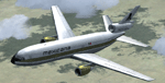
FSX native model, needs FSX ServicePack1 or 2. Version2, this time with custom panel and virtual cockpit. Panel and Gauges build with and for FSX SP2. External model KC10 boom changed to door animation. FSX conversion of Erick Cantus beautiful FS9 WIP mesh with new. By Thomas Ruth and Erick Cantu.
| Filename: | McDonnell_Douglas_DC10_Version20.zip |
| License: | Freeware |
| Added: | 23rd April 2012, 23:20:19 |
| Downloads: | 14,086 |
| Author: | Thomas Ruth, Eric Cantu |
| Size: | 104.21 MB |
| Category: Flight Simulator 2004 - Scenery | |
| Project Mexico Real LOD10 File 3 of 11 |
|
Images related to this file:
File Description:
Re-upload. File 3rd of 11 of a Terrain Mesh that covers the entirety of Mexican Territory and related bordering U.S., Guatemala and Belice areas, part of the "Proyecto Mexico Real" project, compiled at LOD10 (1.24 arcseconds in latitude and 1.65 arcseconds in longitude) resolution from INEGI data. Intended to enhance the virtual flying experience complementing the LOD8 and LOD9 versions compiled from the same data. Compatible backwards with Flight Simulator 2000, Flight Simulator 2002 and Combat Flight Simulator 2. Refer to the file contents about the cover area to this compressed file.
| Filename: | Project_Mexico_Real_LOD10_File_3_of_11.zip |
| License: | Check within download |
| Added: | 8th June 2010, 03:17:03 |
| Downloads: | 3,254 |
| Author: | Juan Jose Galvan Bautista |
| Size: | 73.67 MB |
| Category: Flight Simulator 2004 - Scenery | |
| Project Mexico Real LOD10 File 10 of 11 |
|
Images related to this file:
File Description:
Re-upload. File 10th of 11 of a Terrain Mesh that covers the entirety of Mexican Territory and related bordering U.S., Guatemala and Belice areas, part of the "Proyecto Mexico Real" project, compiled at LOD10 (1.24 arcseconds in latitude and 1.65 arcseconds in longitude) resolution from INEGI data. Intended to enhance the virtual flying experience complementing the LOD8 and LOD9 versions compiled from the same data. Compatible backwards with Flight Simulator 2000, Flight Simulator 2002 and Combat Flight Simulator 2. Refer to the file contents about the cover area to this compressed file.
| Filename: | Project_Mexico_Real_LOD10_File_10_of_11.zip |
| License: | Check within download |
| Added: | 5th September 2010, 20:55:05 |
| Downloads: | 3,061 |
| Author: | Juan Jose Galvan Bautista |
| Size: | 70.54 MB |
| Category: Flight Simulator 2004 - Scenery | |
| Project México Real LOD10 File 4 of 11 |
|
File Description:
File 4th of 11 of a Terrain Mesh that covers the entire Mexican Territory and related areas bordering the U.S., Guatemala and Belice areas. Part of the "Proyecto México Real" project, compiled at LOD10 (1.24 arcseconds in latitude and 1.65 arcseconds in longitude) resolution from INEGI data. Intended to enhance the virtual flying experience complementing the LOD8 and LOD9 versions compiled from the same data. Compatible backwards with Flight Simulator 2000, Flight Simulator 2002 and Combat Flight Simulator 2. Refer to the file contents about the cover area to this compressed file.
| Filename: | Project_Mxico_Real_LOD10_File_4_of_11.zip |
| License: | Check within download |
| Added: | 6th June 2006, 00:58:59 |
| Downloads: | 3,066 |
| Author: | Juan José Galván Bautista |
| Size: | 74.49 MB |
| Category: Flight Simulator 2004 - Scenery | |
| Project México Real LOD10 File 6 of 11 |
|
File Description:
File 6th of 11 of a Terrain Mesh that covers the entire Mexican Territory and related areas bordering the U.S., Guatemala and Belice areas. Part of the "Proyecto México Real" project, compiled at LOD10 (1.24 arcseconds in latitude and 1.65 arcseconds in longitude) resolution from INEGI data. Intended to enhance the virtual flying experience complementing the LOD8 and LOD9 versions compiled from the same data. Compatible backwards with Flight Simulator 2000, Flight Simulator 2002 and Combat Flight Simulator 2. Refer to the file contents about the cover area to this compressed file.
| Filename: | Project_Mxico_Real_LOD10_File_6_of_11.zip |
| License: | Check within download |
| Added: | 6th June 2006, 01:07:16 |
| Downloads: | 3,023 |
| Author: | Juan José Galván Bautista |
| Size: | 71.63 MB |
| Category: Flight Simulator 2004 - Scenery | |
| Project México Real LOD10 File 11 of 11 |
|
File Description:
File 11th of 11 of a Terrain Mesh that covers the entirety of Mexican Territory and related bordering U.S., Guatemala and Belice areas, part of the "Proyecto México Real" project, compiled at LOD10 (1.24 arcseconds in latitude and 1.65 arcseconds in longitude) resolution from INEGI data. Intended to enhance the virtual flying experience complementing the LOD8 and LOD9 versions compiled from the same data. Compatible backwards with Flight Simulator 2000, Flight Simulator 2002 and Combat Flight Simulator 2. Refer to the file contents about the cover area to this compressed file.
| Filename: | Project_Mxico_Real_LOD10_File_11_of_11.zip |
| License: | Check within download |
| Added: | 6th June 2006, 01:52:33 |
| Downloads: | 3,096 |
| Author: | Juan José Galván Bautista |
| Size: | 69.98 MB |
| Category: Flight Simulator 2004 - Scenery | |
| JRM Bahamas EZ Scenery Part #3 |
|
File Description:
FS2004 JRM Bahamas EZ Scenery Part #3
FS9+ EZ scenery Eleutheria Island JRM_Bhm3.zip (see JRM_bhm1.zip & JRM_bhm2.zip) This scenery utilizes FS Global Terrain Mesh and GroundEnv-1. All objects are available by download linked inside. Requires LAGO registered with updates. Completes Eleutheria & Cat Islands.Payware expected detail in which you can even motorcar on sightseeing trips stopping and watching all the eye candy. This scenery completes Eleutheria & Cat Island Bahamas FS9 & FSX only. My best yet and more to come! jimmy R martin [email protected] John 3:16
| Filename: | JRM_Bahamas_EZ_Scenery_Part_3.zip |
| License: | Freeware |
| Added: | 25th March 2006, 03:42:23 |
| Downloads: | 944 |
| Author: | jimmy R martin |
| Size: | 468.29 KB |


© 2001-2026 AVSIM Online
All Rights Reserved
Privacy Policy |