
Where Flight Simulation Enthusiasts Gather from Around the World!
AVSIM Library - Search Results

| Category: Flight Simulator X - Scenery | |
| Mesh Correction |

|
File Description:
These files correct wrong shape of FSX mesh at Lagoa Santa and Governador Valadares, Minas Gerais, Brazil, fixing the elevation to the real height level.
| Filename: | Mesh_Correction.zip |
| License: | Freeware, limited distribution |
| Added: | 16th March 2007, 01:55:24 |
| Downloads: | 943 |
| Author: | Cesar Marinho |
| Size: | 134.9 KB |
| Category: Flight Simulator 2004 - Scenery | |
| Armenia And Surrounding Area |
|
File Description:
Discover Armenia! This mesh includes the whole territory of Armenia, and also small parts at the borders, Georgia and Aserbaidschan. Also included is Büyük Agri, a 5197 meters high mountain in Turkey to the border to Armenia. SRTM 3 arc-second, resampled to LOD9 (76 meters).
| Filename: | Armenia_And_Surrounding_Area.zip |
| License: | Freeware |
| Added: | 13th April 2004, 03:18:39 |
| Downloads: | 4,685 |
| Author: | Michael Speck |
| Size: | 6.6 MB |
| Category: Flight Simulator X - Scenery | |
| Mesh for Northern Africa, Base Grid 0602 |
|
Images related to this file:
File Description:
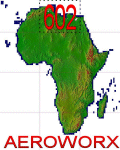
Highly detailed 76m SRTM mesh for Africa using the latest release of STRM Data V2.1. This file covers the Africa Area of base file 0602 (N23 and E00), North of the Equator, Mediterranean Sea Islands not included, DO NOT DISABLE THE DEFAULT DEM 0602 FILE.
| Filename: | Mesh_for_Northern_Africa_Base_Grid_0602.zip |
| License: | Freeware |
| Added: | 11th January 2014, 17:16:50 |
| Downloads: | 2,232 |
| Author: | Martin du Preez, Hannes Steyn, Aeroworx |
| Size: | 302.41 MB |
| Category: Flight Simulator X - Scenery | |
| Western Sahara VFR - Terrain Mesh SRTM 1 Arc/Sec version 3 |
|
Images related to this file:
File Description:
Enhanced Terrain Mesh from data source NASA SRTM 1 Arc/Sec (30 meters) version 3 at LOD 11 (19mt meters/pixel). Coverage: Lat 28 to Lat 20. Re-design coastline of the Western Sahara and replaced Dakhla Airport (GMMH). Fully compatible also with P3D.
| Filename: | Western_Sahara_VFR__Terrain_Mesh_SRTM_1_ArcSec_ver.zip |
| License: | Freeware |
| Added: | 27th April 2015, 12:58:28 |
| Downloads: | 935 |
| Author: | Giovanni Miduri |
| Size: | 373.13 MB |
| Category: Orbiter - Spaceships | |
| Vega 1.0 Mesh Fix |
|
File Description:
Vega 1.0 Mesh fix need Vega 1.0 . This corrects the lighting bug and generaly inhances the apperance of the mesh.
| Filename: | Vega_10_Mesh_Fix.zip |
| License: | Freeware |
| Added: | 23rd September 2002, 17:14:27 |
| Downloads: | 571 |
| Author: | John Hodgkiss |
| Size: | 261.07 KB |
| Category: Flight Simulator 2004 - Scenery | |
| EBLG - Liege Airport |
|
File Description:
EBLG - Liege Airport Scenery created with ADE9 v.1.79, SBuilder and static objects libraries with using the latest satellite images available from Google Earth. Optimized for the use with UT Europe and FS Global Mesh 2010.
| Filename: | EBLG__Liege_Airport.zip |
| License: | Freeware, limited distribution |
| Added: | 15th June 2025, 13:59:13 |
| Downloads: | 117 |
| Author: | Taner Akol |
| Size: | 2.89 MB |
| Category: Flight Simulator X - Scenery | |
| Mesh South America / MeSA A01 |
|
File Description:
FSX Mesh South America Project:
This terrain mesh file is a part of a whole project covering all the Continent of South America and some islands, divided in tiles identified in a map by its column (letters) and rows (numbers).
Those files were multi-LOD compiled from 90m SRTM2 source data, reprocessed with 3DEM to remove voids and spikes, providing a 76.4m (LOD9) horizontal resolution topography intended for use only in FSX updated with SP1.
Although not well documented, to improve performance, the updated FSX loads DEM files in threads and only the closer terrain (about 5 NM from the point of view)is rendered in high detail, while at far distances FSX shows up its default low resolution mesh, when there is not a third part terrain mesh compiled in all others intermediate level of details (multi-LOD).
THIS FILE: FSX_MeSA_A01
(Column A x Row 01)
This file covers the area inside the boundaries:
N = 16º 52,5' N; S = 11º 15' N;
W = 90º 0' W; E = 82º 30' W;
AUTHORS:
Hely Heck Junior - Magrao ( [email protected] )
and Jose Lobo ( [email protected] )
TerraBrasilis: www.terra-brasilis.org
| Filename: | Mesh_South_America__MeSA_A01.zip |
| License: | Freeware |
| Added: | 11th June 2007, 00:03:00 |
| Downloads: | 1,960 |
| Author: | Hely Heck Jr. and José Lôbo |
| Size: | 49.55 MB |
| Category: Flight Simulator X - Scenery | |
| Mesh South America / MeSA B01 |
|
File Description:
FSX Mesh South America Project:
This terrain mesh file is a part of a whole project covering all the Continent of South America and some islands, divided in tiles identified in a map by its column (letters) and rows (numbers).
Those files were multi-LOD compiled from 90m SRTM2 source data, reprocessed with 3DEM to remove voids and spikes, providing a 76.4m (LOD9) horizontal resolution topography intended for use only in FSX updated with SP1.
Although not well documented, to improve performance, the updated FSX loads DEM files in threads and only the closer terrain (about 5-10 NM from the point of view) is rendered in high detail, while at far distances FSX shows up its default low resolution mesh, when there is not a third part terrain mesh compiled in all others intermediate level of details (multi-LOD).
THIS FILE: FSX_MeSA_B01 (Column B x Row 01)
This file covers the area inside the boundaries:
N = 16º 52,5' N; S = 11º 15' N;
W = 82º 30' W; E = 75º 0' W;
AUTHORS:
Hely Heck Junior - Magrao ( [email protected] )
and Jose Lobo ( [email protected] )
TerraBrasilis: www.terra-brasilis.org
| Filename: | Mesh_South_America__MeSA_B01.zip |
| License: | Freeware |
| Added: | 11th June 2007, 15:56:55 |
| Downloads: | 1,403 |
| Author: | Hely Heck Jr. and José Lôbo |
| Size: | 1.53 MB |
| Category: Flight Simulator X - Scenery | |
| Mesh South America / MeSA D01 |
|
File Description:
FSX Mesh South America Project:
This terrain mesh file is a part of a whole project covering all the Continent
of South America and some islands, divided in tiles identified in a map by its
column (letters) and rows (numbers).
Those files were multi-LOD compiled from 90m SRTM2 source data, reprocessed
with 3DEM to remove voids and spikes, providing a 76.4m (LOD9) horizontal
resolution topography intended for use only in FSX updated with SP1.
Although not well documented, to improve performance, the updated FSX loads DEM
files in threads and only the closer terrain (about 5-10 NM from the point of view)
is rendered in high detail, while at far distances FSX shows up its default low
resolution mesh, when there is not a third part terrain mesh compiled in all
others intermediate level of details (multi-LOD).
THIS FILE:
FSX_MeSA_D01 (Column D x Row 01)
covers the area inside the boundaries:
N = 16º 52,5' N; S = 11º 15' N;
W = 67º 30' W; E = 60º 0' W;
AUTHORS:
Hely Heck Junior - Magrao ( [email protected] )
and Jose Lobo ( [email protected] )
TerraBrasilis: www.terra-brasilis.org
| Filename: | Mesh_South_America__MeSA_D01.zip |
| License: | Freeware |
| Added: | 13th June 2007, 01:32:30 |
| Downloads: | 1,356 |
| Author: | Hely Heck Jr. and José Lôbo |
| Size: | 2.68 MB |
| Category: Flight Simulator X - Scenery | |
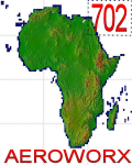
| Mesh for Northern Africa, Base Grid 0702 |
|
Images related to this file:
File Description: Highly detailed 76m SRTM mesh for Africa using the latest release of STRM
Data V2.1. This file covers the Africa Area of base file 0702 (N23 and E30),
North of the Equator, Arabia is not included, DO NOT DISABLE THE DEFAULT DEM
702 FILE.
| Filename: | Mesh_for_Northern_Africa_Base_Grid_0702.zip |
| License: | Freeware |
| Added: | 11th January 2014, 05:27:05 |
| Downloads: | 1,551 |
| Author: | Martin du Preez, Hannes Steyn, Aeroworx |
| Size: | 33.93 MB |


© 2001-2026 AVSIM Online
All Rights Reserved
Privacy Policy |