
Where Flight Simulation Enthusiasts Gather from Around the World!
AVSIM Library - Search Results

| Category: Flight Simulator X - Scenery | |
| Horn Of Africa Mesh, part 3/3 |

|
Images related to this file:
File Description:
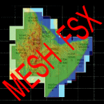
Part 3 of 3 : Mesh (lod 1 to 9) of the "Horn Of Africa": Ethiopia, Erythrea, Djibouti and Somalia. (Re-upload)
| Filename: | Horn_Of_Africa_Mesh_part_33.zip |
| License: | Freeware, limited distribution |
| Added: | 10th June 2010, 09:01:32 |
| Downloads: | 2,077 |
| Author: | Marcel "Teutonique" Wislet |
| Size: | 68.12 MB |
| Category: Flight Simulator 2004 - Scenery | |
| El Formosa - Taiwan Scenery Project, Part 1 |
|
File Description:
Base pack for el Formosa series sceneries. This el Formosa part 1 includes Taiwan high resolution mesh, new coastline & road modification.
| Filename: | El_Formosa__Taiwan_Scenery_Project_Part_1.zip |
| License: | Freeware, limited distribution |
| Added: | 24th October 2010, 07:11:14 |
| Downloads: | 10,590 |
| Author: | Formosa Group |
| Size: | 9.96 MB |
| Category: Flight Simulator X - Scenery | |
| Hong Kong Photo Scenery |
|
File Description:
This photo scenery add-don covers the entire Hong Kong region and part of Shen Zhen. Terrain mesh is not included.
| Filename: | Hong_Kong_Photo_Scenery.zip |
| License: | Freeware, limited distribution |
| Added: | 27th August 2011, 19:54:29 |
| Downloads: | 7,517 |
| Author: | Alex Lo |
| Size: | 52.08 MB |
| Category: Flight Simulator X - Scenery | |
| Mesh for Southern Africa, Base Grid 0605 |
|
Images related to this file:
File Description:
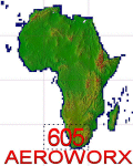
Highly detailed 76m SRTM mesh for Africa using the latest release of STRM Data V2.1. This file covers the Africa Area of base file 0605 (S23 and E00), South of the Equator. DO NOT DISABLE THE DEFAULT DEM 605 FILE.
| Filename: | Mesh_for_Southern_Africa_Base_Grid_0605.zip |
| License: | Freeware |
| Added: | 13th January 2014, 13:37:08 |
| Downloads: | 3,012 |
| Author: | Martin du Preez, Hannes Steyn, Aeroworx |
| Size: | 152.7 MB |
| Category: Flight Simulator X - Scenery | |
| Mesh for Southern Africa, Base Grid 0604 |
|
Images related to this file:
File Description:
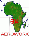
Highly detailed 76m SRTM mesh for Africa using the latest release of STRM Data V2.1. This file covers the Africa Area of base file 0604 (S01 and E00), South of the Equator. DO NOT DISABLE THE DEFAULT DEM 0604 FILE.
| Filename: | Mesh_for_Southern_Africa_Base_Grid_0604.zip |
| License: | Freeware |
| Added: | 31st January 2014, 15:21:39 |
| Downloads: | 2,948 |
| Author: | Martin du Preez, Hannes Steyn, Aeroworx |
| Size: | 397.23 MB |
| Category: Flight Simulator X - Scenery | |
| LFFD - Saint-Andre-de-l'Eure Airport - Normandy, France |
|
File Description:
A forgotten airfield in FSX, near Evreux in Normandy(France). Activity: Microlight (ULM) and light aviation
Realized with the software ADE.
Tested with UTX Europe + Gex + TrueLandscape on a mesh of 38 m.FPS friendly.
| Filename: | LFFD__SaintAndredelEure_Airport__Normandy_France.zip |
| License: | Freeware, limited distribution |
| Added: | 11th August 2013, 16:48:16 |
| Downloads: | 875 |
| Author: | Christian Davi |
| Size: | 4.23 MB |
| Category: Flight Simulator 2002 - Scenery | |
| LightWeight Mesh terrain for Europe and the Mediterranean (Part 2 of 4) |
|
File Description:
Framerate and download friendly mesh that covers the northern half of Portugal and Spain, all but the northern tip of France, most of Italy, all of Switzerland, Austria, the former Yugoslavia, Hungary, Romania and Bulgaria and parts of Belgium, Luxemburg, Germany, the Czech Republic, Slovakia, Poland, the Ukraine, Russia, Greece and Turkey. It is bounded by W20-E40-N50-N40.
| Filename: | LightWeight_Mesh_terrain_for_Europe_and_the_Medite.zip |
| License: | Freeware |
| Added: | 25th July 2002, 16:24:31 |
| Downloads: | 12,309 |
| Author: | Svante Wendel |
| Size: | 22.27 MB |
| Category: Flight Simulator 2002 - Scenery | |
| LightWeight Mesh Terrain for Europe and the Mediterranean (Part 3 of 4) |
|
File Description:
Framerate and download friendly mesh that covers all of the British Isles with the exception of the Shetlands, the northern tip of France, most of Belgium, all of the Netherlands, Denmark, Estonia, Latvia and Lithuania and parts of Norway, Sweden, Poland, the Czech Republic, Slovakia, Belarus and Russia (including Moscow). It is bounded by W20-E20-N60-N50.
| Filename: | LightWeight_Mesh_Terrain_for_Europe_and_the_Medite.zip |
| License: | Freeware |
| Added: | 25th July 2002, 16:25:27 |
| Downloads: | 10,633 |
| Author: | Svante Wendel |
| Size: | 13.17 MB |
| Category: Flight Simulator 2002 - Scenery | |
| LightWeight Mesh terrain for Europe and the Mediterranean (Part 4 of 4) |
|
File Description:
Framerate and download friendly mesh terrain that covers the Faroe Islands, the Shetlands, most of Norway (including Spitsbergen/Svalbard) and Sweden, all of Finland and parts of Russia. It is bounded by W20-E20-N89-N60.
| Filename: | LightWeight_Mesh_terrain_for_Europe_and_the_Medite.zip |
| License: | Freeware |
| Added: | 25th July 2002, 16:26:09 |
| Downloads: | 10,944 |
| Author: | Svante Wendel |
| Size: | 14.29 MB |
| Category: Flight Simulator 2002 - Scenery | |
| New Lake Elevation Corrections |
|
File Description:
The files in this package contain an update correcting some new lake elevations for Quebec terrain mesh (FS2002) created from SRTM-3 : about 100 lakes in Laurentides Park and Charlevoix regions, 80 in Bas-Saint-Laurent and 86 in Beauce, Megantic and Eastern Townships.
| Filename: | New_Lake_Elevation_Corrections.zip |
| License: | Freeware, limited distribution |
| Added: | 17th May 2003, 18:30:57 |
| Downloads: | 1,321 |
| Author: | Gilles Gauthier |
| Size: | 428.59 KB |


© 2001-2026 AVSIM Online
All Rights Reserved
Privacy Policy |