
Where Flight Simulation Enthusiasts Gather from Around the World!
AVSIM Library - Search Results

| Category: Flight Simulator 2004 - Scenery | |
| strm Mesh for Horn of Africa Part 3/9 |

|
File Description:
strm mesh for Ethiopia, Erythrea and Somalia made by FSDEM 1.1 Part 3 of 9.
| Filename: | strm_Mesh_for_Horn_of_Africa_Part_39.zip |
| License: | Freeware |
| Added: | 11th December 2005, 21:09:32 |
| Downloads: | 3,024 |
| Author: | Marcel "Teutonique" Wislet |
| Size: | 25.99 MB |
| Category: Flight Simulator X - Scenery | |
| USA East 10 metre mesh, Batch 4, Part 3 of 9 |
|
File Description:
USA EAST USGS 10 metre mesh terrain - FSX only, includes: IA, MN, WI, IL, IN, MI, OH, PA, NY, VT, NH, ME, MA, CT, RI. Part 3 of 9!
This constitutes 10 metre terrain mesh for a section of the USA, The whole USA East mesh files will abutt the US West Coast 10m mesh already available elsewhere, that was made by: Raimondo Taburet. Make sure you have your scenery terrain settings at about 5 metres in the FSX display dialogue for the mesh to show properly!
| Filename: | USA_East_10_metre_mesh_Batch_4_Part_3_of_9.zip |
| License: | Freeware |
| Added: | 11th May 2009, 10:11:50 |
| Downloads: | 1,062 |
| Author: | Wayne Evans |
| Size: | 29.25 MB |
| Category: Flight Simulator X - Scenery | |
| USA East 10 metre mesh, Batch 4, Part 9 of 9 |
|
File Description:
USA EAST USGS 10 metre mesh terrain - FSX only, includes: IA, MN, WI, IL, IN, MI, OH, PA, NY, VT, NH, ME, MA, CT, RI. Part 9 of 9!
This constitutes 10 metre terrain mesh for a section of the USA, The whole USA East mesh files will abutt the US West Coast 10m mesh already available elsewhere, that was made by: Raimondo Taburet. Make sure you have your scenery terrain settings at about 5 metres in the FSX display dialogue for the mesh to show properly!
| Filename: | USA_East_10_metre_mesh_Batch_4_Part_9_of_9.zip |
| License: | Freeware |
| Added: | 11th May 2009, 10:18:22 |
| Downloads: | 1,020 |
| Author: | Wayne Evans |
| Size: | 28.84 MB |
| Category: Flight Simulator X - Scenery | |
| USA East 10 metre mesh, Batch 4, Part 5 of 9 |
|
File Description:
USA EAST USGS 10 metre mesh terrain - FSX only, includes: IA, MN, WI, IL, IN, MI, OH, PA, NY, VT, NH, ME, MA, CT, RI. Part 5 of 9!
This constitutes 10 metre terrain mesh for a section of the USA, The whole USA East mesh files will abutt the US West Coast 10m mesh already available elsewhere, that was made by: Raimondo Taburet. Make sure you have your scenery terrain settings at about 5 metres in the FSX display dialogue for the mesh to show properly!
| Filename: | USA_East_10_metre_mesh_Batch_4_Part_5_of_9.zip |
| License: | Freeware |
| Added: | 11th May 2009, 10:14:06 |
| Downloads: | 612 |
| Author: | Wayne Evans |
| Size: | 33.15 MB |
| Category: Flight Simulator 2004 - Scenery | |
| Southern California Mesh |
|
File Description:
Terrain mesh from SRTM 3 arc second (90m) data for Southern California.
This file covers the area of latitude N32-34 and longitude W116-118.
Its length roughly from Tijuana Mexico to Barstow in Mojave Desert,
and width from the edge of Salton Sea to Malibu.
This file connects with the "SierraNevadaMesh.Zip", both files
offer a continuous mesh coverage from San Diego California to Reno Nevada.
| Filename: | Southern_California_Mesh.zip |
| License: | Freeware |
| Added: | 5th January 2004, 17:58:40 |
| Downloads: | 6,134 |
| Author: | Bart Dylkiewicz |
| Size: | 7.76 MB |
| Category: Flight Simulator 2004 - Scenery | |
| "Himalayan Peaks" LOD10 Mesh, Volume 8 - Tirich Mir and Pamir |
|
Images related to this file:
File Description:
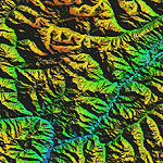
Highly detailed terrain mesh of the Tirich Mir and Pamir areas, N36-39 E71-74. The files in this package are based on Shuttle Radar (SRTM) Version 2 data but with many of the void areas, especially the most significant sections, filled with elevation data generated from topographic maps by Jonathan de Ferranti. While Jonathan's work is unrelated to flight simulation he kindly gave me permission to compile his data for use in FS. The result is a wonderful improvement in detail and accuracy over any existing mesh file, freeware or commercial, based on SRTM or DTED data alone.
Due to the large area of the Himalayas I've compiled the source data as two separate series: the "Himalayan Peaks" series covers prominent mountains and ranges in higher detail and locally overrides any existing LOD9 terrain mesh. In addition, a LOD9 "base mesh" series covering the entire Himalayas will be available for those who do not yet have an add-on terrain mesh of these beautiful mountains.
| Filename: | Himalayan_Peaks_LOD10_Mesh_Volume_8__Tirich_Mir_an.zip |
| License: | Freeware, limited distribution |
| Added: | 29th May 2010, 08:52:47 |
| Downloads: | 9,103 |
| Author: | Holger Sandmann, Jonathan de Ferranti |
| Size: | 47.94 MB |
| Category: Flight Simulator X - Miscellaneous Files | |
| Morocco Vectors VFR |
|
Images related to this file:
File Description:
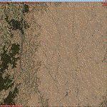
This project add and update vectors for Morocco and Western Sahara. Accurate coastline, lakes, roads, railways and river/streams. This vectors are optimized with Terrain Mesh SRTM 1 arc sec (LOD11). Scenery for FSX//P3Dv1/2/3/4.
| Filename: | Morocco_Vectors_VFR.zip |
| License: | Freeware |
| Added: | 9th June 2017, 21:04:48 |
| Downloads: | 772 |
| Author: | Giovanni Miduri |
| Size: | 20.49 MB |
| Category: Flight Simulator 2004 - Scenery | |
| Turkey Mesh, Part 3 of 5 |
|
File Description:
Created from 3 arc second data and re-sampled @LOD9 (best fit for this data). The created area extends from N35E025 (lower left corner) to N44E047 (upper right corner). You need all the five bgl-files plus the two correction files to cover the whole area. Otherwise you will have only a coverage of the corresponding file. Matthew Style's SRTM_3ARCSEC_TO_BGL program was used to interpolate the srtm data and automate the bgl file creation (Many Thanks to Matthew for his great utility).
| Filename: | Turkey_Mesh_Part_3_of_5.zip |
| License: | Freeware |
| Added: | 15th February 2010, 09:34:40 |
| Downloads: | 8,770 |
| Author: | Abdulkadir Ozturk |
| Size: | 41.97 MB |
| Category: Flight Simulator 2004 - Scenery | |
| Turkey Mesh, Part 4 of 5 |
|
File Description:
Created from 3 arc second data and re-sampled @LOD9 (best fit for this data). The created area extends from N35E025 (lower left corner) to N44E047 (upper right corner). You need all the five bgl-files plus the two correction files to cover the whole area. Otherwise you will have only a coverage of the corresponding file. Matthew Style's SRTM_3ARCSEC_TO_BGL program was used to interpolate the srtm data and automate the bgl file creation (Many Thanks to Matthew for his great utility).
| Filename: | Turkey_Mesh_Part_4_of_5.zip |
| License: | Freeware |
| Added: | 15th February 2010, 09:35:58 |
| Downloads: | 9,040 |
| Author: | Abdulkadir Ozturk |
| Size: | 49.47 MB |
| Category: Flight Simulator 2004 - Scenery | |
| Turkey Mesh, Part 2 of 5 |
|
File Description:
Created from 3 arc second data and re-sampled @LOD9 (best fit for this data). The created area extends from N35E025(lower left corner) to N44E047(upper right corner). You need all the five bgl-files plus the two correction files to cover the whole area. Otherwise you will have only a coverage of the corresponding file. Matthew Style's SRTM_3ARCSEC_TO_BGL program was used to interpolate the srtm data and automate the bgl file creation (Many Thanks to Matthew for his great utility).
| Filename: | Turkey_Mesh_Part_2_of_5.zip |
| License: | Freeware |
| Added: | 15th February 2010, 09:32:47 |
| Downloads: | 8,696 |
| Author: | Abdulkadir Ozturk |
| Size: | 40.8 MB |
© 2001-2026 AVSIM Online
All Rights Reserved
Privacy Policy |